Upper 2 Mile Loop Connector
Total Miles
0.8
Technical Rating
Best Time
Summer, Fall, Spring
Trail Type
50" Trail
Accessible By
Trail Overview
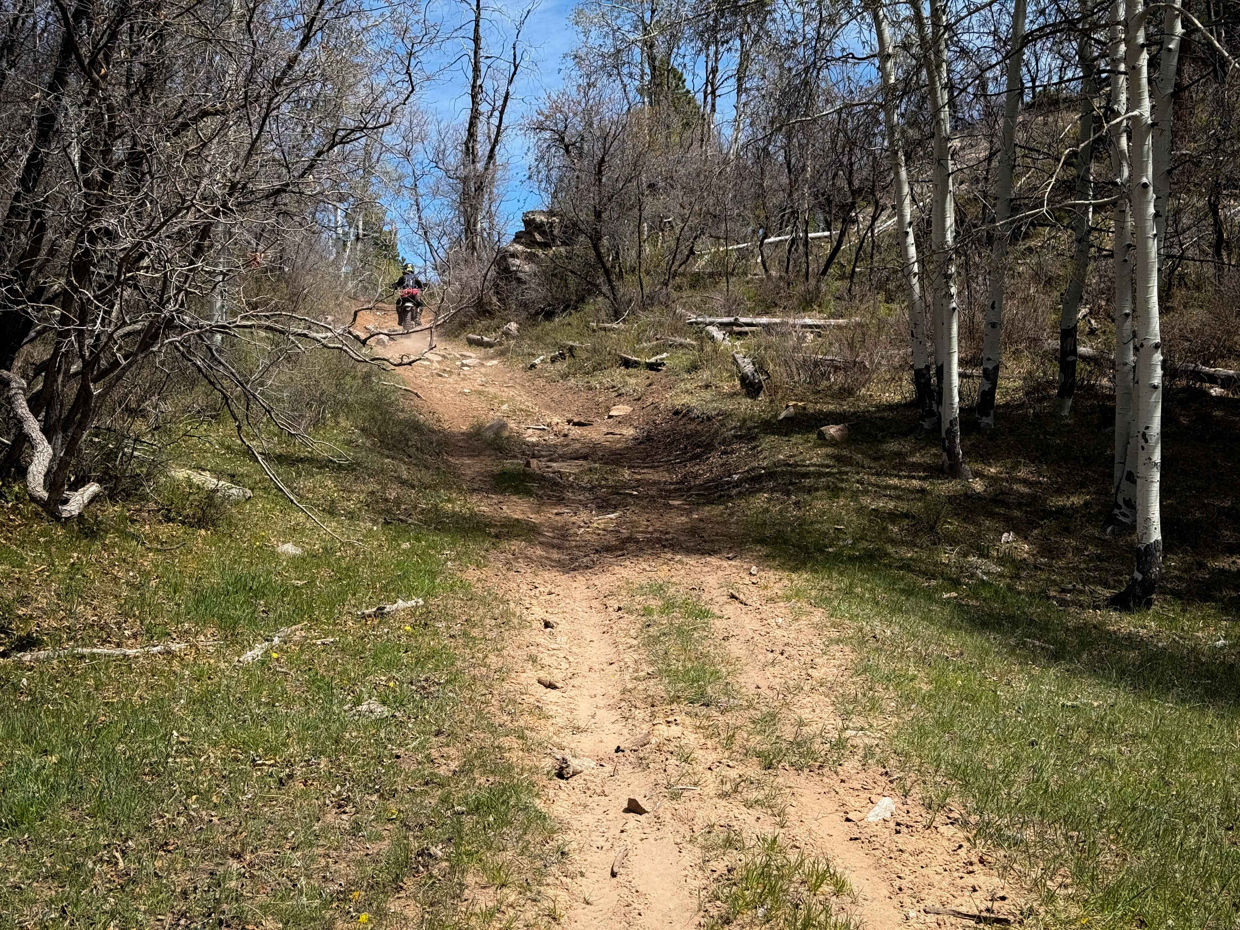
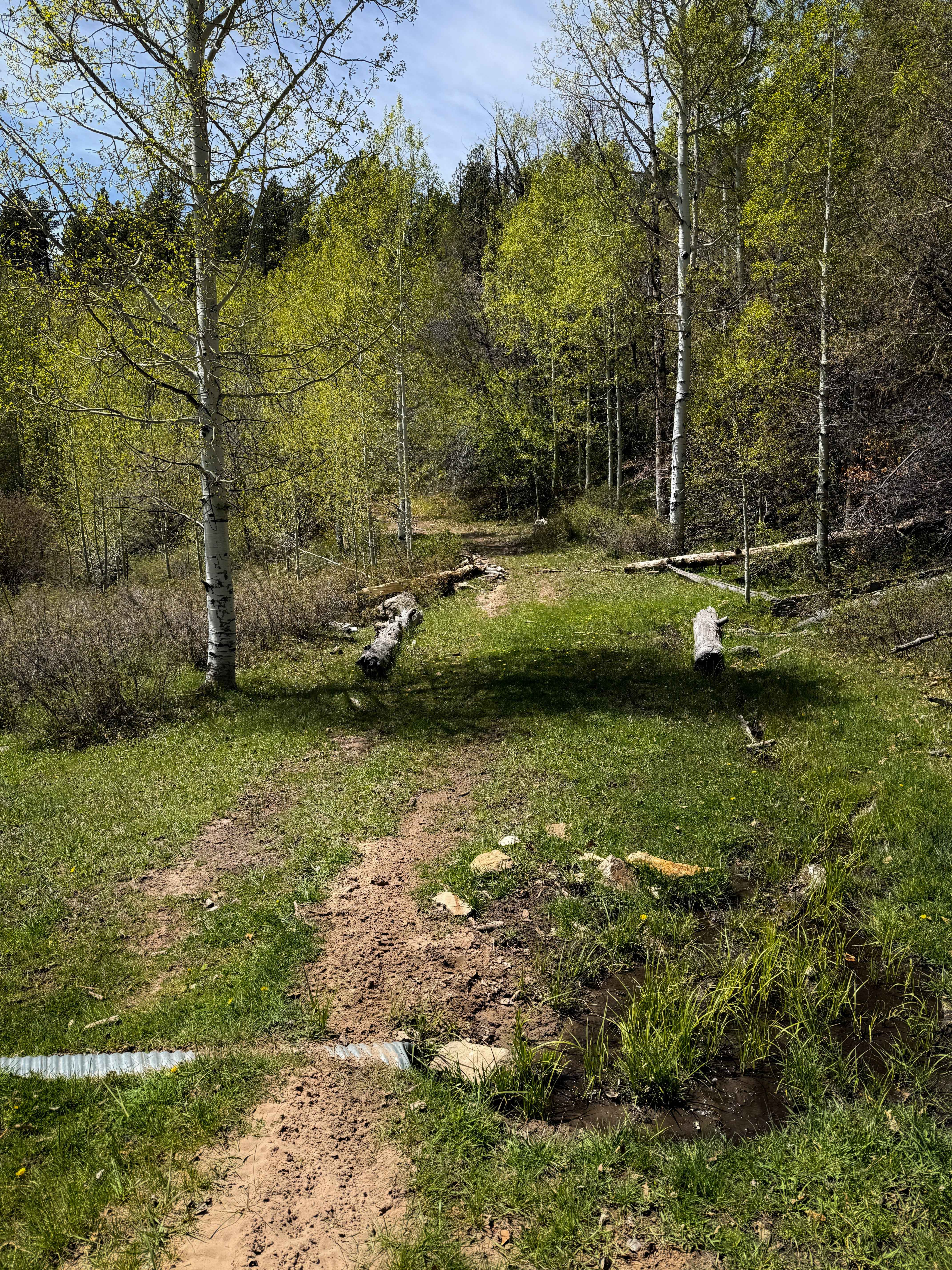
This is an easy connector piece of the Upper 2 Mile ATV Loop that is just under a mile long. The south end starts at an unmarked entrance off of 154 (Rim Rocker trail), and it climbs up a short hill with a few loose rocks, onto a grassy, faint track. The trail rides through some aspen trees and pines with shallow ruts, and a few small downed logs and branches, and is a bit overgrown with grass in sections. Expect small loose rocks and stick debris from cut logs. The trail meanders through the rolling hills until it drops back down to a road portion of Trail 16. Overall, it is very easy and gradual, and is just a short connecting piece of two tracks that takes you off the main dirt road.
Photos of Upper 2 Mile Loop Connector
Difficulty
This is an easy segment of trail as it is overall gradual, flowy, and free of major obstacles. As with any alpine trail at high elevation, there is potential for log hazards, but the trail was clear of any major log obstacles in mid-springtime.
Status Reports
Upper 2 Mile Loop Connector can be accessed by the following ride types:
- ATV (50")
- Dirt Bike
Upper 2 Mile Loop Connector Map
Popular Trails
Rocky Pass Peak
Plan B North

Jack Rabbit Ranch
The onX Offroad Difference
onX Offroad combines trail photos, descriptions, difficulty ratings, width restrictions, seasonality, and more in a user-friendly interface. Available on all devices, with offline access and full compatibility with CarPlay and Android Auto. Discover what you’re missing today!