Bh1270
Total Miles
2.2
Technical Rating
Best Time
Winter, Fall, Spring
Trail Type
Single Track
Accessible By
Trail Overview
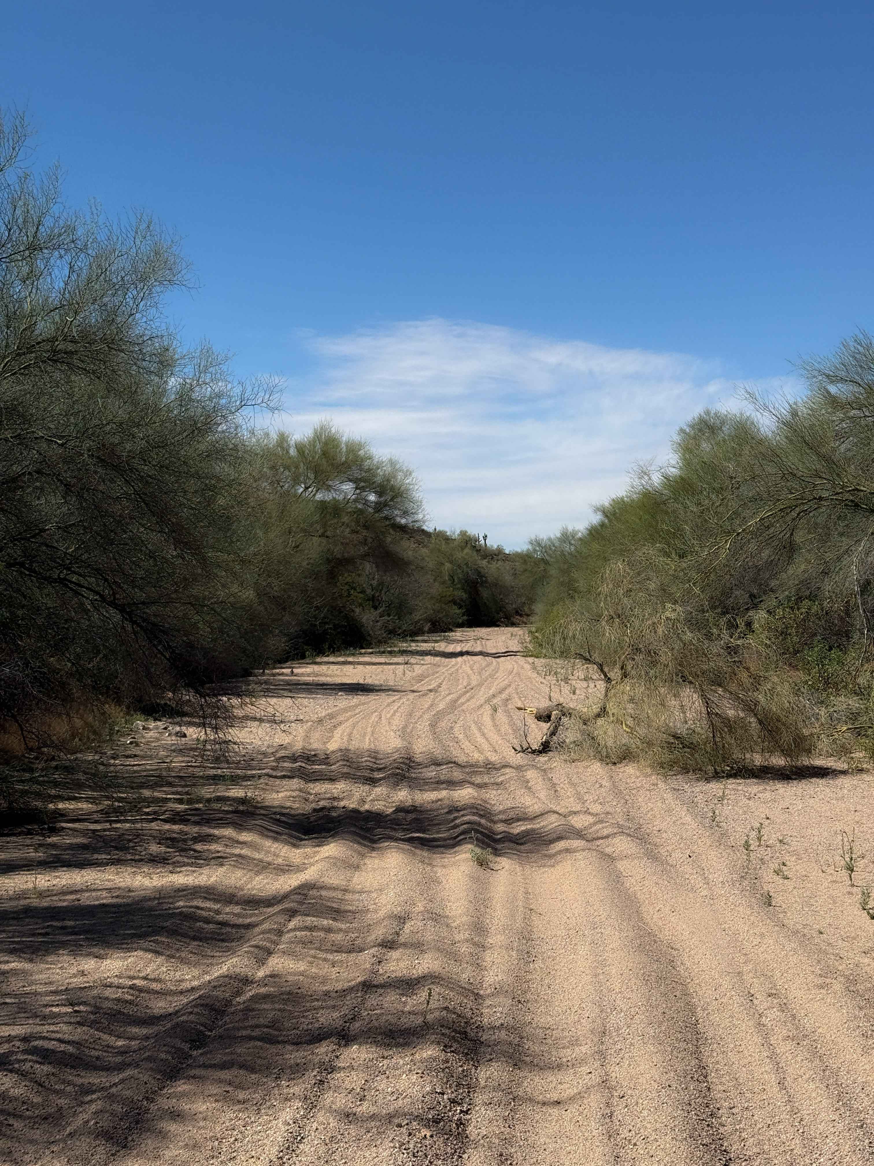
This is a 2.2-mile-long desert trail through the BLM land north of the Table Top Wilderness and Interstate 8. The east end of the trail departs from a more major desert road (Bh1271), and it meanders west through a flat desert terrain on a mix of hard-packed dirt and sand. The trail enters a wide sandy wash with lots of tracks to follow, lined with paloverde trees, desert ironwood, and velvet mesquite. The wash is mostly made of fine white sand, but there are a few brush piles and flat rock surfaces to watch out for, as well as small dips and ruts in the sand. The wash ranges from 10 to 20 feet wide at times. The trail continues through the wash in a very straight line, with minimal elevation change, paralleling the highway the whole time. It ends at an unmarked intersection at the edge of private property in the wash, where a small trail takes you south to the highway, which you can cross to access a few more trails or the Sonoran Desert National Monument Staging Area.
Photos of Bh1270

Difficulty
This is a very easy trail, the sand being the only technical element. The wash is sandy and smooth, with hardly any rock, making it consistently easy.
Status Reports
Bh1270 can be accessed by the following ride types:
- Dirt Bike
Bh1270 Map
Popular Trails

Agway Road-BLM1018

Atkins Cutoff
Training Loops
The onX Offroad Difference
onX Offroad combines trail photos, descriptions, difficulty ratings, width restrictions, seasonality, and more in a user-friendly interface. Available on all devices, with offline access and full compatibility with CarPlay and Android Auto. Discover what you’re missing today!