Spencer - FS 43283
Total Miles
5.0
Technical Rating
Best Time
Spring, Summer, Fall
Trail Type
Full-Width Road
Accessible By
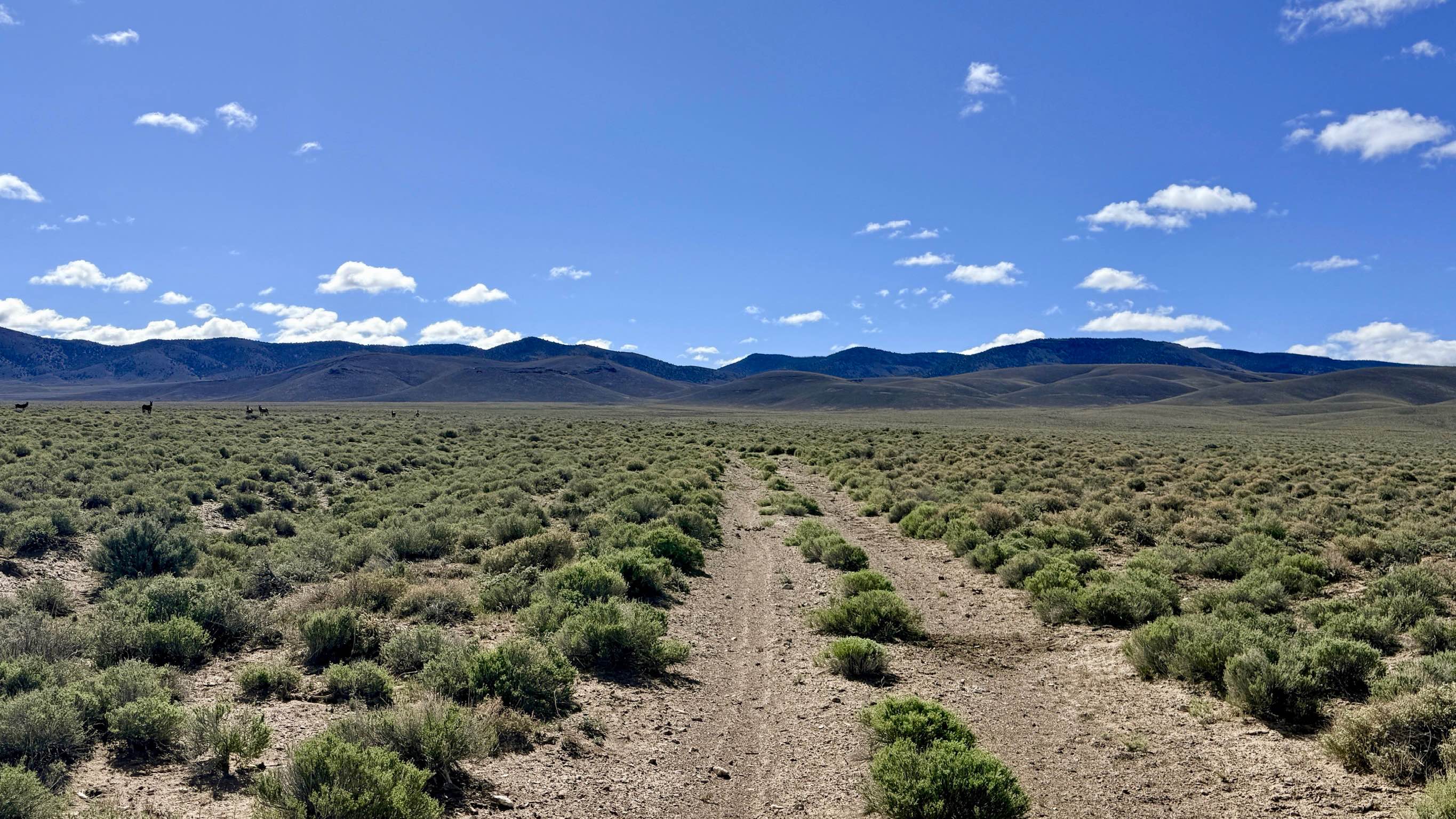
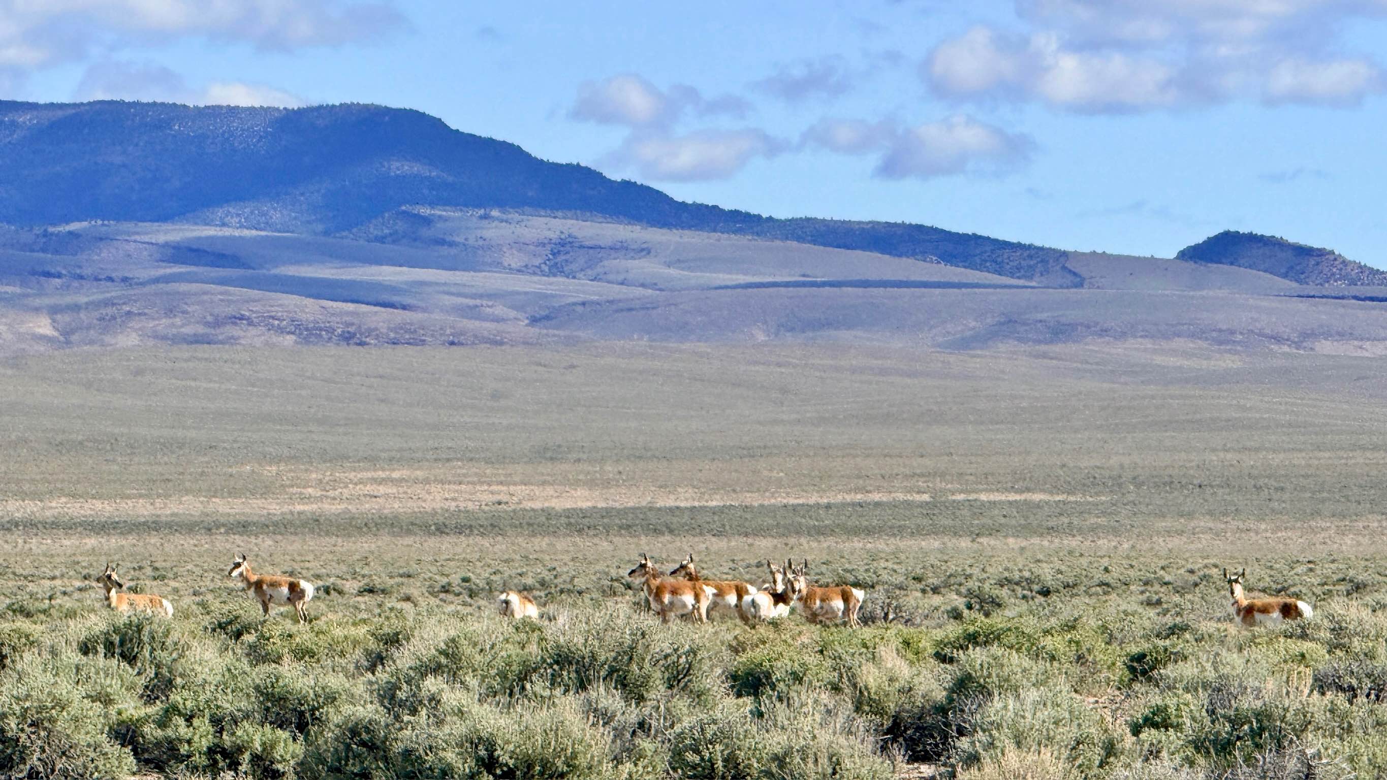
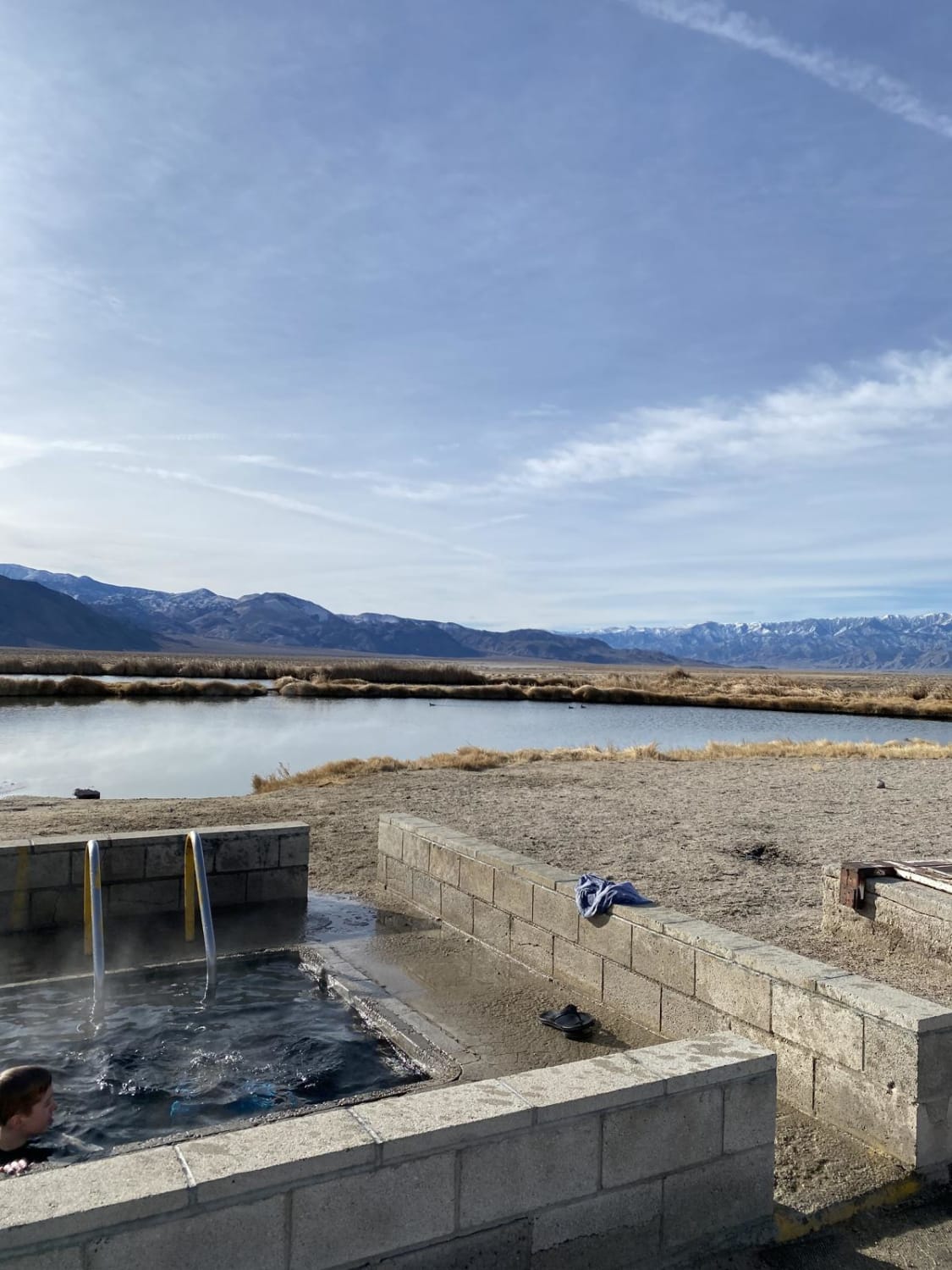
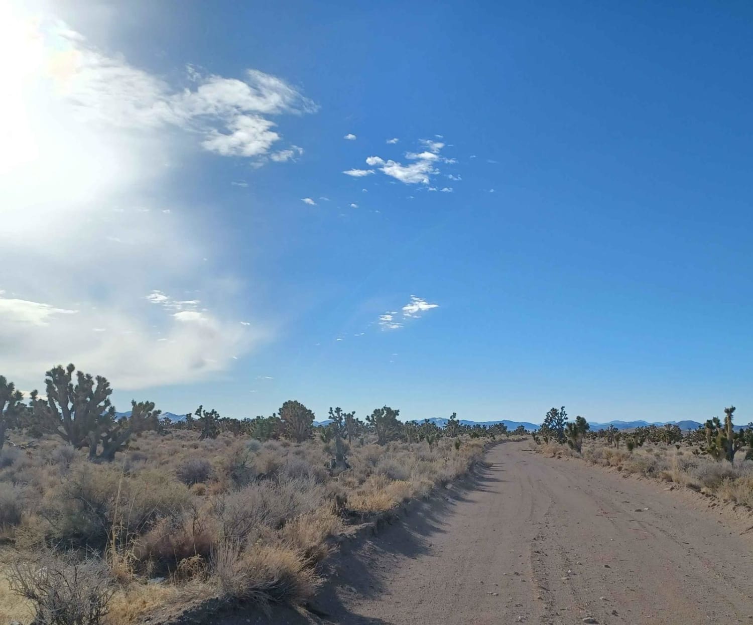
Trail Overview
* Spencer is a moderately technical and highly scenic trail that serves as a premier corridor for wildlife viewing as you ascend into the Toiyabe foothills. The lower portion of the trail takes you through expansive sagebrush flats where you are almost guaranteed to spot herds of Pronghorn and large groups of wild burros. As you enter the canyon itself, the landscape shifts dramatically, surrounding you with towering, intricate rock formations and transitioning into a habitat favored by Mule Deer and Elk. The drive provides a constant visual reward. While the ascent into the canyon is impressive, the view on the way back out is spectacular, offering a wide-angle perspective of the mountain ranges across the Big Smoky Valley. The trail features several technical wash crossings and off-camper obstacles that require focus and precise tire placement. Be aware that the final segment of the trail has become significantly overgrown; reaching the very end of the mapped route would require trail clearing, and paint damage from encroaching brush is likely if you push past the well-established turnaround. You may find one or two bars of service at the beginning of the trail near the valley floor, but it disappears completely once you enter the canyon. Download offline maps before leaving the Austin area.
Photos of Spencer - FS 43283
Difficulty
Rated a 3 due to several deep wash crossings and obstacles. Some sections feature steep entries and exits that can test your approach and departure angles. The end of the trail is heavily overgrown. It is recommended to turn around once the brush begins to scrape the sides of your vehicle unless you are prepared for significant "pinstriping" and manual clearing.
History
The Spencer area is named for the Spencer family, early pioneers who settled in the Big Smoky Valley in the 1870s. These canyons were vital to the early settlers and miners of the Reese River district, providing essential water sources and grazing land for the thousands of mules and oxen that powered the silver boom.
Status Reports
Spencer - FS 43283 can be accessed by the following ride types:
- High-Clearance 4x4
- SUV
- SxS (60")
- ATV (50")
- Dirt Bike
Spencer - FS 43283 Map
Popular Trails
Devil's Hole Road
Fish Lake Springs Rd.
Mackie Reservoir Road
The onX Offroad Difference
onX Offroad combines trail photos, descriptions, difficulty ratings, width restrictions, seasonality, and more in a user-friendly interface. Available on all devices, with offline access and full compatibility with CarPlay and Android Auto. Discover what you’re missing today!