
Dirt Bike Trails
Near Winlock, Washington
Explore All Dirt Bike Trails Near Winlock, Washington
Dirt Bike Trails Near Winlock, Washington
Discover the best dirt bike trails near you. Browse trail maps, check difficulty ratings, and find your next adventure — whether you're looking for a quick ride or an all-day expedition.
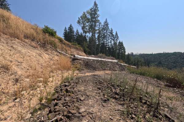
W-1090
Set within the scenic, mixed-timber environment of the Pacific Northwest's managed forestry lands, W-1090 serves as a highly rewarding out-and-back backcountry spur. Accessed via the primary regional logging network, this 1.1-mile dirt and gravel track leads travelers through vibrant evergreen stand...
Learn more about W-1090
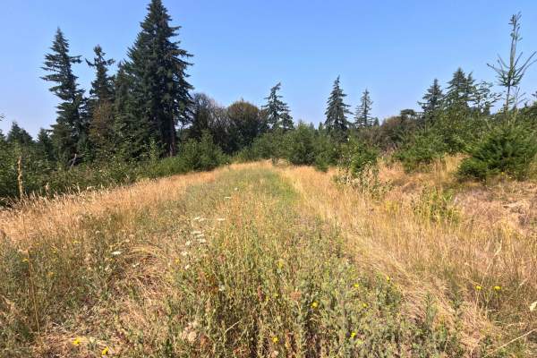
W-1200
Nestled within a vibrant, overgrown woodland of tall cedar and fir trees in the Gifford Pinchot National Forest, the W-1200 route provides a short but highly scenic out-and-back forest detour. Branching directly off the primary regional forestry network, this 1.0-mile single-track spur invites outdo...
Learn more about W-1200
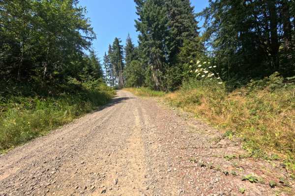
W-1300
Set within a lush, managed timberland featuring dense evergreen stands and expansive clear-cut clearings in the Pacific Northwest, W-1300 offers a pleasant and highly accessible backcountry detour. Functioning as a scenic out-and-back dirt spur accessed via local forestry arteries, this 2.7-mile tra...
Learn more about W-1300
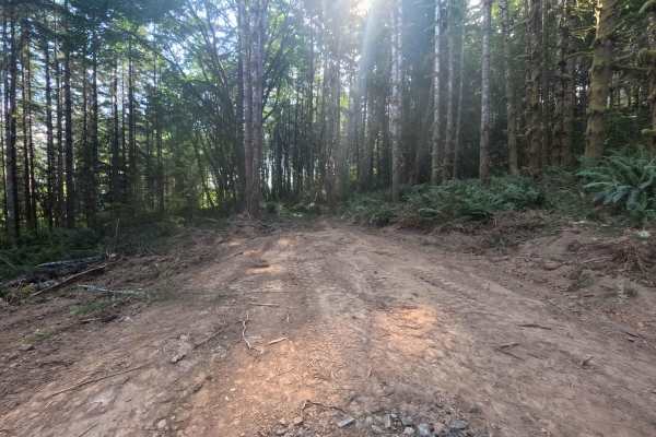
W-1055
Set within a thick, verdant forest of tall pine and fir trees, W-1055 presents a very brief, highly utilitarian out-and-back spur in the Pacific Northwest timberlands. Recently constructed in 2026 to support active logging operations, this short 1.1-mile track was blazed directly through the dense w...
Learn more about W-1055
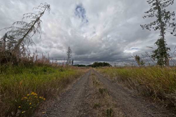
W-2600
Operating as a highly rewarding out-and-back spur, W-2600 offers a beautiful, multifaceted journey through the vibrant Pacific Northwest wilderness. The route travels through a dynamic National Forest environment, seamlessly transitioning between dense, shaded evergreen timber and expansive, newly p...
Learn more about W-2600
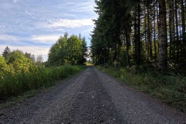
W-2000
Set within the Gifford Pinchot National Forest, W-2000 functions as a wide, open corridor that serves as an additional access point connecting the main paved road to the deeper woodland network. The route traverses a beautiful mix of thick, tree-lined passages and expansive open meadows, with occasi...
Learn more about W-2000
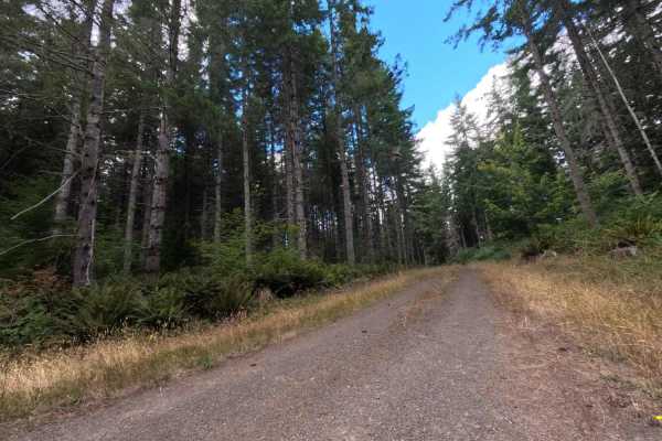
W-514
Located in a heavily timbered section of the National Forest, W-514 is a highly accessible, out-and-back dirt spur utilized primarily by recreational explorers and local wildlife. The road carves a straightforward, single-track path through a deep, shady corridor of densely packed, mature evergreen ...
Learn more about W-514
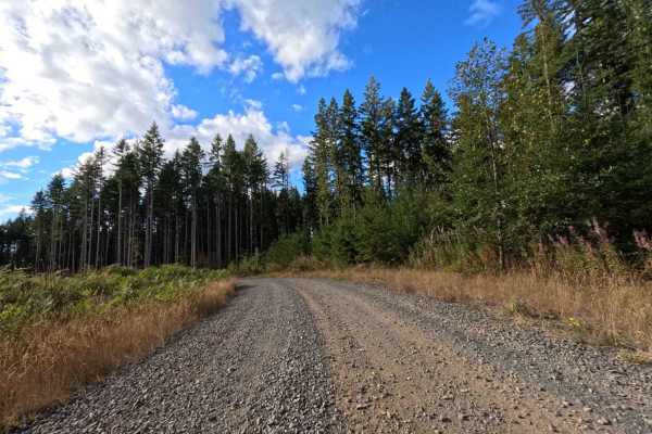
W-512 West
Branching out from the W-510 connector, W-512 West operates as a prominent transit road cutting through the active forestry lands of Washington. The route bounces between contrasting environments, plunging into dense, dark pockets of mature evergreen timber before opening up entirely into massive, r...
Learn more about W-512 West
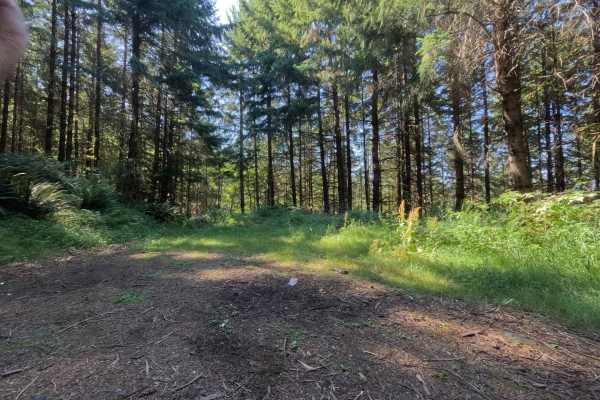
W-1100
Located within the exceptionally lush, densely wooded environment of the Gifford Pinchot National Forest, W-1100 serves as a brief but highly rewarding out-and-back forest spur. Accessed directly off the main pavement near the W - 1000 logging route, this 0.7-mile track leads travelers away from the...
Learn more about W-1100
W-512 East
W-512 East operates as a highly secluded, out-and-back woodland spur. The surrounding environment features a remarkably lush, mature timber canopy where historical logging operations have long since given way to towering evergreens and a thick, vibrant understory packed with wild ferns and sprawling...
Learn more about W-512 East
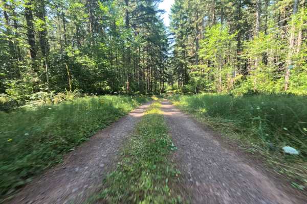
W-3000
W-3000, widely referred to locally as Camp Nine Road, operates as a vital through-connection linking main forestry arteries and providing essential throughput deeper into the backcountry. The route carves a tight path through a vibrant, lush evergreen environment, enveloped by towering mature timber...
Learn more about W-3000
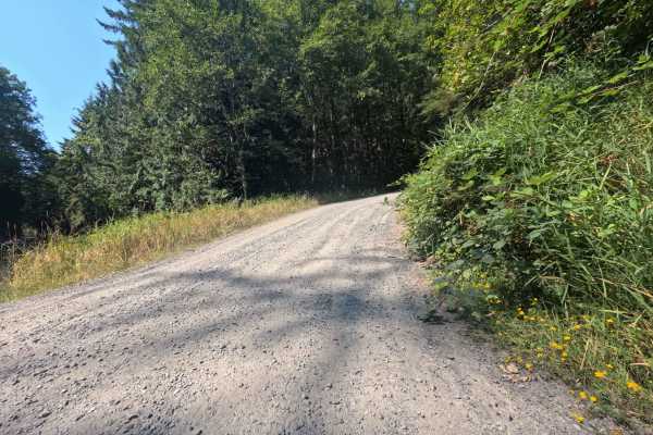
Gifford Pinchot - W1000
Located within the lush, diverse landscapes of the Gifford Pinchot National Forest, the W1000 road serves as a highly scenic, dead-end out-and-back trail. Accessed via local regional forestry routes, this 7.35-mile track requires a Washington Discovery Pass for entry and offers travelers a beautiful...
Learn more about Gifford Pinchot - W1000
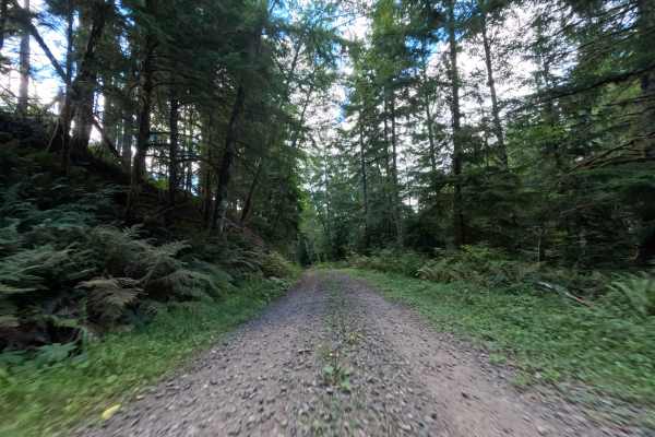
W-519
Branching off the W540 junction where the tree line breaks into an open meadow, W-519 serves as a scenic throughput connector ferrying travelers all the way to the W512 road. The environment begins dramatically at the top of a massive clear-cut, offering spectacular, unobstructed panoramic views of ...
Learn more about W-519
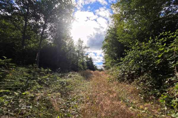
W-549
Branching off the 541 road system, W-549 acts as a heavily shaded, dead-end dirt spur pushing into the Washington backcountry. The trail navigates a lush, overgrown evergreen forest, featuring thick underbrush and towering timber that completely canopy the narrow corridor. Holding a level 2 difficul...
Learn more about W-549
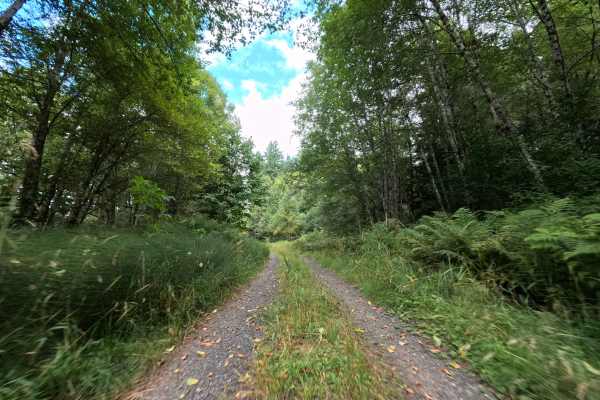
W-544
Operating as a highly scenic out-and-back route, W-544 climbs steadily into the Washington backcountry. The trail begins by winding through a shaded, densely wooded National Forest landscape before transitioning into a massive, un-replanted clear-cut zone that offers sweeping, unobstructed sightline...
Learn more about W-544
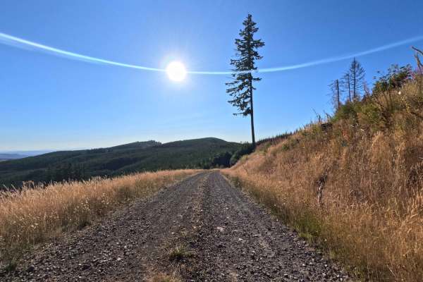
Crazy Man Mountain - W-546
Nestled within the spectacular landscapes of the Gifford Pinchot National Forest, the W-546 route to Crazy Man Mountain serves as a breathtaking out-and-back backcountry spur. Accessed from the surrounding regional forestry network, this 1.7-mile track initially climbs through a steep, shaded evergr...
Learn more about Crazy Man Mountain - W-546
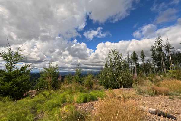
W-545
Branching off the main forestry network, the W-545 operates as a scenic out-and-back dirt spur probing into the Washington backcountry. The trail initially weaves through a densely timbered evergreen forest before dramatically breaking out into a sprawling, open clear-cut environment within the Nati...
Learn more about W-545
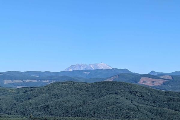
W-535
Set within the scenic expanses of the Gifford Pinchot National Forest, W-535 serves as a brief but incredibly rewarding out-and-back backcountry spur that delivers spectacular regional vistas. Outdoor recreationists, sightseers, and overlanders frequent this route to take in the breathtaking, unobst...
Learn more about W-535
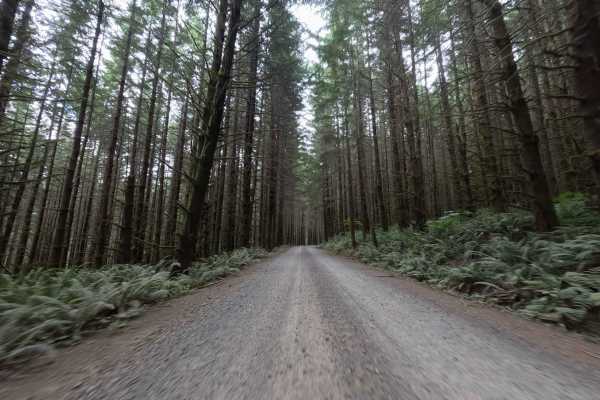
Camp Nine Road
Acting as a critical through-connection traversing private commercial timberlands, Camp Nine Road serves as a major overland artery linking disparate sections of the Washington forest network. Tucked between the W3000 and W541 junctions, this route operates primarily under the ownership of Port Blak...
Learn more about Camp Nine Road
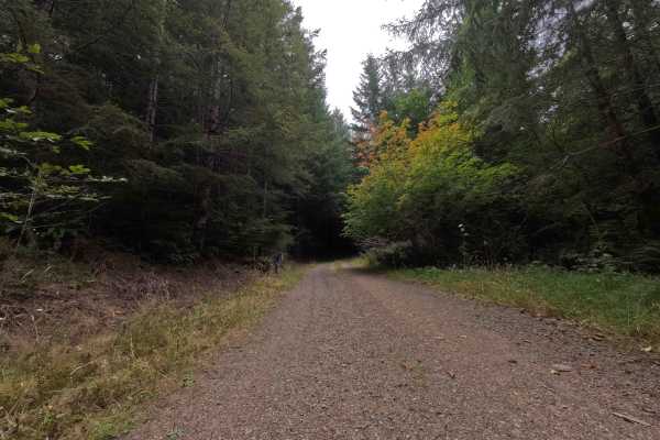
W-3000.7
Branching off the junction where W-3000 transitions into Camp Nine Road, W-3000.7 serves as a quiet, out-and-back dirt offshoot pushing into the National Forest. The trail meanders through a dense, lush evergreen environment featuring a thick timber canopy that keeps the corridor heavily shaded even...
Learn more about W-3000.7
ATV trails near Winlock, Washington
Explore ATV-friendly trails near you. These trails are accessible for vehicles up to 50 inches wide, perfect for ATVs and smaller off-road machines.
W-1090
Set within the scenic, mixed-timber environment of the Pacific Northwest's managed forestry lands, W-1090 serves as a highly rewarding out-and-back backcountry spur. Accessed via the primary regional logging network, this 1.1-mile dirt and gravel track leads travelers through vibrant evergreen stand...
Learn more about W-1090
W-1200
Nestled within a vibrant, overgrown woodland of tall cedar and fir trees in the Gifford Pinchot National Forest, the W-1200 route provides a short but highly scenic out-and-back forest detour. Branching directly off the primary regional forestry network, this 1.0-mile single-track spur invites outdo...
Learn more about W-1200
W-1300
Set within a lush, managed timberland featuring dense evergreen stands and expansive clear-cut clearings in the Pacific Northwest, W-1300 offers a pleasant and highly accessible backcountry detour. Functioning as a scenic out-and-back dirt spur accessed via local forestry arteries, this 2.7-mile tra...
Learn more about W-1300
W-1055
Set within a thick, verdant forest of tall pine and fir trees, W-1055 presents a very brief, highly utilitarian out-and-back spur in the Pacific Northwest timberlands. Recently constructed in 2026 to support active logging operations, this short 1.1-mile track was blazed directly through the dense w...
Learn more about W-1055
UTV/side-by-side trails near Winlock, Washington
Find UTV and side-by-side trails near you. These trails accommodate vehicles up to 60 inches wide, ideal for UTVs, side-by-sides, and wider off-road rigs.
W-1090
Set within the scenic, mixed-timber environment of the Pacific Northwest's managed forestry lands, W-1090 serves as a highly rewarding out-and-back backcountry spur. Accessed via the primary regional logging network, this 1.1-mile dirt and gravel track leads travelers through vibrant evergreen stand...
Learn more about W-1090
W-1200
Nestled within a vibrant, overgrown woodland of tall cedar and fir trees in the Gifford Pinchot National Forest, the W-1200 route provides a short but highly scenic out-and-back forest detour. Branching directly off the primary regional forestry network, this 1.0-mile single-track spur invites outdo...
Learn more about W-1200
W-1300
Set within a lush, managed timberland featuring dense evergreen stands and expansive clear-cut clearings in the Pacific Northwest, W-1300 offers a pleasant and highly accessible backcountry detour. Functioning as a scenic out-and-back dirt spur accessed via local forestry arteries, this 2.7-mile tra...
Learn more about W-1300
W-1055
Set within a thick, verdant forest of tall pine and fir trees, W-1055 presents a very brief, highly utilitarian out-and-back spur in the Pacific Northwest timberlands. Recently constructed in 2026 to support active logging operations, this short 1.1-mile track was blazed directly through the dense w...
Learn more about W-1055
The onX Offroad Difference
onX Offroad combines trail photos, descriptions, difficulty ratings, width restrictions, seasonality, and more in a user-friendly interface. Available on all devices, with offline access and full compatibility with CarPlay and Android Auto. Discover what you're missing today!
Open Trail Map