
Dirt Bike Trails
Near Toledo, Washington
Explore All Dirt Bike Trails Near Toledo, Washington
Dirt Bike Trails Near Toledo, Washington
Discover the best dirt bike trails near you. Browse trail maps, check difficulty ratings, and find your next adventure — whether you're looking for a quick ride or an all-day expedition.
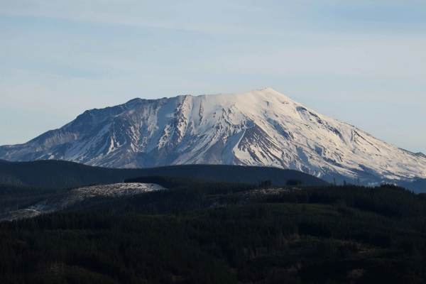
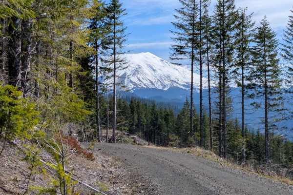
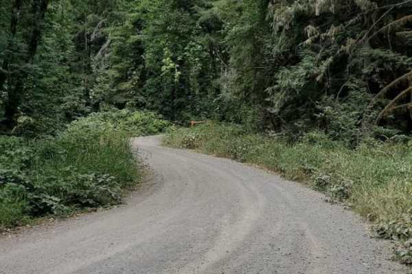
Signal Peak
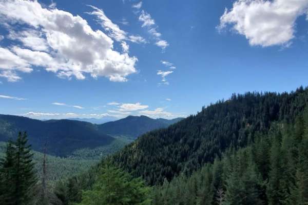
A quick 20-minute scenic, well-maintained side route off the popular 4250 Mount Saint Helens route. The communication tower at the summit may be the end, but the real payoff is the views just before the final winding climb, offering massive, unobstructed views of Mount Saint Helens, Mount Adams, and...
Learn more about Signal Peak
5100
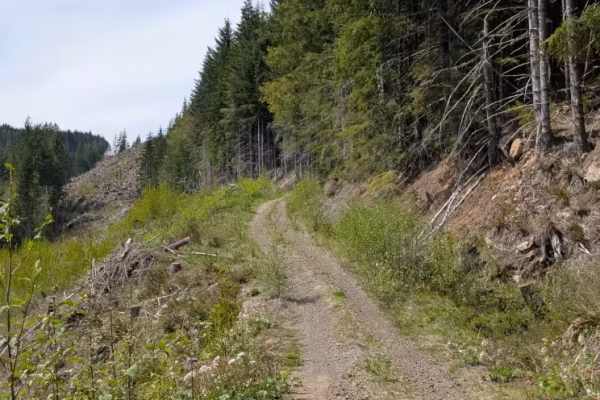
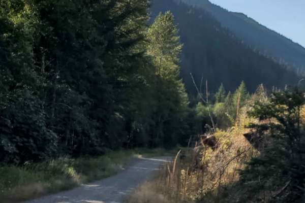
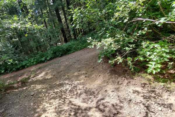
This trail is primarily gravel and single vehicle width, with many areas along the way to pass oncoming traffic (if you see any). It is easily accessible and traversable by most vehicles. You may have to dodge a fallen rock or pothole here and there, but this will not distract from the beauty of the...
Learn more about 5100
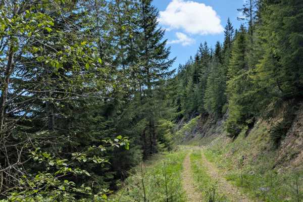
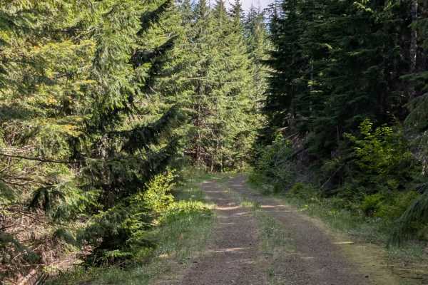
2730
This trail is a branch off of 4250 that connects to 6500 which eventually connects back to 4250, all of which are managed by the Washington State Department of Natural Resources. The trail itself is primarily a grated gravel road and has many offshoots to explore. The trail travels through dense for...
Learn more about 2730
Newaukum Road - FS 7100
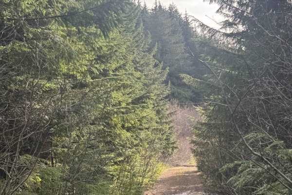
This trail is a gravel forest road that climbs and winds through the National Forest and pieces of Timber Company land. The trail is relatively smooth, but a large portion of it is steep and a shelf road. While climbing and snaking your way up the trail, you will have amazing views of nearby peaks a...
Learn more about Newaukum Road - FS 7100
Jesse Creek
Jesse Creek is a basic, easygoing route great detour while exploring the surrounding area. The trail begins as a wide, well-maintained two-lane dirt road that comfortably descends and winds its way down the valley. As you progress, the road tightens into a single-lane track, introducing a few small ...
Learn more about Jesse Creek
5600
This is a narrow gravel road that is, at the west end, either the start or the finish of the 5600, depending on which way you run it. This route connects the 5100 (west) to the "5600 to 5605" trail (east). Most vehicles can travel this route. Along the way, there are many drainages that in springtim...
Learn more about 5600
Newaukum Lake Road - FS 7100115
This short trail starts off as a gravel road but quickly becomes a two-track road through dense forest. The trail has a couple of mud holes, and is very narrow with overgrown vegetation and tight trees. In some areas, the overhead clearance is low, and you can expect some minor pin striping. This tr...
Learn more about Newaukum Lake Road - FS 7100115
5625
This road is an out-and-back, but worth exploring as there are great views of the S. Fork of the Toutle River Valley. Mostly a gravel road that is narrow in spots and winds in and out of the trees into large clearings that provide the views. Some sections are cut into steep hillside with no shoulde...
Learn more about 5625
5631
Branching off Forest Road 4250, this straightforward spur winds down the hillside through Washington State Department of Natural Resources land. The drive alternates between sections of shaded forest and open ridgelines that provide a clear, rewarding look at the South Fork Toutle River valley and M...
Learn more about 5631
River Road
This beautiful forested road rides alongside the North Fork of Tilton River. Leading deeper into the forest. Gentle roads become rougher and more pitted the deeper you travel. Pull off on one of the many side roads and find butterflies dancing on the wildflowers. Camping spots seem to come out of n...
Learn more about River Road
Weasel Spring Lane
Beautiful lush forest interrupted by logging fields. Lots of wildlife scamper around as you drive this easy-going un-kept logging road. Large open skies, deer, elk, and weasels make this area a joy to explore. Spring is covered in lush vegetation and hard to reach but is clearly audible from the pat...
Learn more about Weasel Spring Lane
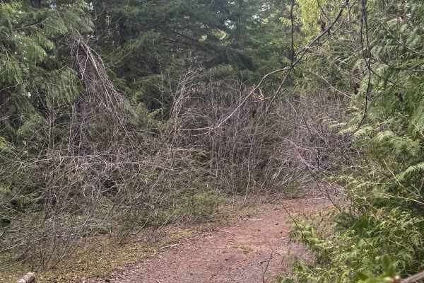
Little Creek
Little Creek Road is an aging logging route that takes you along a ridgeline before descending the valley toward the creek itself. Early on, the trail offers a couple of scenic viewpoints from the ridge. However, as you progress, the road becomes increasingly unmaintained and overgrown, with the enc...
Learn more about Little Creek
Bridge Brook Drive
This long beautiful stretch is surrounded by a beautiful pasture that has consumed once logging land. Beautiful open skies and gently sloping hills are interrupted by a fairy tail-like tree cover housing a bridge that crosses a small waterway. Water is inaccessible without rope due to steep sides. ...
Learn more about Bridge Brook Drive
Mine Creek
Mine Creek is a basic, straightforward spur road that serves primarily as an access point rather than a lengthy drive. The driving portion of the route is short and easygoing, ultimately dead-ending at a locked gate where the land transitions into private logging property.
While the vehicle trail e...
Learn more about Mine Creek
North Fork Tilton Road - FS 7300
This short 1.1-mile trail leads through the National Forest to the edge of Timber Company land. The trail is narrow in the beginning, but then it widens and is relatively smooth. The trail ends with a steep uphill climb of 13-degree pitch to a large flat opening atop a ridge that has a stunning view...
Learn more about North Fork Tilton Road - FS 7300
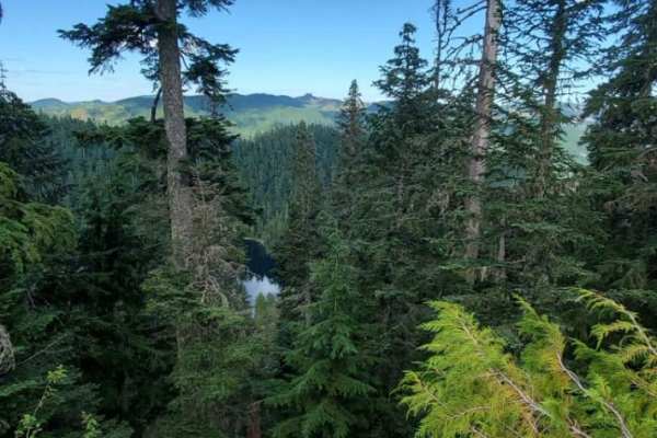
Lake Overlook Camp Out Road
This magnificent land bridge places this one-car wide lane delicately at the top of a very steep tall cliffside. The road is mostly clear of landslide debris but large rocks are not far off the path. Look over the steep edge to see the lakes way down below. But do not stand too close to the edge as ...
Learn more about Lake Overlook Camp Out Road
Quarry Lake Viewpoint Road
This path is the furthest from the quarry fork. It leads to a beautiful land bridge overlooking both lakes. Dense forest trails are unmaintained causing the scraping of wider vehicles. The ground is sturdy and fairly manageable, but low-hanging branches make watching the ground a slow process. The q...
Learn more about Quarry Lake Viewpoint Road
Trail to Roll Cage Landslide Canyon
This long beautiful forested trail opens up to gorgeous mountain views. Rough unkept roads make good suspension worthwhile as the rocky road seems to become quite unpredictable. Sudden drops and obvious recent landslides make this a slow travel trail. Enjoy large open skies and hidden single-car cam...
Learn more about Trail to Roll Cage Landslide Canyon
Wildcat Loop 2 - FS 7400
This 6.1-mile stretch of trail connects the ends of Nisqually Loop and Wildcat/Nisqually Loop, completing the loop. This trail is muddy and rocky, with overgrown vegetation and tight trees. The trail is open to 4x4 and Powersports, but in a 4x4, you can expect major pin striping throughout. At one e...
Learn more about Wildcat Loop 2 - FS 7400

Deep Forest Trail
Thick overgrowth takes you through Gifford's Forest at a decent. Deep overgrowth makes for poor camping, but the intersection for roads at the Sothern end of the trail makes for a great quick campground. Enjoy the cooling effects of deep forest cover. The great diversity of plants makes this trail ...
Learn more about Deep Forest Trail
ATV trails near Toledo, Washington
Explore ATV-friendly trails near you. These trails are accessible for vehicles up to 50 inches wide, perfect for ATVs and smaller off-road machines.
Signal Peak
A quick 20-minute scenic, well-maintained side route off the popular 4250 Mount Saint Helens route. The communication tower at the summit may be the end, but the real payoff is the views just before the final winding climb, offering massive, unobstructed views of Mount Saint Helens, Mount Adams, and...
Learn more about Signal Peak
5100
This trail is primarily gravel and single vehicle width, with many areas along the way to pass oncoming traffic (if you see any). It is easily accessible and traversable by most vehicles. You may have to dodge a fallen rock or pothole here and there, but this will not distract from the beauty of the...
Learn more about 5100
2730
This trail is a branch off of 4250 that connects to 6500 which eventually connects back to 4250, all of which are managed by the Washington State Department of Natural Resources. The trail itself is primarily a grated gravel road and has many offshoots to explore. The trail travels through dense for...
Learn more about 2730
Newaukum Road - FS 7100
This trail is a gravel forest road that climbs and winds through the National Forest and pieces of Timber Company land. The trail is relatively smooth, but a large portion of it is steep and a shelf road. While climbing and snaking your way up the trail, you will have amazing views of nearby peaks a...
Learn more about Newaukum Road - FS 7100
UTV/side-by-side trails near Toledo, Washington
Find UTV and side-by-side trails near you. These trails accommodate vehicles up to 60 inches wide, ideal for UTVs, side-by-sides, and wider off-road rigs.
Signal Peak
A quick 20-minute scenic, well-maintained side route off the popular 4250 Mount Saint Helens route. The communication tower at the summit may be the end, but the real payoff is the views just before the final winding climb, offering massive, unobstructed views of Mount Saint Helens, Mount Adams, and...
Learn more about Signal Peak
5100
This trail is primarily gravel and single vehicle width, with many areas along the way to pass oncoming traffic (if you see any). It is easily accessible and traversable by most vehicles. You may have to dodge a fallen rock or pothole here and there, but this will not distract from the beauty of the...
Learn more about 5100
2730
This trail is a branch off of 4250 that connects to 6500 which eventually connects back to 4250, all of which are managed by the Washington State Department of Natural Resources. The trail itself is primarily a grated gravel road and has many offshoots to explore. The trail travels through dense for...
Learn more about 2730
Newaukum Road - FS 7100
This trail is a gravel forest road that climbs and winds through the National Forest and pieces of Timber Company land. The trail is relatively smooth, but a large portion of it is steep and a shelf road. While climbing and snaking your way up the trail, you will have amazing views of nearby peaks a...
Learn more about Newaukum Road - FS 7100
The onX Offroad Difference
onX Offroad combines trail photos, descriptions, difficulty ratings, width restrictions, seasonality, and more in a user-friendly interface. Available on all devices, with offline access and full compatibility with CarPlay and Android Auto. Discover what you're missing today!
Open Trail Map