
Dirt Bike Trails
Near LaFollette, Tennessee
Explore All Dirt Bike Trails Near LaFollette, Tennessee
Dirt Bike Trails Near LaFollette, Tennessee
Discover the best dirt bike trails near you. Browse trail maps, check difficulty ratings, and find your next adventure — whether you're looking for a quick ride or an all-day expedition.
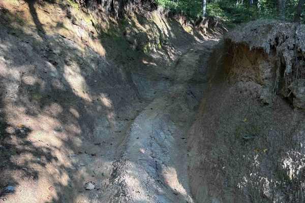
Ivydell Trail
Ivydell Trail is an access road intended for experienced riders seeking a more technical challenge within the Sundquist Unit of North Cumberland Wildlife Management Area. Connecting Flatwoods Road with Ollis Creek Trail, this trail serves as a demanding entry into the interior trail network while t...
Learn more about Ivydell Trail
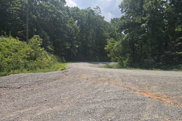
Ivydell Road
This is an easy two lane gravel road to the the trail system at the North Cumberland Wildlife Management Area. There is plenty of room to pass and has a 685 foot elevation gain in a short period. This road is just one of the ways to get to the Elk viewing tower. A North Cumberland Off-Highway Vehicl...
Learn more about Ivydell Road
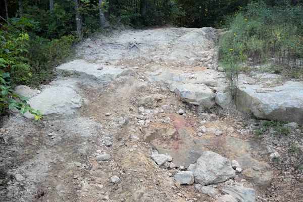
Jamie’s Loop
Jamie’s Loop is a moderately challenging OHV route in the North Cumberland Wildlife Management Area’s Sundquist Unit, designed for riders who want a short but engaging detour off McCormick Cemetery Road. The route branches from McCormick Cemetery Road and reconnects roughly 1.8 miles later, creating...
Learn more about Jamie’s Loop
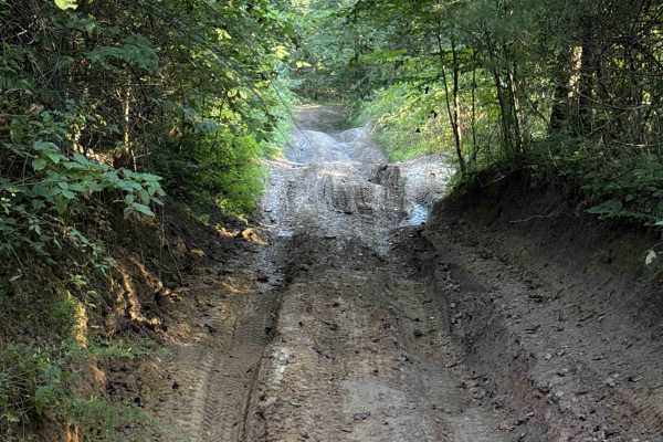
Campbell’s Split
Campbell’s Split is a short Off- Highway Vehicle trail within the North Cumberland Wildlife Management Area, in the Sundquist Unit north of LaFollette, Tennessee. At just under a mile long, the trail connects Ivydell Road (a full-width 4x4 trail) to the Ivydell Off- Highway Vehicle trail. The trail ...
Learn more about Campbell’s Split
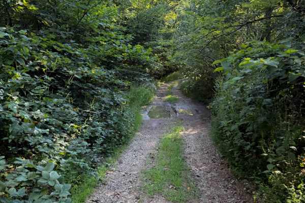
Hunter Access Pond Road
This short hunter’s access road is an unmarked and more primitive Off- Highway Vehicle trail in the Sundquist Unit of the North Cumberland Off- Highway Vehicle Riding Area. The trail starts off from the south end as a single-lane gravel road, lined with locust trees and river birch trees. Watch out ...
Learn more about Hunter Access Pond Road
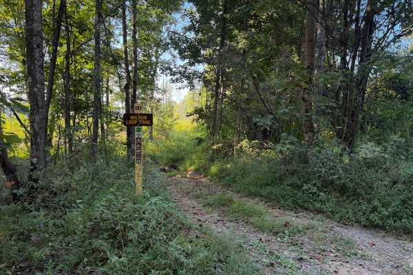
Wilson Loop Trail 38
The Wilson Loop Trail is a .8 mile long Off- Highway Vehicle trail within the North Cumberland Wildlife Management Area, in the Sundquist Unit north of LaFollette, Tennessee, that makes a loop off of McCormick Cemetery Road. There is a mucky mud hole right at the entrance after the sign on the west ...
Learn more about Wilson Loop Trail 38
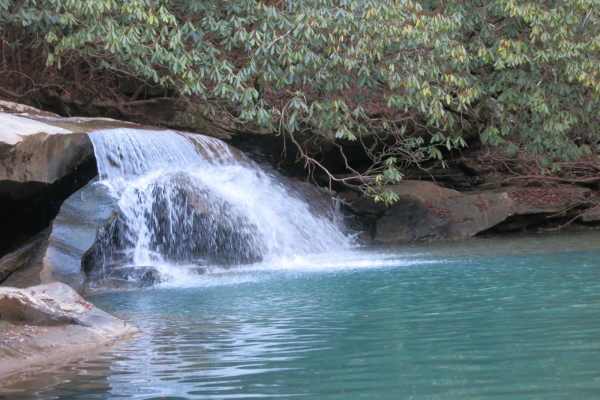
Trail 37 - Hickory Creek Trail
This trail is a wide rocky trail with small mud holes, transitioning to a single-track trail with longer mud holes, rocks, and water crossings near the end. At the end of the trail, you are rewarded with a waterfall and swimming hole. It draws a large crowd in the summer, so expect to get creative t...
Learn more about Trail 37 - Hickory Creek Trail
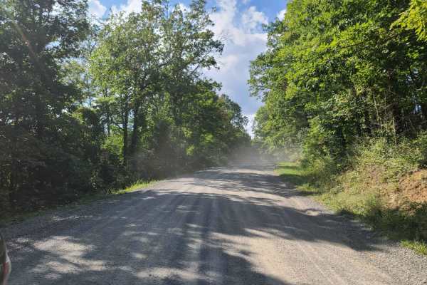
McCormick Cemetery Road - Trail 24
This trail is a maintained gravel road that connects several other popular trails. At one end it connects to Trail 19, and at the other end, it connects to Trail 25. Trail 37 is also accessible from this trail and is a popular waterfall destination. There is also a cemetery called McCormick Cemetery...
Learn more about McCormick Cemetery Road - Trail 24
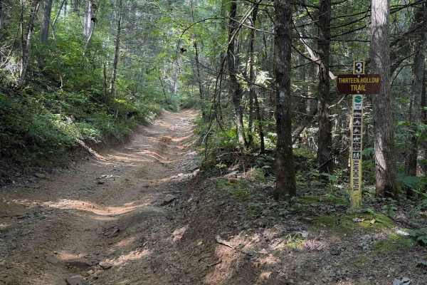
Thirteen Hollow Trail 3
Thirteen Hollow Trail is a short connector trail between Ollie’s Creek Trail 2 and Flatwoods Road Trail 1. The trail is mostly a mix of clay and dirt with loose rocks and shallow ruts that can get very slick when wet, as it rides through a dense forested hollow that holds a lot of moisture in the di...
Learn more about Thirteen Hollow Trail 3
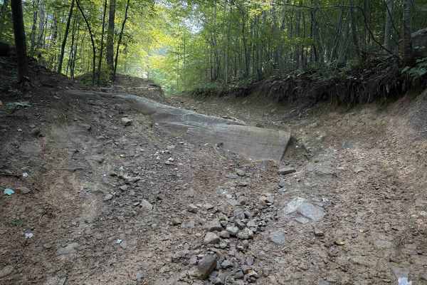
Thompson Hollow 35
Thompson Hollow is a short connector trail within the Sundquist Unit of the North Cumberland OHV Riding Area, north of the town of LaFollette, Tennessee. The .6 mile route is a steep descent off of the Overlook Trail down a narrow quad track with several embedded boulders right away that makes it mo...
Learn more about Thompson Hollow 35
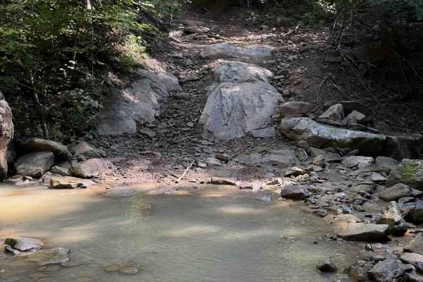
Louse Creek Trail 20
Louse Creek is an intermediate Off- Highway Vehicle trail within the Sundquist Unit of the North Cumberland Off- Highway Vehicle Riding Area, north of the town of LaFollette, Tennessee. The trail is full of greasy mud holes, deep ruts, small stream crossings, and moderate rock features. The trail su...
Learn more about Louse Creek Trail 20
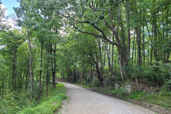
Elk Viewing Tower Road - Trail 25
This is a well-maintained gravel road that goes from Highway 25W to the elk viewing tower at Hatfield Knob. There are several viewing areas and lookouts on the way up as well, so keep an eye out for elk and deer. September is the best time to view elk, as they tend to gather into large herds during ...
Learn more about Elk Viewing Tower Road - Trail 25
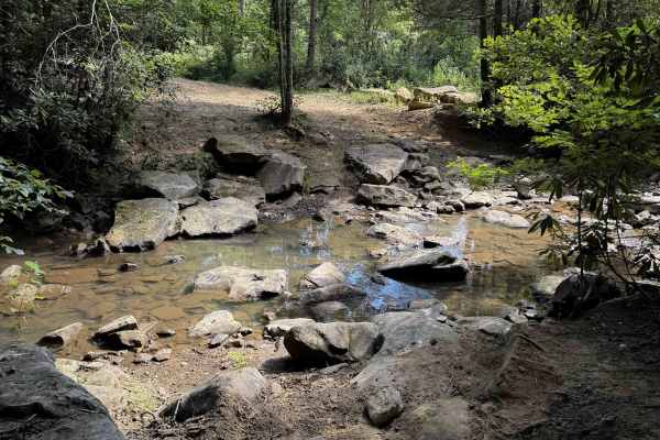
Ollie’s Creek Trail 2
Ollie’s Creek is a long OHV trail within the Sundquist Unit of the North Cumberland OHV Riding Area, with several fun rocky features, mud pits, and a great trailside view of the Yellow Branch waterfall. The east entrance starts in Jordan Hollow, from the Tank Springs Trailhead, and it connects to Tr...
Learn more about Ollie’s Creek Trail 2
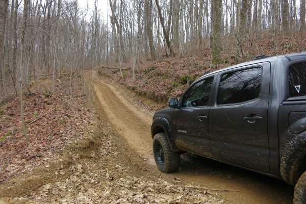
Trail 6 - Short Mountain Trail
This is a one-lane mountain road with steep climbs, ruts, and mud holes. There are places to pass and bypasses around most of the big mud holes. There is one mud pit with a steep entrance/exit that can't be bypassed and one hill climb with deep ruts that can't be bypassed. Have at least 33-inch tire...
Learn more about Trail 6 - Short Mountain Trail
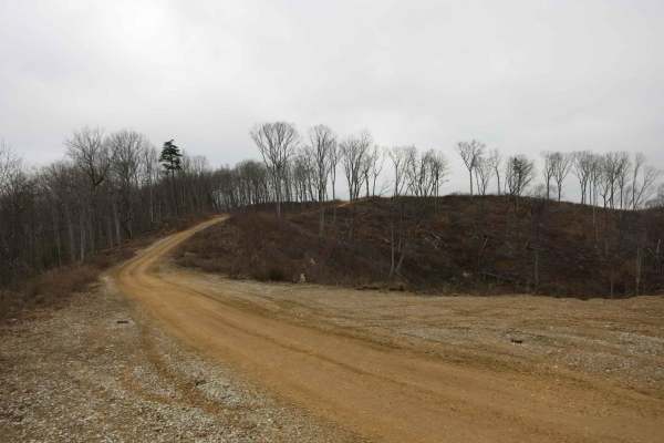
Trail 4 - Short Mountain Road
This is a road along the top of a ridge that has recently been cleared for logging. The road is wide and flat and easily accessible by most stock 4x4s. It gets a little bit rougher as it gets closer to Trail 6 with some humps and dips that may challenge low approach or departure angles. The use of t...
Learn more about Trail 4 - Short Mountain Road
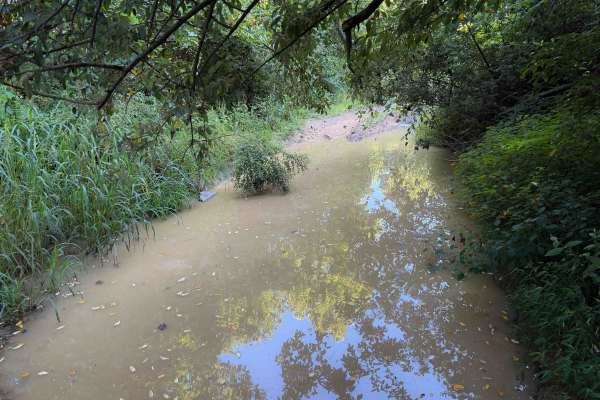
Overlook Trail 36
The Overlook Trail is a rutted and muddy 4x4 trail within the Sundquist Unit of the North Cumberland Off- Highway Vehicle Riding Area, north of the town of LaFollette, Tennessee. Starting from the south end, there are significant ruts right away, about a foot deep, crisscrossing the trail. Riders wi...
Learn more about Overlook Trail 36
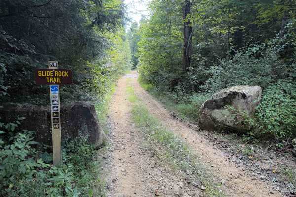
Slide Rock Trail 39
The Slide Rock Trail is a moderate off-highway vehicle trail within the Sundquist Unit of the North Cumberland off-highway vehicle Riding Area in Tennessee. It has easy sections of two-track, with a mix of gravel and loose rocks, shallow ruts, and spots of greasy mud. The dirt is mixed with clay, w...
Learn more about Slide Rock Trail 39
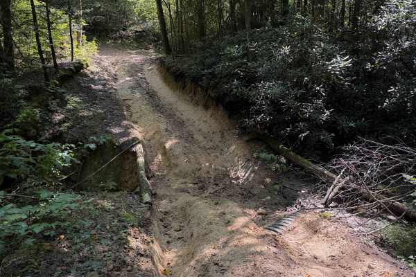
Short Ridge Trail
Short Ridge Trail is an easy Off- Highway Vehicle connector designed for riders looking for a straightforward link within the Walnut Mountain trail network in the Sundquist Unit of North Cumberland Wildlife Management Area. This short route provides a convenient transition between the main travel co...
Learn more about Short Ridge Trail
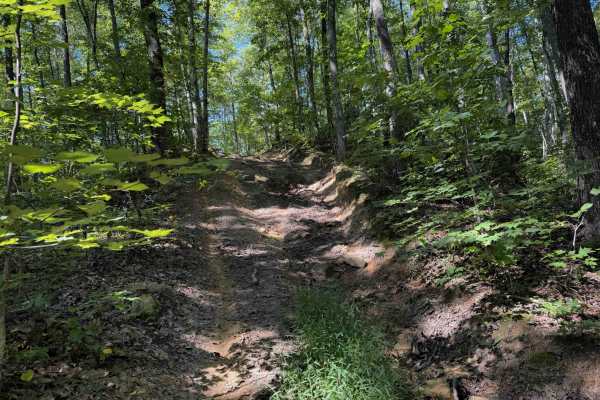
Ridge Top Trail 32
Ridge Top Trail is a dead-end spur off of the Long Haul Hollow Trail, within the Sundquist Unit of the North Cumberland Wildlife Management Area Off- Highway Vehicle Riding Area. Riders can check it out as a quick out-and-back detour. It starts out as a steep descent off of Long Haul Hollow, but the...
Learn more about Ridge Top Trail 32
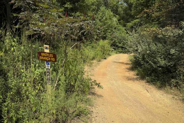
Broyles Branch Trail 17
Broyles Branch Trail is part of the Sundquist Unit in the North Cumberland OHV Riding Area. It is mostly a narrow and easy OHV trail, gradually curving around the mountain sides, making a loop off of Lee Asbury Road Trail 13. There are narrow segments where the trail is troughed and dug out below th...
Learn more about Broyles Branch Trail 17
ATV trails near LaFollette, Tennessee
Explore ATV-friendly trails near you. These trails are accessible for vehicles up to 50 inches wide, perfect for ATVs and smaller off-road machines.
Ivydell Trail
Ivydell Trail is an access road intended for experienced riders seeking a more technical challenge within the Sundquist Unit of North Cumberland Wildlife Management Area. Connecting Flatwoods Road with Ollis Creek Trail, this trail serves as a demanding entry into the interior trail network while t...
Learn more about Ivydell Trail
Ivydell Road
This is an easy two lane gravel road to the the trail system at the North Cumberland Wildlife Management Area. There is plenty of room to pass and has a 685 foot elevation gain in a short period. This road is just one of the ways to get to the Elk viewing tower. A North Cumberland Off-Highway Vehicl...
Learn more about Ivydell Road
Jamie’s Loop
Jamie’s Loop is a moderately challenging OHV route in the North Cumberland Wildlife Management Area’s Sundquist Unit, designed for riders who want a short but engaging detour off McCormick Cemetery Road. The route branches from McCormick Cemetery Road and reconnects roughly 1.8 miles later, creating...
Learn more about Jamie’s Loop
Campbell’s Split
Campbell’s Split is a short Off- Highway Vehicle trail within the North Cumberland Wildlife Management Area, in the Sundquist Unit north of LaFollette, Tennessee. At just under a mile long, the trail connects Ivydell Road (a full-width 4x4 trail) to the Ivydell Off- Highway Vehicle trail. The trail ...
Learn more about Campbell’s Split
UTV/side-by-side trails near LaFollette, Tennessee
Find UTV and side-by-side trails near you. These trails accommodate vehicles up to 60 inches wide, ideal for UTVs, side-by-sides, and wider off-road rigs.
Ivydell Trail
Ivydell Trail is an access road intended for experienced riders seeking a more technical challenge within the Sundquist Unit of North Cumberland Wildlife Management Area. Connecting Flatwoods Road with Ollis Creek Trail, this trail serves as a demanding entry into the interior trail network while t...
Learn more about Ivydell Trail
Ivydell Road
This is an easy two lane gravel road to the the trail system at the North Cumberland Wildlife Management Area. There is plenty of room to pass and has a 685 foot elevation gain in a short period. This road is just one of the ways to get to the Elk viewing tower. A North Cumberland Off-Highway Vehicl...
Learn more about Ivydell Road
Jamie’s Loop
Jamie’s Loop is a moderately challenging OHV route in the North Cumberland Wildlife Management Area’s Sundquist Unit, designed for riders who want a short but engaging detour off McCormick Cemetery Road. The route branches from McCormick Cemetery Road and reconnects roughly 1.8 miles later, creating...
Learn more about Jamie’s Loop
Campbell’s Split
Campbell’s Split is a short Off- Highway Vehicle trail within the North Cumberland Wildlife Management Area, in the Sundquist Unit north of LaFollette, Tennessee. At just under a mile long, the trail connects Ivydell Road (a full-width 4x4 trail) to the Ivydell Off- Highway Vehicle trail. The trail ...
Learn more about Campbell’s Split
The onX Offroad Difference
onX Offroad combines trail photos, descriptions, difficulty ratings, width restrictions, seasonality, and more in a user-friendly interface. Available on all devices, with offline access and full compatibility with CarPlay and Android Auto. Discover what you're missing today!
Open Trail Map