
Dirt Bike Trails
Near Keno, Oregon
Explore All Dirt Bike Trails Near Keno, Oregon
Dirt Bike Trails Near Keno, Oregon
Discover the best dirt bike trails near you. Browse trail maps, check difficulty ratings, and find your next adventure — whether you're looking for a quick ride or an all-day expedition.
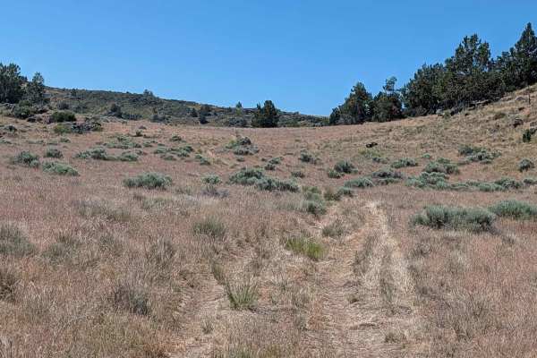
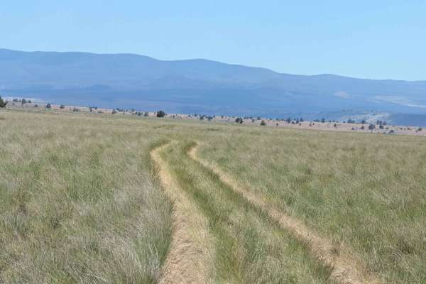
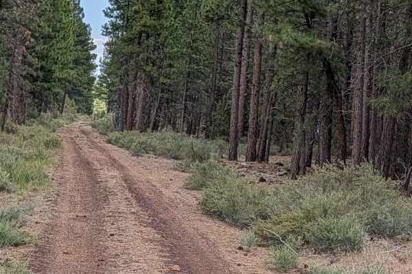
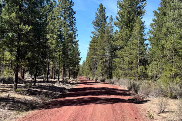
Sheep Camp Spur A - FS 47N18A
This 3.5-mile point-to-point trail connects Sheep Camp Butte to Lower Klamath Road, traveling through a meadow environment flanked by volcanic lava bed ridges. The trail surface consists of loose dirt with occasional small to medium volcanic rocks, some of which can appear unexpectedly since overgro...
Learn more about Sheep Camp Spur A - FS 47N18A
Hagelquin Loop
This is an easy trail/logging road with many offshoots and new things to explore. There is active logging, so it is best to drive this trail in the evenings or on the weekend and carry a CB radio if possible. The first ascent is steep but paved if you are entering near Hagelstein Park, so make sure ...
Learn more about Hagelquin Loop
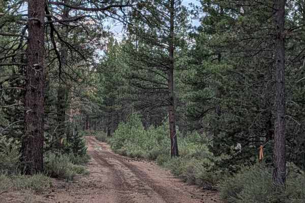
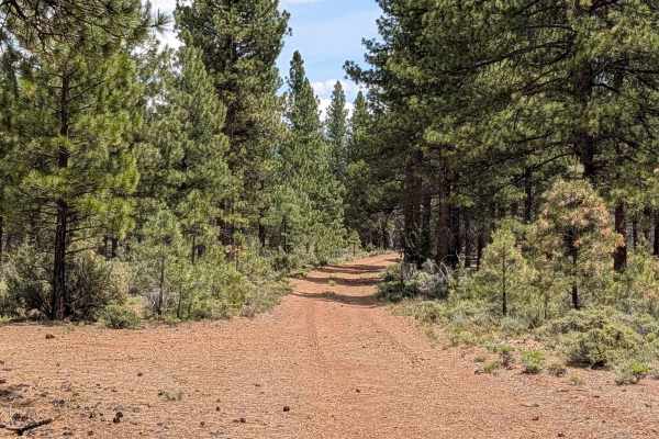
Panhandle Lake - FS 47N21
This short point-to-point route serves as an efficient and scenic shortcut connecting the Bonito Butte area with Gold Digger Pass. The trail traverses a healthy, vibrant section of the Modoc National Forest, characterized by thick stands of pine trees interspersed with patches of sagebrush. As you p...
Learn more about Panhandle Lake - FS 47N21
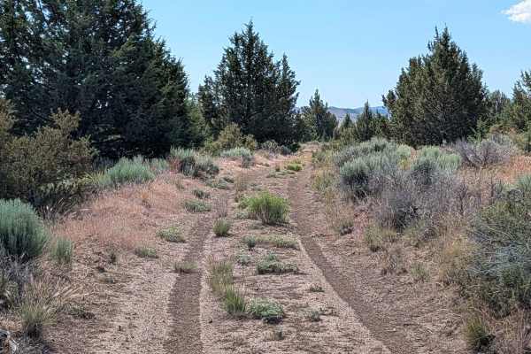
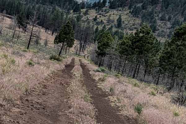
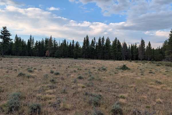
FS 46N21M
This 5-mile point-to-point route provides a scenic ascent from Gold Digger Pass toward FS 46A21K, offering an immersive journey through a diverse high-desert landscape. The trail is framed by thick sagebrush, swaying grasses, and scattered pine trees, with seasonal wildflowers often coloring the pat...
Learn more about FS 46N21M
Sheep Camp Butte - FS 47N18
This trail serves as the main north-south route for this canyon, offering dramatic scenery as it travels through the region. The trail surface consists of dirt with small volcanic rocks, surrounded by short bushes and grasses, some of which grow tall along the trail median. Seasonally blooming wildf...
Learn more about Sheep Camp Butte - FS 47N18
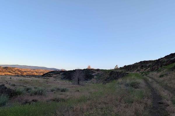
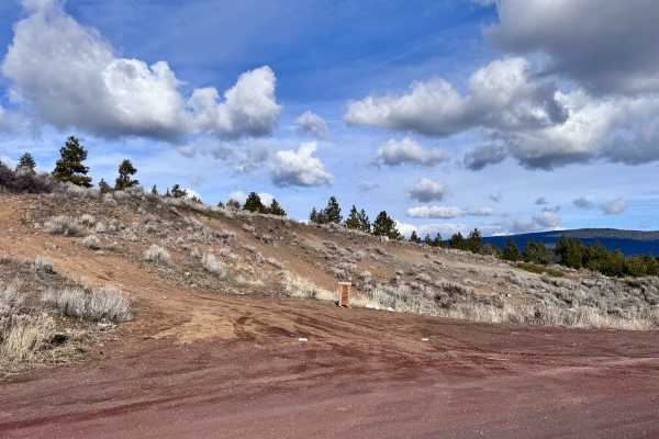
Gold Digger Pass - FS 46N21
This route begins on the east side, diverging from Hill Road within the bounds of the Lava Beds National Monument. The landscape is profoundly defined by ancient volcanic activity, with the trail winding through an environment dominated by sprawling lava rock formations interspersed with patches of ...
Learn more about Gold Digger Pass - FS 46N21
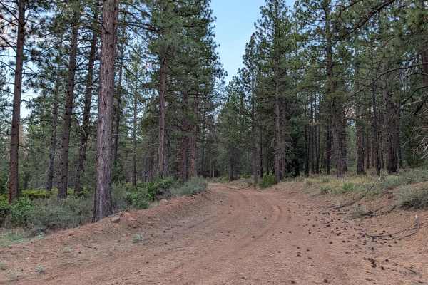
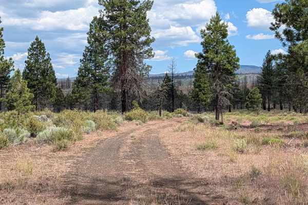
Three Sisters - FS 45N03
This trail serves as one of the main north-south routes in the area, running parallel to Highway 15. The trail is one and a half vehicles wide with a hard-packed dirt surface that remains relatively smooth throughout the journey. The route travels through a forest of healthy pine trees, scattered wi...
Learn more about Three Sisters - FS 45N03
Sisters - FS 45N24Y
This route begins off Highway 15 and serves as a direct line toward the Three Sisters landmark. The first mile of the journey traverses the aftermath of the 2021 Antelope Fire, where you will pass through a landscape defined by charred, standing timber; please note that the trail has been officially...
Learn more about Sisters - FS 45N24Y
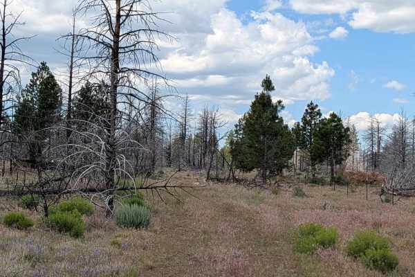
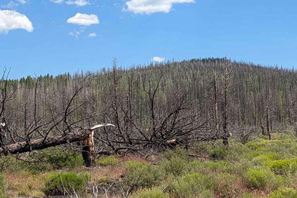
Lairds Well - FS 45N05
This route winds through a serene landscape within the Modoc National Forest, transitioning between expansive open meadows and sparse pine tree forests. The area bears significant evidence of a past forest fire, creating a unique environment where the regrowth of the forest can be observed against a...
Learn more about Lairds Well - FS 45N05
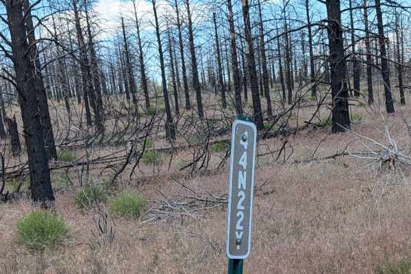
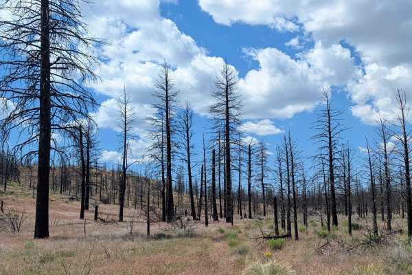
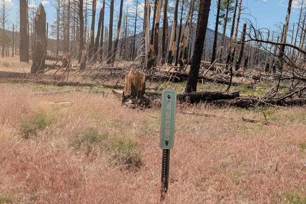
Absolutely Nothing - FS 44N22Y
This route takes you through the stark, sobering landscape of a pine forest significantly altered by the 2021 Antelope Forest Fire. The terrain is characterized by the remnants of fire-affected timber, serving as a powerful display of the fire's reach and the subsequent recovery of the high-desert e...
Learn more about Absolutely Nothing - FS 44N22Y
Porterfield Ranch
This route serves as a functional connector beginning at the south side of Porterfield Ranch, providing a passage toward the Absolutely Nothing - FS44N22Y trail, which ultimately links to Highway 10. The landscape is defined by the lasting impact of the 2021 Antelope Forest Fire, with clear evidence...
Learn more about Porterfield Ranch
Kopi North - FS 45N14Y
This 3-mile point-to-point route serves as a functional and scenic corridor running north to south, paralleling Highway 10 through the Modoc National Forest. The trail connects Highway 15 to the Dock Wells area FS 44N05 and traverses an area that marks the edge of the 2021 Antelope Fire, offering a ...
Learn more about Kopi North - FS 45N14Y
Antelope Well - FS 45N04
This route provides a seamless and accessible transit from Highway 15 to the Three Sisters area. Following extensive forest remediation efforts related to past wildfire activity, the trail has undergone significant grading, resulting in a smooth, well-maintained surface that stands in contrast to th...
Learn more about Antelope Well - FS 45N04
Bob Cat - FS 44N08Y
This route serves as an efficient and recently improved connector, beginning at Highway 15 and terminating at the Kopi South Trail. Its primary utility lies in its connectivity; it allows travelers to easily link into the Kopi South route and continue to the Dock Well loop, creating a cohesive circu...
Learn more about Bob Cat - FS 44N08Y
Antelope - FS 43N83
This 2-mile point-to-point trail serves as a scenic connector between Highway 15 and the Three Sisters Trail within the Klamath National Forest. The first half of the route passes through the significant scar of the 2021 Antelope Forest Fire; while extensive logging and cleanup efforts have removed ...
Learn more about Antelope - FS 43N83
Kopi South - FS 45N14Y
This route provides a clear, accessible path through a landscape heavily altered by the 2021 Antelope Forest Fire. The area has undergone significant remediation, with the trail recently cleared and adjacent timber logged, creating a series of open meadows that contrast with the remaining burnt fore...
Learn more about Kopi South - FS 45N14Y
Soloman - FS 4502
Soloman (FS 4502) is an easy trail designed as an alternative route to Burnt Butte Pit. It is a very easy trail with minimal terrain obstacles, perfect for a low-stress drive. This alternative route to Burnt Butte has little traffic and is a good place to go to be on your own in the woods. Keep your...
Learn more about Soloman - FS 4502
Tigers Tail - FS 44N87
This 4.5-mile point-to-point trail starts on Long Prairie Road and ends at Ragwort Trail, traveling through a mature pine forest within the Klamath National Forest. The surface consists of compact dirt with some of pine needles and pine cones. There is abundant sagebrush and other flora throughout t...
Learn more about Tigers Tail - FS 44N87
Davis Antelope - FS 44N02
This 3-mile out-and-back route begins and ends on Highway 15, guiding travelers through a compelling transition of landscapes within the Klamath National Forest. The initial portion of the trail cuts through the footprint of the 2021 Antelope Forest Fire, where extensive cleanup of fire-damaged timb...
Learn more about Davis Antelope - FS 44N02
C33 Wild Horse Mountain - FS 44N11
This 9-mile point-to-point route serves as a picturesque loop, beginning and ending on the Three Sisters Trail within the Klamath National Forest. The path winds through a mature, serene pine forest, with the forest floor richly lined by sagebrush and a variety of native flora. During the spring and...
Learn more about C33 Wild Horse Mountain - FS 44N11
ATV trails near Keno, Oregon
Explore ATV-friendly trails near you. These trails are accessible for vehicles up to 50 inches wide, perfect for ATVs and smaller off-road machines.
Sheep Camp Spur A - FS 47N18A
This 3.5-mile point-to-point trail connects Sheep Camp Butte to Lower Klamath Road, traveling through a meadow environment flanked by volcanic lava bed ridges. The trail surface consists of loose dirt with occasional small to medium volcanic rocks, some of which can appear unexpectedly since overgro...
Learn more about Sheep Camp Spur A - FS 47N18A
Hagelquin Loop
This is an easy trail/logging road with many offshoots and new things to explore. There is active logging, so it is best to drive this trail in the evenings or on the weekend and carry a CB radio if possible. The first ascent is steep but paved if you are entering near Hagelstein Park, so make sure ...
Learn more about Hagelquin Loop
Panhandle Lake - FS 47N21
This short point-to-point route serves as an efficient and scenic shortcut connecting the Bonito Butte area with Gold Digger Pass. The trail traverses a healthy, vibrant section of the Modoc National Forest, characterized by thick stands of pine trees interspersed with patches of sagebrush. As you p...
Learn more about Panhandle Lake - FS 47N21
FS 46N21M
This 5-mile point-to-point route provides a scenic ascent from Gold Digger Pass toward FS 46A21K, offering an immersive journey through a diverse high-desert landscape. The trail is framed by thick sagebrush, swaying grasses, and scattered pine trees, with seasonal wildflowers often coloring the pat...
Learn more about FS 46N21M
UTV/side-by-side trails near Keno, Oregon
Find UTV and side-by-side trails near you. These trails accommodate vehicles up to 60 inches wide, ideal for UTVs, side-by-sides, and wider off-road rigs.
Sheep Camp Spur A - FS 47N18A
This 3.5-mile point-to-point trail connects Sheep Camp Butte to Lower Klamath Road, traveling through a meadow environment flanked by volcanic lava bed ridges. The trail surface consists of loose dirt with occasional small to medium volcanic rocks, some of which can appear unexpectedly since overgro...
Learn more about Sheep Camp Spur A - FS 47N18A
Hagelquin Loop
This is an easy trail/logging road with many offshoots and new things to explore. There is active logging, so it is best to drive this trail in the evenings or on the weekend and carry a CB radio if possible. The first ascent is steep but paved if you are entering near Hagelstein Park, so make sure ...
Learn more about Hagelquin Loop
Panhandle Lake - FS 47N21
This short point-to-point route serves as an efficient and scenic shortcut connecting the Bonito Butte area with Gold Digger Pass. The trail traverses a healthy, vibrant section of the Modoc National Forest, characterized by thick stands of pine trees interspersed with patches of sagebrush. As you p...
Learn more about Panhandle Lake - FS 47N21
FS 46N21M
This 5-mile point-to-point route provides a scenic ascent from Gold Digger Pass toward FS 46A21K, offering an immersive journey through a diverse high-desert landscape. The trail is framed by thick sagebrush, swaying grasses, and scattered pine trees, with seasonal wildflowers often coloring the pat...
Learn more about FS 46N21M
The onX Offroad Difference
onX Offroad combines trail photos, descriptions, difficulty ratings, width restrictions, seasonality, and more in a user-friendly interface. Available on all devices, with offline access and full compatibility with CarPlay and Android Auto. Discover what you're missing today!
Open Trail Map