
Dirt Bike Trails
Near Clarkrange, Tennessee
Explore All Dirt Bike Trails Near Clarkrange, Tennessee
Dirt Bike Trails Near Clarkrange, Tennessee
Discover the best dirt bike trails near you. Browse trail maps, check difficulty ratings, and find your next adventure — whether you're looking for a quick ride or an all-day expedition.
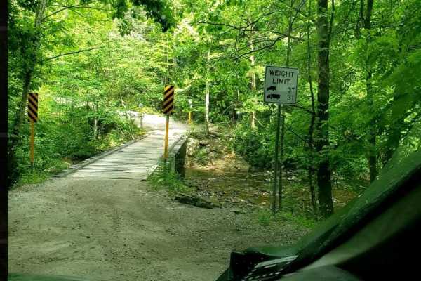
Catoosa WMA Noah Hambey
The Catoosa WMA Noah Hambey loop is a scenic, 17.7-mile gravel route winding through the southwestern reaches of the Catoosa Wildlife Management Area in Tennessee, ideal for beginners, families, or anyone seeking a relaxing, low-stress day in the woods. Rated as a mild 2 out of 10, this route is eas...
Learn more about Catoosa WMA Noah Hambey
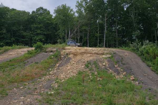
Catoosa Headrick Road
Catoosa Headrick Road offers an engaging 3.3-mile point-to-point journey across the scenic Cumberland Plateau, making it ideal for drivers of four-wheel-drive vehicles and SxSs looking for a mild yet diverse off-road experience. Rated as a 3 out of 10 in technical difficulty, this route climbs from ...
Learn more about Catoosa Headrick Road
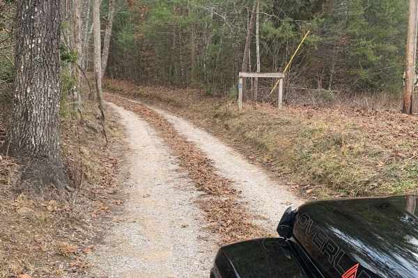
Bandy Creek Trek
This is a combination of dirt, gravel, and single-track in-the-woods roads. There really aren't a lot of difficult obstacles to make a note of other than a few areas that are washed out on Duncan Hollow Road. We had cell service off and on during this drive (Verizon). There weren't any great views a...
Learn more about Bandy Creek Trek
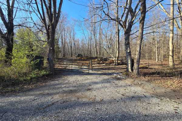
GMP Pavilion Road 1
The “Back Gate” entrance at Golden Mountain Offroad Park is a gravel access road that leads directly to the intersection of the main park road and Pavilion Road 2. This short, easy drive is primarily used by tow rigs and campers accessing the RV areas, making it well-maintained and suitable for all ...
Learn more about GMP Pavilion Road 1
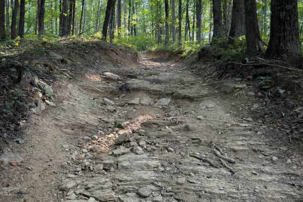
Round Mountain Trail
Round Mountain Trail is a challenging ridgeline route in the North Cumberland OHV Riding Area’s New River Unit, best suited for riders and drivers looking for sustained climbs and technical Appalachian ridge terrain. Beginning near Bowling Gap in Scott County, Tennessee, the trail heads southwest be...
Learn more about Round Mountain Trail
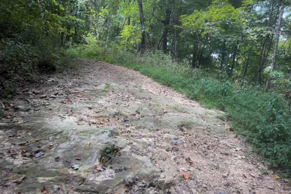
Tower Trail 30
Tower Trail is a less than half-mile-long spur off of Signal Mountain Trail that takes you to the summit of Signal Mountain, at 2,910 feet elevation. There is a utility pole at the top, and space to turn around, but not much of a view. The short spur is a narrow quad track between the dense forested...
Learn more about Tower Trail 30
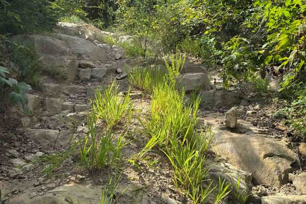
Shack Creek Connector
Shack Creek Connector is a more difficult OHV trail within the North Cumberland OHV Riding Area. The north end starts off with a steep descent over small, loose rocks on a single-lane dirt path. It stays right at the intersection with Shack Creek Road, which looks like the main route, but this trail...
Learn more about Shack Creek Connector
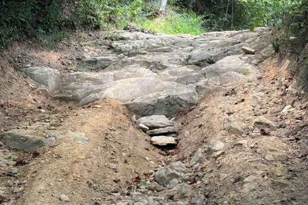
Signal Mountain Trail 29
Signal Mountain Trail is a moderate OHV trail through the North Cumberland OHV Area that spurs off of Round Mountain Trail. This trail is mostly a gradual descent from east to west on a smooth dirt track covered in a light layer of loose rocks. It rides past scenic mossy rock outcroppings in a dense...
Learn more about Signal Mountain Trail 29
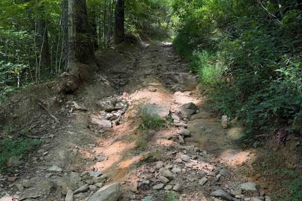
Dry Creek Trail
Dry Creek Trail is a more difficult OHV trail within the North Cumberland OHV Riding Area. The trail mostly descends from north to south, losing over 1,200 feet of elevation over 2 miles, making it rather steep. The descent is full of loose, round rolling rocks that ping you around, with ruts and em...
Learn more about Dry Creek Trail
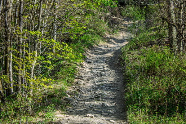
Pipeline Ridge
Pipeline Ridge Trail is a narrow, two-way dirt trail that connects the end of 4 Lane to S7 Trail. This route is a good connector, but it is noticeably tighter and more technical than 4 Lane. There are limited places to pull over and pass, so drivers should stay alert for oncoming traffic and be prep...
Learn more about Pipeline Ridge
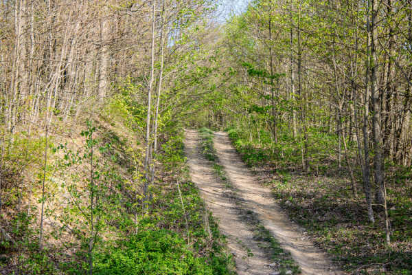
S7
S7 is a short, two-way connector trail that links Pipeline Ridge Trail to S5 Trail. The trail connects near the middle section of S5, giving drivers the option to travel either direction once they reach the end of S7. While it is not a long trail, it is a useful connector for linking routes together...
Learn more about S7
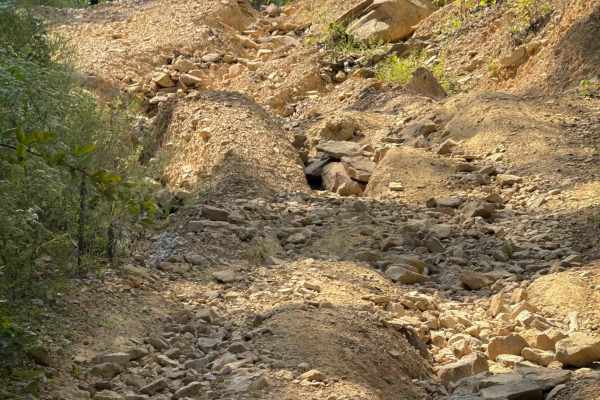
Shack Creek Road
Shack Creek Road is a short OHV trail that connects the Shack Creek Connector Trail to the Dry Creek Trail. It’s an access road for some of the utility buildings for the power lines, but it has narrow sections and a few rutted, rocky sections that make it fun to explore. The trail is unmarked, but i...
Learn more about Shack Creek Road
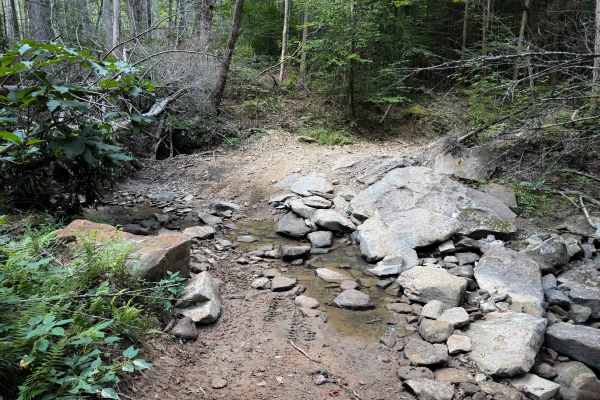
Brashy Fork Trail 6
Brashy Fork Trail is a 1.1-mile-long, moderately easy OHV route through the North Cumberland OHV Area. It mostly descends from west to east, making a loop with the Bull Creek Settlement Trail. The trail is a narrow quad track that is cut into the hillside, going through a dense and shaded forest. Th...
Learn more about Brashy Fork Trail 6
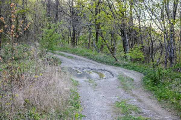
S5
S5 is a two-way trail that connects S6 back to S4 and also provides access to 4 Lane. This trail works well as a primary connector route in the area, giving drivers several options for building a longer loop or moving between nearby trails. The surface is primarily gravel, which makes it more stable...
Learn more about S5
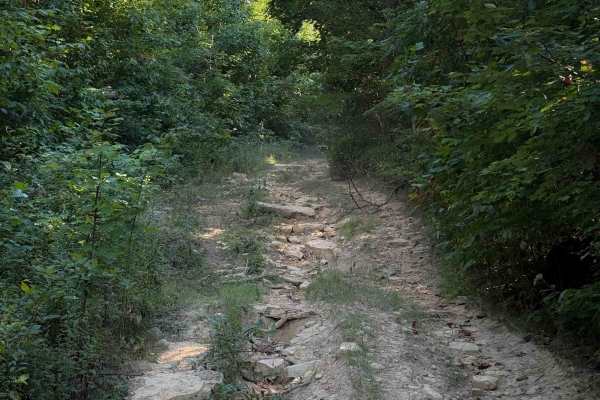
Hurstle Ridge Trail 19
Hurstle Ridge is a short but more difficult connector trail between Rocky Branch Trail and Bull Creek Trail, within the North Cumberland Off- Highway Vehicle Area. It steeply descends from south to north, dropping over 600 feet in elevation in just .8 miles. The descent has deep ruts, and the trail ...
Learn more about Hurstle Ridge Trail 19
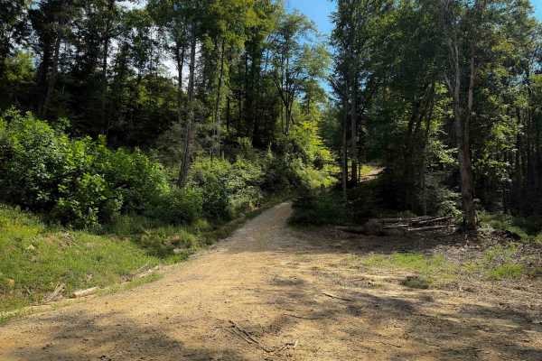
Shack Creek Trail
Shack Creek is an easy OHV trail within the North Cumberland OHV Riding Area. It is a wide dirt path covered in a light layer of small loose rocks, with shallow ruts, dips, and humps. It is wider than a single lane, giving lots of room to pass or pull over. The trail is mostly a semi-steep ascent fr...
Learn more about Shack Creek Trail
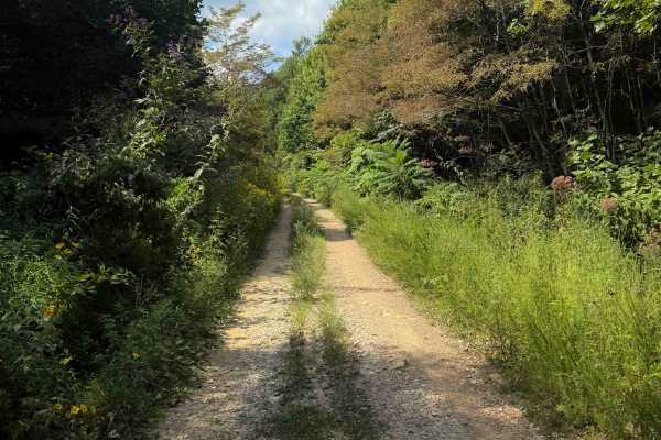
Gibson Knob Road
Gibson Knob Road is a short 4x4 trail within the North Cumberland OHV Riding Area that connects Four Lane Trail to the Gibson Knob OHV trail. It is a flat and straight gravel road with frequent mud puddles, shallow ruts, and overgrown grass in the middle of the trail. The road goes underneath some p...
Learn more about Gibson Knob Road
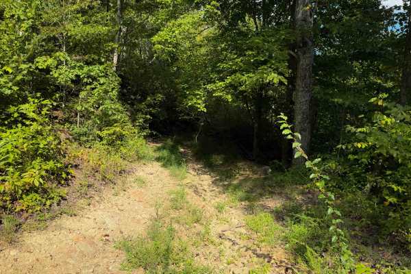
Herman Lowe Trail 25
Herman Lowe Trail is a lightly trafficked and primitive OHV trail in the North Cumberland OHV Riding Area. It spurs off of the Shack Creek Trail, and connects to Smokey Creek Road. The trail is overgrown with grass and branches as it descends steeply from north to south. Expect lots of washouts and ...
Learn more about Herman Lowe Trail 25
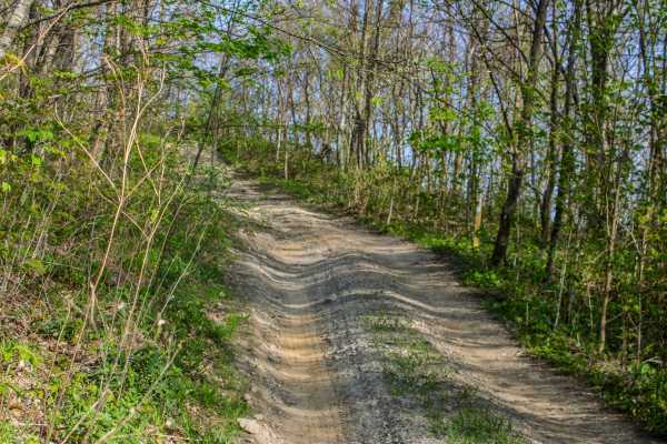
S4
S4 is a two-way trail that connects S5 and S6. The trail is made up mostly of dirt, but it has several sections where mud, standing water, deep ruts, loose rock, and tight trees make it more challenging. There are a few places where vehicles can pull over and pass, but most of the trail is narrow. D...
Learn more about S4
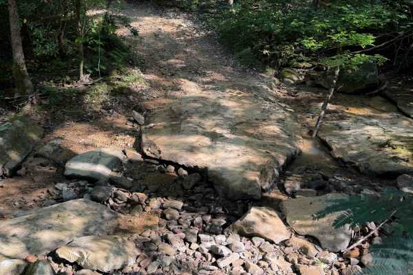
Dry Fork Trail
Dry Fork is a fun off-highway vehicle trail within the North Cumberland Off- Highway Vehicle Riding Area with moderate challenges. It’s a shelf trail that winds through a dense and shaded forest on a mix of dirt and clay that can become slippery when wet. There is a rocky dry creek crossing at the n...
Learn more about Dry Fork Trail
ATV trails near Clarkrange, Tennessee
Explore ATV-friendly trails near you. These trails are accessible for vehicles up to 50 inches wide, perfect for ATVs and smaller off-road machines.
Catoosa WMA Noah Hambey
The Catoosa WMA Noah Hambey loop is a scenic, 17.7-mile gravel route winding through the southwestern reaches of the Catoosa Wildlife Management Area in Tennessee, ideal for beginners, families, or anyone seeking a relaxing, low-stress day in the woods. Rated as a mild 2 out of 10, this route is eas...
Learn more about Catoosa WMA Noah Hambey
Catoosa Headrick Road
Catoosa Headrick Road offers an engaging 3.3-mile point-to-point journey across the scenic Cumberland Plateau, making it ideal for drivers of four-wheel-drive vehicles and SxSs looking for a mild yet diverse off-road experience. Rated as a 3 out of 10 in technical difficulty, this route climbs from ...
Learn more about Catoosa Headrick Road
Bandy Creek Trek
This is a combination of dirt, gravel, and single-track in-the-woods roads. There really aren't a lot of difficult obstacles to make a note of other than a few areas that are washed out on Duncan Hollow Road. We had cell service off and on during this drive (Verizon). There weren't any great views a...
Learn more about Bandy Creek Trek
GMP Pavilion Road 1
The “Back Gate” entrance at Golden Mountain Offroad Park is a gravel access road that leads directly to the intersection of the main park road and Pavilion Road 2. This short, easy drive is primarily used by tow rigs and campers accessing the RV areas, making it well-maintained and suitable for all ...
Learn more about GMP Pavilion Road 1
UTV/side-by-side trails near Clarkrange, Tennessee
Find UTV and side-by-side trails near you. These trails accommodate vehicles up to 60 inches wide, ideal for UTVs, side-by-sides, and wider off-road rigs.
Catoosa WMA Noah Hambey
The Catoosa WMA Noah Hambey loop is a scenic, 17.7-mile gravel route winding through the southwestern reaches of the Catoosa Wildlife Management Area in Tennessee, ideal for beginners, families, or anyone seeking a relaxing, low-stress day in the woods. Rated as a mild 2 out of 10, this route is eas...
Learn more about Catoosa WMA Noah Hambey
Catoosa Headrick Road
Catoosa Headrick Road offers an engaging 3.3-mile point-to-point journey across the scenic Cumberland Plateau, making it ideal for drivers of four-wheel-drive vehicles and SxSs looking for a mild yet diverse off-road experience. Rated as a 3 out of 10 in technical difficulty, this route climbs from ...
Learn more about Catoosa Headrick Road
Bandy Creek Trek
This is a combination of dirt, gravel, and single-track in-the-woods roads. There really aren't a lot of difficult obstacles to make a note of other than a few areas that are washed out on Duncan Hollow Road. We had cell service off and on during this drive (Verizon). There weren't any great views a...
Learn more about Bandy Creek Trek
GMP Pavilion Road 1
The “Back Gate” entrance at Golden Mountain Offroad Park is a gravel access road that leads directly to the intersection of the main park road and Pavilion Road 2. This short, easy drive is primarily used by tow rigs and campers accessing the RV areas, making it well-maintained and suitable for all ...
Learn more about GMP Pavilion Road 1
The onX Offroad Difference
onX Offroad combines trail photos, descriptions, difficulty ratings, width restrictions, seasonality, and more in a user-friendly interface. Available on all devices, with offline access and full compatibility with CarPlay and Android Auto. Discover what you're missing today!
Open Trail Map