
Dirt Bike Trails
Near California Pines, California
Explore All Dirt Bike Trails Near California Pines, California
Dirt Bike Trails Near California Pines, California
Discover the best dirt bike trails near you. Browse trail maps, check difficulty ratings, and find your next adventure — whether you're looking for a quick ride or an all-day expedition.
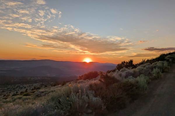
Mount Lively South Fork Mountain Road
This trail begins just off Highway 395 south of the village of Likely, starting on BLM land before transitioning in and out of Modoc National Forest. The first stretch is a recently graded dirt road with scattered loose and embedded rocks, surrounded by sagebrush and stands of pine. After about thre...
Learn more about Mount Lively South Fork Mountain Road
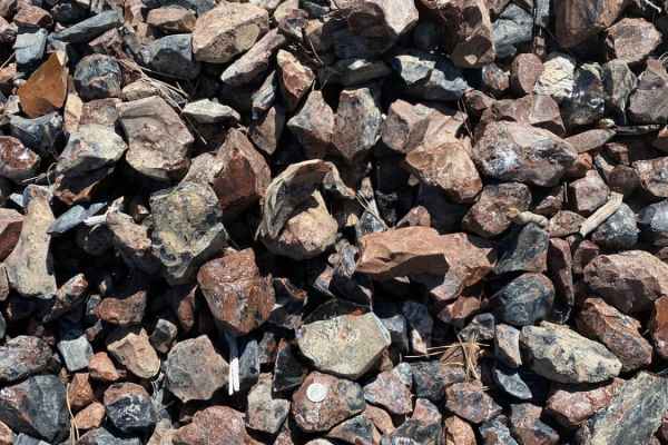
Warner Mountains
This area is part of Modoc National Forest. There are several obsidian collection areas that require a permit that can be obtained at the Alturas Forest Service building. Once you get into the range, the obsidian is everywhere, so beware of flat tires. The area is known for its pink and rainbow obsi...
Learn more about Warner Mountains
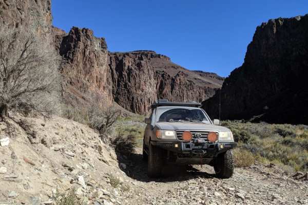
High Rock Canyon
High Rock Canyon is a rugged, two-track trail following the canyon floor and crossing High Rock Creek multiple times. It is accessed from the east via NV-8 at NV-34. This trail connects on its eastern end with Soldier's Meadow, where there is camping and hot/cold springs. From Soldier's Meadow, you ...
Learn more about High Rock Canyon
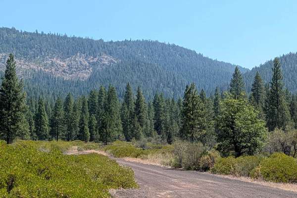
Old Camp Two - FS 41N03
This trail sits on the border of the Shasta and Lassen National Forests, with Lassen to the south and Shasta to the north. It functions as a great east to west route to connect with other trails in the area. The road starts as graded gravel before turning into a winding dirt road through the forest ...
Learn more about Old Camp Two - FS 41N03
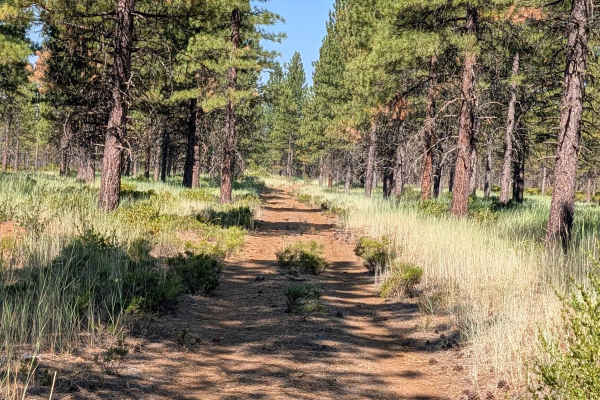
Red Cinder - FS 41N35Y
This 2.5-mile point-to-point trail connects Stud Hill North - FS 42N26 with Porcupine - FS 42N46, climbing almost 200 feet and dropping almost 100 feet, just enough elevation change to offer some views of the surrounding mountains in the distance. The route travels through new-growth pine forest wit...
Learn more about Red Cinder - FS 41N35Y
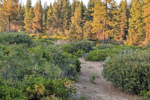
Stud Hill South - FS 42N26
The trail surface here is very powdery dirt, with some rocky sections mixed in, though the defining theme of the south side is manzanita bushes. The entire southern portion of the trail is overrun by manzanita, so expect pinstripes at minimum through this slow-moving stretch. Pine trees are sparse i...
Learn more about Stud Hill South - FS 42N26
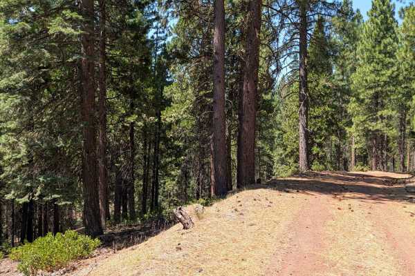
Porcupine - FS 42N46
This 2.3-mile point-to-point trail connects Porcupine Butte South - FS 41N36 with Stud Hill North and South, providing a convenient route between the two areas. Along the way, the route climbs nearly 200 feet and descends less than 100 feet through new-growth pine forest within Shasta National Fores...
Learn more about Porcupine - FS 42N46
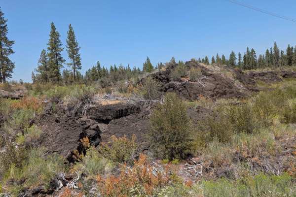
Tower 245 249 - FS 41N02X
This 2+ mile point to point trail runs along large power lines, giving access to towers 245 and 249, which is where the Forest Service name comes from. It also connects Porcupine Butte South - FS 41N36 with Stud Hill South - FS 42N26. The surface is crushed red dirt, staying one vehicle wide, and su...
Learn more about Tower 245 249 - FS 41N02X
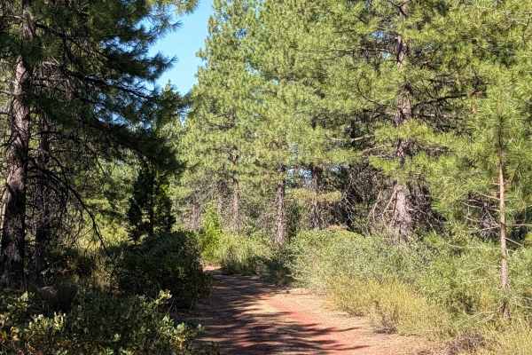
Obsdian - FS 42N35
This short trail connects Stud Hill North - FS 42N26 and Red Lava - FS 42N03, serving as a handy shortcut to get to the other side. It runs through young pine trees and lots of manzanita bushes, all within the Shasta National Forest. The surface is loose red dirt covered with old pine needles. Keep ...
Learn more about Obsdian - FS 42N35
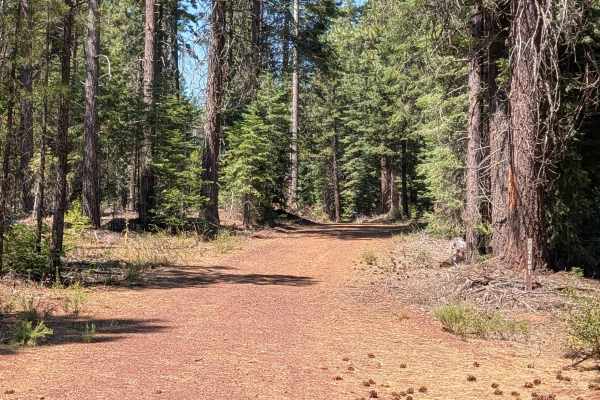
Porcupine Lake - FS 41N01
This 3-mile out-and-back route starts on Sawmill CG - FS 41N70, crossing over Porcupine Butte North - FS 41N36 along the way. The actual Porcupine Lake has long since dried up, so don't expect water at the destination. The trail stays 1.5 vehicles wide, with a surface of dirt covered by lots of old ...
Learn more about Porcupine Lake - FS 41N01
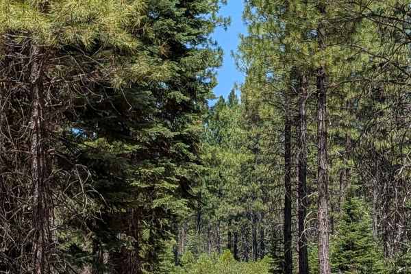
Porcupine Lake Spur C - FS 41N01C
This 2-mile out-and-back spur route starts and ends on Porcupine Lake - FS 41N01. The road runs just over one vehicle wide, made up of dusty dirt covered with dried pine cones and pine needles, surrounded by thick young to medium-aged pine trees within the Shasta National Forest. Evidence of forest ...
Learn more about Porcupine Lake Spur C - FS 41N01C
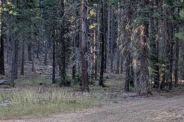
Antelope - FS 42N58
This 3-mile out-and-back route starts and ends at Black Lava FS42N23, beginning near large piles of volcanic rock. The route winds through a pine forest within the Shasta National Forest, climbing almost 400 feet over its length. The final stretch takes you up a hill on a shelf road offering views o...
Learn more about Antelope - FS 42N58
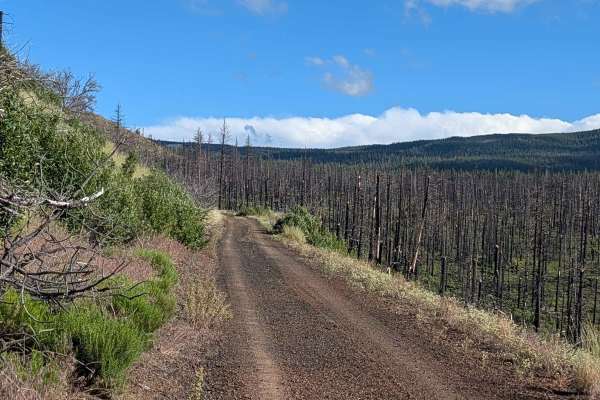
FS 44N23
This route serves as a significant transit line through the Modoc National Forest, traversing an area heavily impacted by the 2021 Antelope Forest Fire. While the fire's legacy is still clearly visible in the many standing dead trees throughout the landscape, the forest is beginning to recover with ...
Learn more about FS 44N23
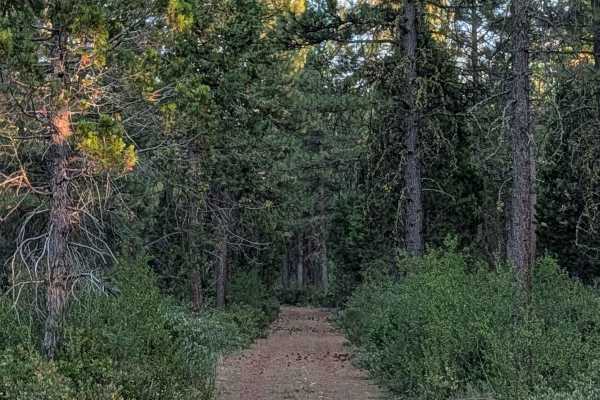
Julia - FS 41N19Y
This 2+ mile point-to-point route connects Porcupine Butt South FS - 41N36 with Stud Hill South - FS 42N26, running through a pine forest and many manzanita bushes. The trail stays 1.5 vehicles wide, with a dirt surface covered in a layer of old pine needles and pine cones. Coming from the west side...
Learn more about Julia - FS 41N19Y
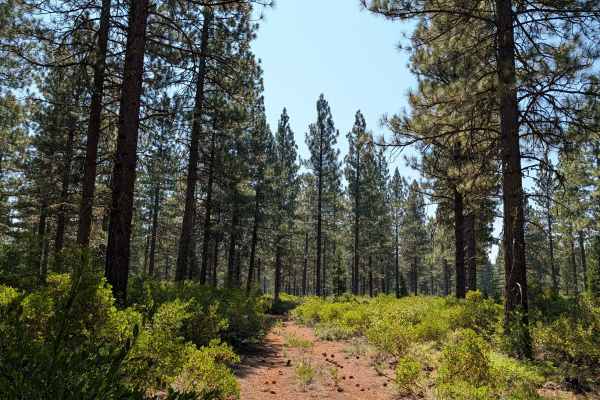
Porcupine Butte - FS 42N20
This 1.6-mile point-to-point trail connects Red Cinder - FS 41N35Y with Stud Hill North and South, making it a handy way to get from one side to the other. This is a shorter east-to-west route called Porcupine Butte, not to be confused with the longer north-to-south route sharing a similar name and ...
Learn more about Porcupine Butte - FS 42N20
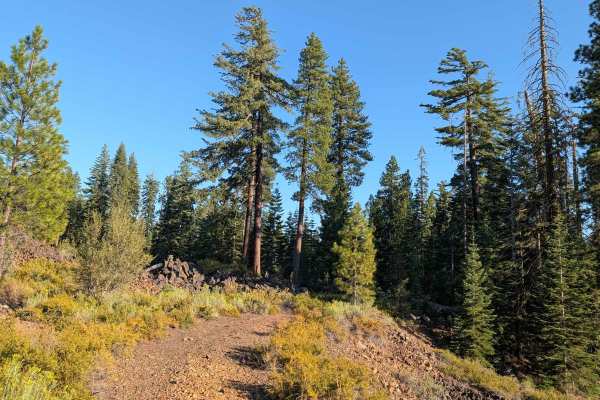
Black Lava - FS 42N23
This 6-mile point-to-point trail starts on Lava Gap - FS 42N59 and ends on Stud Hill North - FS 42N26. The trail gets its name from the large piles of lava rocks scattered throughout the area, though the pine forest sometimes hides these formations from view along the route. Just past some of the la...
Learn more about Black Lava - FS 42N23
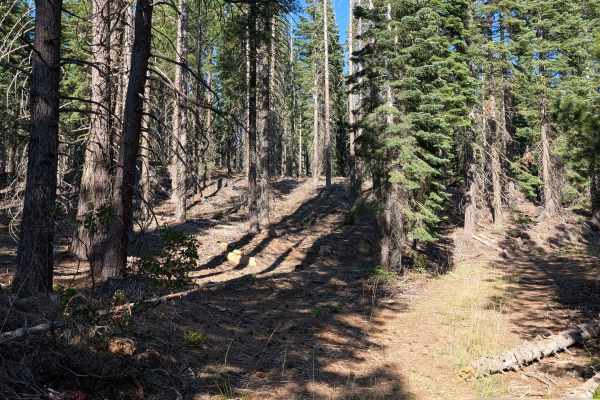
Lava Gap FS42N59
This short point-to-point trail connects Red Lava - FS 42N03 with Antelope - FS 42N58 and also provides access to Black Lava - FS 32N23. It starts in a recently logged area before continuing into young pine forest within the Shasta National Forest. The surface is loose red dirt covered with dry pine...
Learn more about Lava Gap FS42N59
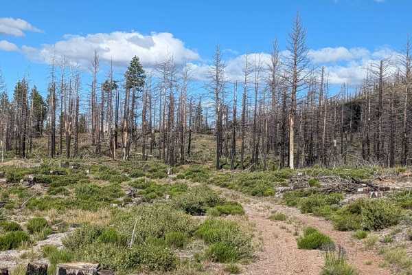
Roost Boundary - FS 44N54
This 2-mile point-to-point connector runs through the Modoc National Forest, linking Tennant Lava Bed Road (FS 44N28) to the FS 44N23 junction. Like much of the surrounding landscape, this route passes through the burn scar of the 2021 Antelope Forest Fire. The trail offers a window into the forest'...
Learn more about Roost Boundary - FS 44N54
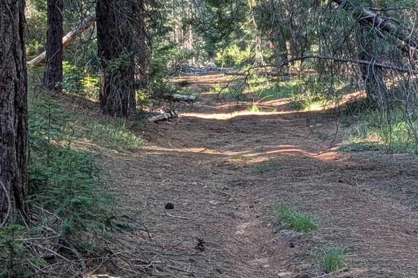
Scoria - FS 42N60
This 2-mile point-to-point route starts on Highway 49, also known as Medicine Lake Road, and ends on Red Lava - FS 42N03, passing by Saddle Hill along the way. The trail stays one vehicle wide, surrounded by pine trees, with a surface of loose red dirt covered in pine needles and pine cones.
Learn more about Scoria - FS 42N60
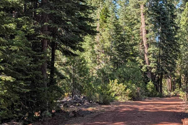
Under Timber - FS 42N04Y
This 4-mile out-and-back route starts and returns to Red Lava - FS 42N03, climbing 281 feet up around Timber Hill. The surface is hard-packed red dirt that can get very dusty at times, staying 1.5 vehicles wide and lined with thick pine trees and manzanita bushes within the Shasta National Forest. T...
Learn more about Under Timber - FS 42N04Y
ATV trails near California Pines, California
Explore ATV-friendly trails near you. These trails are accessible for vehicles up to 50 inches wide, perfect for ATVs and smaller off-road machines.
Mount Lively South Fork Mountain Road
This trail begins just off Highway 395 south of the village of Likely, starting on BLM land before transitioning in and out of Modoc National Forest. The first stretch is a recently graded dirt road with scattered loose and embedded rocks, surrounded by sagebrush and stands of pine. After about thre...
Learn more about Mount Lively South Fork Mountain Road
Warner Mountains
This area is part of Modoc National Forest. There are several obsidian collection areas that require a permit that can be obtained at the Alturas Forest Service building. Once you get into the range, the obsidian is everywhere, so beware of flat tires. The area is known for its pink and rainbow obsi...
Learn more about Warner Mountains
High Rock Canyon
High Rock Canyon is a rugged, two-track trail following the canyon floor and crossing High Rock Creek multiple times. It is accessed from the east via NV-8 at NV-34. This trail connects on its eastern end with Soldier's Meadow, where there is camping and hot/cold springs. From Soldier's Meadow, you ...
Learn more about High Rock Canyon
Old Camp Two - FS 41N03
This trail sits on the border of the Shasta and Lassen National Forests, with Lassen to the south and Shasta to the north. It functions as a great east to west route to connect with other trails in the area. The road starts as graded gravel before turning into a winding dirt road through the forest ...
Learn more about Old Camp Two - FS 41N03
UTV/side-by-side trails near California Pines, California
Find UTV and side-by-side trails near you. These trails accommodate vehicles up to 60 inches wide, ideal for UTVs, side-by-sides, and wider off-road rigs.
Mount Lively South Fork Mountain Road
This trail begins just off Highway 395 south of the village of Likely, starting on BLM land before transitioning in and out of Modoc National Forest. The first stretch is a recently graded dirt road with scattered loose and embedded rocks, surrounded by sagebrush and stands of pine. After about thre...
Learn more about Mount Lively South Fork Mountain Road
Warner Mountains
This area is part of Modoc National Forest. There are several obsidian collection areas that require a permit that can be obtained at the Alturas Forest Service building. Once you get into the range, the obsidian is everywhere, so beware of flat tires. The area is known for its pink and rainbow obsi...
Learn more about Warner Mountains
High Rock Canyon
High Rock Canyon is a rugged, two-track trail following the canyon floor and crossing High Rock Creek multiple times. It is accessed from the east via NV-8 at NV-34. This trail connects on its eastern end with Soldier's Meadow, where there is camping and hot/cold springs. From Soldier's Meadow, you ...
Learn more about High Rock Canyon
Old Camp Two - FS 41N03
This trail sits on the border of the Shasta and Lassen National Forests, with Lassen to the south and Shasta to the north. It functions as a great east to west route to connect with other trails in the area. The road starts as graded gravel before turning into a winding dirt road through the forest ...
Learn more about Old Camp Two - FS 41N03
The onX Offroad Difference
onX Offroad combines trail photos, descriptions, difficulty ratings, width restrictions, seasonality, and more in a user-friendly interface. Available on all devices, with offline access and full compatibility with CarPlay and Android Auto. Discover what you're missing today!
Open Trail Map