
Beginner Off-Road Trails
Near Woody, California
Explore All Beginner Trails Near Woody, California
Beginner Off-Road Trails Near Woody, California
Discover the best beginner-friendly off-road trails near you. These easier, lower-rated trails are a great place to start — browse trail maps, check difficulty ratings, and find your next adventure.
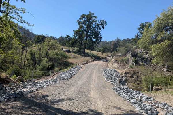
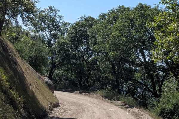
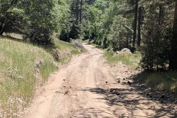
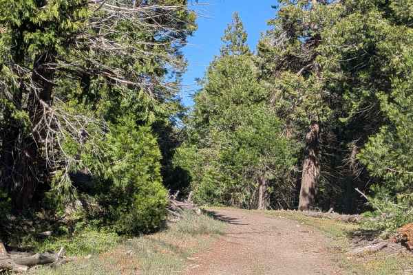
Poso Flat Road
Poso Flat Road climbs 1,300 feet and drops 400 feet over just over 3.3 miles before terminating at the paved road of the same name. The trail winds through a landscape of oak trees and open grass meadows, giving it a pastoral and open feel distinct from the denser pine forest trails in the surroundi...
Learn more about Poso Flat Road
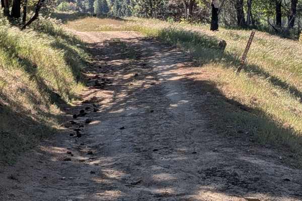
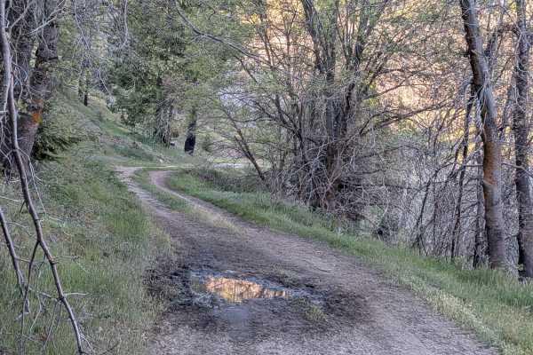
Coffee Creek Road
Coffee Creek Road is a relaxed and flat connector trail linking Poso Road and Poso Flat Road, following the course of Coffee Creek through a corridor of grass and large oak trees. The hard-packed graded surface and relatively flat terrain make this one of the most accessible trails in the network an...
Learn more about Coffee Creek Road
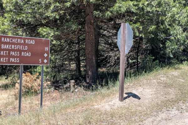
Basket Pass - FS 26S05
Basket Pass (FS 26S05) departs from Rancheria Road South and runs along a shelf road through pine forest within Sequoia National Forest, with beautiful views opening up over the valley below toward the Bakersfield area. Occasional large boulders punctuate the pine-lined corridor. The trail crosses P...
Learn more about Basket Pass - FS 26S05
Pettit - FS 26S37
Pettitt (FS 26S03) runs 6 miles from Basket Pass down to Rancheria Road South, dropping 900 feet and gaining 437 feet along a varied course through the thick Sequoia National Forest. The trail is lined with a mix of pine and oak trees, with occasional boulder fields adding visual interest along the ...
Learn more about Pettit - FS 26S37
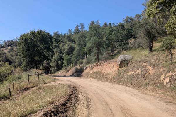
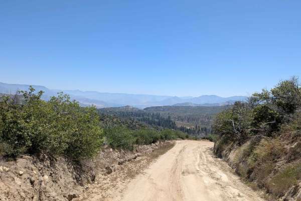
Poso Road
Poso Road departs from Rancheria Road South and drops nearly 1,500 feet in just 2 miles along a winding shelf road overlooking a small canyon. Short patches of rough asphalt appear at heavy water runoff sections along the otherwise dirt surface, remnants of earlier road hardening efforts to manage d...
Learn more about Poso Road
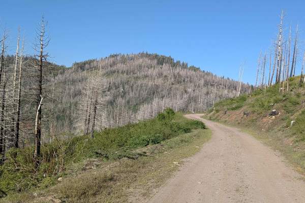
Little Poso Creek - FS 26S12
Little Poso Creek (FS 26S12) climbs over 700 feet in just under 2 miles, winding through a large stand of pine trees within Sequoia National Forest, with evidence of the 2021 French Fire visible throughout. The shelf road route meanders through the hills, delivering beautiful views of grass meadows ...
Learn more about Little Poso Creek - FS 26S12
Rhymes - FS 26S19
Rhymes FS 26S19 branches off Rancheria Road North and runs along a shelf road for the majority of its length, with a significant drop off into the canyon below throughout. The hard-packed dirt surface is consistent, and the trail is open to all vehicle types. Evidence of the 2021 French Fire is visi...
Learn more about Rhymes - FS 26S19
Greenhorn Mountain West - FS 26S01
Greenhorn Mountain West (FS 26S01) cuts through dense pine forest within Sequoia National Forest, running along a shelf road with views of the valley below and surrounding mountaintops. The tree canopy is thick throughout, with overgrown low-hanging branches making frequent contact with taller vehic...
Learn more about Greenhorn Mountain West - FS 26S01
Davis Loop - FS 26S13/26S30
Davis Loop (FS 26S13 & FS 26S30) departs from Rancheria Road South, crosses back over the same trail mid-route, and continues east through open grass and pine forest within Sequoia National Forest. Large boulders punctuate the landscape along the way. A barbed wire fence runs alongside portions of t...
Learn more about Davis Loop - FS 26S13/26S30
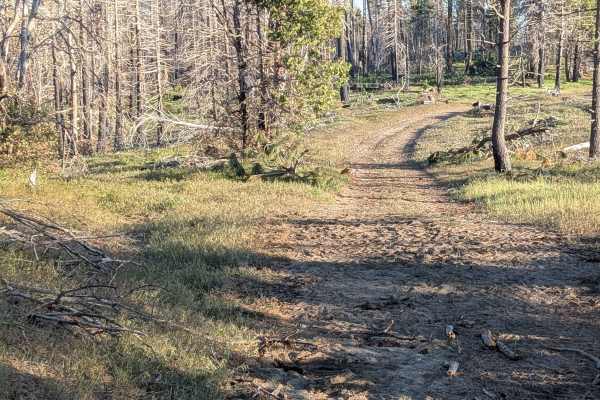
Poso Creek East - FS 26S29
Poso Creek East (FS 26S29) runs along a wide ridge line through Sequoia National Forest with open views of the valleys and mountains on both sides. The evidence of the 2021 French Fire is very apparent throughout the route. Whitetail deer are frequently spotted along this trail, and cattle graze the...
Learn more about Poso Creek East - FS 26S29
Likely Saddle - FS 26S20
Likely Saddle FS 26S20 serves as a connector between Rancheria Road and various other trails in the network, threading through thick pine forest within Sequoia National Forest. The hard-packed dirt surface is fairly smooth, and the trail is a practical and low-stress link between destinations. Evide...
Learn more about Likely Saddle - FS 26S20
Brown's Mill - FS 26S04
Brown's Mill (FS 26S04) departs from Rancheria Road South and winds through a thick stand of pine and other trees within Sequoia National Forest. A partial shelf road section opens up views of the valleys below and the mountains in the distance before the forest closes back in. Downed branches are p...
Learn more about Brown's Mill - FS 26S04
West Evans - FS 31E62
West Evans (FS 31E62) departs from Rancheria Road South and climbs steadily through dense pine forest within Sequoia National Forest. The trail is extremely narrow, barely one vehicle wide, with low-hanging branches that will make contact with taller vehicles throughout. Evidence of recent forest fi...
Learn more about West Evans - FS 31E62
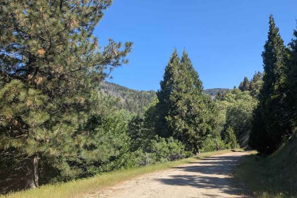
Sawmill Road
Sawmill Road is the primary west-to-east corridor in this section of the Sequoia National Forest, departing from Rancheria Road North and climbing over 2,300 feet in just over 7.5 miles. The trail runs along a shelf road with a canyon dropping away to the south and a drainage ditch to the north, giv...
Learn more about Sawmill Road
Rancheria Road North - FS 25S15
Rancheria Road North (FS 25S15) is one of the primary north-to-south corridors through this section of Sequoia National Forest, serving as the gateway to numerous spur trails in the network. The hard-packed dirt and gravel surface runs from Alta Sierra Ski Resort down to the entrance of Evans Flat C...
Learn more about Rancheria Road North - FS 25S15
Rancheria Road South - FS 25S15
Rancheria Road South (FS 25S15), beginning at Evans Flat Campground and running south through Sequoia National Forest. As one of the primary north-to-south arteries in the area, it is well-maintained and provides access to numerous trails throughout the network. The route is lined with large pine an...
Learn more about Rancheria Road South - FS 25S15
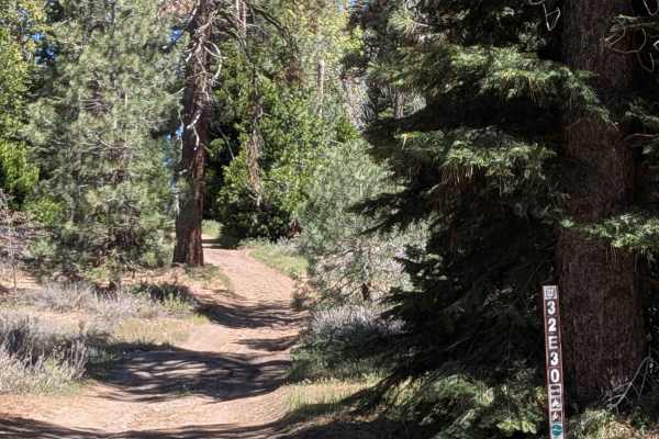
North Evans - FS 32E30
North Evans (FS 32E30) serves as a key connector linking Sawmill Road, Evans Flat (FS 32E53A), Woodward Peak (FS 32E53), Borderline 4WD (FS 32E42), and Rancheria Road North into a cohesive network. The trail cuts through the Sequoia National Forest with a mostly open canopy, though low-hanging branc...
Learn more about North Evans - FS 32E30
Eagle - FS 27S13
Eagle (FS 27S13) branches off Brown's Mill and winds through dense pine trees and grasses within Sequoia National Forest. Shelf road sections break open the canopy at intervals, revealing views of the mountains and valley below before the forest closes back in. Hawks and ground birds, including quai...
Learn more about Eagle - FS 27S13
Frank - FS 26S07
Frank FS 26S07 departs from Rancheria Road and runs along a narrow shelf road through grass and pine forest, much of which shows significant burn damage from the 2021 French Fire. Views of the valley and canyons below appear along the shelf sections. The trail currently ends earlier than its full ex...
Learn more about Frank - FS 26S07
Pine Flat - FS 23S05
Pine Flat FS23S05 departs from Pine Flat and climbs its way toward the White River, gaining over 700 feet and dropping over 300 feet across 3 miles along a shelf road above Capinero Creek. The trail is lined with oak trees and some pine trees throughout, giving it a warmer and more open character th...
Learn more about Pine Flat - FS 23S05
Beginner ATV trails near Woody, California
Explore ATV-friendly trails near you. These trails are accessible for vehicles up to 50 inches wide, perfect for ATVs and smaller off-road machines.
Coffee Creek Road
Coffee Creek Road is a relaxed and flat connector trail linking Poso Road and Poso Flat Road, following the course of Coffee Creek through a corridor of grass and large oak trees. The hard-packed graded surface and relatively flat terrain make this one of the most accessible trails in the network an...
Learn more about Coffee Creek Road
Basket Pass - FS 26S05
Basket Pass (FS 26S05) departs from Rancheria Road South and runs along a shelf road through pine forest within Sequoia National Forest, with beautiful views opening up over the valley below toward the Bakersfield area. Occasional large boulders punctuate the pine-lined corridor. The trail crosses P...
Learn more about Basket Pass - FS 26S05
Pettit - FS 26S37
Pettitt (FS 26S03) runs 6 miles from Basket Pass down to Rancheria Road South, dropping 900 feet and gaining 437 feet along a varied course through the thick Sequoia National Forest. The trail is lined with a mix of pine and oak trees, with occasional boulder fields adding visual interest along the ...
Learn more about Pettit - FS 26S37
Poso Road
Poso Road departs from Rancheria Road South and drops nearly 1,500 feet in just 2 miles along a winding shelf road overlooking a small canyon. Short patches of rough asphalt appear at heavy water runoff sections along the otherwise dirt surface, remnants of earlier road hardening efforts to manage d...
Learn more about Poso Road
Beginner UTV/side-by-side trails near Woody, California
Find UTV and side-by-side trails near you. These trails accommodate vehicles up to 60 inches wide, ideal for UTVs, side-by-sides, and wider off-road rigs.
Coffee Creek Road
Coffee Creek Road is a relaxed and flat connector trail linking Poso Road and Poso Flat Road, following the course of Coffee Creek through a corridor of grass and large oak trees. The hard-packed graded surface and relatively flat terrain make this one of the most accessible trails in the network an...
Learn more about Coffee Creek Road
Basket Pass - FS 26S05
Basket Pass (FS 26S05) departs from Rancheria Road South and runs along a shelf road through pine forest within Sequoia National Forest, with beautiful views opening up over the valley below toward the Bakersfield area. Occasional large boulders punctuate the pine-lined corridor. The trail crosses P...
Learn more about Basket Pass - FS 26S05
Pettit - FS 26S37
Pettitt (FS 26S03) runs 6 miles from Basket Pass down to Rancheria Road South, dropping 900 feet and gaining 437 feet along a varied course through the thick Sequoia National Forest. The trail is lined with a mix of pine and oak trees, with occasional boulder fields adding visual interest along the ...
Learn more about Pettit - FS 26S37
Poso Road
Poso Road departs from Rancheria Road South and drops nearly 1,500 feet in just 2 miles along a winding shelf road overlooking a small canyon. Short patches of rough asphalt appear at heavy water runoff sections along the otherwise dirt surface, remnants of earlier road hardening efforts to manage d...
Learn more about Poso Road
The onX Offroad Difference
onX Offroad combines trail photos, descriptions, difficulty ratings, width restrictions, seasonality, and more in a user-friendly interface. Available on all devices, with offline access and full compatibility with CarPlay and Android Auto. Discover what you're missing today!
Open Trail Map