
Beginner Off-Road Trails
Near McLeod, Texas
Explore All Beginner Trails Near McLeod, Texas
Beginner Off-Road Trails Near McLeod, Texas
Discover the best beginner-friendly off-road trails near you. These easier, lower-rated trails are a great place to start — browse trail maps, check difficulty ratings, and find your next adventure.
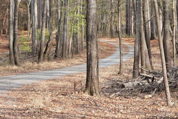
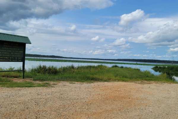
Boggy Creek Monster Trail
This is a maintained gravel road in Mercer Bayou Wildlife Area. Mercer Bayou is a gut located just 18.4 miles from Texarkana, in Miller County, in the state of Arkansas, United States, near Jonesville, AR. Sightings of the Boggy Creek Monster have been reported in this area. The road is normally in ...
Learn more about Boggy Creek Monster Trail
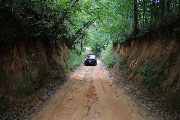
Old Stagecoach Road
Old Stagecoach road is made up of a mix of rock, sand, and dirt. When wet you get a red clay that can be slick as ice. There are some rocks in the road about 8 inches in diameter. Some narrow washouts across the road are 8-plus inches deep. Logging trucks have been traveling sections of the road an...
Learn more about Old Stagecoach Road
Low Water Bridge on Lake Wright Patman
This route starts off of Hwy 67 just west of Texarkana and goes to the low water bridge that crosses part of Wright Patman Lake. There are plenty of areas to fish. Bring a kayak because there is water access on each side of the bridge and plenty of parking. The low water bridge does close when heav...
Learn more about Low Water Bridge on Lake Wright Patman
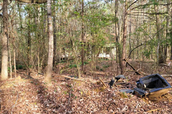
The Dead End Barrel
This trail has a bit of asphalt, dirt, and gravel. It goes to a cemetery and dead-ends at an oil structure. This trail is north of Ivan Lake and northwest of Williams Lake. You will also see an old deserted house on the right-hand side of the road.
Learn more about The Dead End Barrel
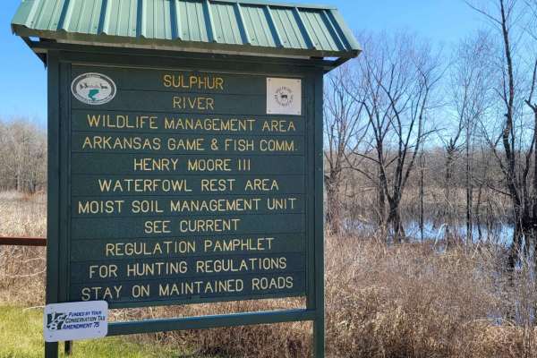
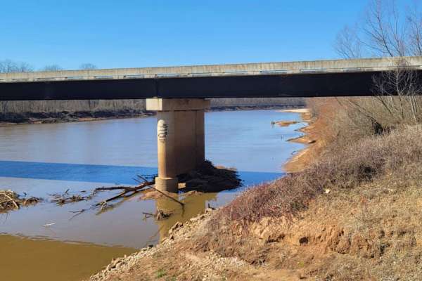
Trail to the Sulphur River
This gravel road starts at the Highway 67 and Highway 8 intersection. It is just past the Highway 8 turn if you're coming from Maud, Texas. You will cross the railroad tracks and follow the maintained gravel road to the Sulphur River. There is a boat launch (dirt ramp) at the end of this road. Along...
Learn more about Trail to the Sulphur River
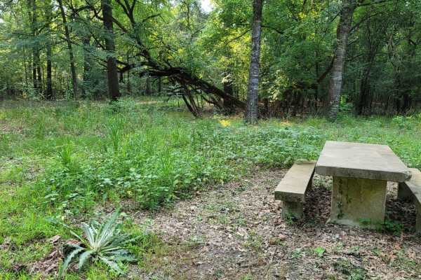
Ivan Lake Trail
This gravel road passes through the Ivan Lake area. There are a few primitive camping spots (permit required), a beautiful fishing lake, and restrooms. This trail exits the park area and heads Northwest towards Arkansas. This is in the Bayou Bodcau WMA, and all WMA rules apply. There is plenty of wi...
Learn more about Ivan Lake Trail
Enter Bodcau Wildlife Management Area
This trail starts at the entry of Bodcau WMA and ends at HWY 371. It stops at an offshoot to a boat ramp with a view of big cypress trees and Bodcau creek. There is also a dirt boat ramp to put a small boat or kayaks in the creek and pond to explore or fish.
Learn more about Enter Bodcau Wildlife Management Area
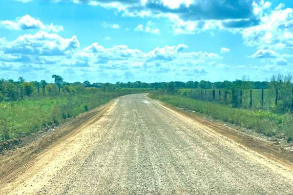
Follow the Red River
This 30-mile route follows along the Northside of the Red River. This East to West route is almost completely gravel roads. The roads are maintained but can be nasty after or during rains. Although you may not see a lot of the river, you will see lots of pasture land with livestock, creeks with brid...
Learn more about Follow the Red River
Bois d'Ark Arkansas Spillway & Dam
This 13,626-acre area is composed of 5,866 acres of state-owned land and 7,760 acres leased from International Paper and Potlatch timber companies.The primary objective of this management area is to provide high-quality wildlife habitat and public hunting opportunities. Bois d'Arc Lake provides exc...
Learn more about Bois d'Ark Arkansas Spillway & Dam
Tower Ends at Private Fishing Club
Gravel Road that goes by a cell tower, lots of fields, and ends at a private fishing club where you will have to turn around. After turning around and backtracking, if you turn right eventually, you can end up on HWY 82. These roads run through private property, so stay on the roads.
Learn more about Tower Ends at Private Fishing Club
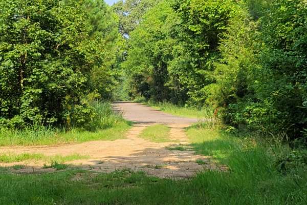
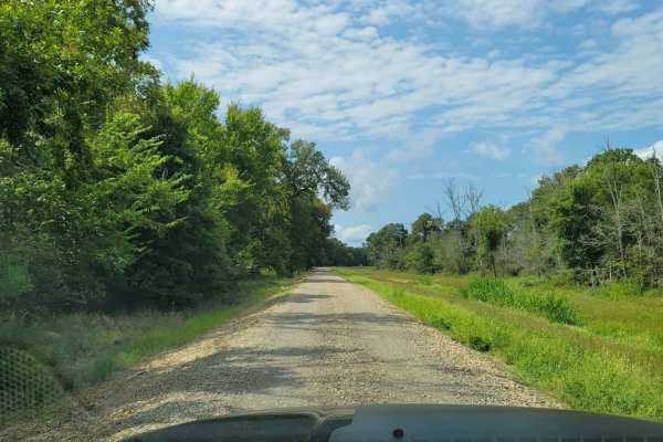
Tuckers Corner CR4306
This is a rural dirt road that winds through open cattle fields, featuring minor washes along the route. The road surface is a mix of gravel and red dirt, with narrow passing lanes in certain areas that require caution when meeting oncoming traffic. It is generally passable in dry conditions but can...
Learn more about Tuckers Corner CR4306
Bois d'Ark Trail back to Interstate 30
This 13,626-acre area is composed of 5,866 acres of state-owned land and 7,760 acres leased from International Paper and Potlatch timber companies.The primary objective of this management area is to provide high-quality wildlife habitat and public hunting opportunities. Bois d' Arc Lake provides ex...
Learn more about Bois d'Ark Trail back to Interstate 30
Too Easy
This is a short connector from "Creek Trail" to "Something Else".
Learn more about Too Easy
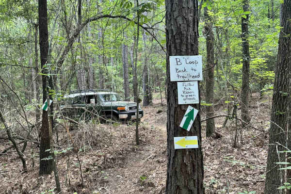
10 Mile
This flowy trail marked by green arrows is a good way to traverse the park if you need to connect the southeast side to the northeast side quickly. The trail is mostly smooth with a few exposed roots, but an occasional tree obstacle to keep the technical skills fresh.
Learn more about 10 Mile
We Show
We Show ** Park Rating: 2/5 ** Technical Rating: 2/10 ** Detailed Notes ** Very tight, short trail designed for short wheelbase rigs. Not recommended for full-size rigs due to sharp turns and narrow lines. Multiple dirt bike crossings. A fun small obstacle at the end that requires a lift but has a b...
Learn more about We Show
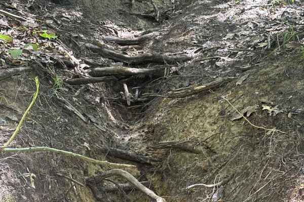
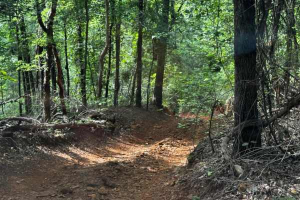
The Pope
This East Texas singletrack cuts through a dense forest of pines and hardwoods on a primarily dirt surface. Riders will encounter frequent exposed roots and occasional patches of rock that add technical character without raising the difficulty too high. The trail features rolling elevation with a fe...
Learn more about The Pope

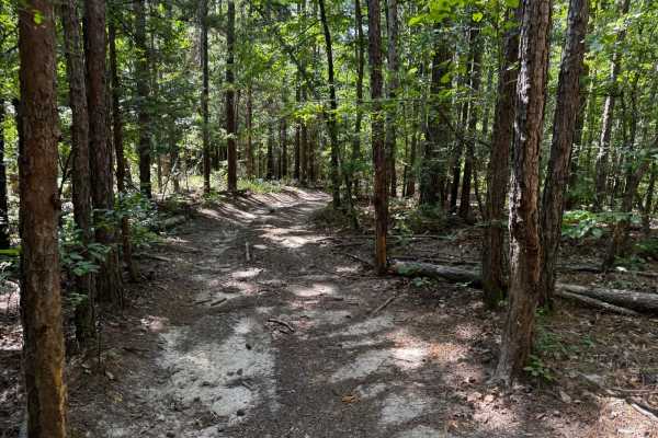
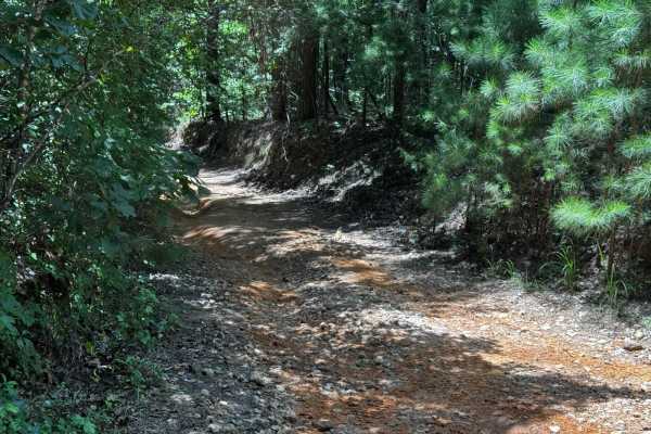
Southeast Main Road
Southeast Main Road ** Park Rating: 1/5 ** Technical Rating: 2/10 **Detailed Notes** Loose dirt and rocks, wide enough for large rigs and trailers, mild bumps. Connects to multiple trails and pavilions. Not technical, serves as a main access and positioning route. Can get muddy in spots after rain b...
Learn more about Southeast Main Road
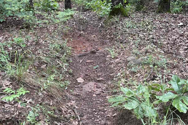
Sunday Cruise Bypass
Sunday Cruise Bypass ** Park Rating: 2/5 ** Technical Rating: 3/10 ** Detailed Notes ** Loose rocks, dirt, and clay; tight canyon-style walls and a water crossing. Steep inclines and declines, but no major ledges. Becomes more slick and tricky after rain. One-directional design makes it straightforw...
Learn more about Sunday Cruise Bypass
Linda Gail
Linda Gail ** Park Rating: 2/5 ** Technical Rating: 3/10 ** Detailed Notes ** Scenic and beginner-friendly trail with multiple rocky creek crossings. Off-camber sections and small rocky obstacles present learning opportunities without big risks. Bypasses exist for all challenging areas. Watch for di...
Learn more about Linda Gail
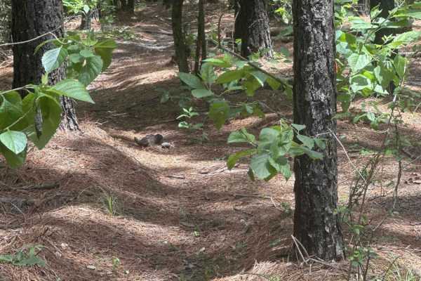
Short Blast
This short, intermediate trail takes you through a pine forest, squeezing through tight trees.
Learn more about Short Blast
Beginner ATV trails near McLeod, Texas
Explore ATV-friendly trails near you. These trails are accessible for vehicles up to 50 inches wide, perfect for ATVs and smaller off-road machines.
Enter Bodcau Wildlife Management Area
This trail starts at the entry of Bodcau WMA and ends at HWY 371. It stops at an offshoot to a boat ramp with a view of big cypress trees and Bodcau creek. There is also a dirt boat ramp to put a small boat or kayaks in the creek and pond to explore or fish.
Learn more about Enter Bodcau Wildlife Management Area
Tuckers Corner CR4306
This is a rural dirt road that winds through open cattle fields, featuring minor washes along the route. The road surface is a mix of gravel and red dirt, with narrow passing lanes in certain areas that require caution when meeting oncoming traffic. It is generally passable in dry conditions but can...
Learn more about Tuckers Corner CR4306
We Show
We Show ** Park Rating: 2/5 ** Technical Rating: 2/10 ** Detailed Notes ** Very tight, short trail designed for short wheelbase rigs. Not recommended for full-size rigs due to sharp turns and narrow lines. Multiple dirt bike crossings. A fun small obstacle at the end that requires a lift but has a b...
Learn more about We Show
Southeast Main Road
Southeast Main Road ** Park Rating: 1/5 ** Technical Rating: 2/10 **Detailed Notes** Loose dirt and rocks, wide enough for large rigs and trailers, mild bumps. Connects to multiple trails and pavilions. Not technical, serves as a main access and positioning route. Can get muddy in spots after rain b...
Learn more about Southeast Main Road
Beginner UTV/side-by-side trails near McLeod, Texas
Find UTV and side-by-side trails near you. These trails accommodate vehicles up to 60 inches wide, ideal for UTVs, side-by-sides, and wider off-road rigs.
Enter Bodcau Wildlife Management Area
This trail starts at the entry of Bodcau WMA and ends at HWY 371. It stops at an offshoot to a boat ramp with a view of big cypress trees and Bodcau creek. There is also a dirt boat ramp to put a small boat or kayaks in the creek and pond to explore or fish.
Learn more about Enter Bodcau Wildlife Management Area
Tuckers Corner CR4306
This is a rural dirt road that winds through open cattle fields, featuring minor washes along the route. The road surface is a mix of gravel and red dirt, with narrow passing lanes in certain areas that require caution when meeting oncoming traffic. It is generally passable in dry conditions but can...
Learn more about Tuckers Corner CR4306
We Show
We Show ** Park Rating: 2/5 ** Technical Rating: 2/10 ** Detailed Notes ** Very tight, short trail designed for short wheelbase rigs. Not recommended for full-size rigs due to sharp turns and narrow lines. Multiple dirt bike crossings. A fun small obstacle at the end that requires a lift but has a b...
Learn more about We Show
Southeast Main Road
Southeast Main Road ** Park Rating: 1/5 ** Technical Rating: 2/10 **Detailed Notes** Loose dirt and rocks, wide enough for large rigs and trailers, mild bumps. Connects to multiple trails and pavilions. Not technical, serves as a main access and positioning route. Can get muddy in spots after rain b...
Learn more about Southeast Main Road
The onX Offroad Difference
onX Offroad combines trail photos, descriptions, difficulty ratings, width restrictions, seasonality, and more in a user-friendly interface. Available on all devices, with offline access and full compatibility with CarPlay and Android Auto. Discover what you're missing today!
Open Trail Map