
Beginner Off-Road Trails
Near Klamath Falls, Oregon
Explore All Beginner Trails Near Klamath Falls, Oregon
Beginner Off-Road Trails Near Klamath Falls, Oregon
Discover the best beginner-friendly off-road trails near you. These easier, lower-rated trails are a great place to start — browse trail maps, check difficulty ratings, and find your next adventure.
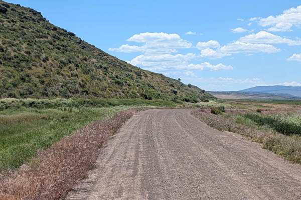
Sheepy East Hunter Access Road
This route serves as a functional and scenic corridor cutting through the Lower Klamath National Wildlife Refuge. Designed primarily to provide access for waterfowl hunters to the refuge and the northern reaches of the Modoc National Forest, the trail offers a direct line of sight into the diverse w...
Learn more about Sheepy East Hunter Access Road
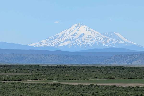
Lower Klamath Road
Embarking on this historical passage offers travelers a fascinating journey through time, tracing a segment of the storied California Trail system. As you traverse this route, the landscape unfolds in a majestic display of high-desert beauty, dominated by expansive horizons and rolling topography. T...
Learn more about Lower Klamath Road
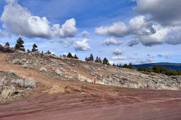
Hagelquin Loop
This is an easy trail/logging road with many offshoots and new things to explore. There is active logging, so it is best to drive this trail in the evenings or on the weekend and carry a CB radio if possible. The first ascent is steep but paved if you are entering near Hagelstein Park, so make sure ...
Learn more about Hagelquin Loop
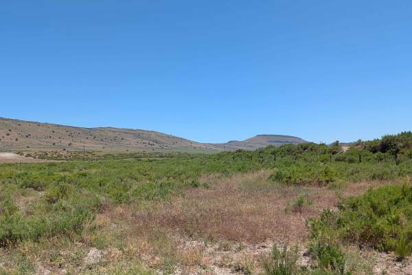
Brownell Lava Bed Road
This route begins as a divergence from the Lower Klamath Road, serving as an entry point into a distinctive landscape characterized by expansive, grassy meadows and rolling topography. The terrain is notably influenced by ancient volcanic activity, featuring gradual hills formed from weathered lava ...
Learn more about Brownell Lava Bed Road
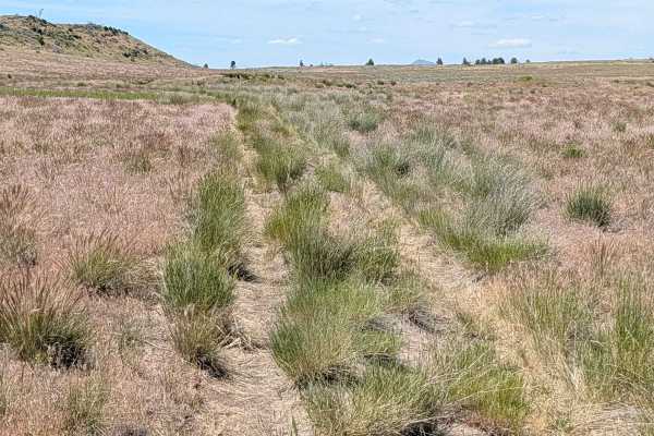
FS 47B18B
This 3.5-mile out-and-back route provides a serene journey through a wide, expansive meadow characterized by short grasses and sparse, scattered bushes. As you traverse the landscape, you will find yourself running parallel to a striking lava bed ridge situated on the western side of the meadow, whi...
Learn more about FS 47B18B
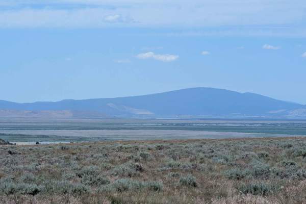
FS 47B18C
This 3.5-mile out-and-back route is a hidden gem that leads travelers up a ridge-line and into an expansive, high-altitude meadow. Reaching the summit rewards you with a spectacular 360-degree vantage point, offering panoramic views of the entire surrounding mountain range, with the prominent peak o...
Learn more about FS 47B18C
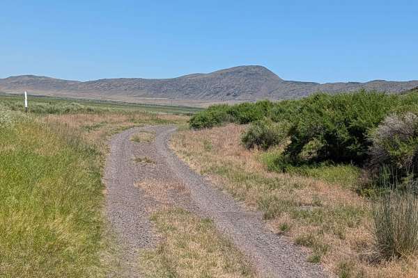
Lower Klamath Road
This exceptionally scenic route winds along a narrow shelf road situated at the base of a prominent lava bed ridge, offering expansive, panoramic views that define the character of the region. As you navigate the path, you are treated to sweeping overlooks of the Lower Klamath National Wildlife Refu...
Learn more about Lower Klamath Road
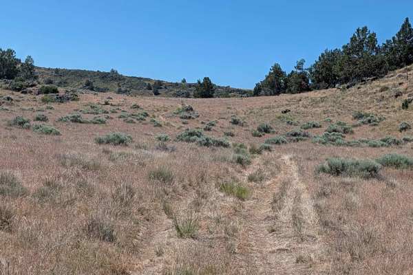
Sheep Camp Spur A - FS 47N18A
This 3.5-mile point-to-point trail connects Sheep Camp Butte to Lower Klamath Road, traveling through a meadow environment flanked by volcanic lava bed ridges. The trail surface consists of loose dirt with occasional small to medium volcanic rocks, some of which can appear unexpectedly since overgro...
Learn more about Sheep Camp Spur A - FS 47N18A
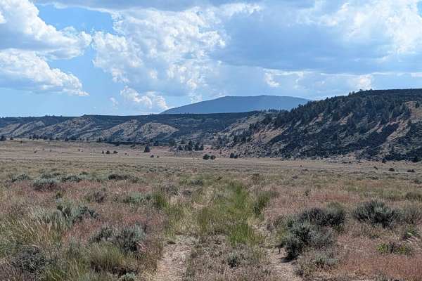
FS 47A18B
This 4-mile out-and-back trail offers a diverse journey through the high-desert landscape, beginning at Sheep Camp Butte and winding its way toward a prominent lava bed ridgeline. The route initially traverses an expansive, open meadow dominated by short grasses, providing a sense of openness and tr...
Learn more about FS 47A18B
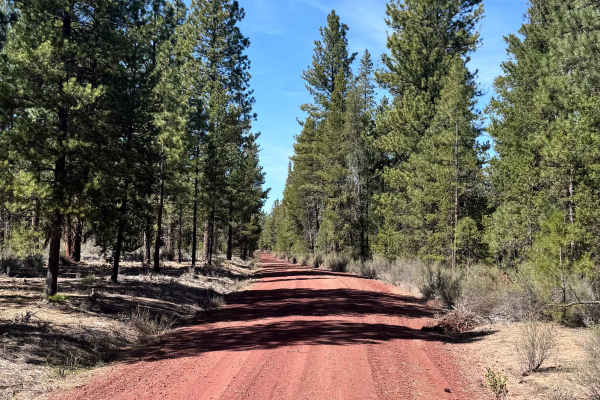
Soloman - FS 4502
Soloman (FS 4502) is an easy trail designed as an alternative route to Burnt Butte Pit. It is a very easy trail with minimal terrain obstacles, perfect for a low-stress drive. This alternative route to Burnt Butte has little traffic and is a good place to go to be on your own in the woods. Keep your...
Learn more about Soloman - FS 4502
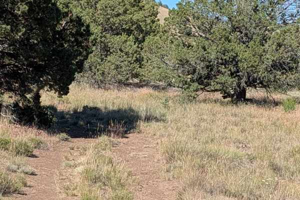
FS 47A14E
This short, functional connector trail provides a direct path through a picturesque landscape defined by rolling grass fields, sparse clusters of small brush, and occasional trees. As you travel from west to east, the route offers pleasant, elevated views of the surrounding mountains and hills, prov...
Learn more about FS 47A14E
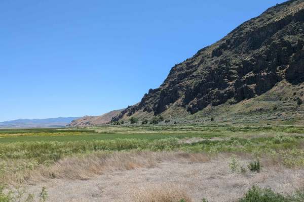
Auto Tour Route Along Sump 1 A and South Sump 1B
This scenic auto tour route offers a tranquil journey along the southern shore of Tule Lake, located within the Tule Lake National Wildlife Refuge. The landscape is a study in contrasts, featuring the expansive, water-filled reservoir on one side and vast, verdant grass meadows on the other. As you ...
Learn more about Auto Tour Route Along Sump 1 A and South Sump 1B
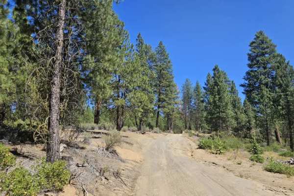
Cave Mountain - FS 5812000
This user-maintained trail offers an enjoyable drive through mixed forest with a surface that changes from sandy beige silt in the south to darker gravel farther north. Near the southern entrance is a parking area that resembles a small camping or staging area, although visitors should note the unfo...
Learn more about Cave Mountain - FS 5812000
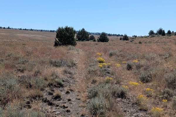
FS 47N18C
This 3-mile point-to-point route functions as a scenic loop, originating and concluding at the Sheep Camp Butte FS 47N18 road. The trail traverses a wide-open meadow landscape dominated by dense grasses and low-lying brush, offering a quintessential high-desert experience. As you proceed in a northe...
Learn more about FS 47N18C
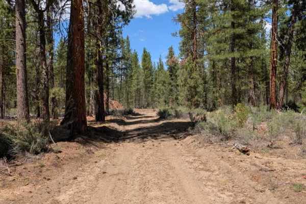
FS 5811450
This trail connects to Pine Ridge and starts fairly tight, with numerous humps and uneven sections that make the first part a little more tiring to drive. An abandoned boat sits along the left side of the trail shortly after the entrance. As you continue, the route gradually becomes easier, and arou...
Learn more about FS 5811450
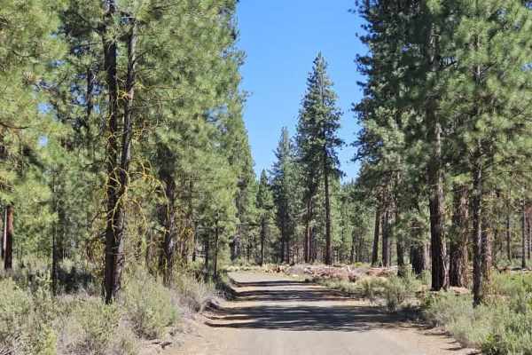
FS 4502080
This scenic forest trail begins on a sandy surface before climbing steadily onto a rocky section where exposed stones and rain erosion require careful wheel placement. After reaching the plateau, the trail levels out before descending into a beautiful pine forest with a soft carpet of pine needles t...
Learn more about FS 4502080
FS 47A14D
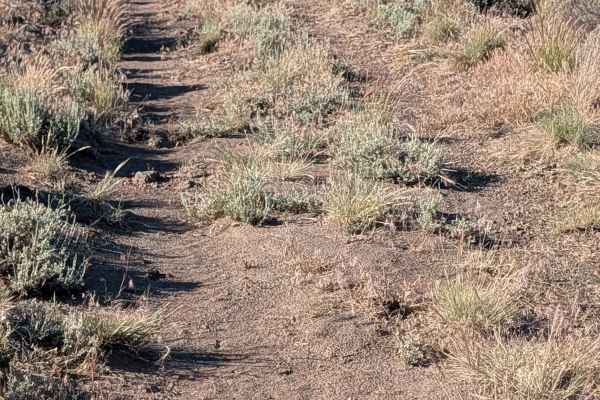
This short route offers an immersive experience within the Modoc National Forest, winding through a narrow canyon framed by dramatic walls of volcanic rock. The path provides a consistent, scenic transit, highlighted by expansive views of Mount Shasta and the broader panorama of surrounding Californ...
Learn more about FS 47A14D
Barntop Spur - FS 47A14C
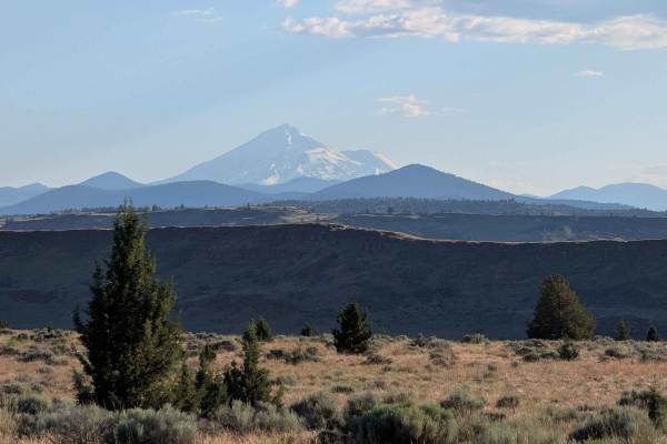
This 4.5-mile out-and-back route serves as an engaging diversion from the Barntop Trail, inviting travelers to explore the varied terrain of the Modoc National Forest. The journey begins with a transit through rugged forest landscapes before the path splits near the third-mile mark, where drivers ha...
Learn more about Barntop Spur - FS 47A14C
Barntop Spur Bypass
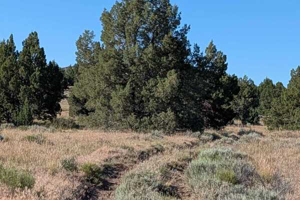
This bypass route serves as an optional loop that begins and ends along the Barntop Spur. It offers a concise journey through the rolling landscape of the region, providing travelers with elevated perspectives of the surrounding hills and mountains. A significant highlight of this trail is the promi...
Learn more about Barntop Spur Bypass
FS 4502100
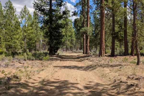
This trail is a well-traveled logging road that provides a straightforward connection between the previously mapped route and the main arterial road. The surface is primarily a mix of sand and scattered rock, with a handful of mildly uneven inclines and descents, but nothing that presents a signific...
Learn more about FS 4502100
Beginner ATV trails near Klamath Falls, Oregon
Explore ATV-friendly trails near you. These trails are accessible for vehicles up to 50 inches wide, perfect for ATVs and smaller off-road machines.
Hagelquin Loop
This is an easy trail/logging road with many offshoots and new things to explore. There is active logging, so it is best to drive this trail in the evenings or on the weekend and carry a CB radio if possible. The first ascent is steep but paved if you are entering near Hagelstein Park, so make sure ...
Learn more about Hagelquin Loop
Sheep Camp Spur A - FS 47N18A
This 3.5-mile point-to-point trail connects Sheep Camp Butte to Lower Klamath Road, traveling through a meadow environment flanked by volcanic lava bed ridges. The trail surface consists of loose dirt with occasional small to medium volcanic rocks, some of which can appear unexpectedly since overgro...
Learn more about Sheep Camp Spur A - FS 47N18A
Soloman - FS 4502
Soloman (FS 4502) is an easy trail designed as an alternative route to Burnt Butte Pit. It is a very easy trail with minimal terrain obstacles, perfect for a low-stress drive. This alternative route to Burnt Butte has little traffic and is a good place to go to be on your own in the woods. Keep your...
Learn more about Soloman - FS 4502
Cave Mountain - FS 5812000
This user-maintained trail offers an enjoyable drive through mixed forest with a surface that changes from sandy beige silt in the south to darker gravel farther north. Near the southern entrance is a parking area that resembles a small camping or staging area, although visitors should note the unfo...
Learn more about Cave Mountain - FS 5812000
Beginner UTV/side-by-side trails near Klamath Falls, Oregon
Find UTV and side-by-side trails near you. These trails accommodate vehicles up to 60 inches wide, ideal for UTVs, side-by-sides, and wider off-road rigs.
Hagelquin Loop
This is an easy trail/logging road with many offshoots and new things to explore. There is active logging, so it is best to drive this trail in the evenings or on the weekend and carry a CB radio if possible. The first ascent is steep but paved if you are entering near Hagelstein Park, so make sure ...
Learn more about Hagelquin Loop
Sheep Camp Spur A - FS 47N18A
This 3.5-mile point-to-point trail connects Sheep Camp Butte to Lower Klamath Road, traveling through a meadow environment flanked by volcanic lava bed ridges. The trail surface consists of loose dirt with occasional small to medium volcanic rocks, some of which can appear unexpectedly since overgro...
Learn more about Sheep Camp Spur A - FS 47N18A
Soloman - FS 4502
Soloman (FS 4502) is an easy trail designed as an alternative route to Burnt Butte Pit. It is a very easy trail with minimal terrain obstacles, perfect for a low-stress drive. This alternative route to Burnt Butte has little traffic and is a good place to go to be on your own in the woods. Keep your...
Learn more about Soloman - FS 4502
Cave Mountain - FS 5812000
This user-maintained trail offers an enjoyable drive through mixed forest with a surface that changes from sandy beige silt in the south to darker gravel farther north. Near the southern entrance is a parking area that resembles a small camping or staging area, although visitors should note the unfo...
Learn more about Cave Mountain - FS 5812000
The onX Offroad Difference
onX Offroad combines trail photos, descriptions, difficulty ratings, width restrictions, seasonality, and more in a user-friendly interface. Available on all devices, with offline access and full compatibility with CarPlay and Android Auto. Discover what you're missing today!
Open Trail Map