
Beginner Off-Road Trails
Near Colusa, California
Explore All Beginner Trails Near Colusa, California
Beginner Off-Road Trails Near Colusa, California
Discover the best beginner-friendly off-road trails near you. These easier, lower-rated trails are a great place to start — browse trail maps, check difficulty ratings, and find your next adventure.
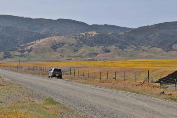
Bear Valley Road Trail
Easy dirt trail with connections to the Berryessa Snow Mountain Monument area Trails with wildflower sights in Spring and the main road to The Wilbur Hot Springs. Beautiful scenery of the Bear Valley in Lake and Colusa Counties in Spring with Bear Creek passing next to the trail. Near the end of the...
Learn more about Bear Valley Road Trail

Walker Ridge Road to Indian Valley Reservoir Road
Walker Ridge Road to Indian Valley Reservoir Road is a 9.7-mile scenic gravel connector route providing direct access to the Indian Valley Reservoir and Walker Ridge Recreation Area. The route climbs to a maximum elevation of 2,813 feet, offering expansive views of the chaparral-covered hills and se...
Learn more about Walker Ridge Road to Indian Valley Reservoir Road
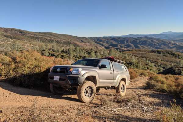
Cold Spring
Cold Spring is an inviting off-road spur trail ideal for high-clearance four-wheel-drive vehicles, SxSs, and dirt bikes seeking a quiet mountain escape with panoramic views of the Indian Valley Reservoir. Branching off the county-maintained Bartlett Springs Road near Cold Spring Mountain, this route...
Learn more about Cold Spring

Dunnigan Hill
Dunnigan Hill is an ideal route for offroaders of all skill levels, serving as the main scenic corridor connecting the north and south entrances of the Knoxville Off-Highway Vehicle (OHV) Area. Stretching approximately 7.8 miles through the rugged inner Coast Range, this point-to-point route reaches...
Learn more about Dunnigan Hill
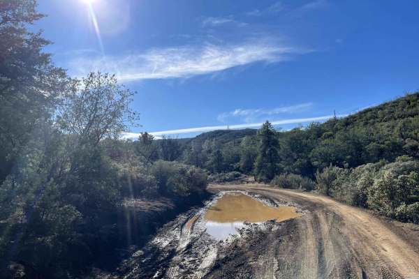
Devilhead Road
This is an easy fire road in dry weather and a fun mud run in wet weather. The road doubles as the southern entrance to Knoxville, OHV, and Berryessa Snow Mountain National Monument. It then splits into access for Adams Ridge, Cement Creek, and Hunting Creek trails. While not very challenging, it do...
Learn more about Devilhead Road
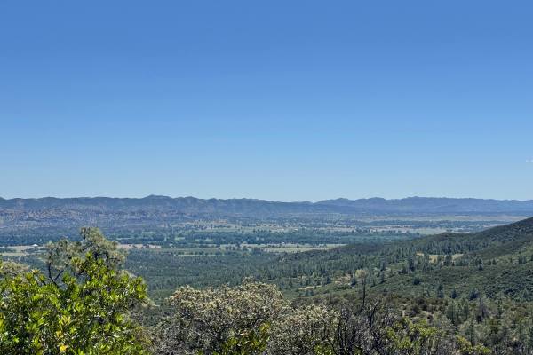
Open Ridge Black Diamond East - FS 18N02
This trail can be accessed by Main Road 306. It goes through private property for a short bit and a water crossing before reaching national forest land. There are many ruts throughout the trail due to water flow and some dips. The trail is nice and easy otherwise. There are beautiful views along the...
Learn more about Open Ridge Black Diamond East - FS 18N02

Bartlett Springs Road
Bartlett Springs Road begins southeast of Mendocino National Forest and boasts excellent views. This route passes through BLM land, and there are plenty of offshoots from the trail. There are also opportunities for camping, hiking, mountain biking, fishing, hunting, and recreational shooting. Cell s...
Learn more about Bartlett Springs Road
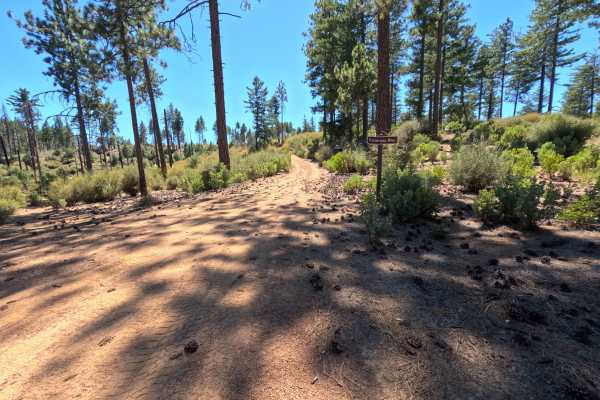
Cracker - FS 17N76
Set within the Stonyford OHV Recreation Area along chaparral-covered ridges recovering from past wildfire impacts in the Mendocino National Forest, Cracker - FS 17N76 provides a secluded and visually captivating mountain ridge trip. Accessed directly off of Cracker Box Trail near a major OHV trail ...
Learn more about Cracker - FS 17N76

Cement Creek
This trail has great views throughout with a spectacular view of Lake Berryessa at its highest elevation point. Expect to drive dirt, gravel and mud along the out and back trail. There are also many dispersed camping sites along the way. After 11.4 miles the trail does dead end on a private property...
Learn more about Cement Creek
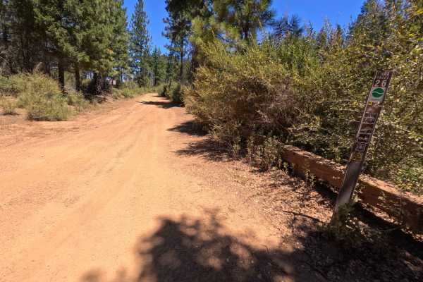
Hornet's Nest Ridge - FS 17N05
Set along an elevated mountain spine in a mixed pine and chaparral environment recovering from the 2018 Ranch Fire within the Mendocino National Forest, Hornet's Nest Ridge - FS 17N05 delivers a scenic and engaging off-road excursion. Accessed directly off of Forest Highway M5, this 2.4-mile single-...
Learn more about Hornet's Nest Ridge - FS 17N05
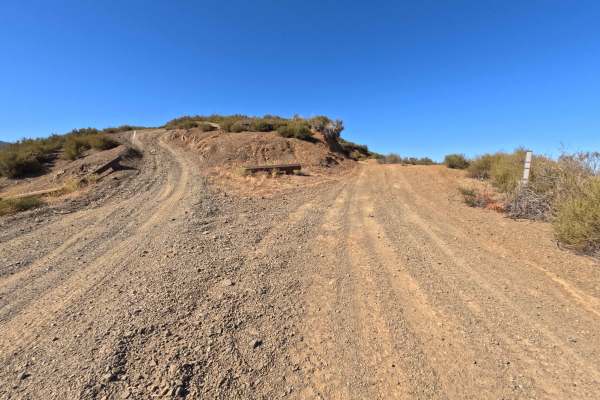
Salt - FS 17N78
Set along open, chaparral-covered ridges recovering from the massive 2018 Ranch Fire within the Mendocino National Forest, Salt - FS 17N78 delivers an exciting high-country mountain ridge drive. Accessed directly off of Forest Highway M5, this single-track dirt spur functions as a scenic loop connec...
Learn more about Salt - FS 17N78
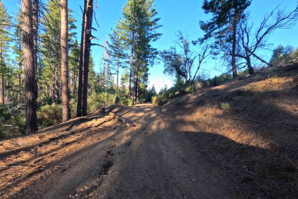
Little Sullivan Ridge - FS 85346
Set within a dense chaparral and pine forest recovering from the 2018 Ranch Fire in the Mendocino National Forest, Little Sullivan Ridge - FS 85346 delivers a secluded and heavily sheltered mountain drive. Accessed directly off of Forest Highway M5, this 1.8-mile single-track dirt spur functions as ...
Learn more about Little Sullivan Ridge - FS 85346
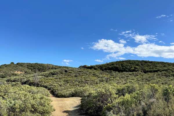
Black Diamond - FS 18N30
This trail has a spot to camp shortly after getting on the trail with a great view. There is a steep hill that a hitch will drag on, not far from the entrance, and some ruts and washes along the trail. Where the trail ends, there is only a very steep hill, nothing else indicating the end of the trai...
Learn more about Black Diamond - FS 18N30
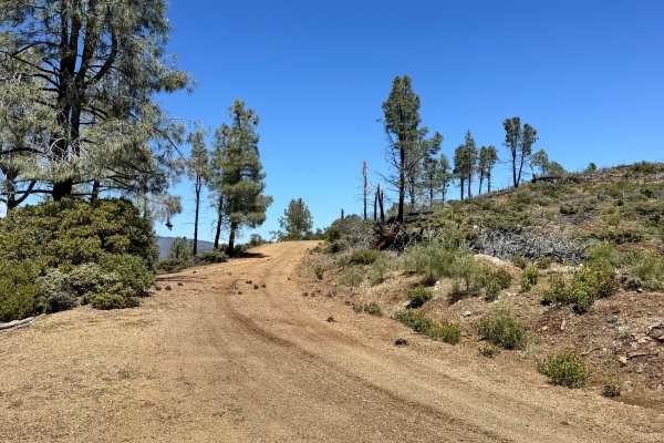
Open Ridge Black Diamond West - FS 18N02
This trail consists of dirt and gravel. It is an out-and-back trail as there is a major washout about 1 mile from the west end, where it's supposed to connect with M3. The trail has some ruts, washes, and a few shelf roads along the way. There are some beautiful views and a few spots to pull off and...
Learn more about Open Ridge Black Diamond West - FS 18N02
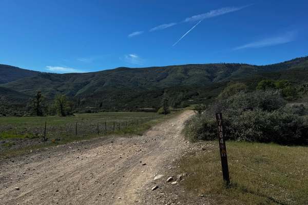
Letts Ridge Trailhead Entrance
This is the beginning of the Letts Ridge trail. Past this is only for dirtbikes and other smaller OHV machines. This trail will also take you to the Champagne trail wh8ch also connects to Potato Hill. At the end is a big area to unload to do the rest of the Letts Ridge trail. A lot of whoops-style b...
Learn more about Letts Ridge Trailhead Entrance
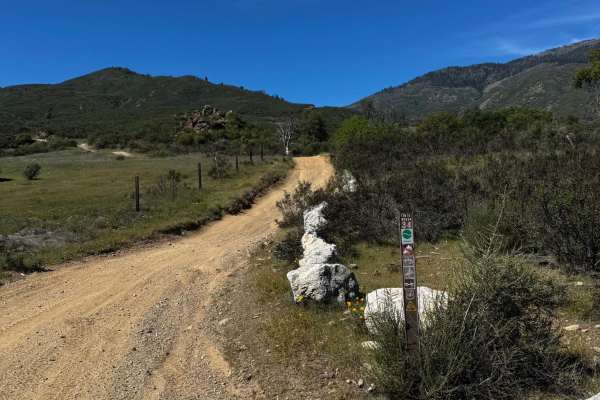
Champagne - FS 17N79
This trail immediately starts climbing. Has many rolling water drainages and rocky sections. Start to get good views of the canyon as well. Crossing a road and continuing on the other side, it's easy to see and is marked. Good warm-up before going on the Potato Hill trail that gets pretty steep.
Learn more about Champagne - FS 17N79
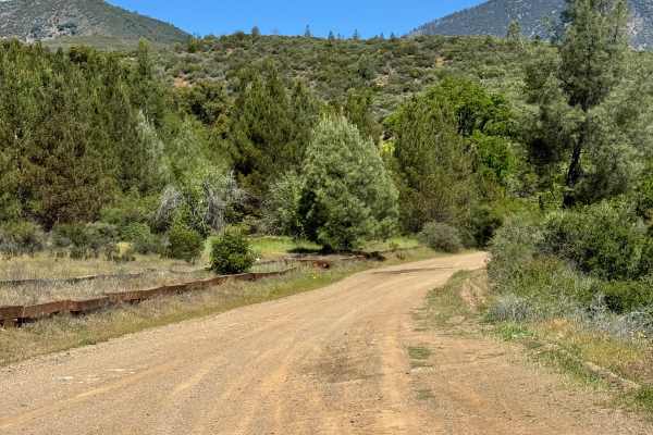
North Fork - FS 18N03
This is a semi maintained fire road. From the South end starts out groomed and starts to get narrow on the shelf road. Some overgrown brush to get some pin stripes. There are multiple smaller washouts and one that you need to navigate carefully since the outside is sliding a bit.
Learn more about North Fork - FS 18N03
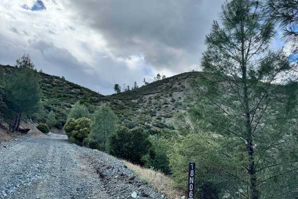
Saint John - FS 18N06
This is an out and back or should I say up and down trail that takes you from the bottom of the canyon to the top of the Saint John mountain. Trail is single wide with turn outs. Mostly smooth until the last mile or so. There are a lot of water drainage humps and some overgrown vegetation I barely t...
Learn more about Saint John - FS 18N06
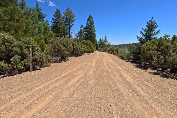
Miner Spur C - FS 17N62C
Set within a mixed pine timber and chaparral environment recovering from the 2018 Ranch Fire in the Mendocino National Forest, Miner Spur C - FS 17N62C offers a quiet, downhill mountain trip. Accessed directly off of Miner Road - FS 17N62, this 1.2-mile out-and-back dirt spur descends along mountain...
Learn more about Miner Spur C - FS 17N62C
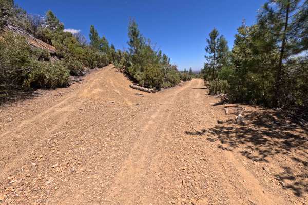
Miner Spur B - FS 17N62B
Set within a mixed pine and chaparral forest recovering from the 2018 Ranch Fire in the Mendocino National Forest, Miner Spur B - FS 17N62B offers a secluded mountain-side drive. Accessed directly off of Miner Road - FS 17N62 at a distinct Y-split junction, this 1.3-mile out-and-back dirt spur trave...
Learn more about Miner Spur B - FS 17N62B
Beginner ATV trails near Colusa, California
Explore ATV-friendly trails near you. These trails are accessible for vehicles up to 50 inches wide, perfect for ATVs and smaller off-road machines.
Bear Valley Road Trail
Easy dirt trail with connections to the Berryessa Snow Mountain Monument area Trails with wildflower sights in Spring and the main road to The Wilbur Hot Springs. Beautiful scenery of the Bear Valley in Lake and Colusa Counties in Spring with Bear Creek passing next to the trail. Near the end of the...
Learn more about Bear Valley Road Trail
Walker Ridge Road to Indian Valley Reservoir Road
Walker Ridge Road to Indian Valley Reservoir Road is a 9.7-mile scenic gravel connector route providing direct access to the Indian Valley Reservoir and Walker Ridge Recreation Area. The route climbs to a maximum elevation of 2,813 feet, offering expansive views of the chaparral-covered hills and se...
Learn more about Walker Ridge Road to Indian Valley Reservoir Road
Cold Spring
Cold Spring is an inviting off-road spur trail ideal for high-clearance four-wheel-drive vehicles, SxSs, and dirt bikes seeking a quiet mountain escape with panoramic views of the Indian Valley Reservoir. Branching off the county-maintained Bartlett Springs Road near Cold Spring Mountain, this route...
Learn more about Cold Spring
Dunnigan Hill
Dunnigan Hill is an ideal route for offroaders of all skill levels, serving as the main scenic corridor connecting the north and south entrances of the Knoxville Off-Highway Vehicle (OHV) Area. Stretching approximately 7.8 miles through the rugged inner Coast Range, this point-to-point route reaches...
Learn more about Dunnigan Hill
Beginner UTV/side-by-side trails near Colusa, California
Find UTV and side-by-side trails near you. These trails accommodate vehicles up to 60 inches wide, ideal for UTVs, side-by-sides, and wider off-road rigs.
Bear Valley Road Trail
Easy dirt trail with connections to the Berryessa Snow Mountain Monument area Trails with wildflower sights in Spring and the main road to The Wilbur Hot Springs. Beautiful scenery of the Bear Valley in Lake and Colusa Counties in Spring with Bear Creek passing next to the trail. Near the end of the...
Learn more about Bear Valley Road Trail
Walker Ridge Road to Indian Valley Reservoir Road
Walker Ridge Road to Indian Valley Reservoir Road is a 9.7-mile scenic gravel connector route providing direct access to the Indian Valley Reservoir and Walker Ridge Recreation Area. The route climbs to a maximum elevation of 2,813 feet, offering expansive views of the chaparral-covered hills and se...
Learn more about Walker Ridge Road to Indian Valley Reservoir Road
Cold Spring
Cold Spring is an inviting off-road spur trail ideal for high-clearance four-wheel-drive vehicles, SxSs, and dirt bikes seeking a quiet mountain escape with panoramic views of the Indian Valley Reservoir. Branching off the county-maintained Bartlett Springs Road near Cold Spring Mountain, this route...
Learn more about Cold Spring
Dunnigan Hill
Dunnigan Hill is an ideal route for offroaders of all skill levels, serving as the main scenic corridor connecting the north and south entrances of the Knoxville Off-Highway Vehicle (OHV) Area. Stretching approximately 7.8 miles through the rugged inner Coast Range, this point-to-point route reaches...
Learn more about Dunnigan Hill
The onX Offroad Difference
onX Offroad combines trail photos, descriptions, difficulty ratings, width restrictions, seasonality, and more in a user-friendly interface. Available on all devices, with offline access and full compatibility with CarPlay and Android Auto. Discover what you're missing today!
Open Trail Map