
Beginner Off-Road Trails
Near Angwin, California
Explore All Beginner Trails Near Angwin, California
Beginner Off-Road Trails Near Angwin, California
Discover the best beginner-friendly off-road trails near you. These easier, lower-rated trails are a great place to start — browse trail maps, check difficulty ratings, and find your next adventure.

Cement Creek
This trail has great views throughout with a spectacular view of Lake Berryessa at its highest elevation point. Expect to drive dirt, gravel and mud along the out and back trail. There are also many dispersed camping sites along the way. After 11.4 miles the trail does dead end on a private property...
Learn more about Cement Creek
Devilhead Road
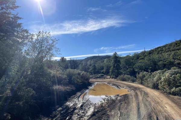
This is an easy fire road in dry weather and a fun mud run in wet weather. The road doubles as the southern entrance to Knoxville, OHV, and Berryessa Snow Mountain National Monument. It then splits into access for Adams Ridge, Cement Creek, and Hunting Creek trails. While not very challenging, it do...
Learn more about Devilhead Road

Dunnigan Hill
Dunnigan Hill is an ideal route for offroaders of all skill levels, serving as the main scenic corridor connecting the north and south entrances of the Knoxville Off-Highway Vehicle (OHV) Area. Stretching approximately 7.8 miles through the rugged inner Coast Range, this point-to-point route reaches...
Learn more about Dunnigan Hill
Bear Valley Road Trail
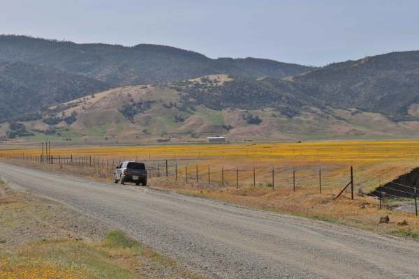
Easy dirt trail with connections to the Berryessa Snow Mountain Monument area Trails with wildflower sights in Spring and the main road to The Wilbur Hot Springs. Beautiful scenery of the Bear Valley in Lake and Colusa Counties in Spring with Bear Creek passing next to the trail. Near the end of the...
Learn more about Bear Valley Road Trail

Walker Ridge Road to Indian Valley Reservoir Road
Walker Ridge Road to Indian Valley Reservoir Road is a 9.7-mile scenic gravel connector route providing direct access to the Indian Valley Reservoir and Walker Ridge Recreation Area. The route climbs to a maximum elevation of 2,813 feet, offering expansive views of the chaparral-covered hills and se...
Learn more about Walker Ridge Road to Indian Valley Reservoir Road
Cold Spring
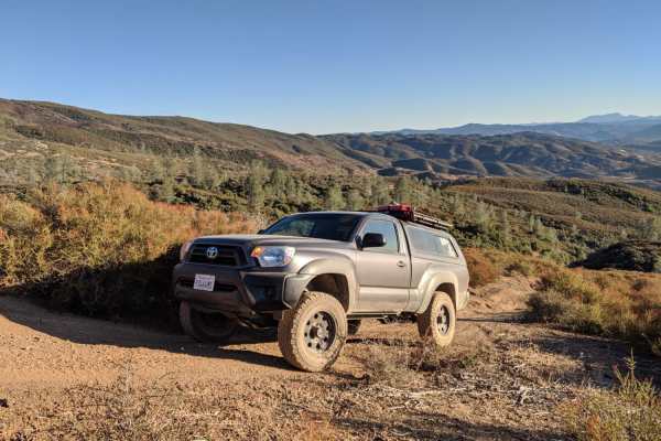
Cold Spring is an inviting off-road spur trail ideal for high-clearance four-wheel-drive vehicles, SxSs, and dirt bikes seeking a quiet mountain escape with panoramic views of the Indian Valley Reservoir. Branching off the county-maintained Bartlett Springs Road near Cold Spring Mountain, this route...
Learn more about Cold Spring

Bartlett Springs Road
Bartlett Springs Road begins southeast of Mendocino National Forest and boasts excellent views. This route passes through BLM land, and there are plenty of offshoots from the trail. There are also opportunities for camping, hiking, mountain biking, fishing, hunting, and recreational shooting. Cell s...
Learn more about Bartlett Springs Road
Pilot Grove - FS 16N01
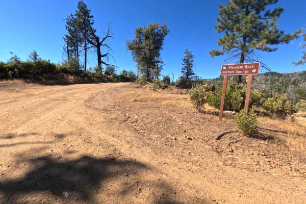
Set within an open mountain landscape recovering from the 2018 Ranch Fire with fresh brush regrowth and standing pine snags in the Mendocino National Forest, Pilot Grove (FS 16N01) offers an exceptionally scenic ridgeline drive. Accessed directly from Bartlett Springs Road at Bartlett Mountain Summi...
Learn more about Pilot Grove - FS 16N01
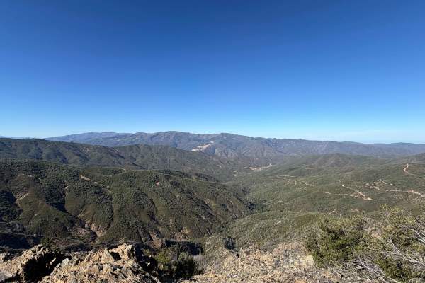
Pinnacle Rock - FS 16N01D
Winding along a high, exposed ridge recovering from the massive 2018 Ranch Fire, with chaparral growth and standing snags in the Mendocino National Forest, Pinnacle Rock (FS 16N01D) offers a brief but visually rewarding mountain excursion. Accessed directly off Pilot Grove Road (FS 16N01), this shor...
Learn more about Pinnacle Rock - FS 16N01D
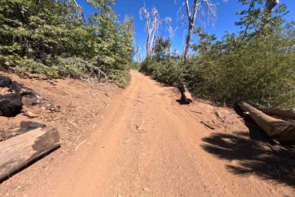
Linger Longer - FS 17N14
Set along a high, scenic mountain ridge within a forest recovering from the 2018 Ranch Fire with standing pine snags and fresh brush regrowth in the Mendocino National Forest, Linger Longer - FS 17N14 offers an engaging ridge drive. Accessed via Board Camp Ridge Road - FS 17N10, the Mendocino Scenic...
Learn more about Linger Longer - FS 17N14

Mendo-Lake Road
Mendo-Lake Road is an easy 13-mile dirt route serving as the primary corridor through the South Cow Mountain OHV Management Area between Ukiah and Lakeport. The wide, well-maintained road climbs from 1,480 feet to a maximum elevation of 3,223 feet, offering panoramic views of Clear Lake, Lakeport, a...
Learn more about Mendo-Lake Road
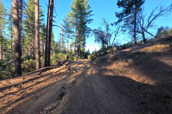
Little Sullivan Ridge - FS 85346
Set within a dense chaparral and pine forest recovering from the 2018 Ranch Fire in the Mendocino National Forest, Little Sullivan Ridge - FS 85346 delivers a secluded and heavily sheltered mountain drive. Accessed directly off of Forest Highway M5, this 1.8-mile single-track dirt spur functions as ...
Learn more about Little Sullivan Ridge - FS 85346
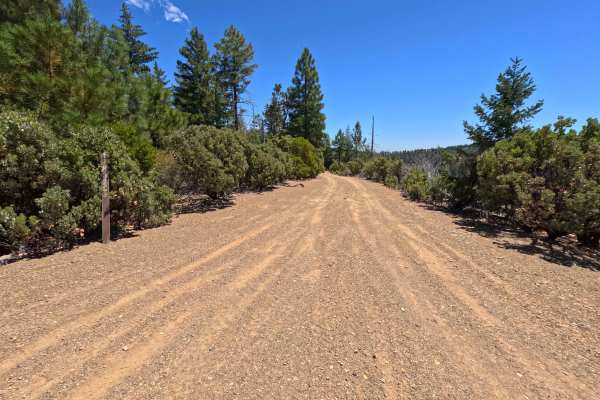
Miner Spur C - FS 17N62C
Set within a mixed pine timber and chaparral environment recovering from the 2018 Ranch Fire in the Mendocino National Forest, Miner Spur C - FS 17N62C offers a quiet, downhill mountain trip. Accessed directly off of Miner Road - FS 17N62, this 1.2-mile out-and-back dirt spur descends along mountain...
Learn more about Miner Spur C - FS 17N62C
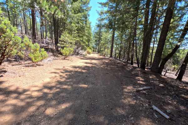
Miner - FS 17N62
Set within a mixed pine and chaparral woodland recovering from the 2018 Ranch Fire in the Mendocino National Forest, Miner - FS 17N62 provides a short and scenic mountain drive. Accessed directly off of New Miner Trail, this 1.3-mile round-trip out-and-back dirt spur travels along elevated slopes to...
Learn more about Miner - FS 17N62
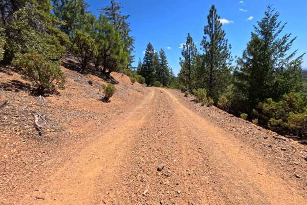
New Miner - FS 17N68
Set within a mixed pine, oak, and chaparral forest recovering from the 2018 Ranch Fire in the Mendocino National Forest, New Miner - FS 17N68 provides a scenic backcountry connection. Accessed directly off of Letts Lake Trail near the popular Letts Lake Recreation Area, this 2.0-mile single-lane dir...
Learn more about New Miner - FS 17N68
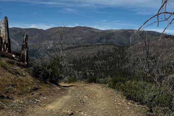
Wilblain - FS 16N18
Narrow trail connecting Mendocino Scenic Corridor and Richardson Glade. More of a tighter two-track section with lots of off-camber and washes to navigate through. You will encounter tough vegetation in some sections and get some pinstripes. Goes through a burned area, so it might have fallen trees ...
Learn more about Wilblain - FS 16N18
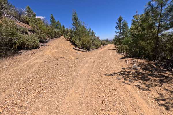
Miner Spur B - FS 17N62B
Set within a mixed pine and chaparral forest recovering from the 2018 Ranch Fire in the Mendocino National Forest, Miner Spur B - FS 17N62B offers a secluded mountain-side drive. Accessed directly off of Miner Road - FS 17N62 at a distinct Y-split junction, this 1.3-mile out-and-back dirt spur trave...
Learn more about Miner Spur B - FS 17N62B
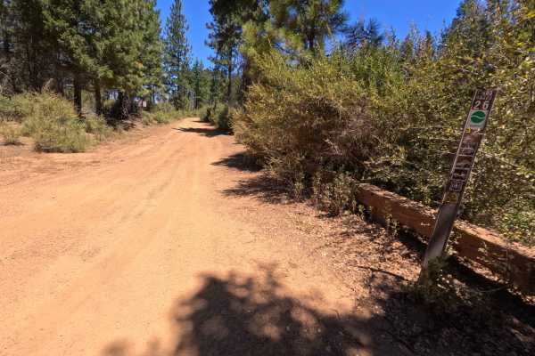
Hornet's Nest Ridge - FS 17N05
Set along an elevated mountain spine in a mixed pine and chaparral environment recovering from the 2018 Ranch Fire within the Mendocino National Forest, Hornet's Nest Ridge - FS 17N05 delivers a scenic and engaging off-road excursion. Accessed directly off of Forest Highway M5, this 2.4-mile single-...
Learn more about Hornet's Nest Ridge - FS 17N05
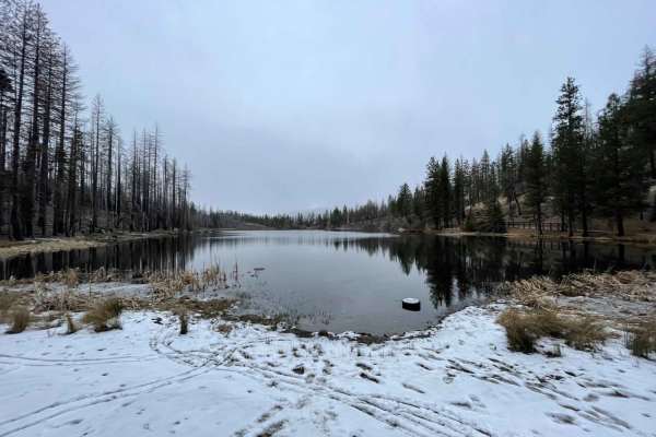
Letts Lake
This trail is a little less than 4 miles and leads to Letts Lake and campground. As the only lake in the lower half of Mendocino NF, it is worth visiting. There are four campsites around the lake; each has a handful of first come, first serve sites. You may also swim and fish in the lake.
Learn more about Letts Lake
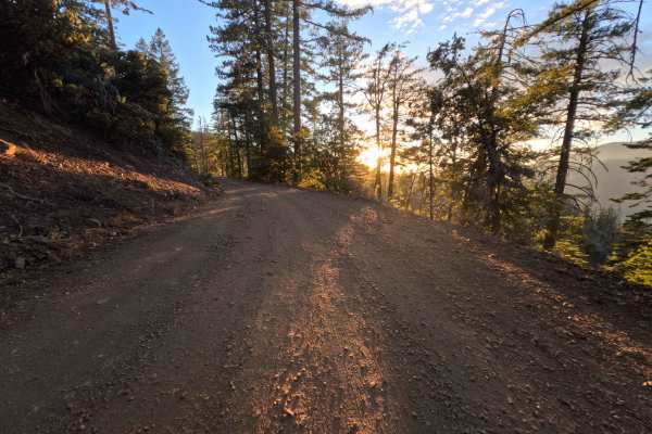
Upper Letts Lake - FS 17N09
Set within a scenic mountain pine forest and chaparral understory recovering from the 2018 Ranch Fire in the Mendocino National Forest, Upper Letts Lake - FS 17N09 serves as a pleasant connecting route. Accessed directly from the Letts Lake Campground area, this 2.0-mile single-lane forest road clim...
Learn more about Upper Letts Lake - FS 17N09
Beginner ATV trails near Angwin, California
Explore ATV-friendly trails near you. These trails are accessible for vehicles up to 50 inches wide, perfect for ATVs and smaller off-road machines.
Dunnigan Hill
Dunnigan Hill is an ideal route for offroaders of all skill levels, serving as the main scenic corridor connecting the north and south entrances of the Knoxville Off-Highway Vehicle (OHV) Area. Stretching approximately 7.8 miles through the rugged inner Coast Range, this point-to-point route reaches...
Learn more about Dunnigan Hill
Bear Valley Road Trail
Easy dirt trail with connections to the Berryessa Snow Mountain Monument area Trails with wildflower sights in Spring and the main road to The Wilbur Hot Springs. Beautiful scenery of the Bear Valley in Lake and Colusa Counties in Spring with Bear Creek passing next to the trail. Near the end of the...
Learn more about Bear Valley Road Trail
Walker Ridge Road to Indian Valley Reservoir Road
Walker Ridge Road to Indian Valley Reservoir Road is a 9.7-mile scenic gravel connector route providing direct access to the Indian Valley Reservoir and Walker Ridge Recreation Area. The route climbs to a maximum elevation of 2,813 feet, offering expansive views of the chaparral-covered hills and se...
Learn more about Walker Ridge Road to Indian Valley Reservoir Road
Cold Spring
Cold Spring is an inviting off-road spur trail ideal for high-clearance four-wheel-drive vehicles, SxSs, and dirt bikes seeking a quiet mountain escape with panoramic views of the Indian Valley Reservoir. Branching off the county-maintained Bartlett Springs Road near Cold Spring Mountain, this route...
Learn more about Cold Spring
Beginner UTV/side-by-side trails near Angwin, California
Find UTV and side-by-side trails near you. These trails accommodate vehicles up to 60 inches wide, ideal for UTVs, side-by-sides, and wider off-road rigs.
Dunnigan Hill
Dunnigan Hill is an ideal route for offroaders of all skill levels, serving as the main scenic corridor connecting the north and south entrances of the Knoxville Off-Highway Vehicle (OHV) Area. Stretching approximately 7.8 miles through the rugged inner Coast Range, this point-to-point route reaches...
Learn more about Dunnigan Hill
Bear Valley Road Trail
Easy dirt trail with connections to the Berryessa Snow Mountain Monument area Trails with wildflower sights in Spring and the main road to The Wilbur Hot Springs. Beautiful scenery of the Bear Valley in Lake and Colusa Counties in Spring with Bear Creek passing next to the trail. Near the end of the...
Learn more about Bear Valley Road Trail
Walker Ridge Road to Indian Valley Reservoir Road
Walker Ridge Road to Indian Valley Reservoir Road is a 9.7-mile scenic gravel connector route providing direct access to the Indian Valley Reservoir and Walker Ridge Recreation Area. The route climbs to a maximum elevation of 2,813 feet, offering expansive views of the chaparral-covered hills and se...
Learn more about Walker Ridge Road to Indian Valley Reservoir Road
Cold Spring
Cold Spring is an inviting off-road spur trail ideal for high-clearance four-wheel-drive vehicles, SxSs, and dirt bikes seeking a quiet mountain escape with panoramic views of the Indian Valley Reservoir. Branching off the county-maintained Bartlett Springs Road near Cold Spring Mountain, this route...
Learn more about Cold Spring
The onX Offroad Difference
onX Offroad combines trail photos, descriptions, difficulty ratings, width restrictions, seasonality, and more in a user-friendly interface. Available on all devices, with offline access and full compatibility with CarPlay and Android Auto. Discover what you're missing today!
Open Trail Map