Hunters still use their GPS units for hunting, and there are many who rely on the onX Hunt App but also carry a GPS. Why? Most often it comes down to the perceived durability of a GPS and the ability to change batteries in the field. Some carry a GPS because it’s familiar. Before the Hunt App, our members relied on the Hunt Chip for navigating public lands and private property boundaries.
As we noted in our Best Hunting GPS article, GPS technology was developed in “the early 1970s as a means of navigation that would not be limited by weather patterns. It is a system of 30+ satellites orbiting earth. … Once your receiver can calculate its distance from four or more GPS satellites, it can figure out where you are within 7.8 meters 95% of the time.”
We are familiar with many hunters who appreciate the simplicity of having a GPS clipped to their belt or pack, always on and viewable, instead of taking their phones out of their pockets and unlocking its screen. For those hunters who carry a GPS for hunting here’s how to best use it for hunting a variety of game.
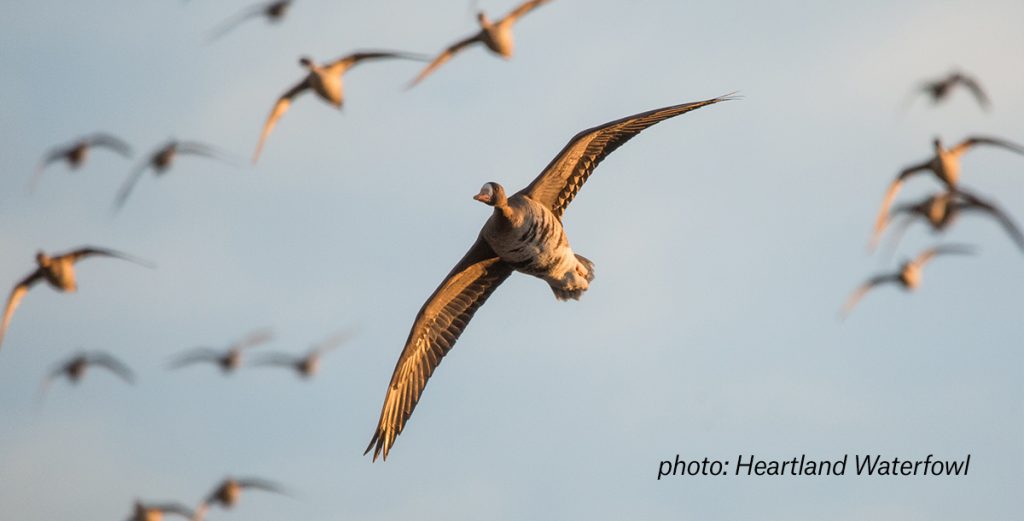
Use a GPS for Hunting Waterfowl
Several things set a waterfowl hunter apart from other hunters. Most notably, it’s their proximity to, and use of, water when hunting. For this reason, most hunters use a GPS for hunting ducks that’s waterproof, easy to use with gloved hands, and perhaps has some useful maps for navigating waterways.
One important way waterfowlers are similar to other hunters is their need to scout good hunting spots ahead of the season. Waterfowl are dynamic with their feeding and roosting patterns, so hunters need to be able to track as they scout, marking waypoints for key features (such as feeding birds or loafing water) or potential locations for ground blinds and access points. Sometimes when scouting they’ll find that the best spot for ducks and geese is on private land. Pulling up landowner data from the Hunt Chip will give a waterfowler an opportunity to seek permission to hunt their land.
Having tracks visible on a GPS is also beneficial for hunters who walk to their blinds in the dark. Especially if you’re hunting marshland and you don’t want to take a wrong step into a deep puddle, if you’ve already laid down a track from your truck to your blind it’s easy to follow a lit GPS screen in the early morning.
Weather also matters to waterfowl hunters. Interestingly, foul weather can even be a “duck hunter’s greatest blessing.” And while some high-end GPS units (Garmin Rino 650t) have a built-in NOAA radio for severe weather alerts, here’s where you might want to open up your Hunt App to check the latest weather conditions from the nearest weather station to where you’re actually hunting.
And whether you’re in the rain or on the water, having a waterproof device is why waterfowlers will consider an older Garmin 76CSx GPS, which has an IPX7 waterproof rating (incidental exposure to water of up to 1 meter for up to 30 minutes), is BlueChart compatible, and it floats.
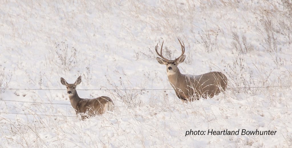
Use a GPS for Hunting Big Game
From weeklong backcountry elk hunts to plotting a path to your tree stand on leased land, having a GPS for hunting big game essentially boils down to having quick access to these features:
- Tracks
- Waypoints
- Public / Private Land Boundaries
- Topo Maps
Big game hunters are often on the move, either to or from tree stands, up and over saddles, along draws, or when side-stepping steep mountainsides. Being able to glance at a GPS attached to their belt or backpack makes it easy to stay on the right path, or keep to the public lands they are hunting.
For hunters who might be hunting new areas in a big national forest, for instance, using a GPS for recording tracks can easily save a hunter from getting turned around or lost. There’s a saying that backcountry skiers have when it comes to their avalanche beacons: “On at the car. Off at the bar.” This could be adapted for the GPS to illustrate when you should start and stop your tracking feature.
Those who choose to carry a GPS because of its durability are especially appreciative of it when they’re scrambling over rock slides in the high country or trudging through snow in the open country. They’re not spending time worrying about a potential drop or two when checking their maps on a GPS.
With nearly all GPS units, marking a waypoint is quick and easy. Maybe you’ve found a water source you want to come back to, or where a few game trails cross, and you don’t want to forget that location. Marking up a waypoint while on-the-go is a simple task.
No hunter wants to find out they’ve accidentally trespassed onto private property. That’s why having easy-to-read, color-coded boundaries on their GPS brings peace of mind. Savvy big game hunters will even use the borders between public and private lands to their advantage, knowing that deer and elk will often bed or feed on one and travel back to the other. Catching them on the public side is how many hunters have filled their tags.
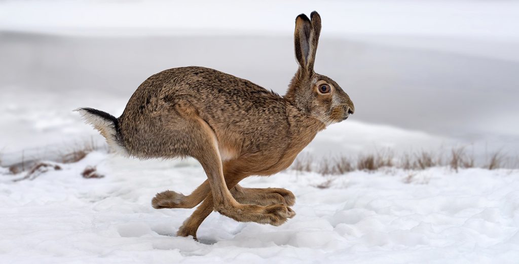
Use a GPS for Hunting Small Game
Hunting small game can be described as a pastime, a hobby, a starting point for youth hunters, or a lifelong passion. That’s what makes small game hunting so fun. From squirrels and rabbits to pheasants and grouse, having a GPS for hunting small game introduces a distinctive piece of technology for a distinctive hunting partner many small game hunters have—a dog.
As outlined above, any of the reasons to carry a GPS while hunting waterfowl and big game can be used for smaller quarry. But add to that mix the use of a GPS dog collar and the ability to track your dogs, and you see why a GPS can bring a real advantage to your hunting experience.
GPS collars have been around for a number of years now (Garmin Astro / Alpha series), but with the newer lines of wearable GPS, like the Garmin fēnix® which syncs to trackable collars, you can run your dogs and see their distance and direction on your wrist.
One pro tip worth pointing out for hunting one of our favorite small game animals – squirrels – is using a GPS to mark different nut trees with waypoints. Throughout the season, squirrels will feed on a variety of different nuts and food sources at different times of the year. Mapping both individual trees and stands of trees, along with your tracks between them, is a great way to use a GPS for hunting squirrels.
Turn Your Phone Into a GPS
Of course, you don’t have to carry a GPS to have the same functionality and maps for hunting. The onX Hunt App offers Tracking, Waypoints, and Public/Private Boundaries, but it does a lot more than any GPS can. The Hunt App has unique features designed for hunters, such as the Line Tool, Area Shape Tool, and a wide array of Map Layers that can be shown over Aerial, Topo, or Hybrid Maps.
Having your phone set up as a GPS will open doors in other ways, too. Imagine having access to the most up-to-date weather information available that delivers an hour-by-hour forecast for your exact hunting location. The completely reimagined Weather feature in the Hunt App will do exactly that.
And the strongest way the Hunt App mimics a GPS unit is by having the option to download Offline Maps, which can be saved in three different resolutions. This means you won’t need cell service to use your phone like a GPS. Your position will be found with satellites, just like with a GPS.