One in every 10 acres in the United States is managed by the Bureau of Land Management (BLM), as is 30 percent of the nation’s minerals. This makes the BLM the largest landowner in the U.S. The BLM was created in 1946 during President Harry S. Truman’s administration as the successor to and reorganization of the General Land Office (first established in 1812) and the U.S. Grazing Service (renamed as such in 1939).
The mission of the BLM is “to sustain the health, diversity, and productivity of public lands for the use and enjoyment of present and future generations.” The allowed uses of BLM lands “include renewable energy development (solar, wind, other); conventional energy development (oil and gas, coal); livestock grazing; hardrock mining (gold, silver, other), timber harvesting; and outdoor recreation (such as camping, hunting, rafting, and off-highway vehicle driving).” The ways in which the BLM manages its lands for multi-use purposes are consistent with the Federal Land Policy and Management Act (FLPMA) of 1976.
TL;DR: The Bureau of Land Management (BLM) oversees ~247.3 million acres—about 1 in every 10 U.S. acres—under a multiple-use mandate (energy, grazing, timber, and recreation). Most BLM lands lie in 12 western states and are generally open to activities like hunting, camping, hiking, and off-roading (often with no fees). BLM also protects wilderness, monuments, WSRs, and National Conservation Lands. A major challenge is access: ~9.52 million acres of western public land are landlocked, 93% of which are BLM. Use onX Hunt to find yellow-shaded BLM parcels, check access, see OHV designations, and download Offline Maps.
What Is BLM Land?
The 247.3 million acres managed by the BLM are considered public lands. Originally, BLM lands were lands nobody wanted when they were passed up by western homesteaders during the Homestead Act of 1862. Most BLM public lands are located in 12 western states: Alaska, Arizona, California, Colorado, Idaho, Montana, Nevada, New Mexico, Oregon, Utah, Washington, and Wyoming.
With its emphasis on multiple-use management, not all BLM lands are used in the same way. Ranchers hold roughly 18,000 grazing permits to run livestock on 155 million acres of BLM land. There are also more than 89,000 oil and gas wells connected to 23,500 oil and gas leases on BLM lands. These energy leases cover approximately 23 million federal acres and make up 11 percent of all oil and 9 percent of all natural gas produced in the United States.
However, the Bureau of Land Management also manages 487 Wilderness Study Areas and 263 wilderness areas, which are lands untainted by roads or other human development. BLM also helps manage national recreation areas, 29 national monuments, 81 designated wild and scenic rivers (WSRs) totaling nearly 2,700 miles, 35 million acres of National Conservation Lands, and nearly 6,000 miles of National Scenic and Historic Trails.
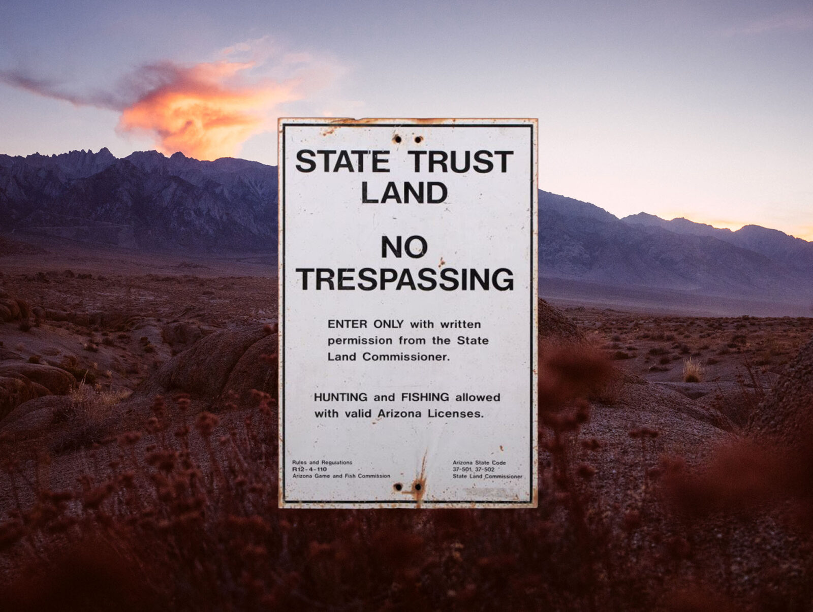
State Land vs. BLM Land
State lands and BLM lands are managed differently and have different goals. While BLM lands are generally public land, state-managed lands may have many access and recreation restrictions in place. Additionally, public lands do not often require additional fees to access (national parks are a notable exception), but state lands may require annual fees or day-use permits for recreational use.
As one example, in Montana, a $10 State Recreational Use License is required for all recreational use of state lands, including when hunting and fishing, and most camping is limited to designated campgrounds requiring a per-night fee.
The entities that regularly control or manage state lands are the Department of Natural Resources (DNRC), state-level Fish, Wildlife and Parks, and even the Department of Corrections. A common form of state land is labeled School Trust lands, for which public schools receive some of the funding the state generates from recreational use and various types of leasing: grazing, coal, mineral, oil and gas, and timber harvesting. However, most of the revenue is generated through the sale of trust lands for development and that money is invested to generate long-term interest income for the beneficiaries. There are roughly 46 million acres of school trust lands in 23 U.S. states.
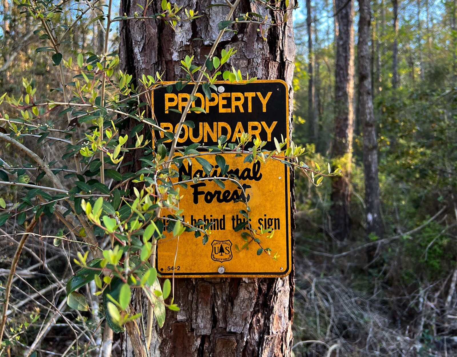
Forest Service vs. BLM Land
The Forest Service and BLM have different but intertwining origins. Whereas the BLM was formed to manage mineral and grazing rights and “leftover” lands that were not sold during the Homestead Act, parts of its lands also came from land not designated as “National Forests.”
The Forest Service was named as such in 1905 and it is a different agency than the BLM. The Forest Service resides under the Department of Agriculture and the BLM is under the Department of the Interior. The Forest Service is also tasked with managing national forests, with a responsibility for timber harvests that occur on them (although the BLM does manage some timber harvests).
One of the most interesting diversions between the U.S. Forest Service and the BLM is geography. While both agencies manage many millions of acres in western states, the BLM manages virtually no lands in the eastern half of the U.S. Most of the federal forests and public lands in the east are managed by the Forest Service.
Altogether, the Forest Service manages 193 million acres of public lands and the BLM manages 245 million acres, though the Forest Service is the larger agency with three times the number of employees and four times the budget the BLM has.
How To Find BLM Land
Most of the Bureau of Land Management lands are in the western half of the United States. On all maps, including onX Maps, BLM lands are denoted by yellow shading.
The BLM website does offer a way to search for maps and areas based on location, activity, or keyword. You can find that here.
Landlocked BLM Lands
BLM lands are, unfortunately, one of America’s most inaccessible public lands because so many are landlocked. Landlocked public lands are surrounded by private property with no public roads or trails to reach them.
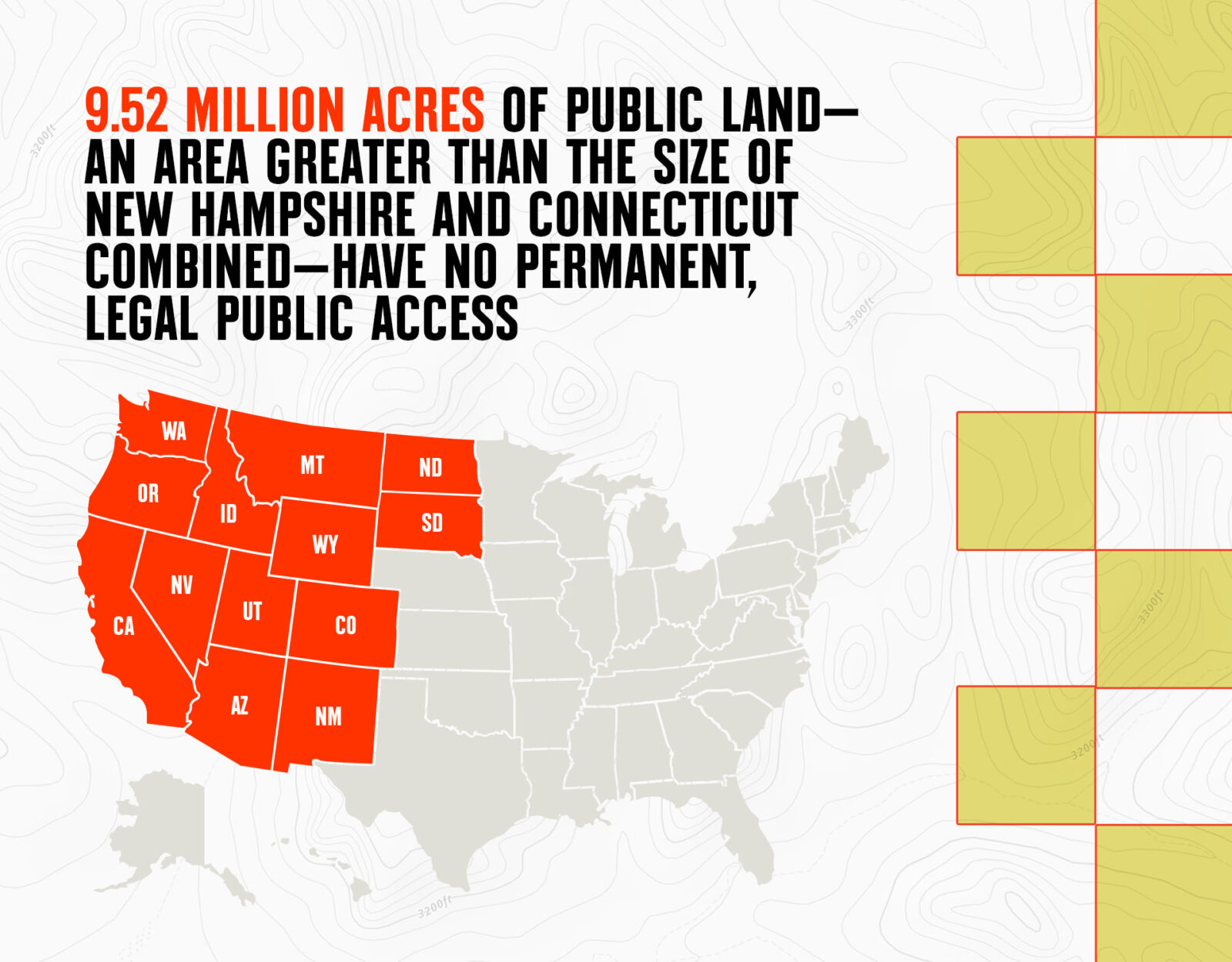
In total, 9.52 million acres of public land in 13 western states have no permanent, legal public access. And of those 9.52 million acres, 93.2% of them are BLM land. By comparison, only 4% of landlocked lands are Forest Service land.
onX and the Theodore Roosevelt Conservation Partnership have been working together to open up access to landlocked and corner-locked public lands. If interested, you can read through our joint reports that affect all regions of the country. Check out “Landlocked Public Lands.”
Types of Recreation
According to the BLM, more than 99% of BLM-managed lands are available for recreational use with no fees, and annually there are an estimated 62 million visits to some type of BLM public land.
Traditional activities, such as hunting, hiking, fishing, and mountain biking are acceptable on BLM land, as well as many other types of recreation, including horseback riding, off-roading, whitewater rafting, and hang gliding.
Camping
Camping at an established campground on BLM land most likely requires a fee, which helps maintain the facilities. Most of the remainder of BLM public lands are open to dispersed camping as long as it does not conflict with other authorized uses, is in an area posted “closed to camping,” or exceeds 14 days within a 28 consecutive day period. Camping is one of the most popular activities that occurs on BLM lands, with an annual 22.3 million visitor days recorded. This is about one-third of all recorded recreational activities on BLM land.
Off-Roading
BLM lands are the most open public lands for off-roading, and annually, there are 7.2 million visitor days recorded on BLM land for off-roading use. Only about 6% (or 13.1 million acres) are closed to OHV (off-highway vehicle) use, and another 66 million acres are designated for open use of OHVs, which means you do not have to stick to trails (but also as long as you don’t cause any damage to plants, animal habitats, or natural features). The remaining 146.6 million acres of BLM land is limited-use land, where OHV use is limited to specific trails.
There are two excellent resources for finding out where to use OHVs on BLM land, what restrictions might be in place, and what trails are open or closed to off-roading. One resource is a map created by the BLM called “Top BLM Motorized Recreational Opportunities.” The other is the onX Offroad App.
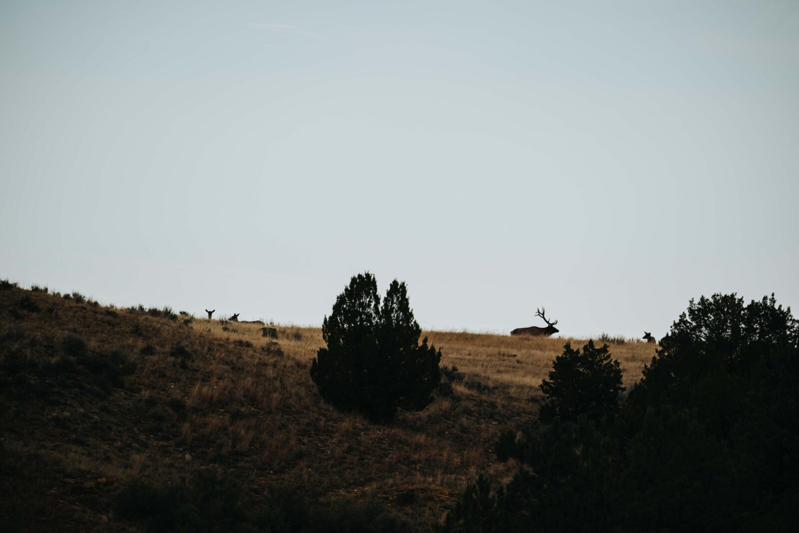
Hunting
Unless specifically prohibited, lands managed by the BLM are open to hunting. BLM land is home to over 3,000 species, and the organization actively manages 43 million acres of elk habitat, 131 million acres of mule deer habitat, and 23 million acres of bighorn sheep habitat. Small game, furbearers, upland birds, and waterfowl also make their homes on BLM public land.
Hiking
There are 6,000 miles of National Scenic and Historic Trails on 18 designated trails on BLM land in 15 different states. In addition to those trails, there are another 1,477 hiking areas discoverable through BLM’s website search, or via onX Backcountry. Annually, there are 6.6 million visitor days recorded for non-motorized recreation on BLM public land.

Hunting Regs Without the Hassle
Compliance shouldn’t be the hard part. FieldRegs is a free app from the team behind onX Hunt that helps you quickly find hunting regulations, seasons, and legal requirements without digging through agency websites and PDFs. No credit card required.


FAQ
Public land managed by the Bureau of Land Management for multiple use—from energy and grazing to recreation and conservation—primarily across 12 western states.
Yes, BLM land is considered public land and is managed by the Bureau of Land Management for multiple-use recreation and other leased activities.
The BLM occasionally sells parcels of land if a land-use study shows it would be appropriate, but since 1976, BLM land sales have been infrequent thanks to a government mandate aimed at retaining as much BLM land as possible for public use. At times, the BLM may exchange land with private landowners to improve management or consolidate lands.
BLM lands are denoted with yellow shading on most or all paper and digital maps, including onX Hunt, onX Offroad, and onX Backcountry.
Per BLM, >99% of BLM lands are open to some form of recreation; most areas don’t charge fees (developed campgrounds/trailheads may).
Yes, unless specifically prohibited. BLM manages vast wildlife habitat (e.g., 43M acres elk, 131M acres mule deer, 23M acres bighorn). You must follow state seasons, licenses, and weapon rules.