
Land Ownership Maps
Landowner details, parcel viewer, and property lines at your fingertips.
Locate Property Lines and View Landowner Information
Knowing who owns the land you stand on is invaluable. With the onX Hunt App, you can see property boundaries and landowner information throughout the United States and, in Canada, you can view property lines where available. Know where you stand—and where you can and cannot hunt—with the Hunt App.
Land Ownership Maps Breakdown
View Property Lines
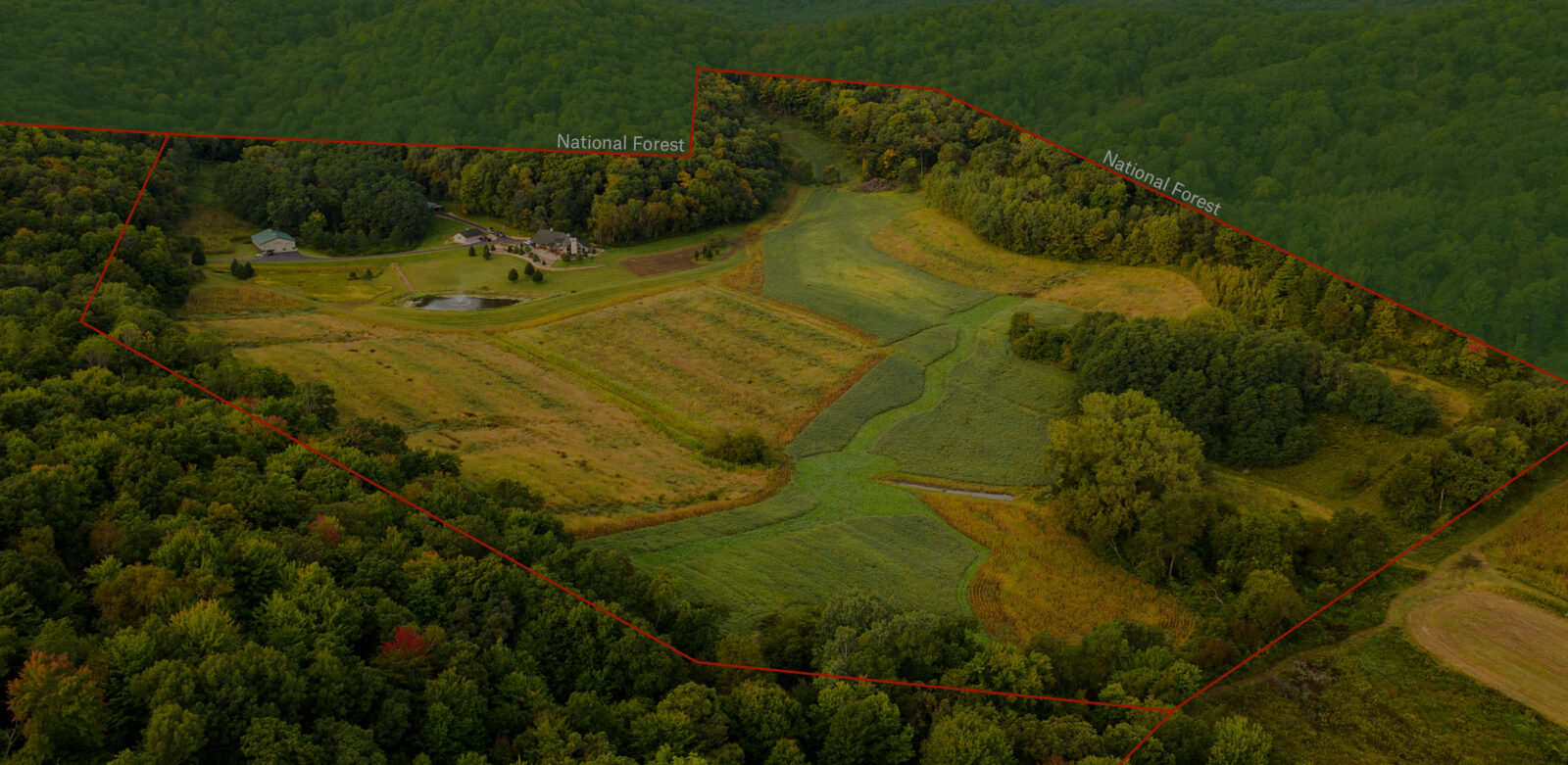
Understand where you can and can’t hunt, and be certain about where you are standing in relation to nearby property lines so you remain legal. It’s easy to view boundary lines between public and private land with onX Hunt, so you can be certain when that buck you’re watching is indeed on shootable land. Pulling data from over 3,100 counties in the U.S., our in-house team builds accurate maps that include boundary lines and private landowner information.
Get Landowner Information
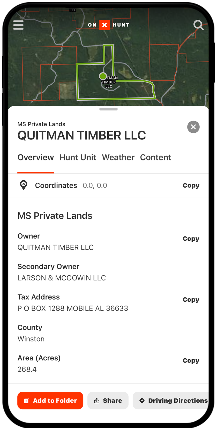
See landowner name, tax address, property coordinates, acreage, and more, right in the Hunt App. This information makes it easy to understand if land is publicly or privately owned and—if private—who you should contact for permission to hunt. If an animal you shoot on public land crosses on to private, simply look up the landowner’s information so you know who to ask for recovery permissions.

Understand Public Access to Private Lands
Expand your horizons by finding more huntable land. The onX Hunt App comes with a Possible Access Layer, in addition to state-specific layers showing private land available to the public during certain hunting seasons. Possible Access properties are private lands owned by timber companies, non-governmental organizations, and other private entities that may allow public access for hunting. (Make sure to contact the landowner for permission before you visit.)
Manage Parcel-Specific Map Content
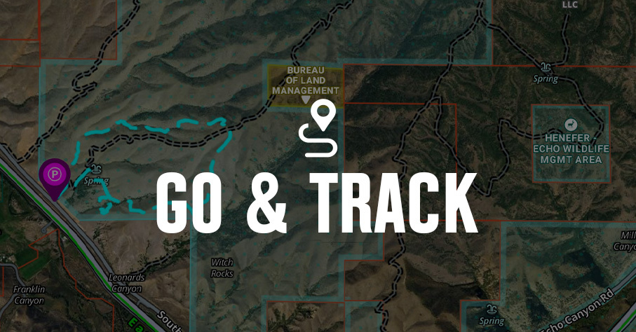
Every hunter understands that knowing the lay of the land—and being able to use it to our advantage—is part of the battle. Use Map Markups in the onX Hunt App to add, view, and manage details specific to a certain parcel of land. Add Waypoints, Tracks, Lines, and more to help remember certain land features, access points, stand locations and more, helping ensure a smooth plan of operation on the day of your hunt.
Everybody talks about how onX Hunt helps you figure out places to hunt, but I think it’s equally important to find out where you can’t hunt. onX keeps you in the clear and lets you focus on what you’re doing, and what you should be doing, which is hunting.
– Steven Rinella, Meateater
Know Where You Stand
Understand public and private land boundaries, land ownership, and more with onX Hunt.
FAQs: Land Ownership Maps and Property Line App
The onX Hunt App is one of the most accurate property line apps available, combining GPS technology with detailed parcel data to show land boundaries, ownership information, and public vs. private land in one interactive map.
Turn on the “Private Lands” Map Layer found under a given state’s Map Layer collection, and you will see private property boundaries outlined in red, showing who owns each parcel and where it begins and ends.
Selecting any land parcel in the app displays the landowner’s name, tax address, property coordinates, acreage, and more, making it easy to identify who to contact for hunting permission.
onX sources its property line maps from official county and state records, pulling data from over 3,100 U.S. counties, and updates them regularly to provide reliable boundary data, though accuracy may vary slightly by region.
Yes, the Possible Access Layer highlights private lands owned by timber companies, non-governmental organizations, and other entities that may allow public access for hunting, though you should always contact the landowner for permission before visiting.
The app shows property boundaries throughout the United States, and in Canada, property lines are available where data exists.
Yes, the Map Markups feature lets you add Waypoints, Tracks, Lines, and other details to specific parcels to help you remember land features, access points, stand locations, and more.