
Go Farther With Offline Hiking Maps
Cell service ends fast in the backcountry. Your ability to navigate should not. With Offline Maps in onX Backcountry, you can download detailed hiking maps to your phone before you leave service, then view your location, follow trails, mark Waypoints, and navigate with your phone’s GPS while you’re offline. Plan your route at home, save the map area you need, and head out with a reliable trail map built for hiking beyond cell coverage.
Download Trail Maps Before You Hike
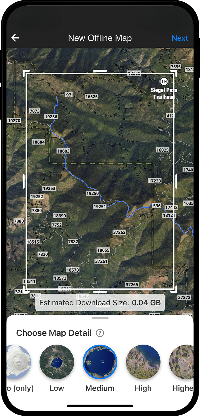
Before you hit the trail, save an Offline Map of the area you plan to explore. Choose your map resolution, adjust the map box around your route, and download the map directly to your mobile device so it is ready when cell service drops.
Offline Maps let you bring key onX Backcountry map details with you, including trails, topo information, Waypoints, Lines, and other saved map content. You can also save multiple maps or overlap coverage areas for longer hikes, backpacking trips, or routes where you may wander beyond your original plan.

Navigate Without Cell Service
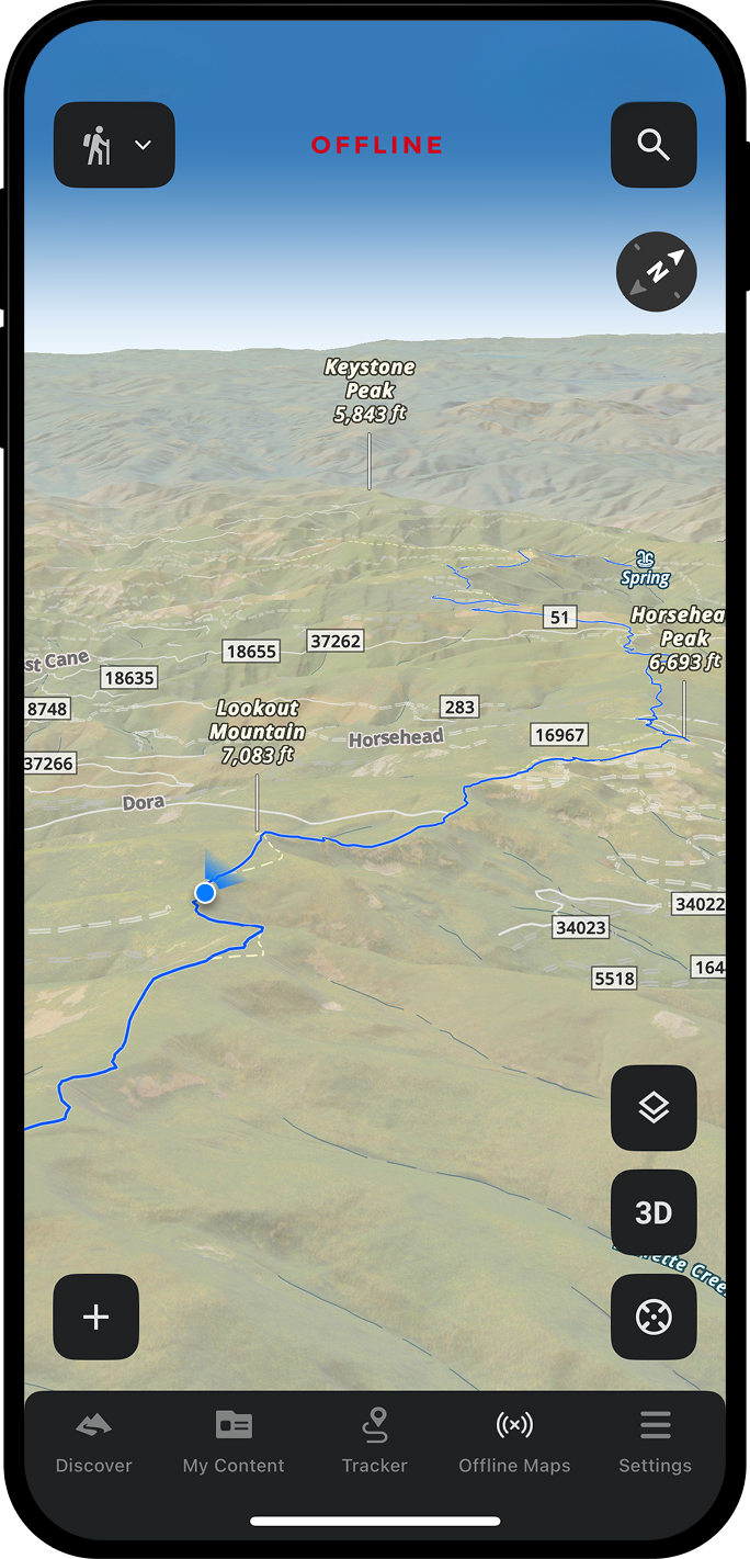
Once your map is downloaded, onX Backcountry turns your phone into an offline GPS map for hiking. Your phone’s internal GPS can still show your location as a blue dot on your saved map, even when you don’t have cell coverage.
Use Offline Maps to stay oriented on the trail, check your position against your planned route, find your way back to the trailhead, and make more confident decisions when terrain, weather, or daylight changes your plan. You can also use Tracker to record your route and retrace where you have been while offline.

Keep Your Hiking Tools Available Off Grid
Offline hiking maps are most useful when they do more than show a static image. With onX Backcountry, you can keep using essential map tools in the field, including Waypoints, Lines, and Tracks. Drop a Waypoint at a water source, campsite, viewpoint, trail junction, or hazard, then sync your updates once you return to service.
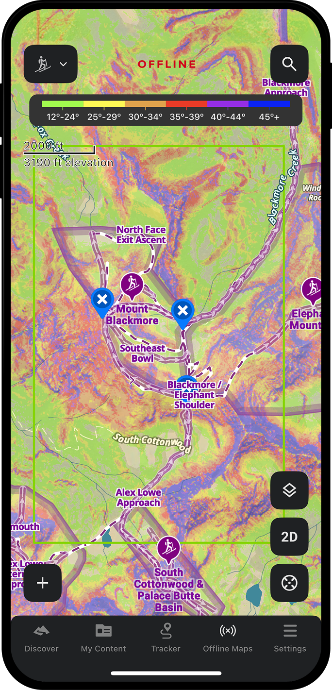
Offline Maps also help you carry important planning context into the field. Depending on the map area and layers you have saved, you can view trails, topo detail, slope-angle, and other backcountry map information while offline.
Built for Hikes Beyond Coverage
The best hikes often start where the signal bar disappears. onX Backcountry Offline Maps help you prepare before you go, stay oriented while you are out, and navigate back with confidence.
Whether you are hiking a local trail, scouting a new route, or linking together a longer backcountry objective, download your map ahead of time and keep your trail navigation tools available when you need them most.
“The peace of mind of knowing exactly where I am regardless of cell service is truly invaluable. Plus, the ability to create offline maps of only the terrain that I need in different levels of detail saves space on my phone while still allowing me to cast a wide net for any contingency.”
–Griffin Post

How To Download Offline Maps

On Desktop
- Log in to your account at webmap.onxmaps.com/backcountry/login.
- Select Offline Maps on the left-hand side.
- Click New Offline Map.
- Name your map, add a note, choose your map resolution detail, and orient the map box over your hiking area.
- Click Save.
- Open the onX Backcountry App on your mobile device.
- Select the Offline Maps tab and tap the download icon next to the map you created to save it for offline use.

In App
- Open the onX Backcountry App on your mobile device.
- Tap Offline Maps from the bottom row.
- Tap New Map.
- Name your map, choose the map resolution detail, and move the map box to cover your hiking area.
- Tap Save.
- Wait for your map to download. You should receive a notification when the download is complete.
- Before you head out, go to the Offline Maps tab and select Go Offline to test your saved map.

Plan with Better Maps.
Start your free 7-day onX Backcountry trial today to start exploring.
Frequently Asked Questions
The best offline GPS map app for hiking lets you download trail maps before your trip, see your location without cell service, and use key navigation tools in the field. onX Backcountry is built for hikers who need downloadable trail maps, offline GPS location, topo detail, route planning, Waypoints, and tracking tools in one app.
Yes. Once you download an Offline Map to your mobile device, you can use onX Backcountry without cell service in that saved map area. You can view your location, follow trails, use saved map content, and keep navigating with your phone’s internal GPS.
Yes. Your phone’s GPS doesn’t rely on cell service or mobile data, it communicates with satellites. In onX Backcountry, your location appears as a blue dot on your downloaded Offline Map so you can see where you are on the trail.
Open the onX Backcountry App, tap Offline Maps, select New Map, choose your map area and resolution, then tap Save. Wait until the map fully downloads before leaving cell service.
Yes. You can create and configure Offline Maps on desktop, but the maps themselves must still be downloaded on your mobile device. After saving an Offline Map on desktop, open the onX Backcountry App and download that map from the Offline Maps tab before your hike.
Yes. You can use Tracker while offline to record your route and see where you have been. When you return to service, your saved map activity syncs with your account.
Yes. You can drop Waypoints, draw Lines, and save important places while you are offline. Use Waypoints to mark trail junctions, campsites, water sources, viewpoints, hazards, or places you want to revisit.
The number of Offline Maps you can save depends on your device’s available storage. Higher-resolution maps provide more detail but use more storage, while lower-resolution maps can cover larger areas.
Use high resolution for detailed trail navigation in a smaller area, such as a day hike or technical route. Use medium or low resolution when you need to cover a larger area, such as a longer backpacking route, multi-day trip, or backup map around your planned trail.
Yes. After downloading your map, use Go Offline in the Offline Maps tab to confirm your map is saved and ready. This helps you make sure the map area, resolution, and downloaded content are available before you lose service.