

3D Maps for Skiing, Hiking, and Backpacking
Planning a backcountry ski tour, hike, or adventure is more fun and helpful in three dimensions. That’s why you should use onX Backcountry’s 3D Maps to explore these areas virtually, customize your maps, drop Waypoints, and visualize your journey all before hitting the road.
Planning a backcountry ski tour, hike, or adventure is more fun and helpful in three dimensions. That’s why you should use onX Backcountry’s 3D Maps to explore these areas virtually, customize your maps, drop Waypoints, and visualize your journey all before hitting the road.
Visualize Your Objective in 3D
Plan your mission with 3D Maps that enable you to visualize your outdoor pursuit in stunning detail. Whether you are hiking to an alpine lake or backcountry skiing in a couloir, onX Backcountry’s 3D Maps can help you plan your objective like never before.
Explore Your World in Three Dimensions
Below is an interactive map sample. Click ctrl+left click to tilt, pan, play with the map. Try a free trial or purchase Premium to unlock an entire route planning Swiss Army Knife before your next adventure. Login or create an account to gain full functionality.

3D Adventure Maps for All Seasons
Your adventures take place in three dimensions, your planning should too. Whether you’re backcountry skiing, hiking, or backpacking onX Backcountry’s 3D adventure maps can help you plan your next objective. Try onX Backcountry for free for 7-days and start exploring.
On the Go or Your At-Home Planning Tool
Whether you need 3D maps on your computer or on your mobile device, onX Backcountry has you covered. Plan across devices and your Waypoints, Tracks, and other markups will automatically sync between devices.
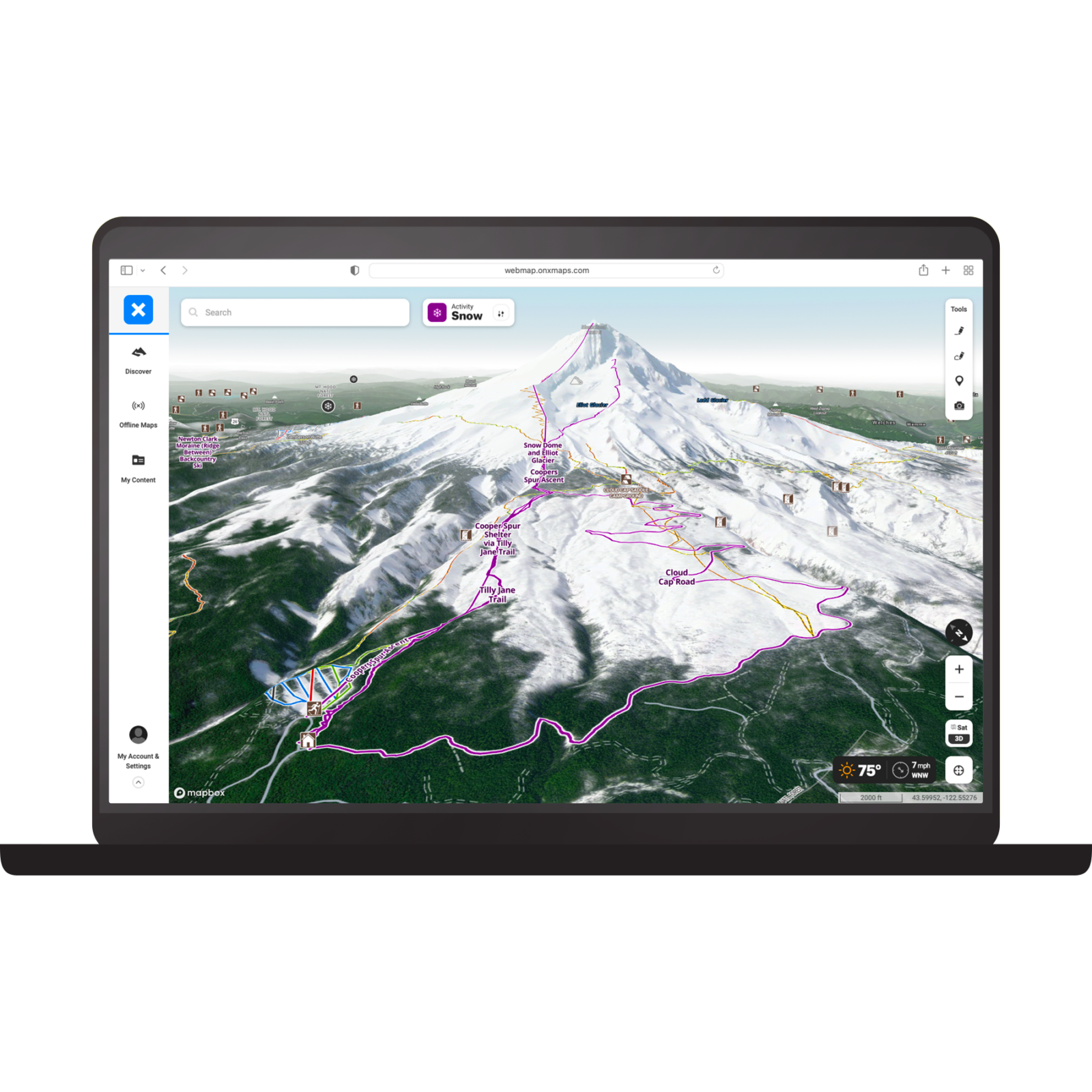
Your Ultimate 3D Planning Tool on Web
View mountain peaks and deep canyons in 3D before you head out on your adventure. Toggle 3D on to tilt, pan, and zoom your way throughout the virtual landscape. Mark Waypoints, build routes, and view layers in 3D on your laptop. Next to having boots on the ground, this is the closest you’ll get to being there.
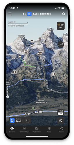
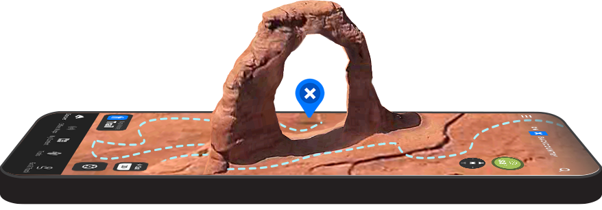
3D Maps on the Go
Explore routes in 3D in the palm of your hand in the onX Backcountry App. View Waypoints, Tracks, layers, and terrain features in 3D to help you plan your next hike, backpacking trip, or backcountry ski adventure.

“
The 3D feature brings a traditionally dull topo to life.
3D Maps allow you to scout terrain and very easily see features that could be interesting or problematic, saving you time both in the scouting process and out in the field. Just another step in making trip planning easier and letting you focus on the adventure at hand rather than logistics.“
Griffin Post
Professional Backcountry Skier
How to View 3D Maps

On Desktop
- Log into your account webmap.onxmaps.com/backcountry/login
- Select basemap icon.
- Toggle 3D mode on.
- CTRL + left click to pan.

In App
- Select the basemap icon.
- Ensure you’re in satellite view and select 3D.
- Use two fingers to tilt.
*3D not currently available offline on mobile.
Frequently Asked Questions
Yes, onX Backcountry offers 3D Maps for iOS devices. You can drop waypoints, view map layers, and more from your iphone.
Yes, onX Backcountry’s 3D maps are available on Android devices.
Yes, you can view 3D Maps on your onX Backcountry webmap.
Yes, 3D Maps are now currently available when using onX Backcountry in Offline Mode.
Try onX Backcountry’s 3D Adventure Maps Today
Start your free 7-day onX Backcountry trial today to start exploring.