W71
Total Miles
1.3
Technical Rating
Best Time
Spring, Fall, Summer
Trail Type
60" Trail
Accessible By
Trail Overview
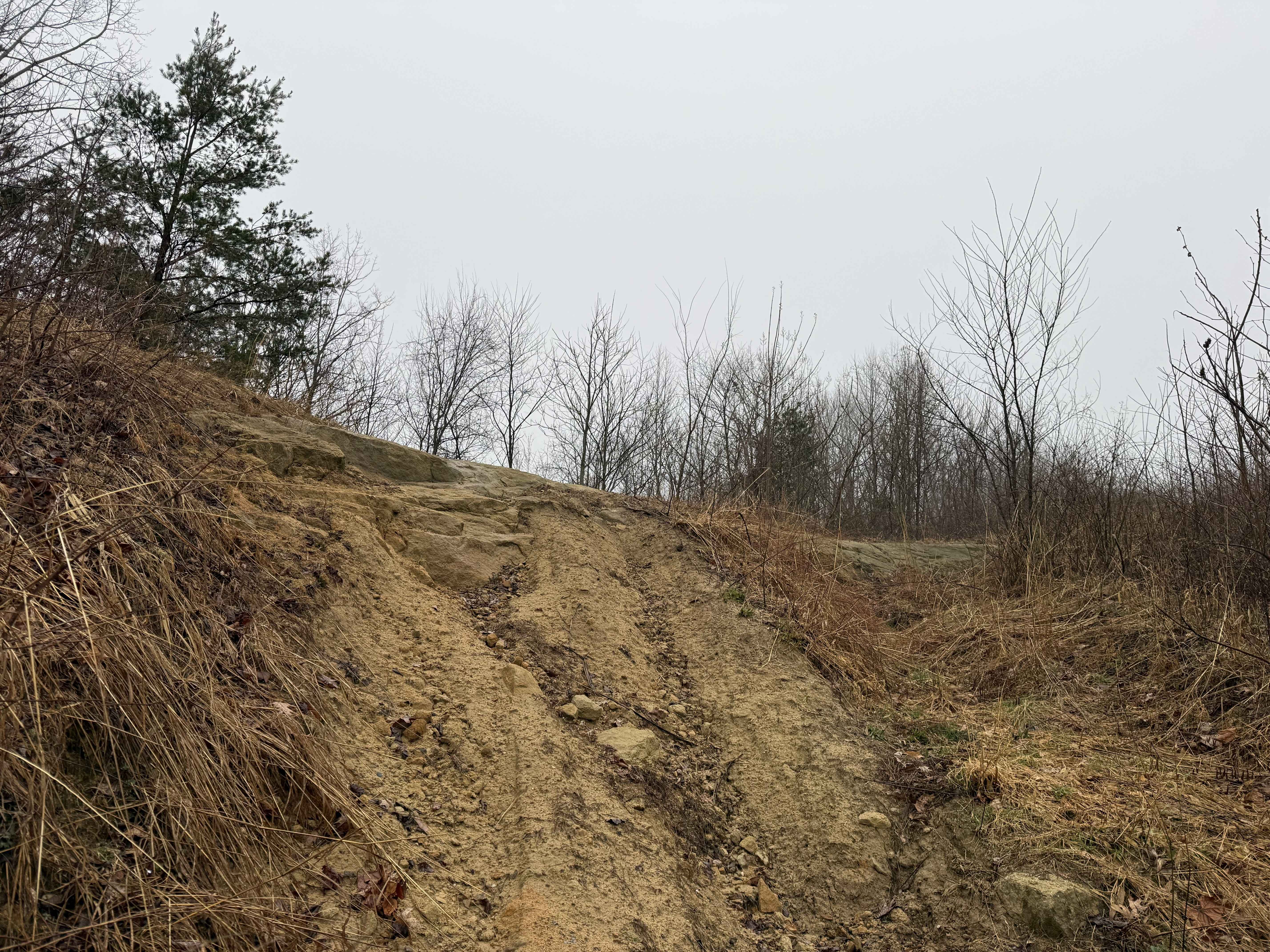
Trail W71 is a 1.6-mile connector that climbs steeply from north to south, offering a more technical ride suited for intermediate users. Starting with a small stream crossing, the trail dips briefly before entering a dense beech forest, paralleling a ravine with potential water on the trail. The narrow path includes loose rock, ruts, and a tight hairpin switchback. A particularly steep section near the south end features embedded rock and deeper ruts, adding to the challenge.
Photos of W71


Difficulty
This is a moderately easy SxS route with some steeper sections that have more pronounced ruts and rock, making it best for intermediate riders. Note that this is considered Most Difficult by Hatfield McCoy's Rating System.
Status Reports
W71 can be accessed by the following ride types:
- SxS (60")
- ATV (50")
- Dirt Bike
W71 Map
Popular Trails


Canaan Loop
The onX Offroad Difference
onX Offroad combines trail photos, descriptions, difficulty ratings, width restrictions, seasonality, and more in a user-friendly interface. Available on all devices, with offline access and full compatibility with CarPlay and Android Auto. Discover what you’re missing today!