RH 29
Total Miles
2.6
Technical Rating
Best Time
Fall, Spring, Summer, Winter
Trail Type
60" Trail
Accessible By
Trail Overview
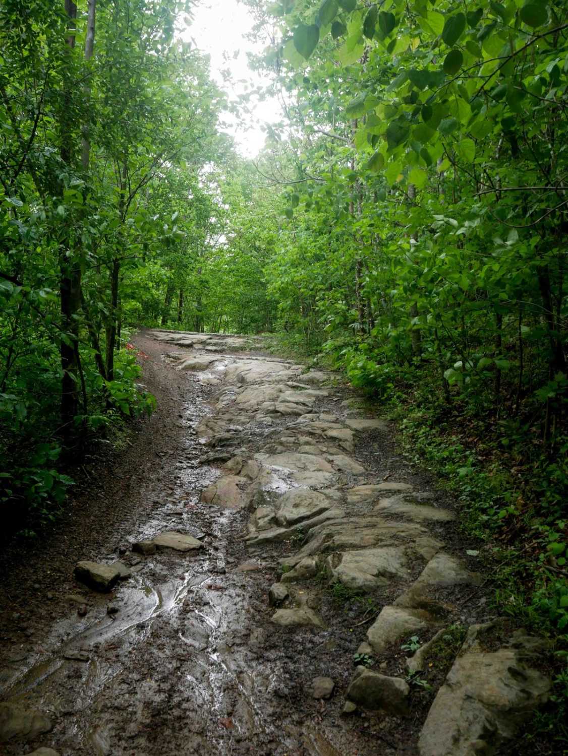
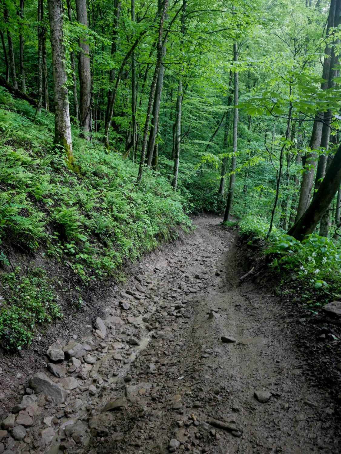
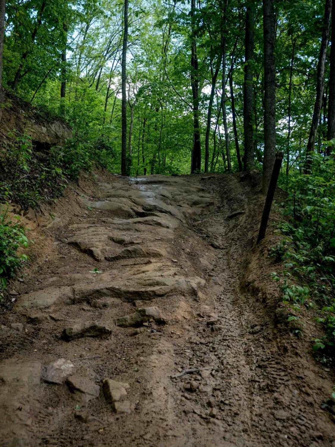
RH 29 is a more challenging trail best suited for intermediate riders, and can be even more difficult in wet conditions. Starting from the north, it immediately presents embedded rock layers forming 6-inch ledges along a narrow path, followed by loose rock as it curves across a hillside. The trail narrows between overgrown tree branches beneath a lush canopy and features an extremely steep, loose climb with ruts that make maintaining momentum and traction difficult--particularly when wet. Riders should be cautious of a significant washout on one of the corners. The ascent continues with tight switchbacks, rocks, and ruts before reaching a high point and transitioning to a smooth, easy path leading to the intersection with RH 40. Despite the absence of large drops or shelves, the sustained steep grade and surface conditions add to its technical demands.
Photos of RH 29
Difficulty
This trail is best for upper intermediate riders comfortable with steep and loose grades. Note that this is considered Most Difficult by Hatfield McCoy's rating system.
Status Reports
RH 29 can be accessed by the following ride types:
- SxS (60")
- ATV (50")
- Dirt Bike
RH 29 Map
Popular Trails
Parsons to Stone Lake Run


The onX Offroad Difference
onX Offroad combines trail photos, descriptions, difficulty ratings, width restrictions, seasonality, and more in a user-friendly interface. Available on all devices, with offline access and full compatibility with CarPlay and Android Auto. Discover what you’re missing today!