OP 100
Total Miles
0.4
Technical Rating
Best Time
Fall, Spring, Summer, Winter
Trail Type
60" Trail
Accessible By
Trail Overview
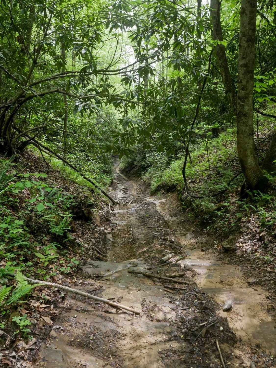
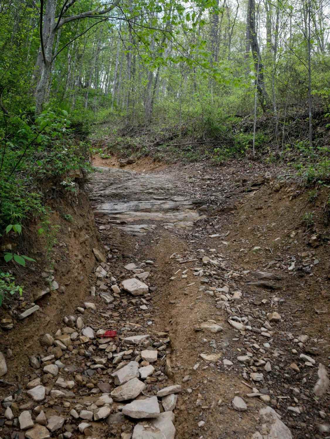
OP 100 is a half-mile trail that connects OP 6 and OP 56. It begins as a smooth, wide path descending with ruts and a big sweeping turn, then dips briefly to cross a ravine. From there, it transitions into a rockier climb with embedded rock layers on a steeper slope. It's narrow for the majority of the route, a one-lane shelf alongside rhododendron thickets and dense forested hillsides. Slightly more difficult than surrounding trails, but still manageable with controlled momentum.
Photos of OP 100


Difficulty
This moderately easy route has a steep climb with ruts and loose rock, making it best suited for drivers who are confident with basic off-road techniques. This is considered Most Difficult by Spearhead's rating system.
Status Reports
OP 100 can be accessed by the following ride types:
- SxS (60")
- ATV (50")
- Dirt Bike
OP 100 Map
Popular Trails

The onX Offroad Difference
onX Offroad combines trail photos, descriptions, difficulty ratings, width restrictions, seasonality, and more in a user-friendly interface. Available on all devices, with offline access and full compatibility with CarPlay and Android Auto. Discover what you’re missing today!