IB 45
Total Miles
1.9
Technical Rating
Best Time
Fall, Spring, Summer, Winter
Trail Type
High-Clearance 4x4 Trail
Accessible By
Trail Overview
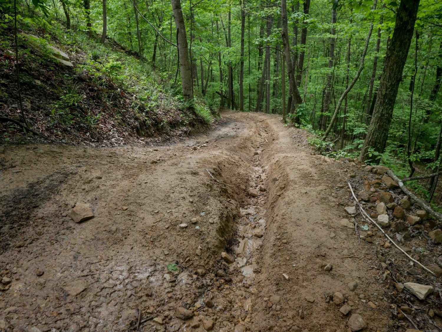
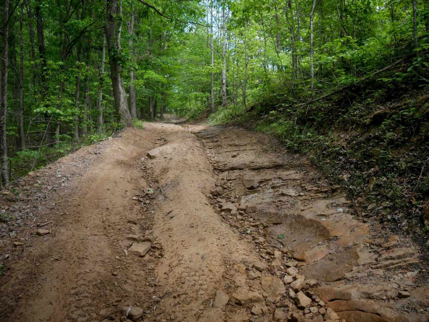
IB 45 is a 2-mile trail along the eastern edge of the system, starting from the north with deep ruts--often along the sides and sometimes down the center--along with natural uneven surfaces creating small drop-offs. The northern section includes loose rock, tight switchbacks, steep grades, large waterbars, and a shelf path elevated above a ravine. The southern half becomes smoother and more gradual, with easier terrain. It goes along train tracks for part of it, and note that it is not directly accessible by Highway 119.
Photos of IB 45
Difficulty
This is a moderately easy route with steep grades, ruts, and lots of loose rocks.
Status Reports
IB 45 can be accessed by the following ride types:
- High-Clearance 4x4
- SxS (60")
- ATV (50")
- Dirt Bike
IB 45 Map
Popular Trails


The onX Offroad Difference
onX Offroad combines trail photos, descriptions, difficulty ratings, width restrictions, seasonality, and more in a user-friendly interface. Available on all devices, with offline access and full compatibility with CarPlay and Android Auto. Discover what you’re missing today!