OP 16
Total Miles
1.6
Technical Rating
Best Time
Fall, Spring, Summer, Winter
Trail Type
60" Trail
Accessible By
Trail Overview
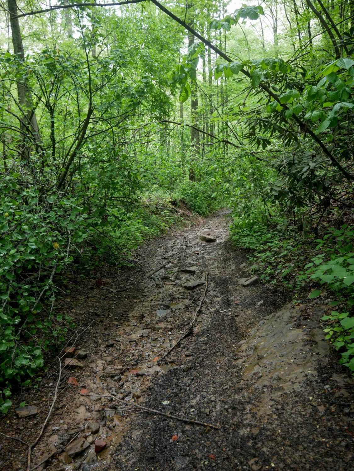
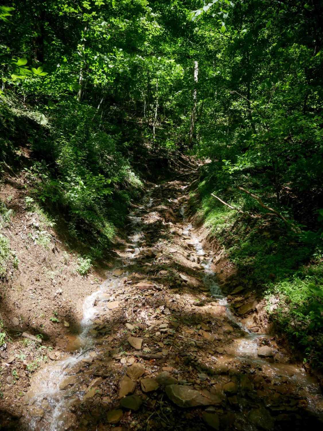
OP 16 is a 1.7-mile trail in the western section of the system, offering a slightly more difficult ride due to occasional steeper grades, embedded rock layers, and loose rock. It sometimes parallels a ravine and winds through a lush forest floor lined with rhododendron thickets. Several well-marked intersections make navigation straightforward. The trail features gradual switchbacks and can become rutted and slick when wet, but overall maintains a steady, flowing feel through classic Appalachian terrain.
Photos of OP 16

Difficulty
This moderately easy route features occasional steep climbs with ruts and loose rock, making it best suited for drivers who are confident with basic off-road techniques.
Status Reports
OP 16 can be accessed by the following ride types:
- SxS (60")
- ATV (50")
- Dirt Bike
OP 16 Map
Popular Trails

Second Mountain Trail
Laurel Bed Lake
The onX Offroad Difference
onX Offroad combines trail photos, descriptions, difficulty ratings, width restrictions, seasonality, and more in a user-friendly interface. Available on all devices, with offline access and full compatibility with CarPlay and Android Auto. Discover what you’re missing today!