David E
Nov 06, 2025
2022 Rivian R1T
Open
DustyRough/Deteriorated
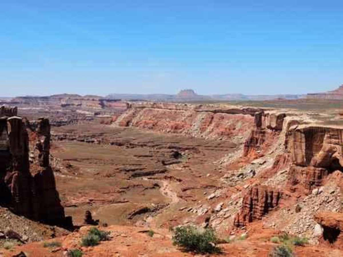
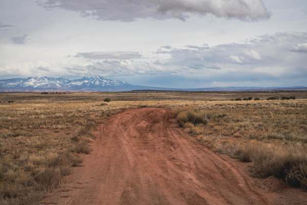
Spectacular route. Most of the trail is easy for a 4x4 but rough and slow, with a lot of driving on sandstone. Of the two harder sections I’d read trip reports about, I found Murphy’s much easier than expected. It is steep and exposed, but straight and not too rough. The crux is spotting traffic, which is much easier for the driver at the top on both sides. Hardscrabble was harder than expected, and after driving I watched some videos from a year or two ago and it seems recent rains have exposed MUCH more sharp rocks and ledges. The Rivian went up it without issue but careful precise tire placement is essential. Charged at RMP EA station in Moab to 100% returned to station after full loop plus longs at 36% including cooking on the battery for 2 breakfasts and dinners. If you love exposed switchbacks you will enjoy, if you don’t…
Matt M
Oct 29, 2025
Open
I drove the entire white rim road starting at the Schafer Switchbacks over 3 days, 2 nights. I drive a stock 4runner with aftermarket steel skid plates and rocksliders, both of which saw some use. The trail was rough, but I didn't see too many spots where I thought that I could get stuck. The west side of the trail was very rutted - you could see that at some point it got really muddy. This is a bucket list trip for sure, do yourself a favor and don't research it to much and ruin the surprise! make sure you visit the NPS website and purchase the correct permits for White Rim.
Steve Lipscomb
Sep 18, 2025
2020 KTM 790 Adventure
Open
Normal
We rode White rim on Thursday September 18th, starting at Potash rd. I was on my Honda 250 Rally, and my friend on his KTM 350 EXC-F. The reason for a 5/10 rating for us was the length and remoteness of the road, the Murphy Hogback climb, the Hardscrabble climb (we thought this was more difficult than the Murphy’s), and the small section of deep sand towards the end of the trail (heading clockwise). We enjoyed the challenges the trail offered, and enjoyed chatting with the folks we met on the way.
Louis Michael
Sep 17, 2025
2022 Toyota 4Runner
Open
DustyMuddy/WetWashboard
Started a little after 7AM on 9/17 at potash road. We took our time stopping to take photos and breaks and got to our Labrynth camp site about 7:30PM. Left camp at 10:00 and finished the trail around 12PM on 9/18. Not a difficult trail but had to go slow as it is fairly rocky/bumpy in some parts, nothing very technical but the hard scrabble portion was a little hairy as it is a single vehicle width climbing up a bumpy portion of a shelf road. Really just an unbelievable experience driving 100 miles through a beautiful NP, definitely recommend!
That Raptor Nerd
Sep 04, 2025
2017 Ford F-Series
Open
This trail is definitely a 4 out of 10. For full size rigs it can be a 5 in some areas. The trail is narrow and has some pretty tight switchback shelf roads. We camped at Potato Bottom and it was amazing. I recommend doing this trail over at least 2 days and if you have 3 it would be better. Space your camp site locations out and if you are only doing the trail in 2 days, understand going in that you are going to have some LONG Driving days.
This trail is NOT for the faint at heart, and should only be attempted by experienced off road drivers in vehicles that are wel maintaiined and in good working order.
Michael Gallagher
Aug 29, 2025
2024 Toyota Tundra
Open
NormalDustyRough/Deteriorated
Pictures won’t do the view nor the road justice. The majority of the track is very straightforward, dirt road with ruts and rock obstacles to navigate and avoid - 2-3 on the difficulty scale. Hogsback is steep and on a shelf, but manageable for most vehicles with high clearance. We had a Ford Raptor in our group, and it maxed out the trail width wise. Hardscramble is no joke, not for inexperienced or squeamish drivers. Rocks, ruts and recent washouts made it a tedious and slow track to navigate. Going with a group for spotters and to help navigate incoming traffic recommended. Contrary to Reddit, few stock vehicles can navigate the entirety of this route.
Nicholas Woike
Aug 10, 2025
2023 Ford Bronco
Open
Normal
Most of the trail was rocky but fairly easy with occasional short stretches of dirt or sand roads but there are 2-3 sections with steep rocky inclines that I am glad I had a rear locker for. Lots of shelf roads.
Jason Braswell
Aug 07, 2025
2023 Chevrolet Colorado
Open
DustyRough/Deteriorated
Where do I start? The views are AMAZING! The road (trail) is rough, deteriorating, and steep. When you think the hard part is over, it’s not. Hardscrabble was a challenge. Steep, loose rocks, and narrow. Not for the faint of heart.
Andy Kachelmeier
Jul 30, 2025
2023 Ford Bronco
Open
NormalDusty
It’s been said before, but yeah, this is truly an epic ride. We did the entire trail as laid out in onX from Shafer all the way up to 313 in one day. We got an early start and it took around 11 hours with all the stops to enjoy the amazing views. We didn’t feel rushed at all and we didn’t see another human until we ran into a ranger at the halfway point checking permits (make sure you get one).
The trail was in good shape really. Murphy Hogback took 4L and some lockers. The Labyrinth at the end took a bit of nerve and the skid plates have some new marks to remember the trip. We used a half tank of gas, so about 10 gallons.
Brent H
Jul 11, 2025
2021 Ford Bronco
Open
NormalRough/Deteriorated
Started at Shafer in the morning. Nice trail down to White Crack campground. Good sightseeing, easy going only saw two other vehicles all day. Second day on around to Potato Bottom and out Mineral Bottom Rd. Trail definitely rougher and more technical. See comments from July 3rd. It had dried out but left trail worse than I expected from YouTube videos. Between Potato Bottom and Fort Bottom there are some steep narrow and a few rocky sections that I didn’t expect. Stock Bronco no lockers and A/T 32’s. Two days with overnight camp was a good pace without feeling rushed.
Bryan Dillehay
Jul 03, 2025
2021 Jeep Wrangler
Open
Muddy/Wet
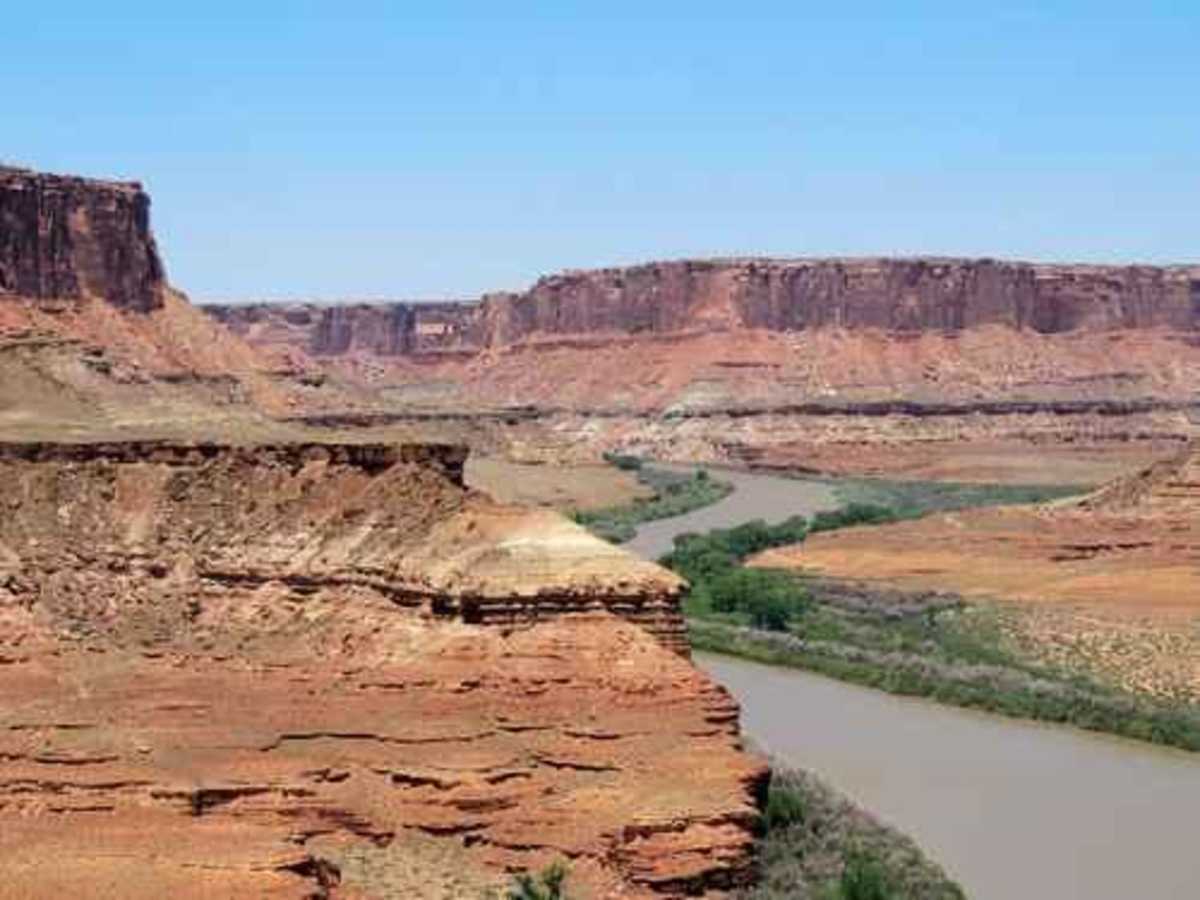
Epic. All in one day. Started at shafer then finished near the Labrinth/Green River. The Murphy/Hogback area is steep and rutted. The switchbacks near Hardscrabble were very washed out from the morning thunderstorm. Experienced drivers only until they repair the trail. Not for the faint of heart if you don’t like shelf roads. Near the Green River end it was very muddy with deep holes. 10 hrs on the trail and saw 3 vehicles all day.
Dennis Page
Jun 03, 2025
2023 Rivian R1T
Open
NormalWashboardDustyRough/Deteriorated
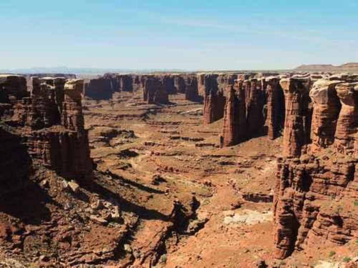
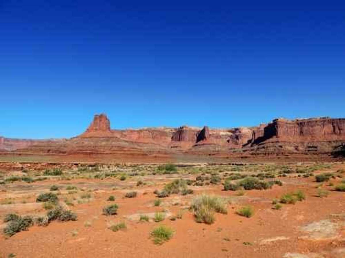
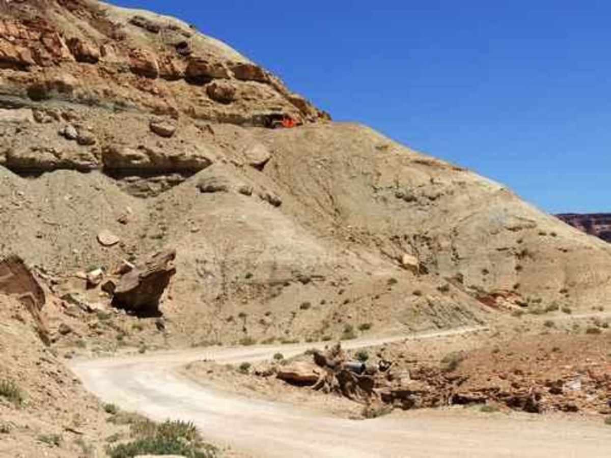
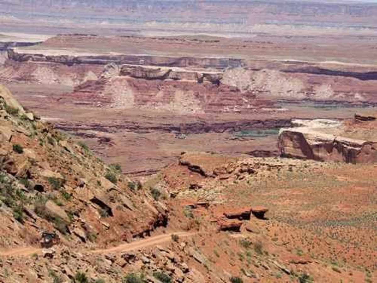
We were in our stock Rivian R1T with 35" wheels, our friends were in their offroad-enhanced Sprinter van, after watching many videos of others saying it would be ok. A couple of the photos are from Murphy campground, which is now my favorite campground anywhere - fantastic views! Awesome trip, did the entire loop starting at Shaffer. The Sprinter lost its transmission near Hogback and had to be towed out (third pic). Loved Hogback and Hardscrabble - a good challenge for my limited experience, but the Rivian handled both like a champ. Started at Shaffer with 91% charge, ended at Mineral Bottom Rd with about 35%, using electric stove, air pumps, Starlink the whole way, charging phones, electric coffee pot, etc. Don't be concerned about charge! Saw only about 5 other cars the whole way. Had just a bit of rain and temps in the 80s. Fantastic trip! Just prepare well and don't attempt it with a Ford Escort. :)
AJ Brown
May 21, 2025
2023 Ford Bronco
Open
Normal
Harry & Shannon Xterra
May 17, 2025
2011 Nissan Xterra
Open
Rough/Deteriorated
Some hard bumps but not technically challenging at all for the segment that we did. Road can be a bit rough as a whole and saw a variety of vehicles (many stock). Had a day permit and started the trail at Potash Road (after coming down Shafter Canyon) -- started pretty late at 1:30pm. Turned around at Monster Tower as we had to be elsewhere that night.
Zach W
May 10, 2025
Open
Normal
First time doing this trail and it was great. The only technical part was Hard Scrabble. Few groups of people mountain biking other than that didn’t run into many people. Camped at White Crack and the views were incredible. Definitely do Lathrop canyon. (If you had to U-turn at Lathrop you should stick to being a pavement princess lol)