Trust Lands Singletrack (North)
Total Miles
2.9
Technical Rating
Best Time
Summer, Fall, Spring
Trail Type
Single Track
Accessible By
Trail Overview
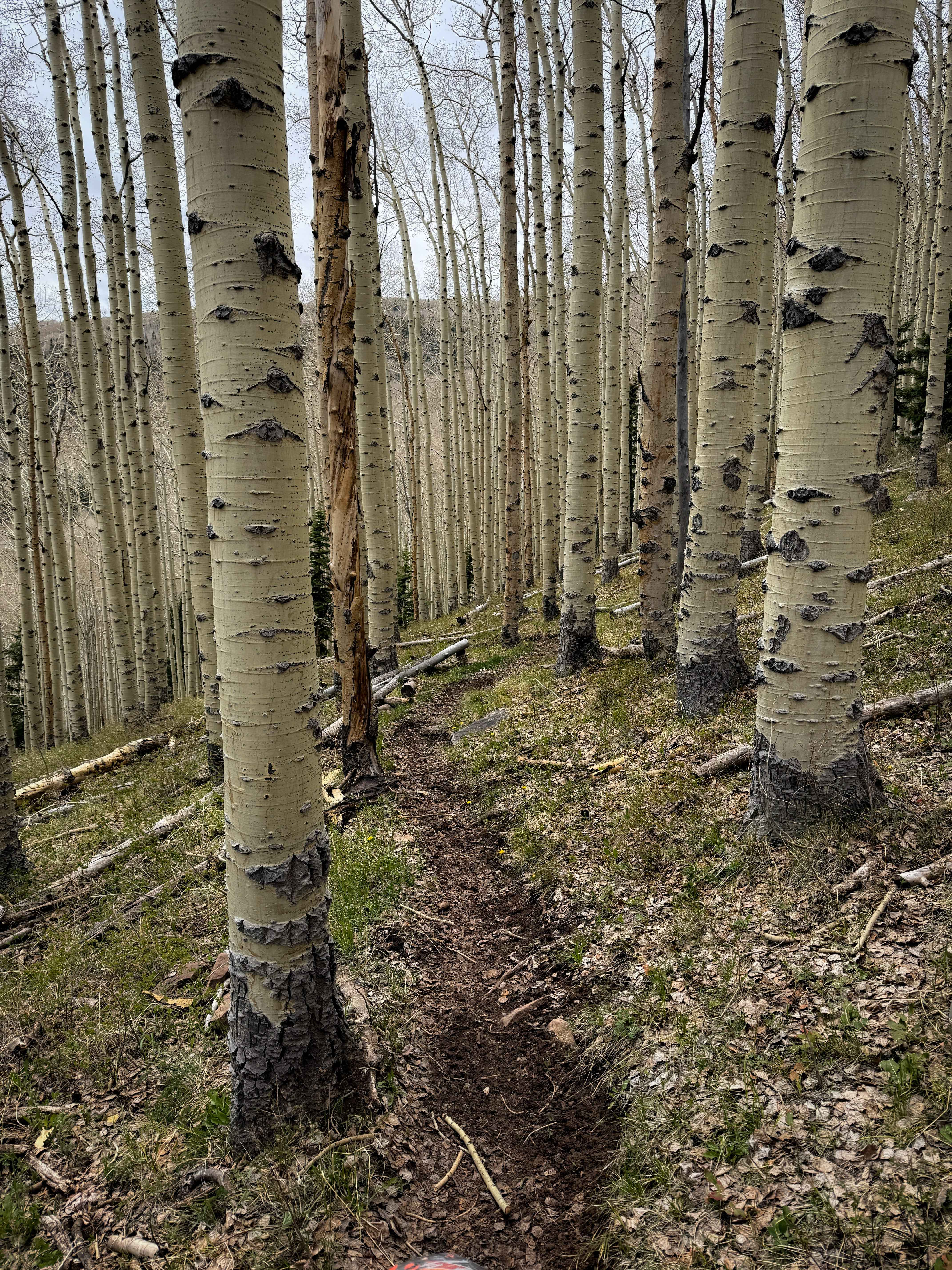
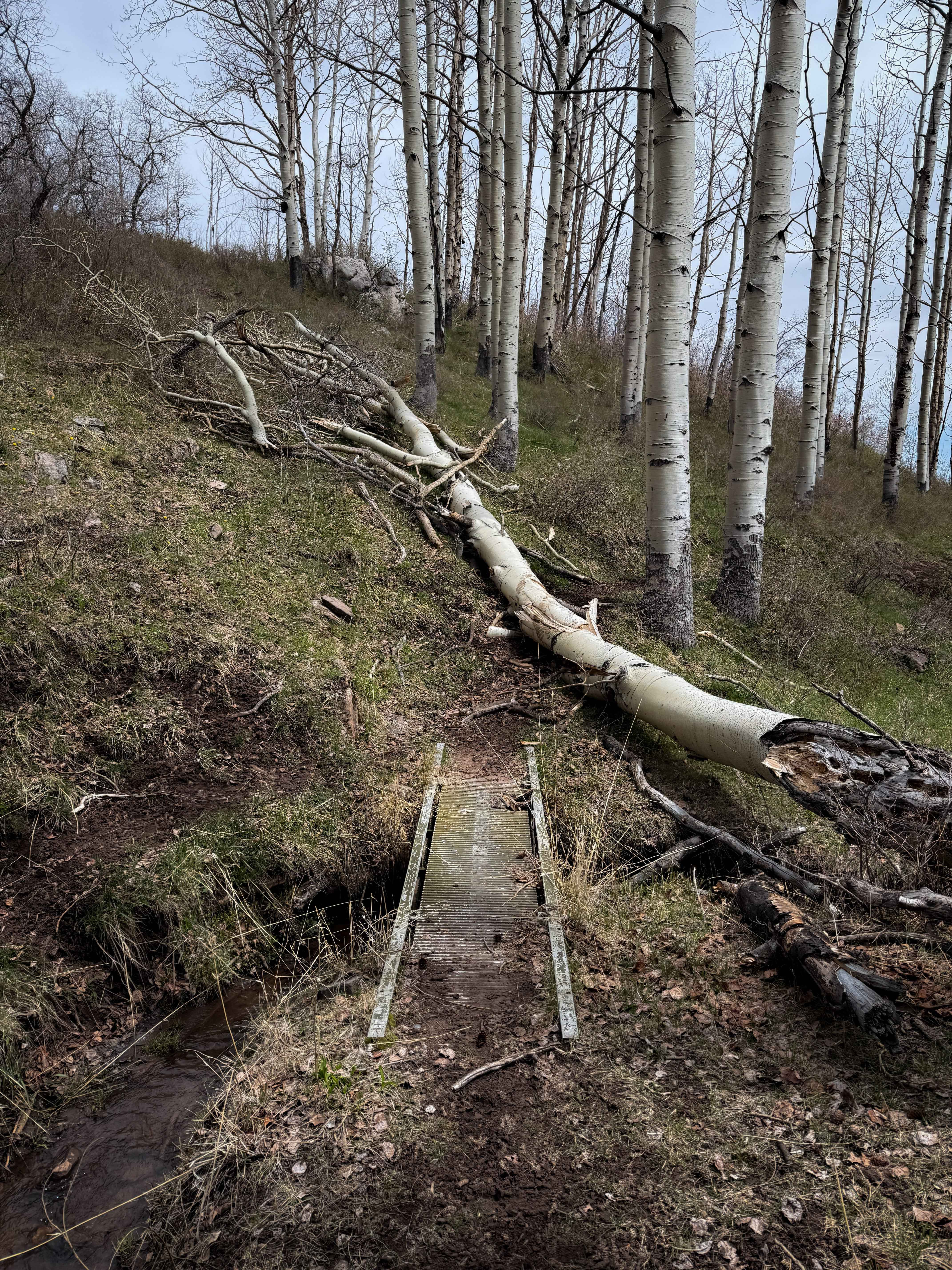
This is a fun and scenic section of singletrack that meanders through aspen groves and scenic meadows in the La Sal Mountain range on Utah State Trust Land. The west end of the trail starts at almost 9,800 feet elevation, and it drops over 1100 feet over 3 miles as it goes east. There are several downed logs throughout the route, but the trail system looks well maintained and trafficked enough to where many new logs will get cut for the season, but there is always potential for new downfall. It's mostly small to medium sized aspen trees, but sometimes elevated over the trail. One large log was down right after a muddy creek crossing with a small bridge, and the log is off-camber diagonally across the trail, making it more difficult to get over. The trail is mostly a skinny and smooth dirt single track that is flowy through the trees, with tight curves, and minor rocky sections. It does some mild side-hilling, has a couple short steep climbs, and a few small roots. It goes through a logging area with wide open views over the hillsides.
Photos of Trust Lands Singletrack (North)
Difficulty
This is a moderate section of singletrack as it had several large log obstacles. The difficulty could be easier if the logs get cleared. The trail itself is easier and flowy, with only a couple rocks and steeper spots.
Status Reports
Trust Lands Singletrack (North) can be accessed by the following ride types:
- Dirt Bike
Trust Lands Singletrack (North) Map
Popular Trails

Baulie's Road - San Juan County B236
Little Creek Lookout Loop

Bates Canyon Trail Access To Erda Lookout
Colorado River Overlook
The onX Offroad Difference
onX Offroad combines trail photos, descriptions, difficulty ratings, width restrictions, seasonality, and more in a user-friendly interface. Available on all devices, with offline access and full compatibility with CarPlay and Android Auto. Discover what you’re missing today!