Revenue Gulch Cottonwood (72)
Total Miles
1.0
Technical Rating
Best Time
Spring, Summer, Fall
Trail Type
60" Trail
Accessible By
Trail Overview
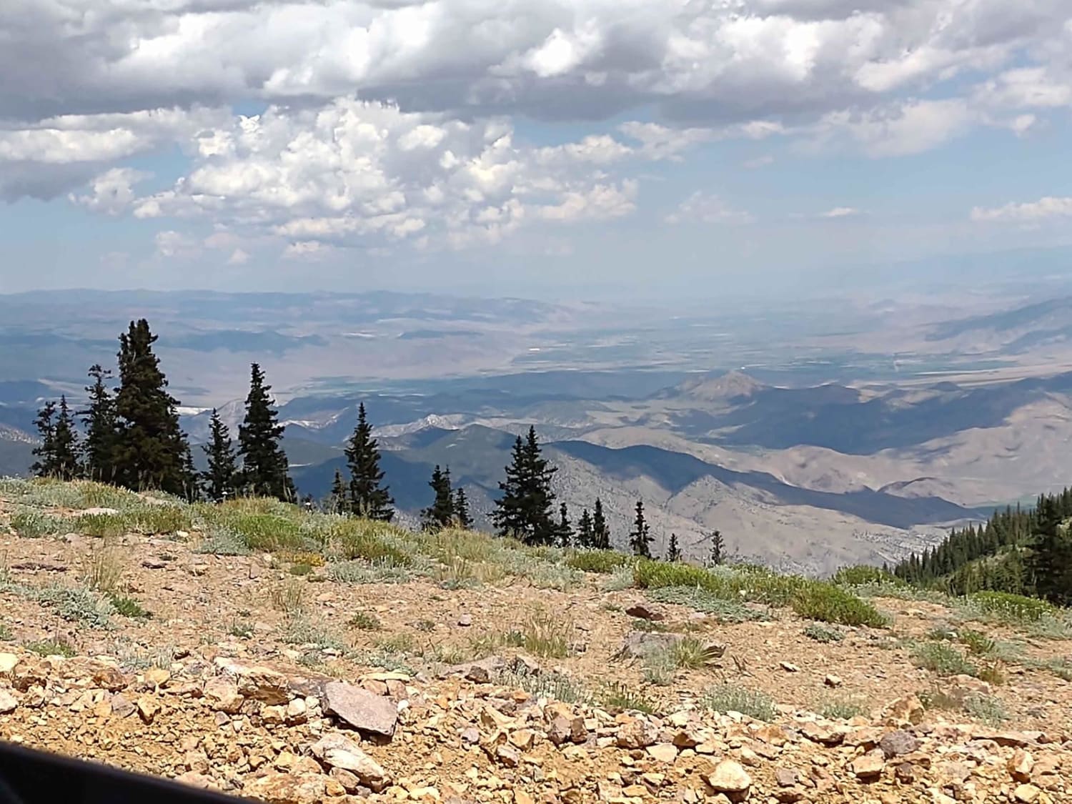
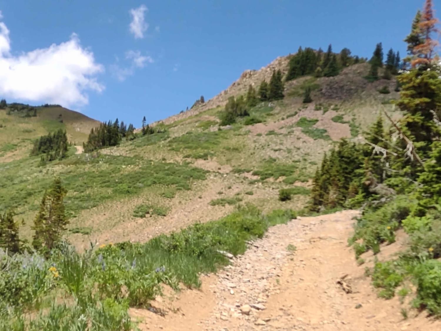
This track is only a mile, but you gain over 700 feet in elevation in that mile, and it's a slow, rocky crawl to the top of the world. Edna Peak (11,653 feet) and Mount Brigham (11,709 feet) are near the top. The other name for this trail is South Bullion to Gold Hill. You go past the historic Alunite Mining site, which if you haven't explored it yet, is worth a stop. The information at the site tells you they hauled Alunite down to the valley floor with a tramway, and it took 72 teams of oxen to tow the cables up to this location for the tram when they were installing it. This full-width trail is steep, it's got loose rocks in a lot of places, there are some embedded rocks you cross, there are parts that are a bit off-camber, and it's narrow, with no room to turn around or let someone pass. The good news is you can see the entire trail from the top and the bottom, so you'll know before you head up or down whether someone else is on the trail. You have a couple of water crossings that were easy in late July 2023. Spring run-off has eroded the center of the trail with a wide ditch, but if your machine is at least 60 inches wide, you can straddle it. At the very top, 11,331 feet above sea level, the views are fantastic in every direction. There is a large parking area there, interestingly. It would likely hold 20 cars with no problem and with room to turn around. There is a hiking trail sign, and this is the trailhead for the Alunite Ridge Hiking Trail.
Photos of Revenue Gulch Cottonwood (72)
Difficulty
This trail has loose rocks on very steep hills. This is a slow climb, but completely worth it. At the top, there is ample room to turn around. The trail has a wide ditch that's been created by erosion right in the middle of the trail. Parts of the trail are off-camber.
History
The Alunite Mine located along this trail has a fascinating history. They hauled the Alunite to the valley floor via a tram system they installed. It took 70+ teams of oxen to haul the cables up to the top of this mountain when they installed the tram.
Revenue Gulch Cottonwood (72) can be accessed by the following ride types:
- SxS (60")
Revenue Gulch Cottonwood (72) Map
Popular Trails

Paiute 1 to Richfield-Pioneer
Salt Valley 146

Cheese and Raisins
The onX Offroad Difference
onX Offroad combines trail photos, descriptions, difficulty ratings, width restrictions, seasonality, and more in a user-friendly interface. Available on all devices, with offline access and full compatibility with CarPlay and Android Auto. Discover what you’re missing today!