FS 30650A
Total Miles
0.7
Technical Rating
Best Time
Spring, Summer, Fall
Trail Type
High-Clearance 4x4 Trail
Accessible By
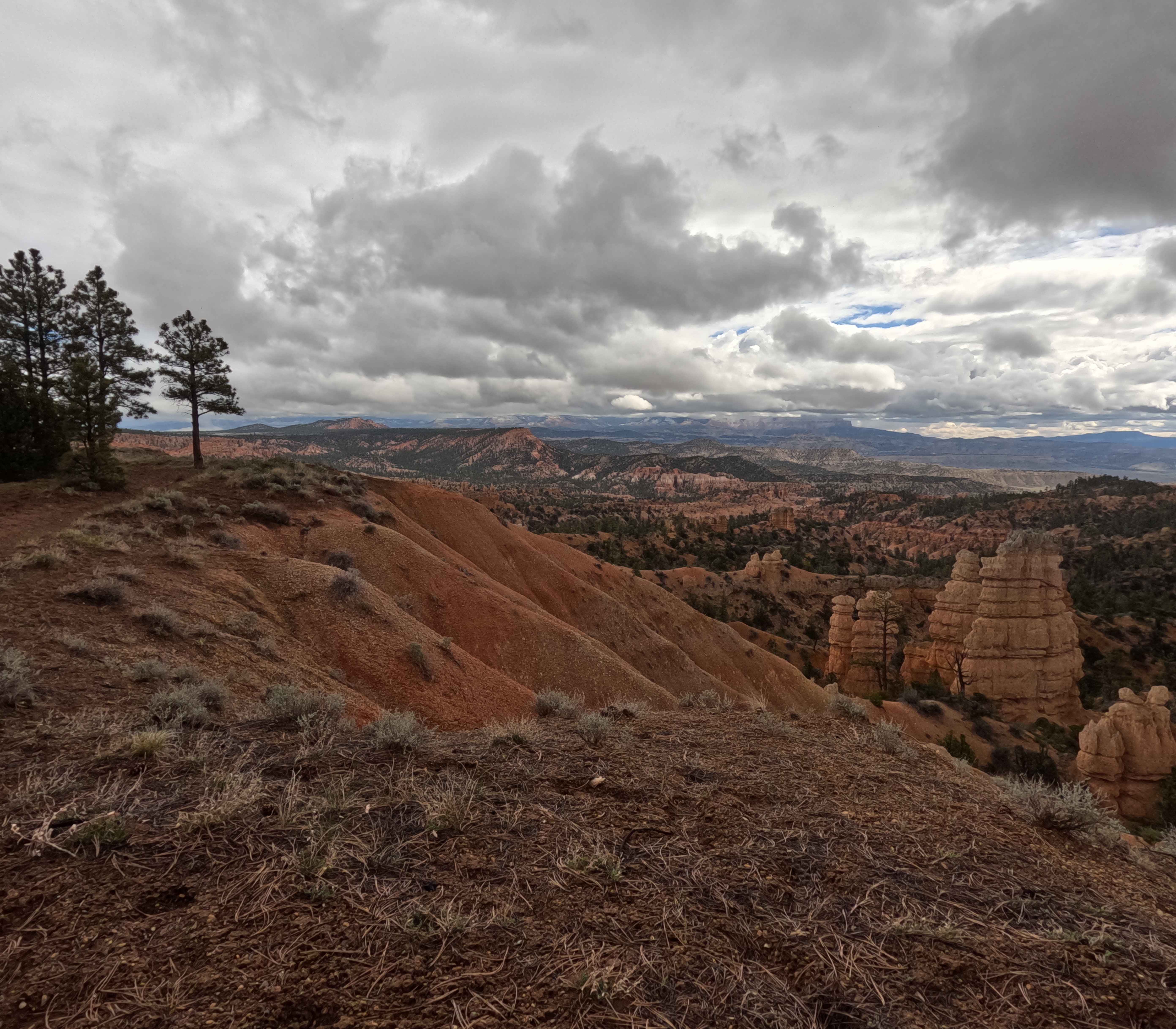
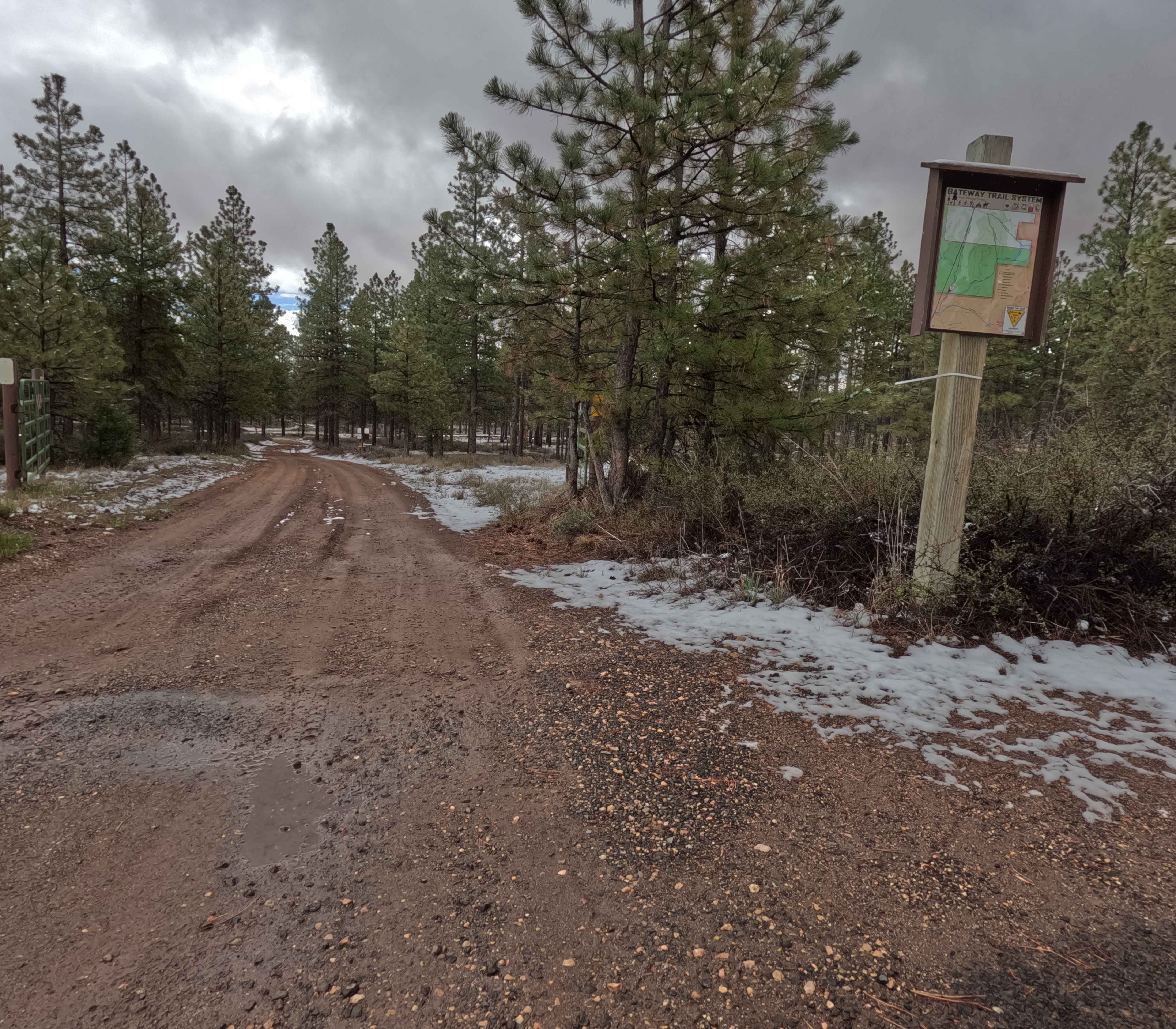
Trail Overview
Located immediately north of Bryce Canyon National Park within the picturesque Dixie National Forest, the Rim Snow Trail is a breathtaking 1.6-mile single-lane forest service road. Serving as a key segment of the larger Ruby multi-use network--also signed locally as the Gateway Trail System--this route winds gracefully through dense, towering pine forests. Along the drive, explorers are treated to spectacular, sweeping viewpoints of the iconic red rock hoodoos and dramatic canyon landscapes that define this unique region. As you navigate the smooth, well-maintained dirt track, you will find it highly accessible, though you may encounter seasonal snow patches clinging to the shaded shoulders during the early spring and late fall. It is critical to note that dispersed camping is strictly prohibited along this specific road. Clear kiosk signage directs visitors to nearby designated areas instead, such as Dave's Hollow. Additionally, drivers must remain observant of trail boundaries and respect any closed green gates marking private property. This highly accessible trail is open to motorized vehicles from May 1st through October 31st, transforming into a pristine, groomed track for cross-country skiing during the winter months.
Photos of FS 30650A
Difficulty
The Rim Snow Trail firmly earns a Level 1 Very Easy rating. The surface consists of a straightforward, single-lane dirt road that is exceptionally well-maintained, featuring only negligible surface imperfections. Because the terrain is predominantly flat and travels through a structured pine forest, it is highly accessible for virtually any standard 2WD passenger car, AWD crossover, and stock SUV during the dry summer months. However, drivers should be acutely aware of seasonal conditions; early spring or late fall travel often presents slick mud and residual snow along the tree line, which may temporarily elevate the difficulty. Finally, always adhere to the strict seasonal motorized vehicle closure from November 1st to April 30th when the area is dedicated exclusively to winter sports.
Status Reports
FS 30650A can be accessed by the following ride types:
- High-Clearance 4x4
FS 30650A Map
Popular Trails

Keg Mountain Road

Road to Quick Dip
BLM735-Kane County 4130
Tommy Loop Connector
The onX Offroad Difference
onX Offroad combines trail photos, descriptions, difficulty ratings, width restrictions, seasonality, and more in a user-friendly interface. Available on all devices, with offline access and full compatibility with CarPlay and Android Auto. Discover what you’re missing today!