Crystal Geyser Trail (North)
Total Miles
1.5
Technical Rating
Best Time
Spring, Winter, Fall
Trail Type
Single Track
Accessible By
Trail Overview
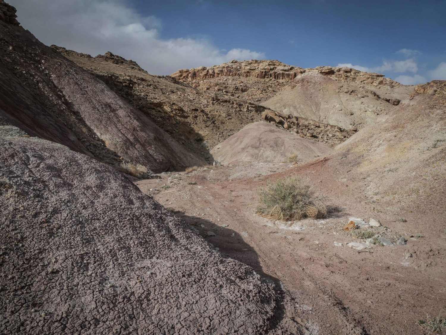
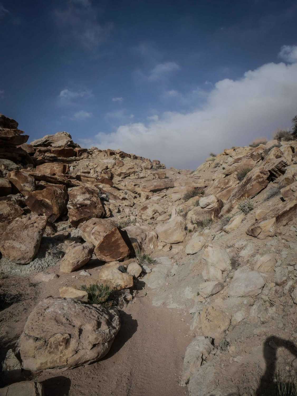
This 1.6-mile segment of the Crystal Geyser Single Track starts on the south end off of Guys Trail (West) and heads north from a wash on chopped-up dirt with washouts on grey bentonite soil. It crosses narrow ravines and crosses Crystal Geyser Road. It heads into the red colorful hills. You'll ride in the ravines between the hills, then ride up onto the ridgelines with a few steep hill climbs. This one looks less trafficked, as there are fewer tracks on this trail. It continues as a narrow ridgeline way up high, then comes to a rocky ledge obstacle. It is several-foot-high rock ledges in a row on a steep climb that would be tricky for a lot of riders. Once you get past this, the top of the mesa is really scenic with tight turns, winding through big boulders lining the trail with a few more challenging ledges. Some are pretty blunt and tall rock faces that you have to get up. It's a fun challenge and a very unique landscape. The trail ends on the north end at Town Trail, a 4x4 Jeep road that you can take back to Crystal Geyser Road.
Photos of Crystal Geyser Trail (North)
Difficulty
This is a 6 difficulty for several intermediate rock ledges that are tricky to get up. It also has several steep climbs, tight turns, and some exposure on the ridgelines.
Status Reports
Crystal Geyser Trail (North) can be accessed by the following ride types:
- Dirt Bike
Crystal Geyser Trail (North) Map
Popular Trails
Paiute Trail #15 to Paiute Trail #6

Lightning Draw Trail
Fix It Pass
The onX Offroad Difference
onX Offroad combines trail photos, descriptions, difficulty ratings, width restrictions, seasonality, and more in a user-friendly interface. Available on all devices, with offline access and full compatibility with CarPlay and Android Auto. Discover what you’re missing today!