BBRSP Madrid Falls Road
Total Miles
5.3
Technical Rating
Best Time
Spring, Summer, Fall, Winter
Trail Type
Full-Width Road
Accessible By
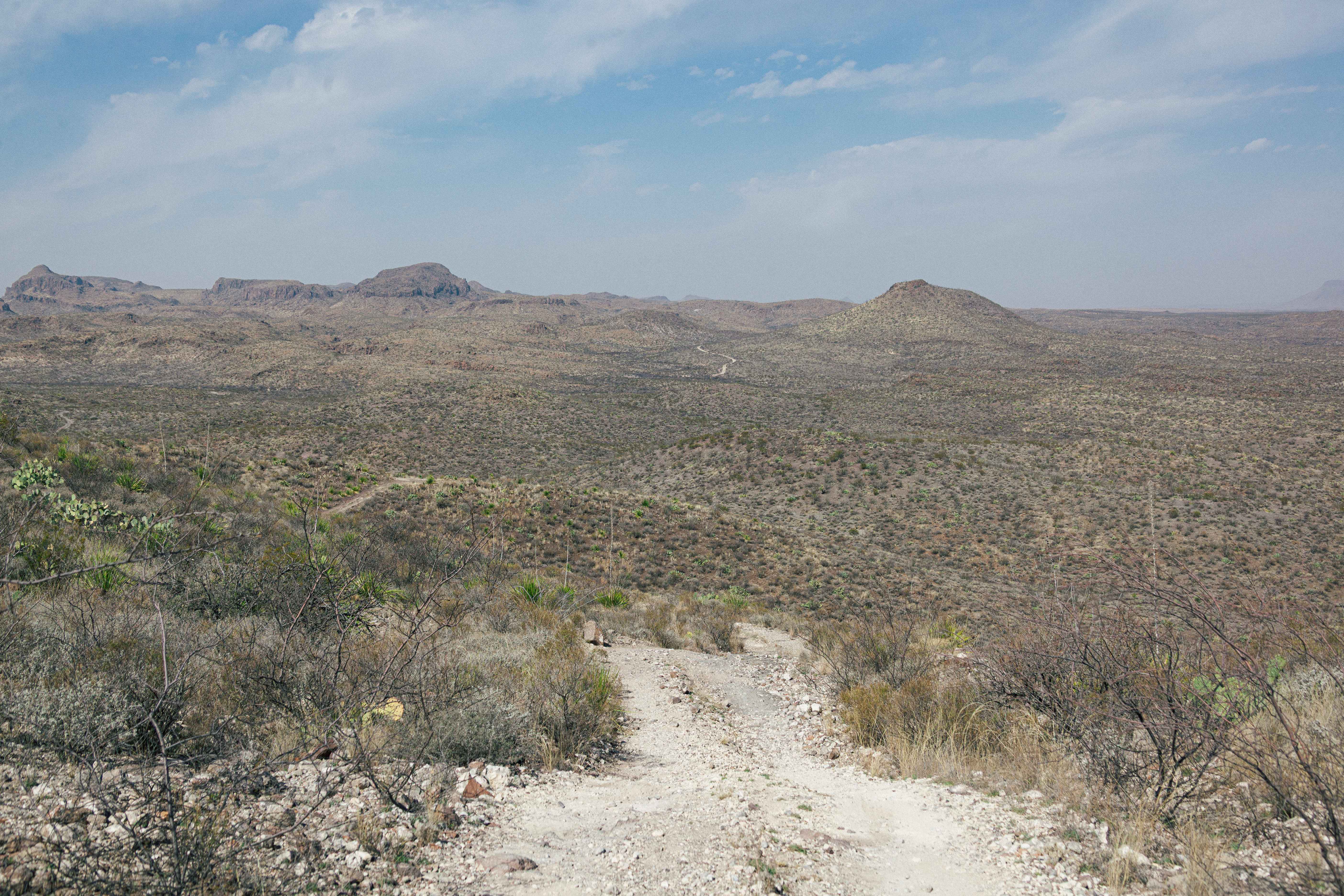
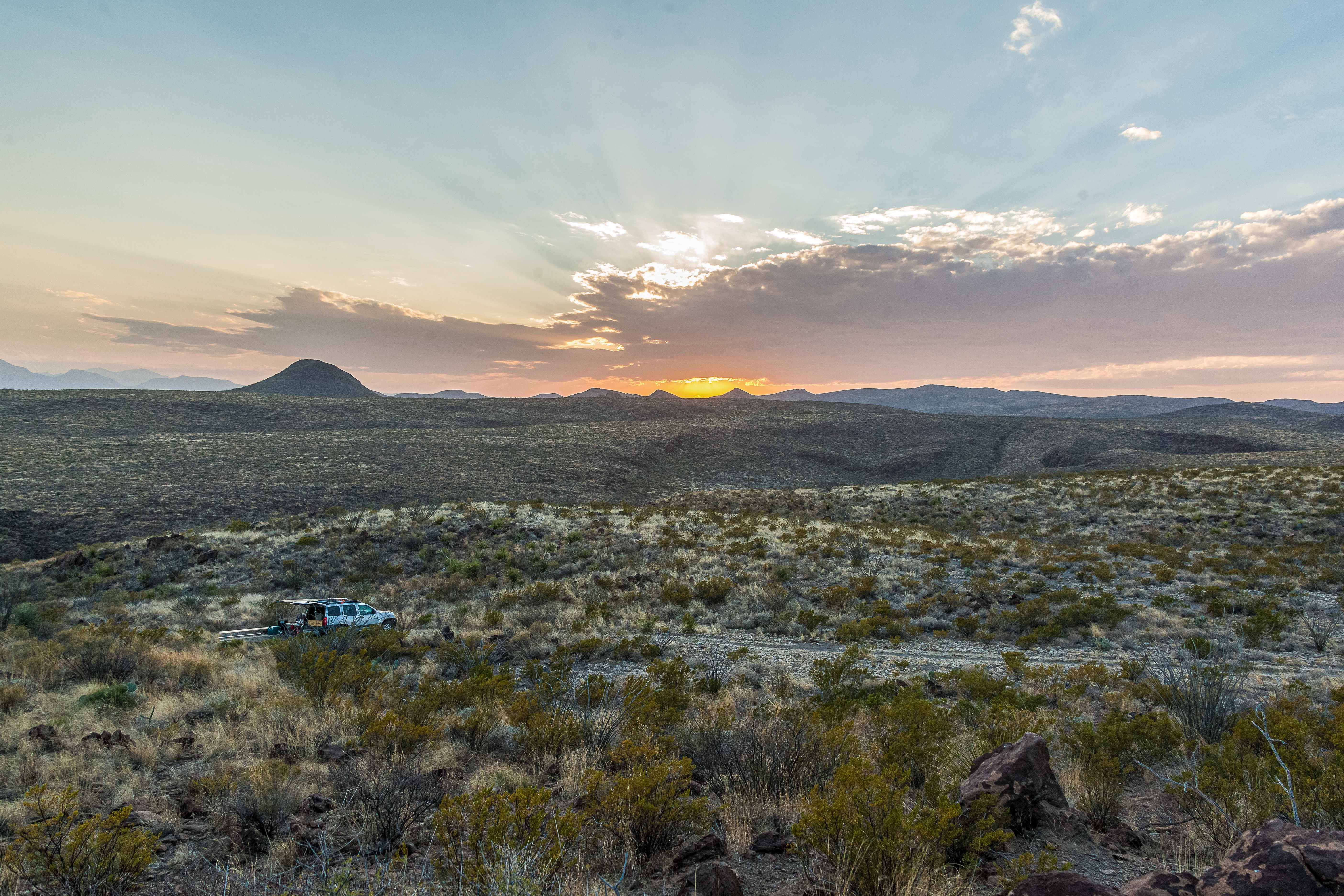
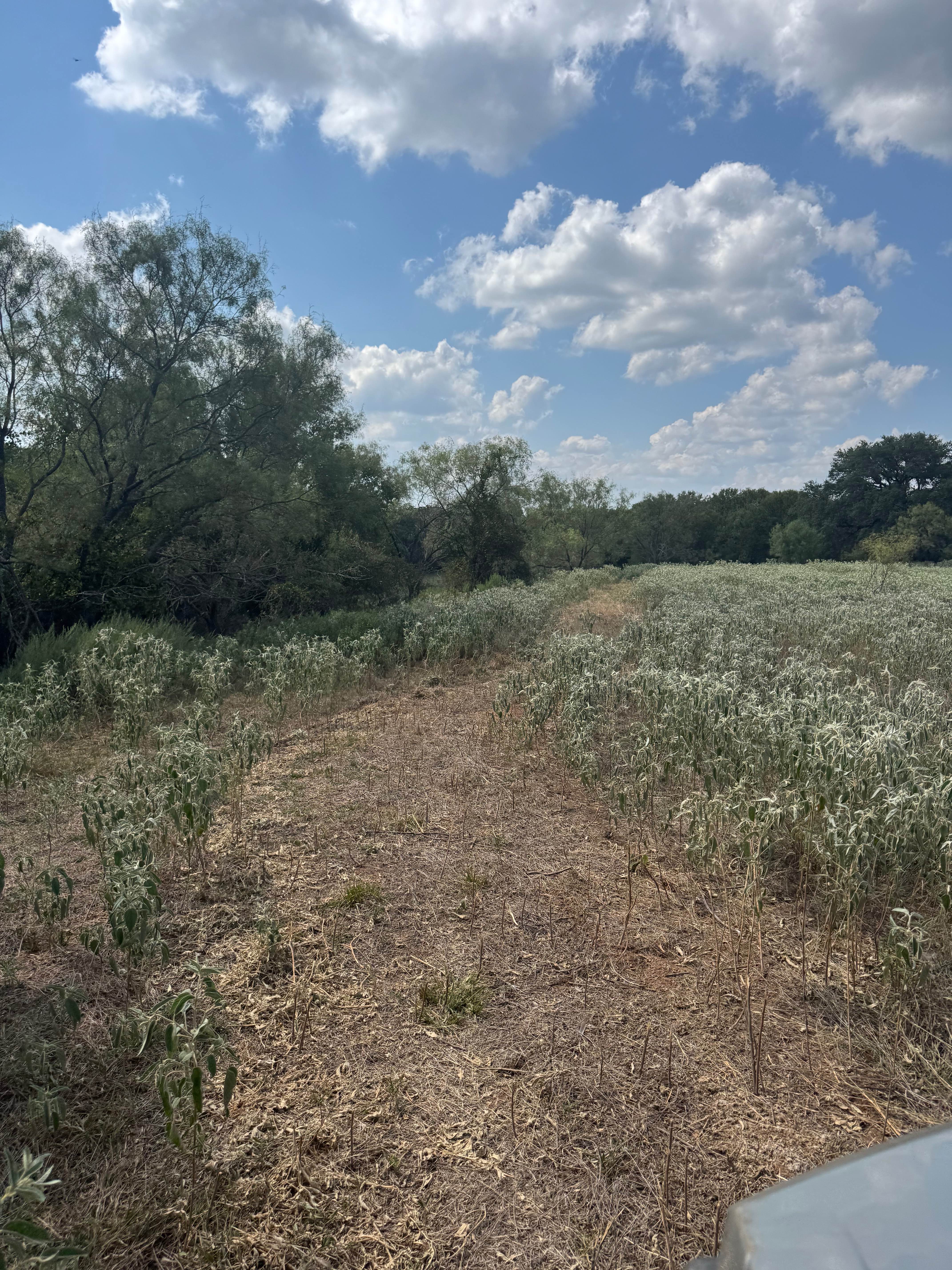
Trail Overview
Street Legal vehicles only. This 5 mile stretch is an out and back 4WD High Clearance two track, that ends at the Madrid Falls Hiking Trailhead and the Chorro Vista camp site. Along this road are 5 other spurs that all end at designated camp sites. The first mile is the steepest incline of the whole road. Expect a little loose rock but nothing challenging. During heavy rains, there are several washes that could contain flowing water. Let the water subside before attempting to cross, this road is a long way from any park official help. The road end offers a spectacular view of the Flat Irons of the Solitario, best viewed during sunset. From the Madrid Falls Hiking Trailhead, it is approx 20-30 minutes to reach the first view point of the falls proper.
Photos of BBRSP Madrid Falls Road
Difficulty
This is not a challenging road, however, it is a two track with very few places to let any other traffic pass. It is rare to encounter another vehicle along this road while traveling through the region. Expect light pinstriping from the brush that hugs the road. When a tire leaves the road, one must be prepared to receive a flat from the sharp rocks and vegetation along the way. Do not attempt to cross a wash if water is flowing and present.
Status Reports
BBRSP Madrid Falls Road can be accessed by the following ride types:
- High-Clearance 4x4
- SUV
BBRSP Madrid Falls Road Map
Popular Trails
Shake Rattle & Roll
Damn Crossing
Sandy Point Road
The onX Offroad Difference
onX Offroad combines trail photos, descriptions, difficulty ratings, width restrictions, seasonality, and more in a user-friendly interface. Available on all devices, with offline access and full compatibility with CarPlay and Android Auto. Discover what you’re missing today!