Trout Run Road
Total Miles
7.6
Technical Rating
Best Time
Spring, Summer, Fall
Trail Type
Full-Width Road
Accessible By
Trail Overview
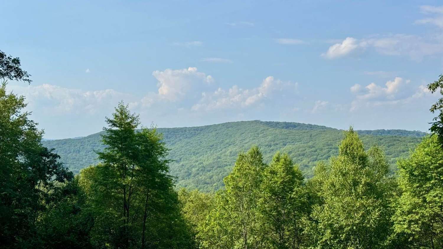
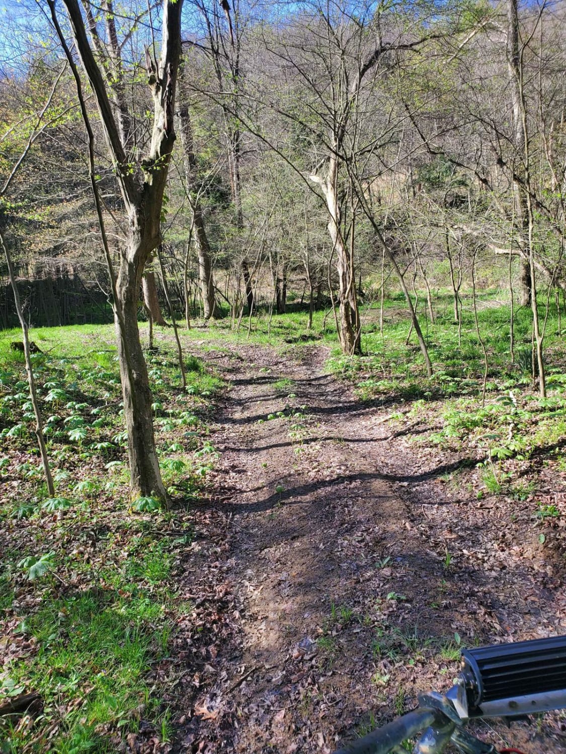
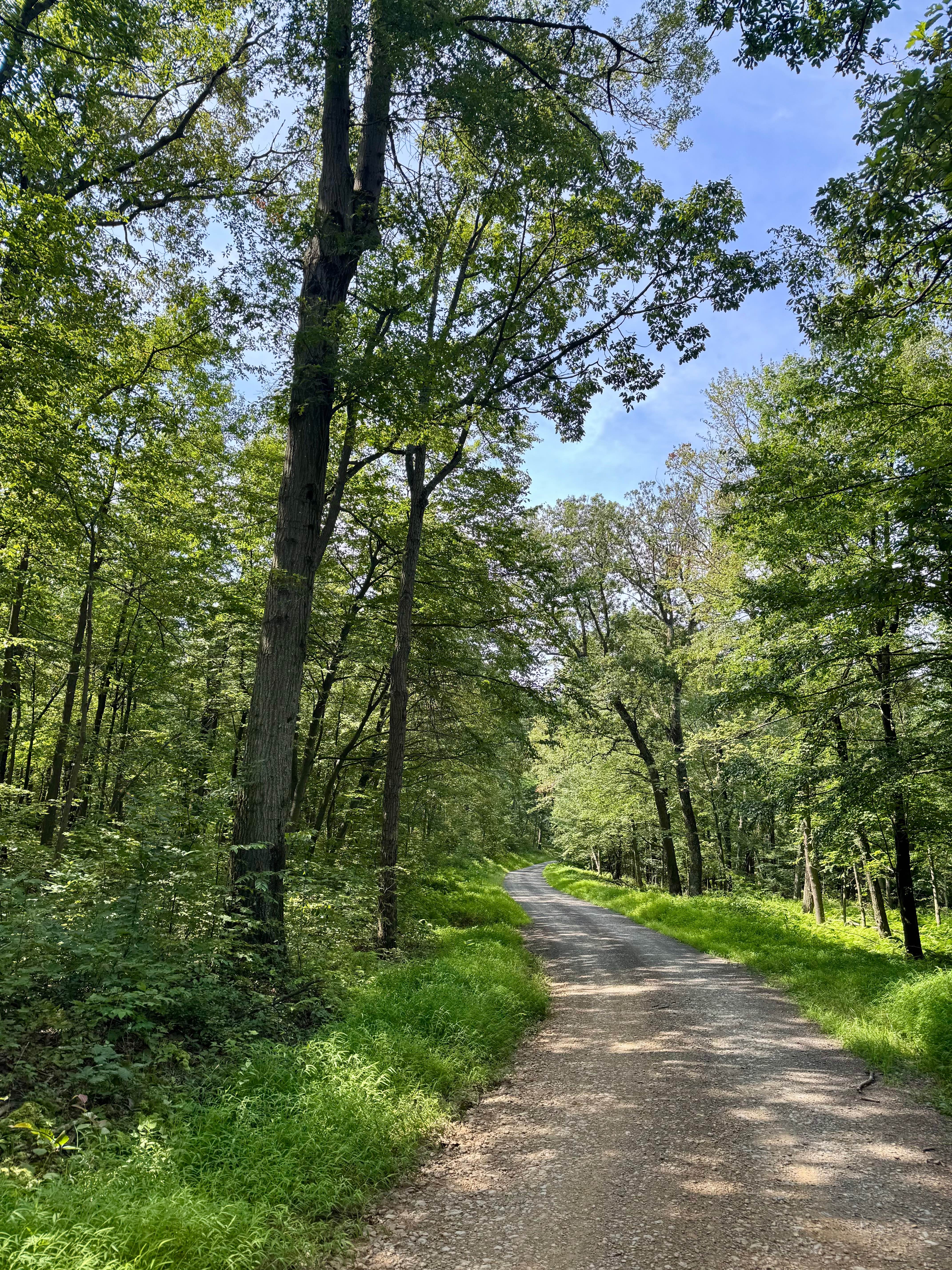
This is classified as an "improved dirt road" in Susquehannock State Forest, so expect primarily gravel and packed dirt that, in ideal conditions, will be passable by all vehicles. This trail runs north/south through the southwest corner of the main tract of the forest along the western edge of the Hammersley Wild Area. This trail is southwest of Cherry Springs State Park and on the southern portion runs along the edge of Sproul State Forest. This particular trail is not legal for SxS, ATV, etc, though the forest does have other shared and dedicated trails for those vehicles. The north part of the trail has two vistas. The southernmost of the two is nicer and has a picnic bench perfect for lunch, a snack, or just sitting to consider the view into the Hammersley Wild Area. There are trailheads for several hiking trails into the Hammersley Wild Area, which prohibits motorized use. The other feature of this trail is 2 "dispersed motorized campsites." These require reservations on Reserve America. Bell Branch is reserved as part of Susquehannock State Forest, and Cooks Run is reserved as part of Sproul State Forest. Cook's run is less desirable as it's at the intersection with Wickoff Road, with nothing separating it from the 2 trails. If nobody is camping there, it is a good picnic option. Other than pothole-type disruptions to the pretty well-graded surface, there are no obstacles to be considered. There is evidence of the gas pipeline at the northern part of the trail, and the pipeline crossing makes a "vista" of sorts as well.
Photos of Trout Run Road

Difficulty
Other than a temporary obstacle from weather, this trail should not even require high clearance. During the winter, any state forest road can become dangerous if there is snow and ice on the ground; otherwise, this is an easy cruise through the forest.
History
The trail and those connected to it likely follow old logging railroad grades that were built by the Goodyear Brothers. In the 1890s, Frank and Charles Goodyear purchased most of the land that drained into the West Branch of the Pine Creek. Frank built the Sinnemahoning Valley Railroad in 1885 to access the forest in this region. At that time, they built a large camp and engine terminal with steam locomotives pulling log trains on 10 miles of main line and 30 miles of spurs. Each day, up to 100 train cars of logs were hauled from Lymans Run and other areas to the sawmill in Galeton.
Status Reports
Trout Run Road can be accessed by the following ride types:
- High-Clearance 4x4
- SUV
Trout Run Road Map
Popular Trails
Mud and Off-Camber - BFR - Black - Difficult
High Rock Road

56 - BFR - Black - Difficult

City View Blue
The onX Offroad Difference
onX Offroad combines trail photos, descriptions, difficulty ratings, width restrictions, seasonality, and more in a user-friendly interface. Available on all devices, with offline access and full compatibility with CarPlay and Android Auto. Discover what you’re missing today!