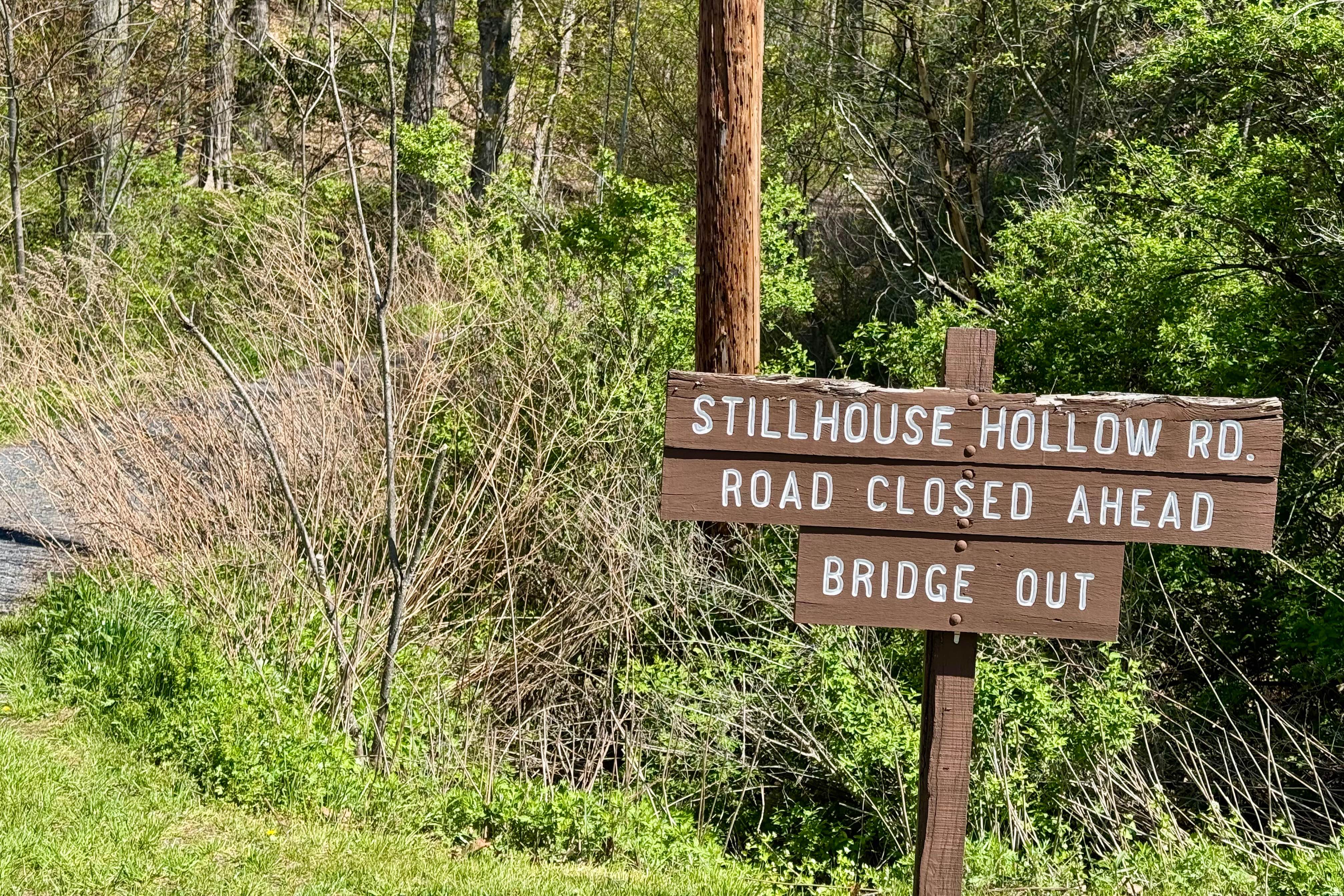
Stillhouse Hollow Rd
Total Miles
2.8
Technical Rating
Best Time
Spring, Fall
Trail Type
Full-Width Road
Accessible By
Trail Overview
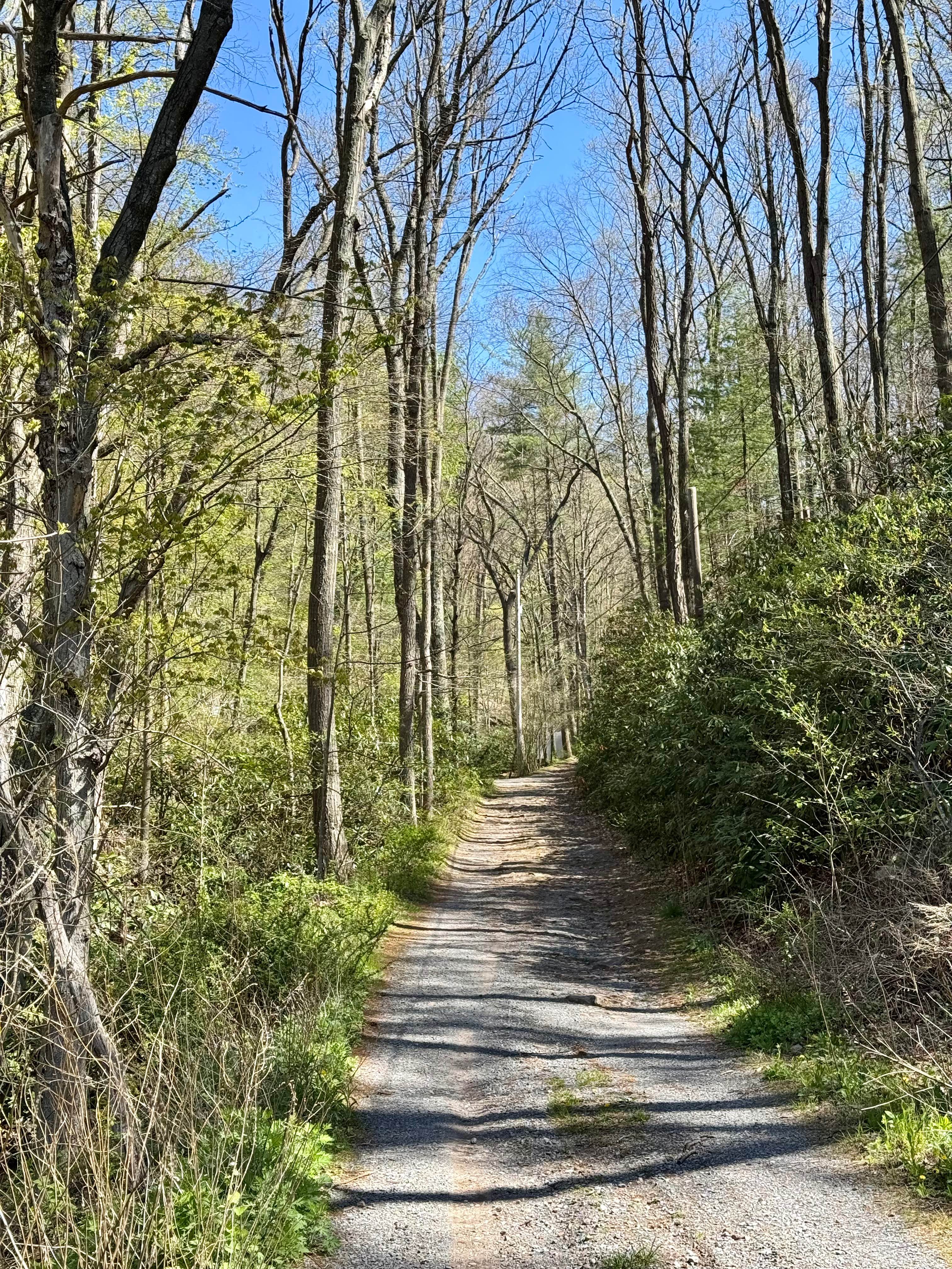
The PA DCNR map shows this as a drivable trail and advises the use of a high-clearance 4x4 vehicle. That's good advice. Bald Eagle State Forest is notable for having a number of more challenging drivable trails, and this forest road falls into that category. This is an out-and-back track that may not be well-suited for full-size trucks and SUVs, as there is not much room to turn around at the end. Pinstripes are pretty much a given at the beginning and end of the trail as well. This road gets little traffic as it used to be gated, and the paved road you access it from is marked as only being open to local traffic. Once you locate the trailhead, which does have a small forest road sign, you begin your ascent towards an older camp building and two spring houses just beyond that. The road is muddy, rutted, and washed out in places on this portion, and the vegetation growing in from the right side narrows the way. Past this, it opens up to a bit more typical gravel road, but strewn with larger rocks embedded in the earth. It stays this way until the trail reaches its highest point, and then as it descends, it again tightens with vegetation on the right and a drop off on the left before it reaches the end at a muddy turnaround by the failed bridge that marks the end of the road. The bridge can still carry foot traffic, and if your vehicle became stuck or disabled on this half of the trail, you could still follow the path across the bridge and reach the scout camp on Sand Mountain Road with less than a mile's hike. Be prepared for downed tree limbs and a bumpy ride. After rain or snow/ice, this road is probably best avoided. A stock 4x4 with good tires should be fine, but come prepared with recovery gear and be unconcerned about pinstripes.
Photos of Stillhouse Hollow Rd
Difficulty
Any large rocks can be avoided. The trail is single vehicle wide at both ends. The turnaround at the bridge can be muddy. Ruts and wash can be 6 or more inches deep. The descent towards the bridge has a narrow shelf. Meeting another vehicle at either end will require one vehicle to back up for a ways, especially on the end near the bridge.
History
Before the bridge was out, this road ran all the way to the scout camp on Sand Mountain Rd. It was gated before the second switchback until recently. The old gate still stands.
Status Reports
Stillhouse Hollow Rd can be accessed by the following ride types:
- High-Clearance 4x4
- SUV
Stillhouse Hollow Rd Map
Popular Trails

Old Union Road

Ashland Single Track 1
Left Straight Run Trail
The onX Offroad Difference
onX Offroad combines trail photos, descriptions, difficulty ratings, width restrictions, seasonality, and more in a user-friendly interface. Available on all devices, with offline access and full compatibility with CarPlay and Android Auto. Discover what you’re missing today!