Trail Overview
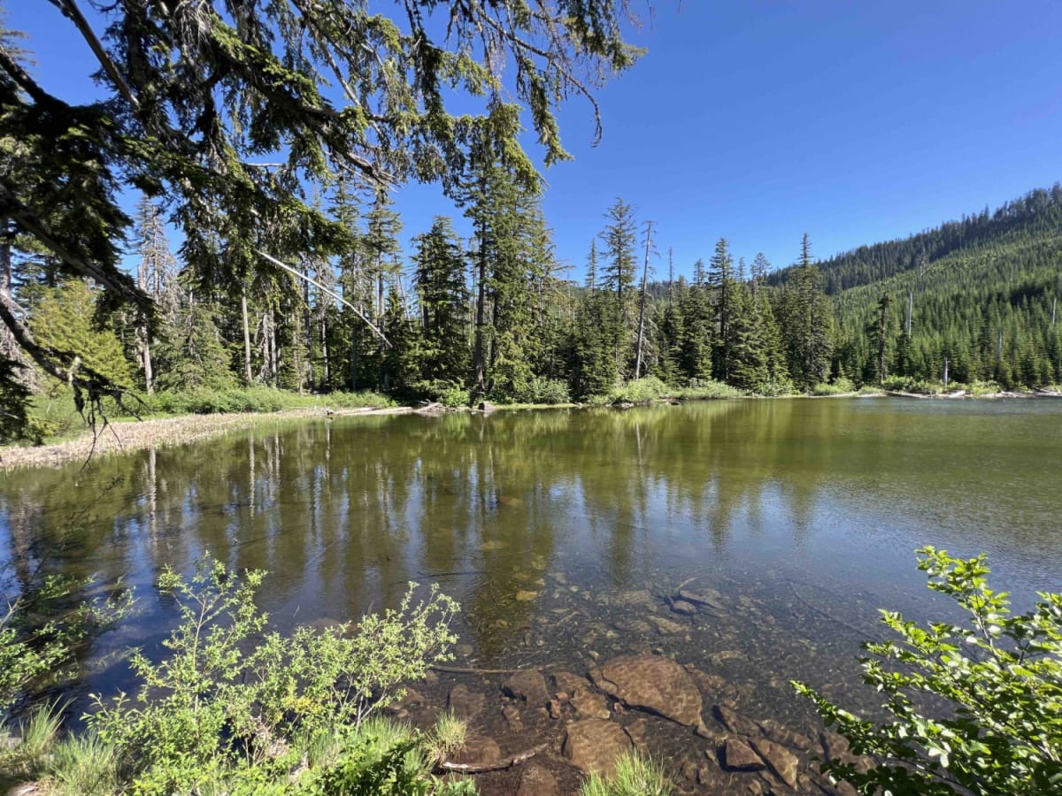
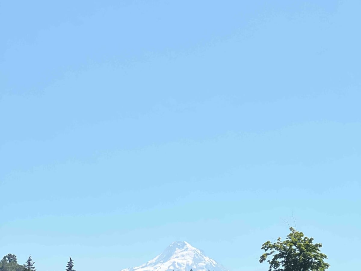
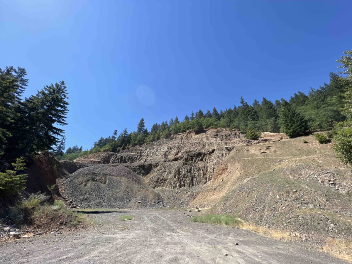
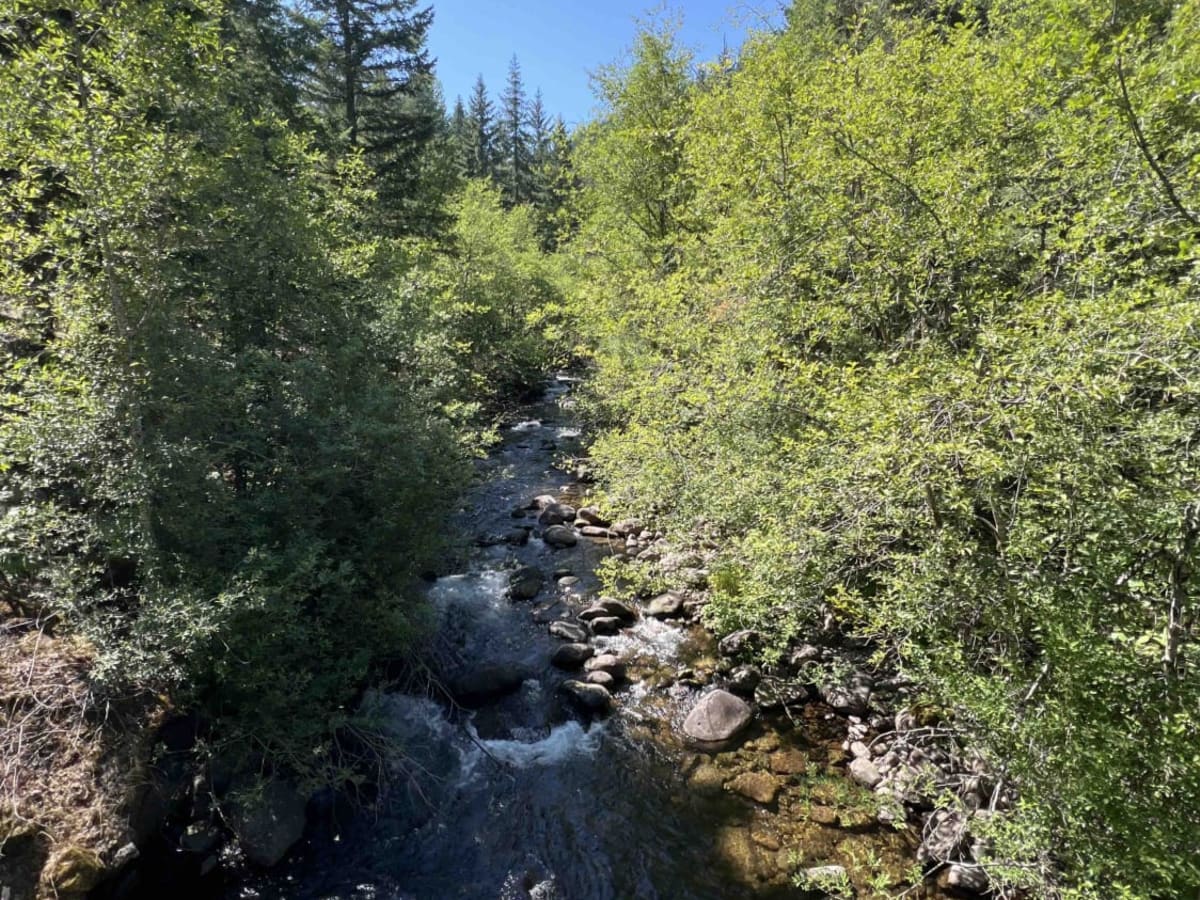
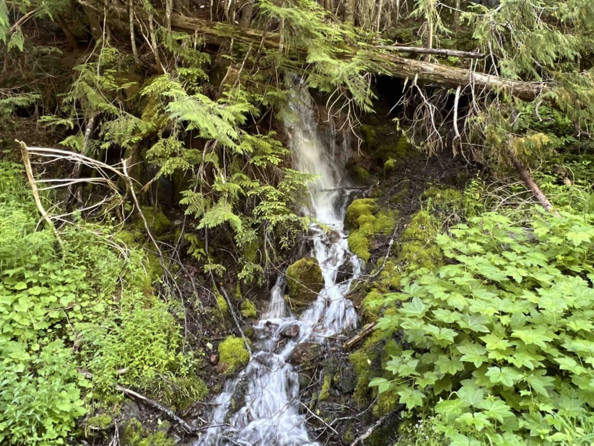
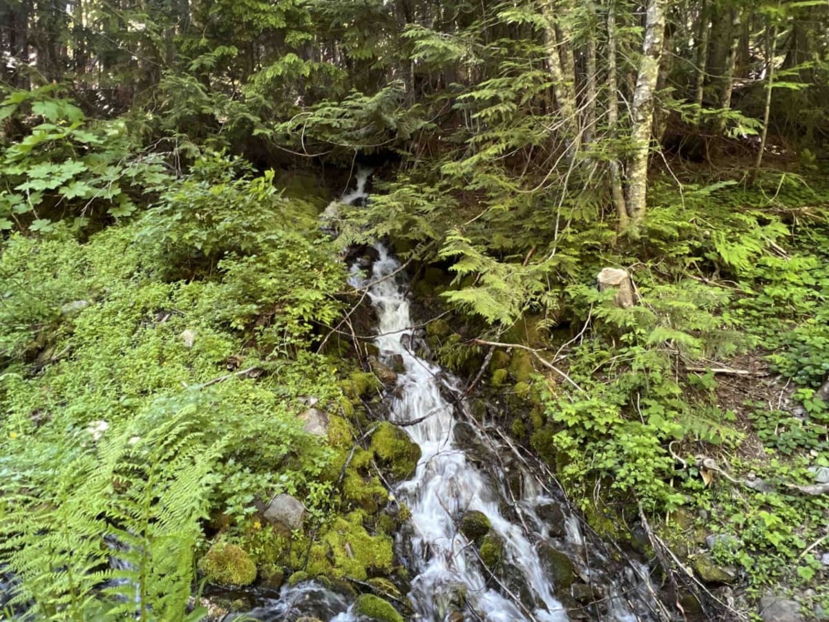
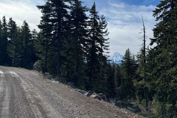
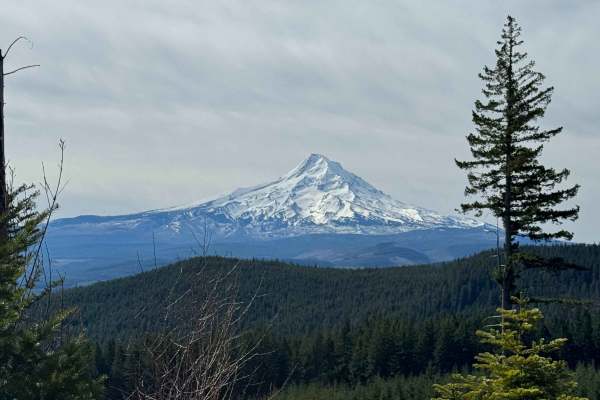
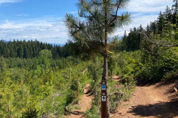
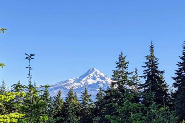
Green Point - 2810 is a beautiful scenic drive through the Mount Hood National Forest in Northwest Oregon. This road is mainly gravel however there are areas where large boulders and rocks have come on the road and you have to swerve to avoid them as well as large trees lying over the road. Going up the hill you will see beautiful views of Mount Hood and the Cascades. About a mile in there is a a rock quarry that is being used as a shooting range. Moving along you will come to a bridge where Green Point Creek runs under it. There is a little trail to the creek across the bridge so you can stop to enjoy the cool glacier water. This route has very steep ledges major cliffs, and drop-offs, and is narrow with only room for one vehicle at a time. There are several waterfalls that come right down along the road which makes it great for some photography opportunities. Once an old logging road, Green Point leads to a beautiful crystal clear glacier-fed lake called Ottertail Lake where you see high peaks, trees, little glaciers remanence of the snow season, fish in the lake, woodpeckers and hear the sound of the breeze going through the trees. Here you can set up camp, and enjoy the wilderness kayak, mountain bike, hike, and fish. Due to its location, this area is not heavily trafficked however campsites are first come first serve and are primitive with no running water. The MHNF is lined with many different species of trees including Douglas-Fir, Western Red Cedar, Black Cotton Wood Big Leaf Maple, and much more. The wildlife will consist of elk, deer, bobcats, cougars, and spotted owls. Due to the elevation of this location and the surrounding areas access to this location can only be attained in late spring through the early fall. The MHNF receives around 300+ inches of snow every year. Mount Hood Recreation Passes are available at ranger stations and are required on most trailheads.
Difficulty
There are really big boulders in the middle of the road between miles 3 and 4.5 along with other smaller rocks. Trees are over the road in some areas, causing low clearance. This road goes from an elevation of 887 feet to an elevation of 3,836 feet, so there is quite the climb to get to this lake.