Calamut Way
Total Miles
1.6
Technical Rating
Best Time
Summer, Spring, Fall
Trail Type
50" Trail
Accessible By
Trail Overview
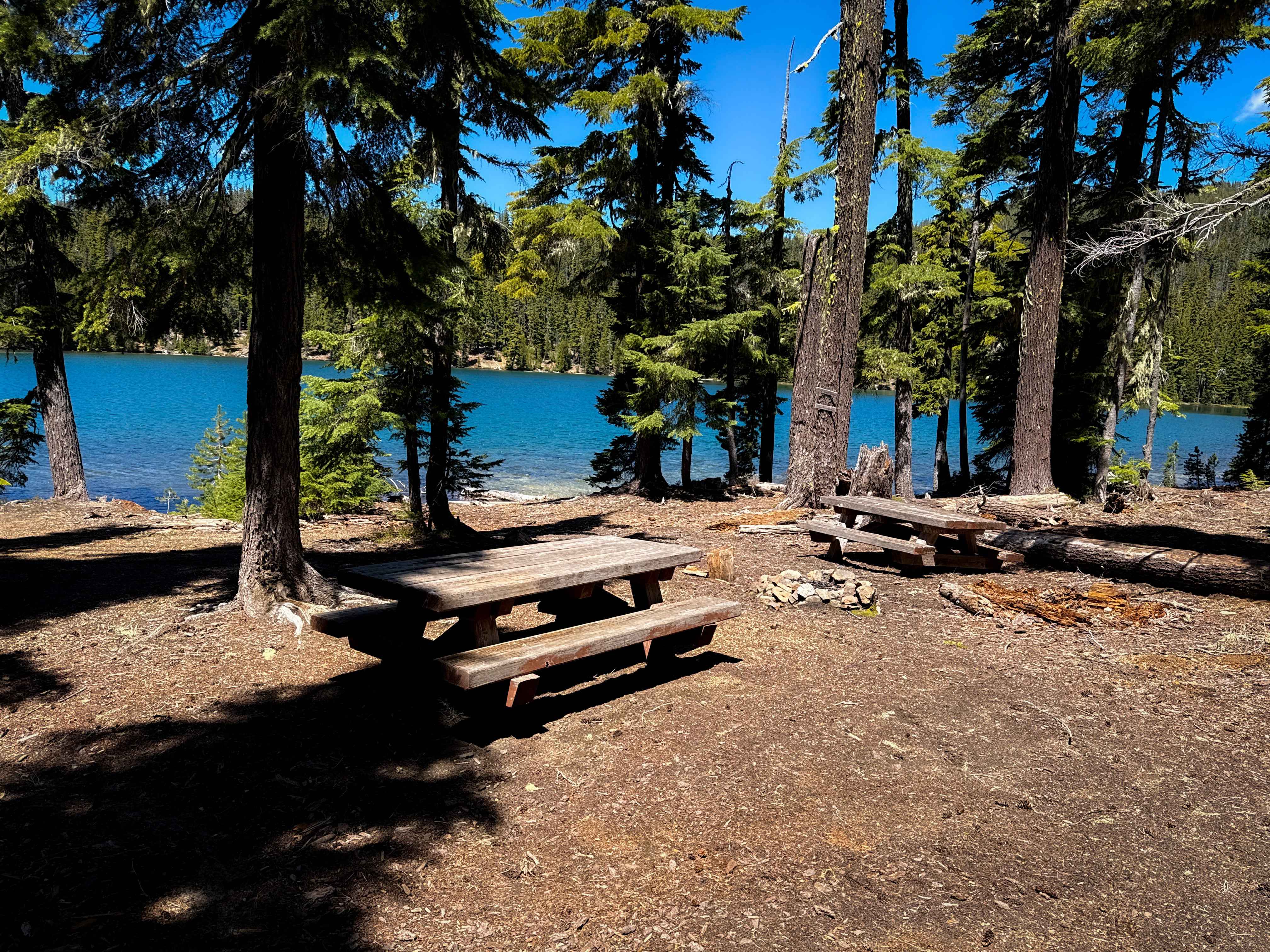
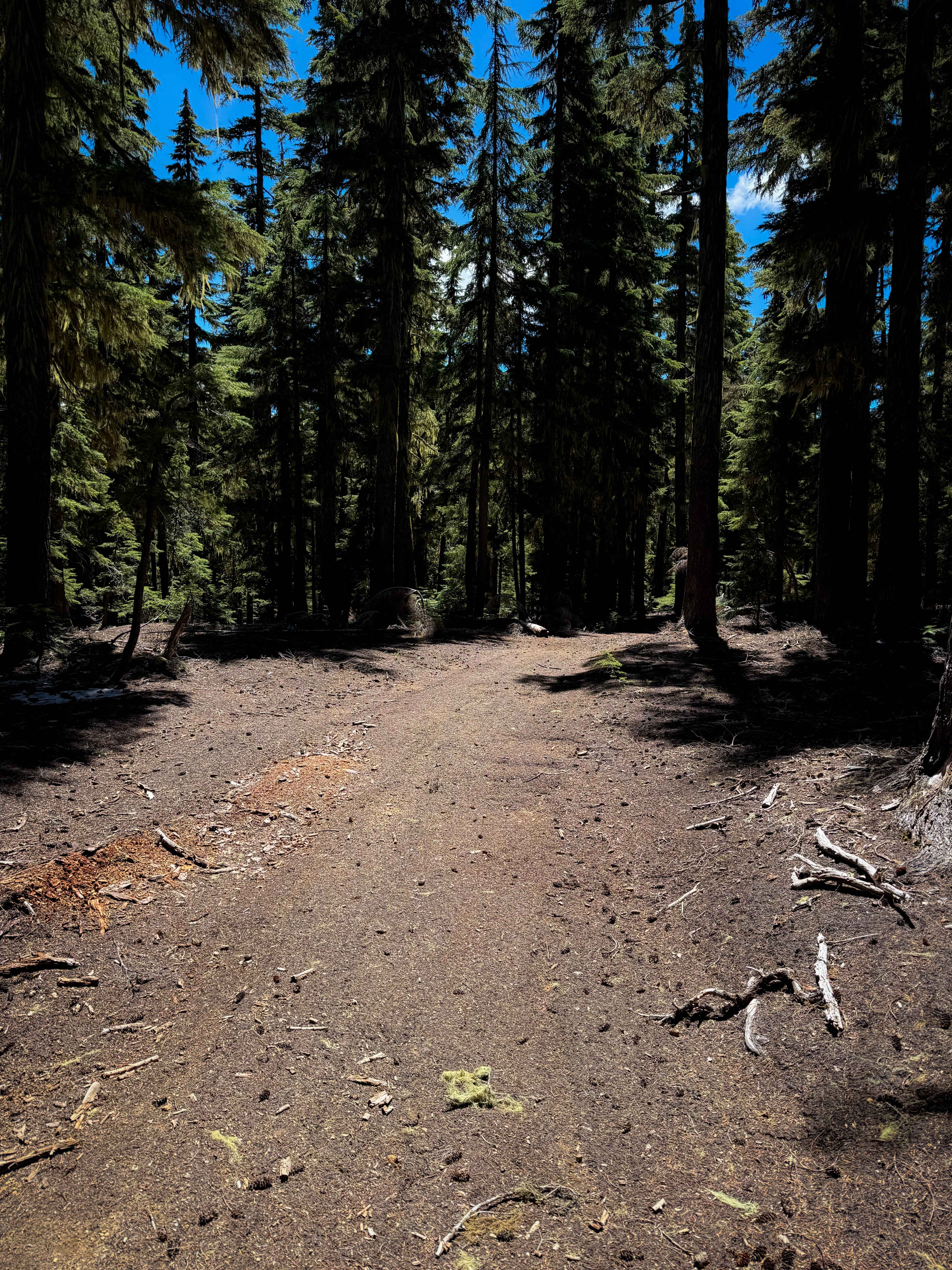
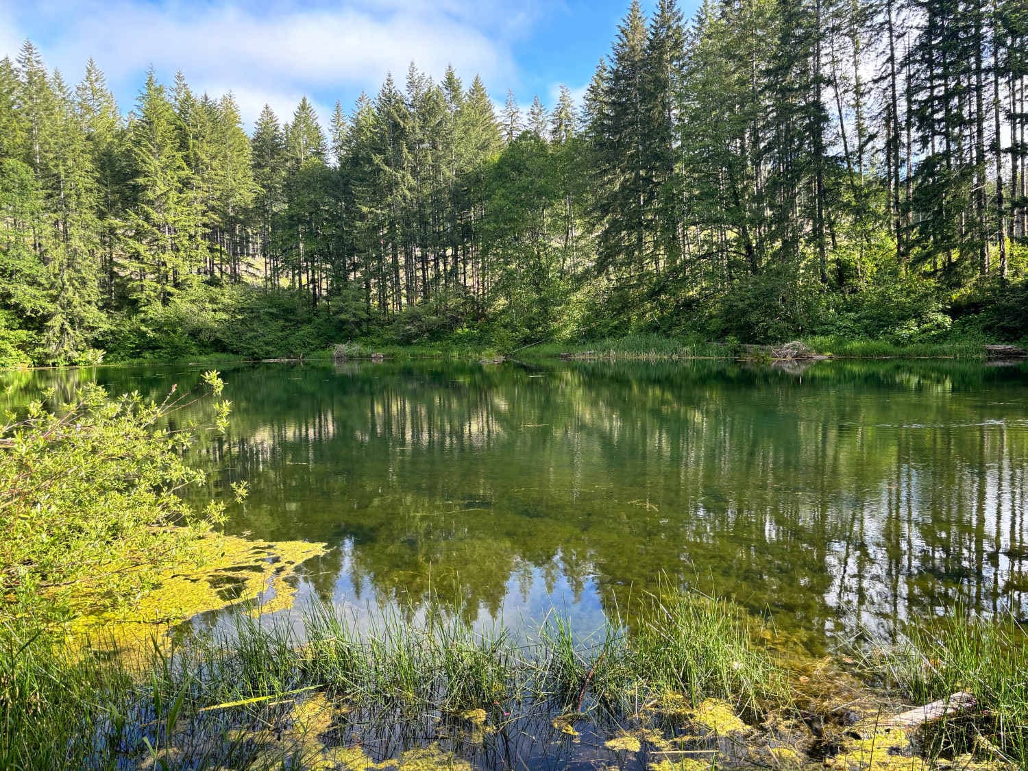
Calamut Way is a 1.6-mile-long ATV trail through the Umpqua National Forest that ends at a spectacular view of Calamut Lake. There are picnic tables at the north end by the lake for a scenic rest stop or lunch break. The trail is a gradual ascent from south to north, on a wide and easy two-track trail through a pine forest. The trail was cleared of any major logs and was rideable by late May or early June. Watch out for new log hazards or small branches sticking out over the trail. The track was rutted in several spots, with shallow rain ruts running down the middle or sides of the trail, but it was not off-camber or steep, making the ruts easy to navigate. The trail was mostly smooth dirt, with only a couple of rocky spots that added minor difficulty, but there weren't any big rock obstacles or ledges. The trail was unmarked at the southern entrance from the road. ATVs will have to ride this as an out-and-back, but dirt bikers can connect to the single track at the lake.
Photos of Calamut Way
Difficulty
This is an easy ATV trail as it remains gradual and obstacle-free for the entire route. It has shallow ruts and the potential for new log hazards, but is otherwise ideal for riders with less experience.
Status Reports
Calamut Way can be accessed by the following ride types:
- ATV (50")
- Dirt Bike
Calamut Way Map
Popular Trails
McPhillips Beach Trail
Dovre Peak to Tahoe Lake

The onX Offroad Difference
onX Offroad combines trail photos, descriptions, difficulty ratings, width restrictions, seasonality, and more in a user-friendly interface. Available on all devices, with offline access and full compatibility with CarPlay and Android Auto. Discover what you’re missing today!