Wild Horse
Total Miles
3.8
Technical Rating
Best Time
Spring, Summer, Fall, Winter
Trail Type
Full-Width Road
Accessible By
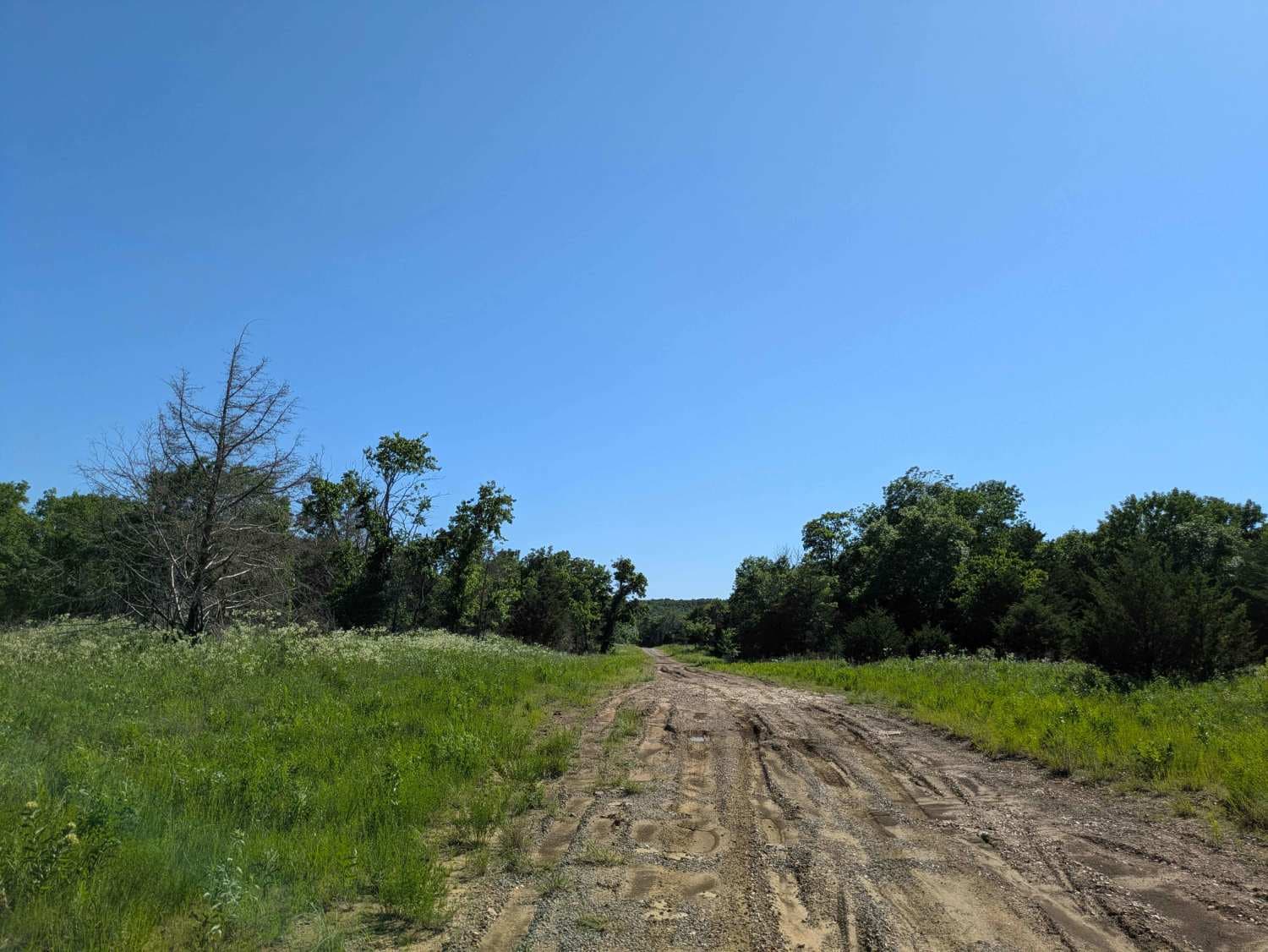
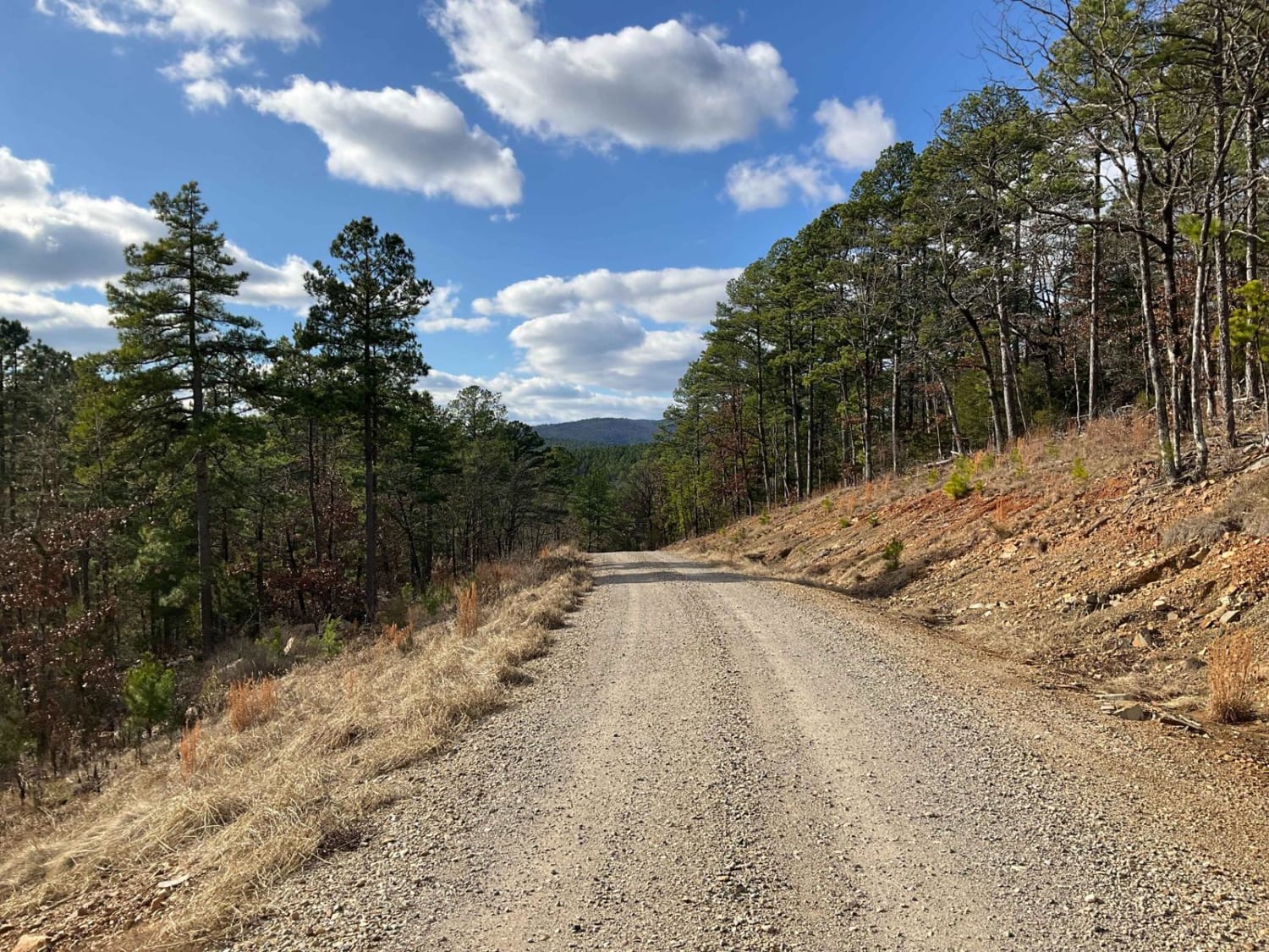
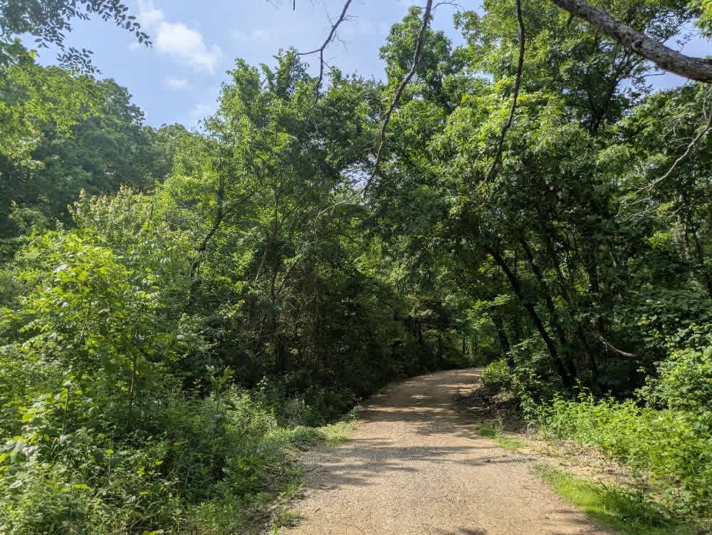
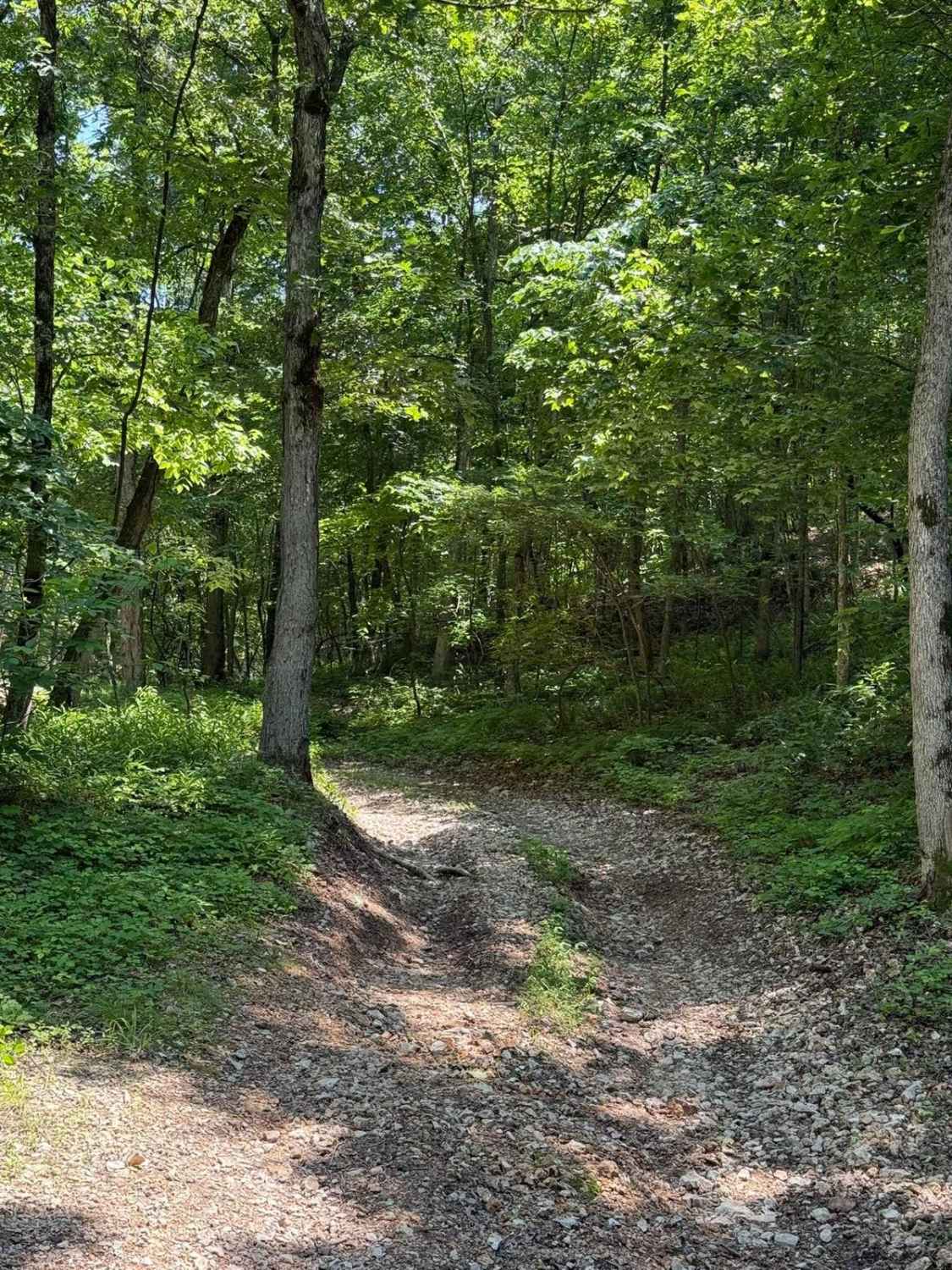
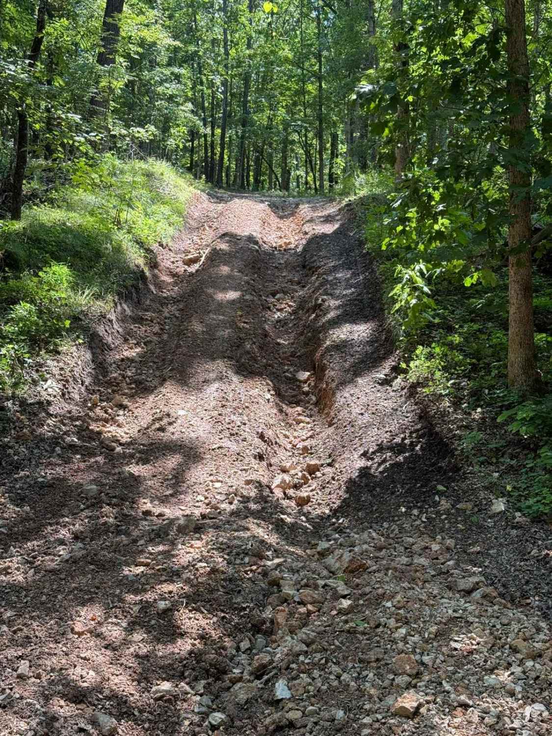
Trail Overview
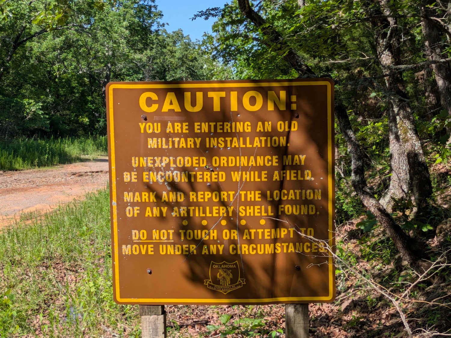
This trail begins with a smooth and easy drive, but conditions change quickly. As you continue, the route becomes more challenging with frequent climbs and descents, deep mud, and large puddles scattered throughout. Progress slows the farther you go due to rough, rocky sections and increasingly uneven terrain. The trail eventually ends at a closed gate next to a warning sign about unexploded ordnance and artillery shells from the nearby military base, so it's definitely a spot to turn around. There are no formal or dispersed campsites along this trail, and no access to water or trash facilities. Cell coverage is limited, so check the OnX app before heading out.
Photos of Wild Horse
Difficulty
This trail is maintained and easy in the beginning, but becomes more rutted with deep mud.
History
Cherokee Wildlife Management Area occupies more than 31,000 acres of rolling oak-hickory hills, meadows, and pond-dotted creek bottoms in southwestern Cherokee County. The property is split almost evenly between a 16,000-acre Public Hunting Area that stays open for statewide seasons and a 15,360-acre Game Management Area reserved mainly for controlled hunts, allowing wildlife managers to balance public access with habitat protection.
Status Reports
Wild Horse can be accessed by the following ride types:
- High-Clearance 4x4
- SUV
Wild Horse Map
Popular Trails
West Kelly (A45)
Gunnar's Trail
Emma's Trail
The onX Offroad Difference
onX Offroad combines trail photos, descriptions, difficulty ratings, width restrictions, seasonality, and more in a user-friendly interface. Available on all devices, with offline access and full compatibility with CarPlay and Android Auto. Discover what you’re missing today!