Rye Patch Desert Road
Total Miles
9.0
Technical Rating
Best Time
Spring, Summer, Fall
Trail Type
Full-Width Road
Accessible By
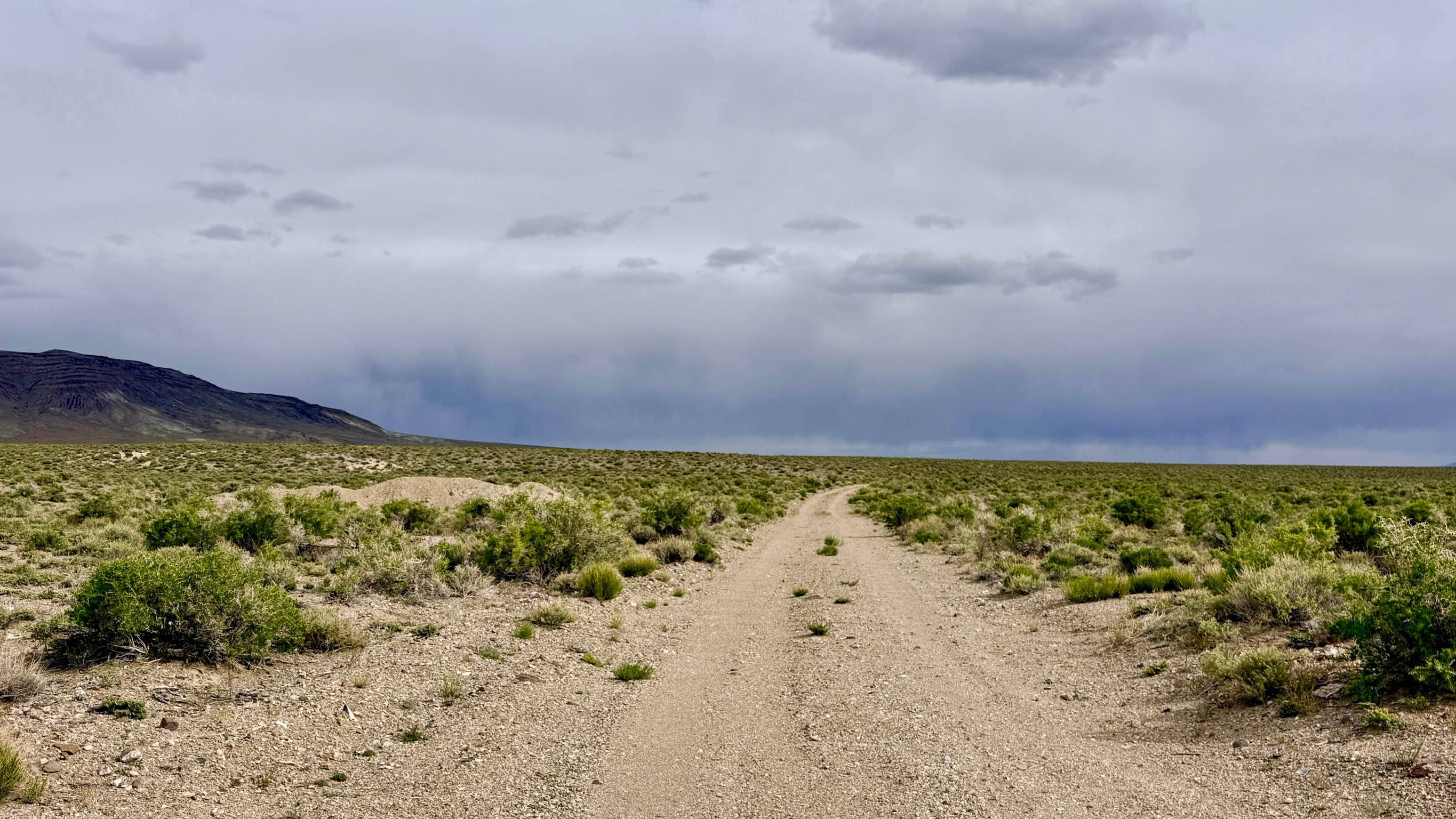
Trail Overview
This route offers a spirited and scenic alternative to the paved highway, allowing explorers to "rip" across the vast Great Basin floor on a classic desert two-track. This trail provides a true sense of scale, with the jagged silhouette of Thunder Mountain dominating the eastern horizon. The drive is generally flat and fast, but it is far from monotonous. As you traverse the sagebrush plains, you will cross several legendary historical corridors, including the Thunder Mountain Road and the Hannapah Stage Route. While the surface is mostly smooth, the trail is punctuated by numerous small wash crossings. Drivers should exercise caution as these washes are just deep enough to act as "reverse speed bumps" if approached at high speeds; they can cause a sudden, jarring impact. Aside from these "sneaky" transitions, the route is a straightforward and enjoyable way to connect the Air Force Range access road to the south and the Cedar Corral/Rye Patch North trail systems to the north. This is active cattle country. Livestock frequently wander across the track. You may find a couple of bars of LTE service in the open flats, but coverage can vanish instantly if you dip behind a low ridge. Download offline maps before leaving the Tonopah area.
Photos of Rye Patch Desert Road

Difficulty
Suitable for almost all high-clearance vehicles and SUVs. Under dry conditions, this route is accessible for most standard crossover vehicles. Rated a 2 for the multiple small wash crossings. They are often difficult to see until you are right on top of them.
History
Rye Patch Desert Road is a literal crossroads of Nevada history. By crossing the Hannapah Stage Route, you are intersecting the same corridor used by 20th-century teamsters who hauled silver ore and passengers between the Tonopah boomtown and the outlying Hannapah district. Before the era of modern highways, these "desert roads" were the high-speed arteries of the state, fueled by the sweat of mule teams and the grit of early stagecoach drivers.
Status Reports
Rye Patch Desert Road can be accessed by the following ride types:
- High-Clearance 4x4
- SUV
- SxS (60")
- ATV (50")
- Dirt Bike
Rye Patch Desert Road Map
Popular Trails
Fish Lake Springs Rd.

Airport Cove Loop
Babes Bluff Road
The onX Offroad Difference
onX Offroad combines trail photos, descriptions, difficulty ratings, width restrictions, seasonality, and more in a user-friendly interface. Available on all devices, with offline access and full compatibility with CarPlay and Android Auto. Discover what you’re missing today!