Boyd Cutover - 431A
Total Miles
1.5
Technical Rating
Best Time
Spring, Summer, Fall
Trail Type
Full-Width Road
Accessible By
Trail Overview
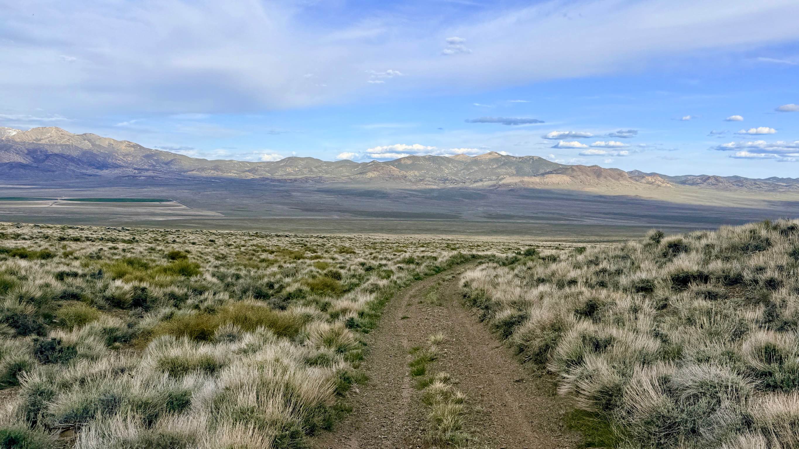
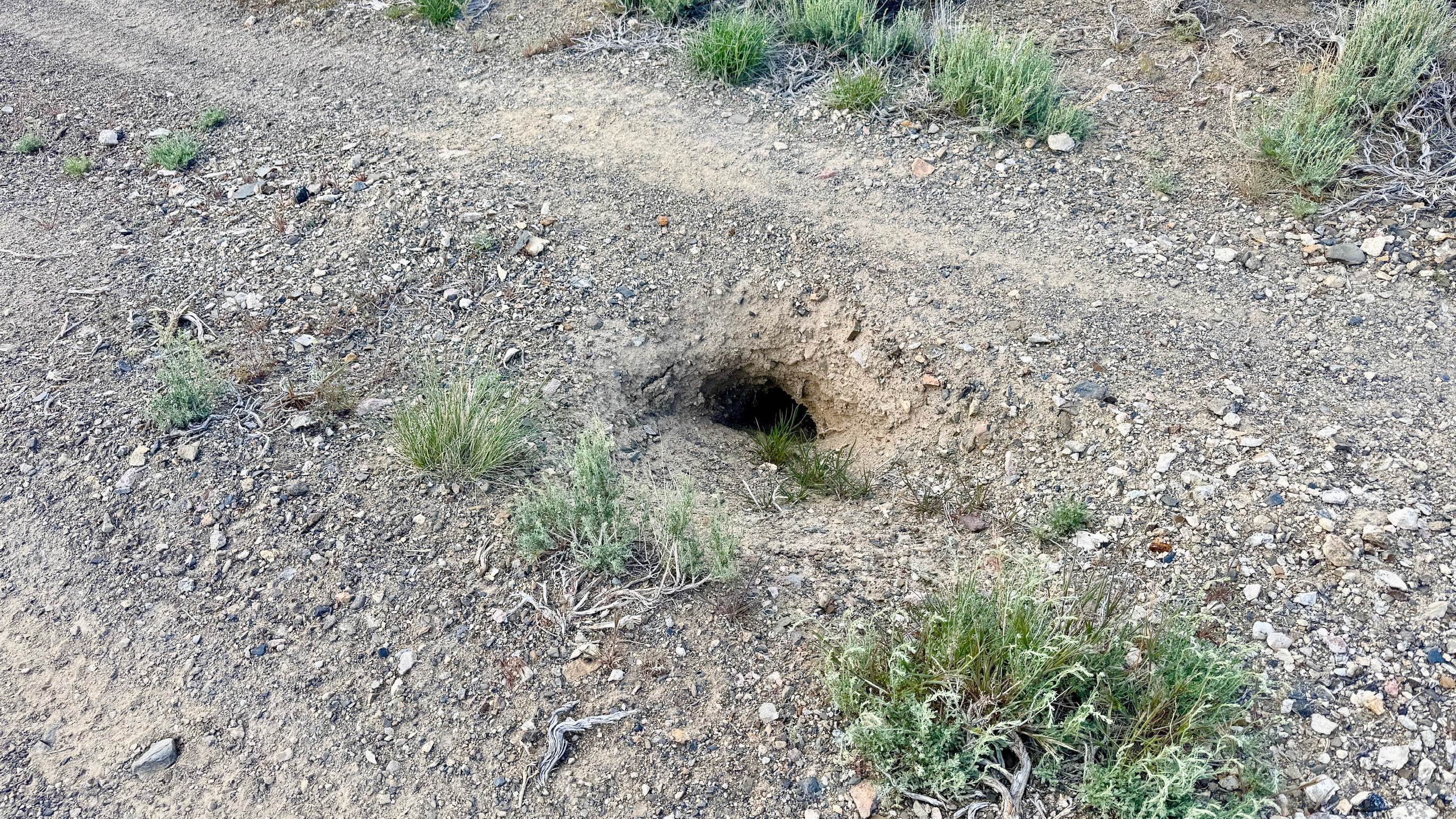
The Boyd Cutover is a highly convenient and engaging route that traverses the mid-elevation slopes of the Toiyabe Range, providing a vital link between Antelope Creek and the Boyd Canyon system. The trail zigzags across rugged terrain, offering a spirited driving experience as it follows the mountain's natural contours. From this elevated position, travelers are treated to spectacular wide-angle views of the Big Smoky Valley floor and the shimmering horizons to the east. While the driving is generally straightforward, this trail features a unique and hazardous obstacle that demands your full attention. The route is punctuated by several large badger holes situated directly in the middle of the track. These excavations are impressively large, exceeding the diameter of a 33-inch tire, and could easily cause significant suspension damage. Maintaining a moderate pace and keeping a sharp eye on the trail surface is essential. Aside from these "tire-swallowers," the route is a pleasant cruise through sagebrush, where you have an excellent chance of spotting Pronghorn Antelope or other local wildlife scurrying through the brush. Unusually for this region, this trail offers a couple of LTE bars. However, it can still be intermittent in the deeper draws. Download offline maps to ensure you navigate the junctions correctly.
Photos of Boyd Cutover - 431A
Difficulty
Rated a 2 for its easy grade, but be extremely wary of the large badger holes in the trail center. The track is narrow, and you will need to find wide spots or existing turnouts to allow oncoming traffic to pass.
History
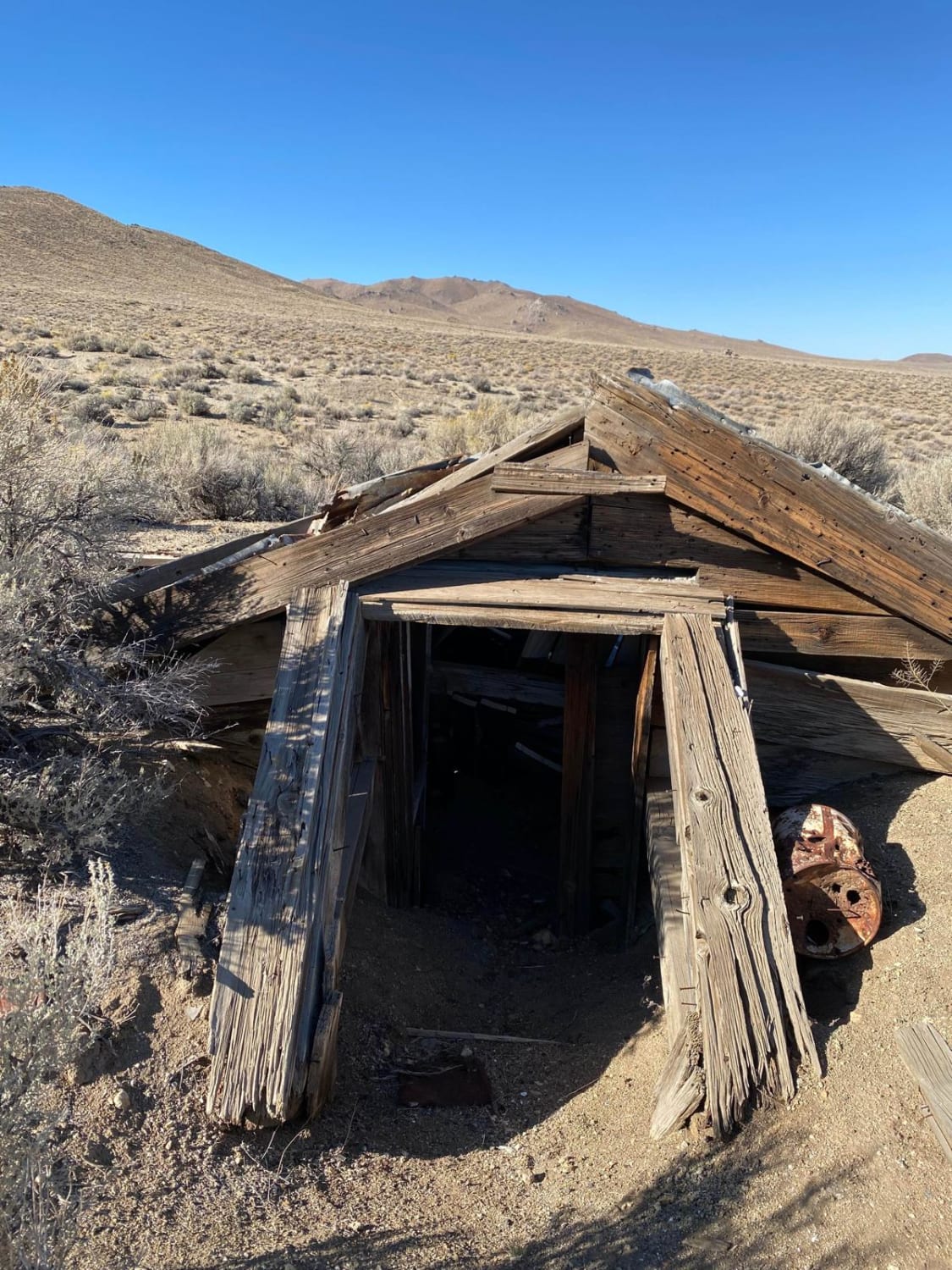
The Boyd Cutover represents the "connective tissue" of the Reese River Mining District. In the 1800s, these mid-mountain trails were the preferred routes for prospectors and buckaroos because they stayed above the treacherous "gumbo" mud of the valley floor during the spring thaw.
Status Reports
Boyd Cutover - 431A can be accessed by the following ride types:
- High-Clearance 4x4
- SUV
- SxS (60")
- ATV (50")
- Dirt Bike
Boyd Cutover - 431A Map
Popular Trails

Little High Rock to Steven's Camp Back Door
Nightingale Mine
North 5th Street

Stevens's Camp Back Door
The onX Offroad Difference
onX Offroad combines trail photos, descriptions, difficulty ratings, width restrictions, seasonality, and more in a user-friendly interface. Available on all devices, with offline access and full compatibility with CarPlay and Android Auto. Discover what you’re missing today!