Heather & Emerald Scramble
Total Miles
5.2
Technical Rating
Best Time
Fall, Summer
Trail Type
Single Track
Accessible By
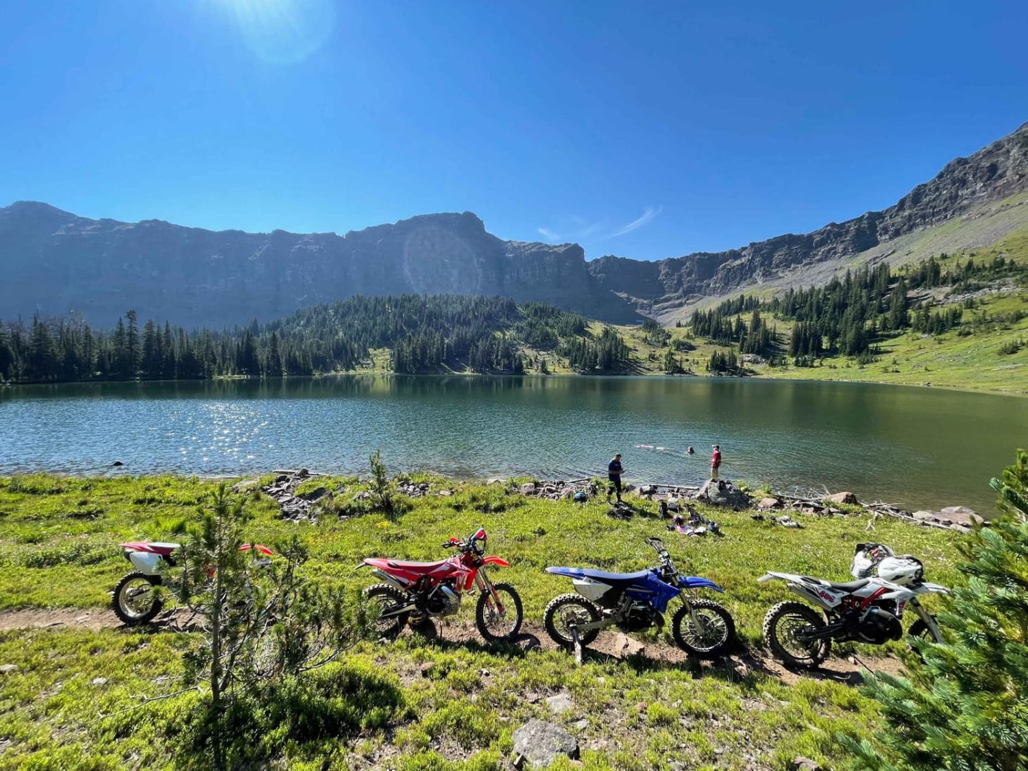
Trail Overview
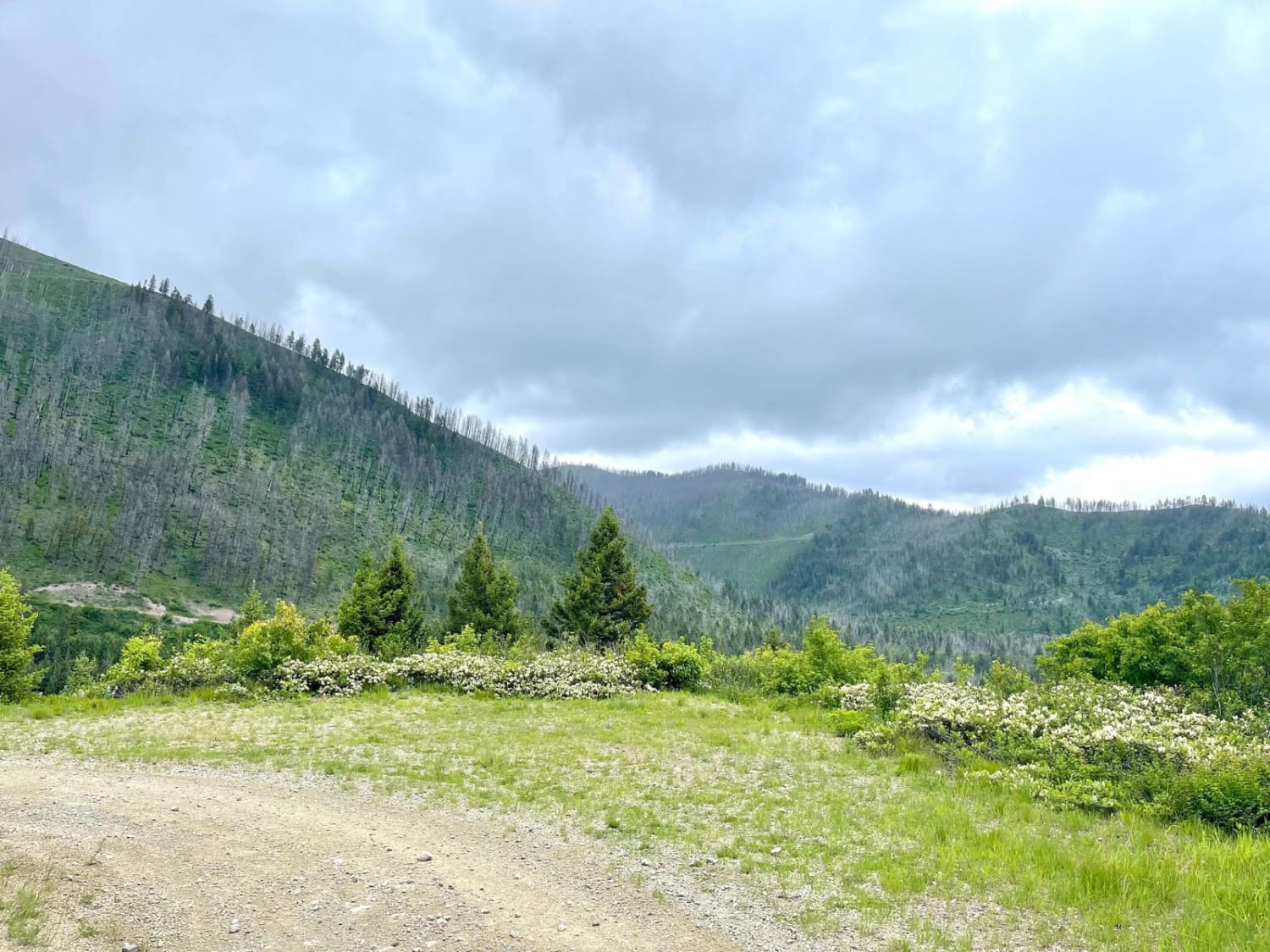
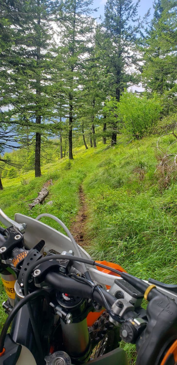
Starting from the East Fork Hyalite trailhead, you will be winding and zipping through the trees headed south until you reach Emerald lake, followed by Heather Lake. Emerald is about 5 miles, with Heather being about 1 more mile. This trail has some difficulty however followed by beautiful views of creeks, wildflowers, cliffs, open meadows, and of course the lakes. Trail has curves and nice straightaways with bumps and obstacles along the way. Difficulty increases towards the top. But don't shy away as I have seen little 50cc bikes navigate the trail. And if you like fishing bring a pole! Plenty of fish to catch. Experts may be able to complete the trail in less than 40 minute. And for beginner/intermediate riders may take over 1 hour. Remember this trail is shared by hikers and mountain bikers so be prepared and be respectful. This trail falls under a timeshare. What that means for dirt bike riders is it only accessible by motorcycle July 16- Sep 4. Wednesday- Saturday. Sunday-Tuesday it is closed to motorcycles. (As of 8/22/22) Always check the regulations as policies change regularly. Enjoy!
Photos of Heather & Emerald Scramble
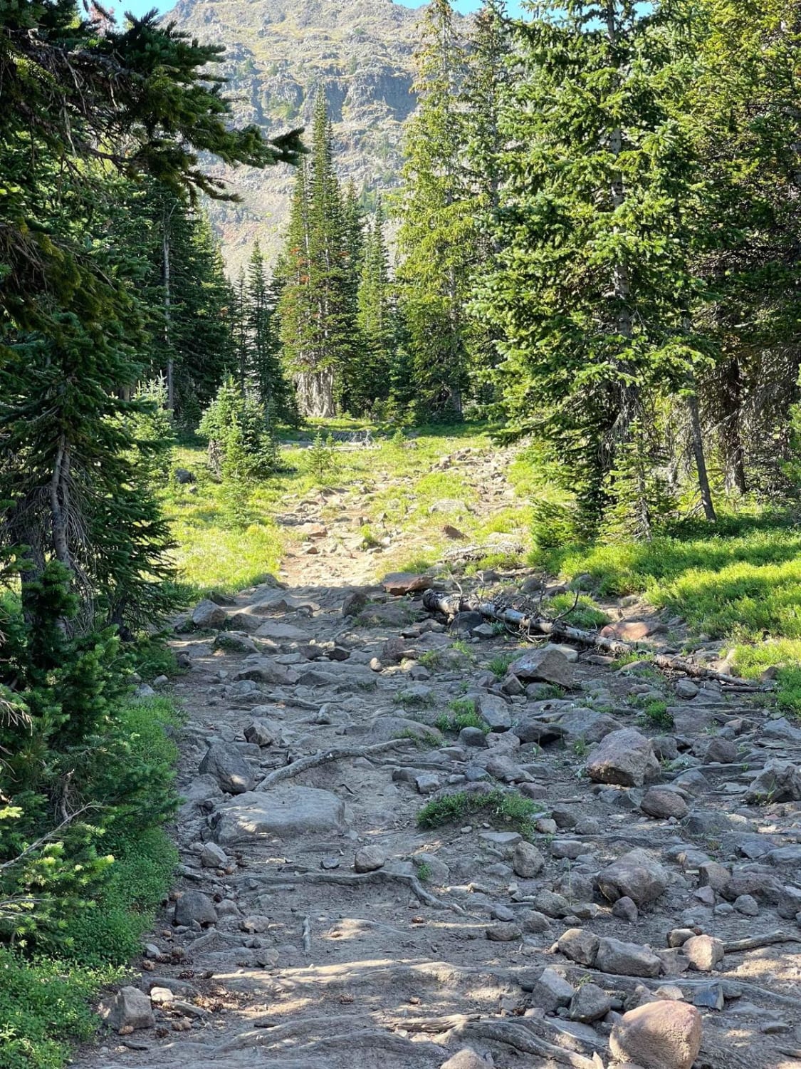
Difficulty
As for motorcycle travel we rate this trail a 7. You will encounter roots and boulders 2-7 inches tall. And occasionally obstacles as large as 18 inches or more. The trail has smooth sections and random boulder fields. There are switchbacks that get somewhat tight at the top. Occasionally you will be on exposed hill sides. The trail varies from 18"-36" wide. When the trail is wet difficulty rises due to mud ands slippery roots. Don't let the difficulty stop you as I have seen young kids and experts navigate this trail. Some obstacle are avoidable so go for it!
Status Reports
Heather & Emerald Scramble can be accessed by the following ride types:
- Dirt Bike
Heather & Emerald Scramble Map
Popular Trails
Black Canyon Ridge Road
South Cottonwood
Olson Peak Singletrack
The onX Offroad Difference
onX Offroad combines trail photos, descriptions, difficulty ratings, width restrictions, seasonality, and more in a user-friendly interface. Available on all devices, with offline access and full compatibility with CarPlay and Android Auto. Discover what you’re missing today!