Colter Creek
Total Miles
3.3
Technical Rating
Best Time
Summer, Fall
Trail Type
Single Track
Accessible By
Trail Overview
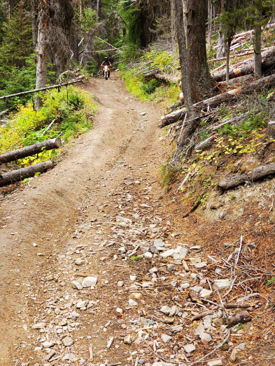
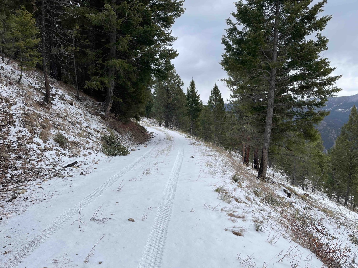
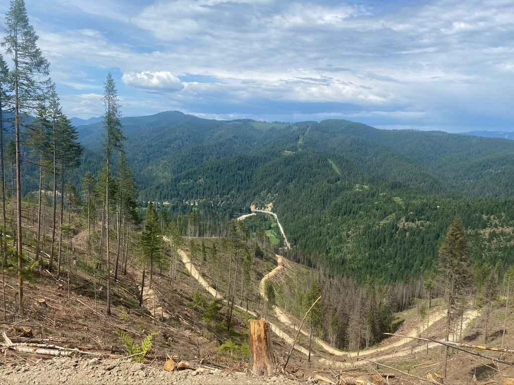
Colter Creek Trail is a 3.5-mile long dirt bike route that begins off Forest Service Road 5734 behind Lost Trail Pass Ski Resort. The east half is a shelfy, narrow singletrack that clings to the mountainside through a burn area, with high exposure, demanding balance and control. The trail surface itself is not overly technical - it's mostly smooth with small loose rock and occasional embedded rocks, but the exposure makes it more of an intermediate trail. The west half gets more flowy through meadows without the exposure, and through an easy creek crossing. Although a lot of logs have been cut, riders should expect to cross a few small downed ones, and always expect changing conditions with downed trees. One section has a large root bed from a fallen tree that juts into the narrow trail and must be skirted carefully. It has several sharp corners on the inside of the turns as it follows the curvature of the mountains, keeping things interesting. The trail winds through scenic high alpine forest and connects to Shields Creek Trail on the west end, which can be taken to the viewpoint of Overwich Falls.
Photos of Colter Creek


Difficulty
This is an intermediate trail due to its narrow width, exposure, and occasional rock and log obstacles that require precise handling and solid control.
Status Reports
Colter Creek can be accessed by the following ride types:
- Dirt Bike
Colter Creek Map
Popular Trails
Blue Mountain Lookout Spur (6.07)
Wheeler Creek
620 Character Ridge Road

Lower Buck Ridge ATV
The onX Offroad Difference
onX Offroad combines trail photos, descriptions, difficulty ratings, width restrictions, seasonality, and more in a user-friendly interface. Available on all devices, with offline access and full compatibility with CarPlay and Android Auto. Discover what you’re missing today!