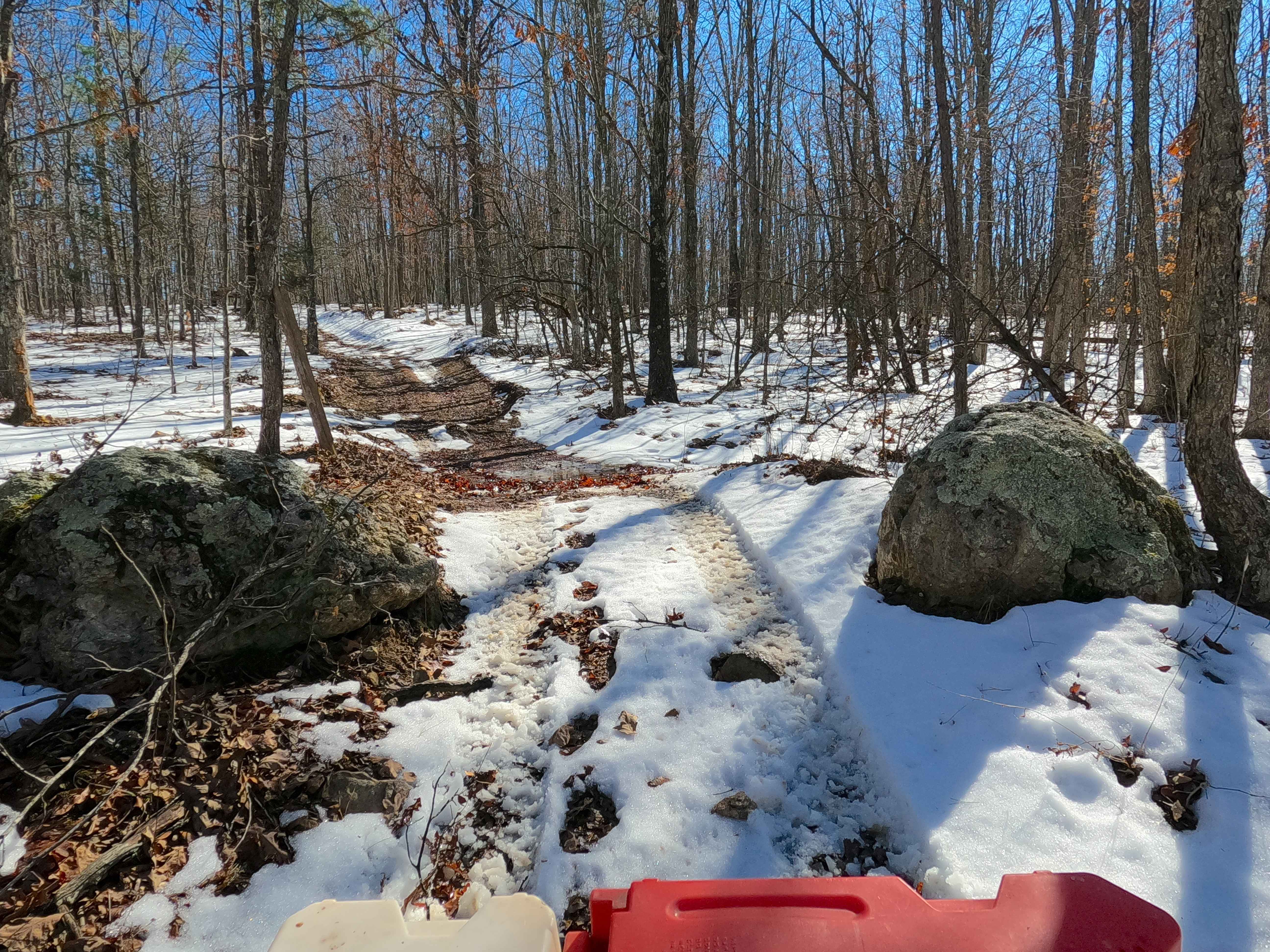
Sutton Bluff ATV 14 North - SB 14
Total Miles
2.1
Technical Rating
Best Time
Spring, Summer, Fall, Winter
Trail Type
50" Trail
Accessible By
Trail Overview
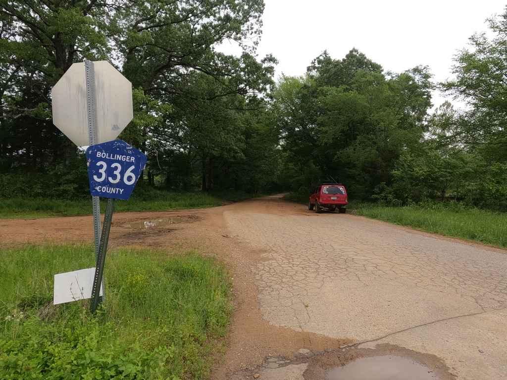
Sutton Bluff ATV 14 (North Section), also known as River Road Gap (legal/emergency ID SB 14), is a 50-inch and under restricted trail within the Sutton Bluff OHV trail system managed by the Mark Twain National Forest Salem Unit. SB 14 North is a part of the "far east section" of the Sutton Bluff OHV system. Oriented as a north-to-south trail, it connects between Sutton Bluff Road and Reynolds County Road 849 on the north end and the crossing with SB 13 and SB 14 South on the south end. Summary of the SB 14 North track: starting from its north end near Reynolds County Road 849, using SB 4 South for 160 feet heading southeast, SB 14 North spurs off to the south starting at its highest elevation, immediately descending in elevation through tight trees with a small switchback section, to the middle section crossing a small water runoff channel that eventually feeds into the Stillwell Branch Creek. This is the lowest point of elevation, also marking the beginning of the larger switchback section that climbs back up in elevation to cross the southern hill along the track, which has an extended ridgetop section, seemingly the flattest section of the trail, before dropping in elevation for a short distance to the conclusion at the three-way crossing with SB 14 South and SB 13. SB 14 North's notable core elements include hilly switchback sections via a natural coarse-gravel-dirt path. The path features whoops, loose cobbles, mini boulders, natural rock slabs, tree roots, small water runoff crossings, and small water-collection spots. To enjoy this trail and OHV system, obtain the required Sutton Bluff permit from Mark Twain National Forest, and if intending to use an ATV on Reynolds County Roads to commute between trails, obtain the Reynolds County ATV/UTV permit as well, in accordance with Missouri state laws.
Photos of Sutton Bluff ATV 14 North - SB 14
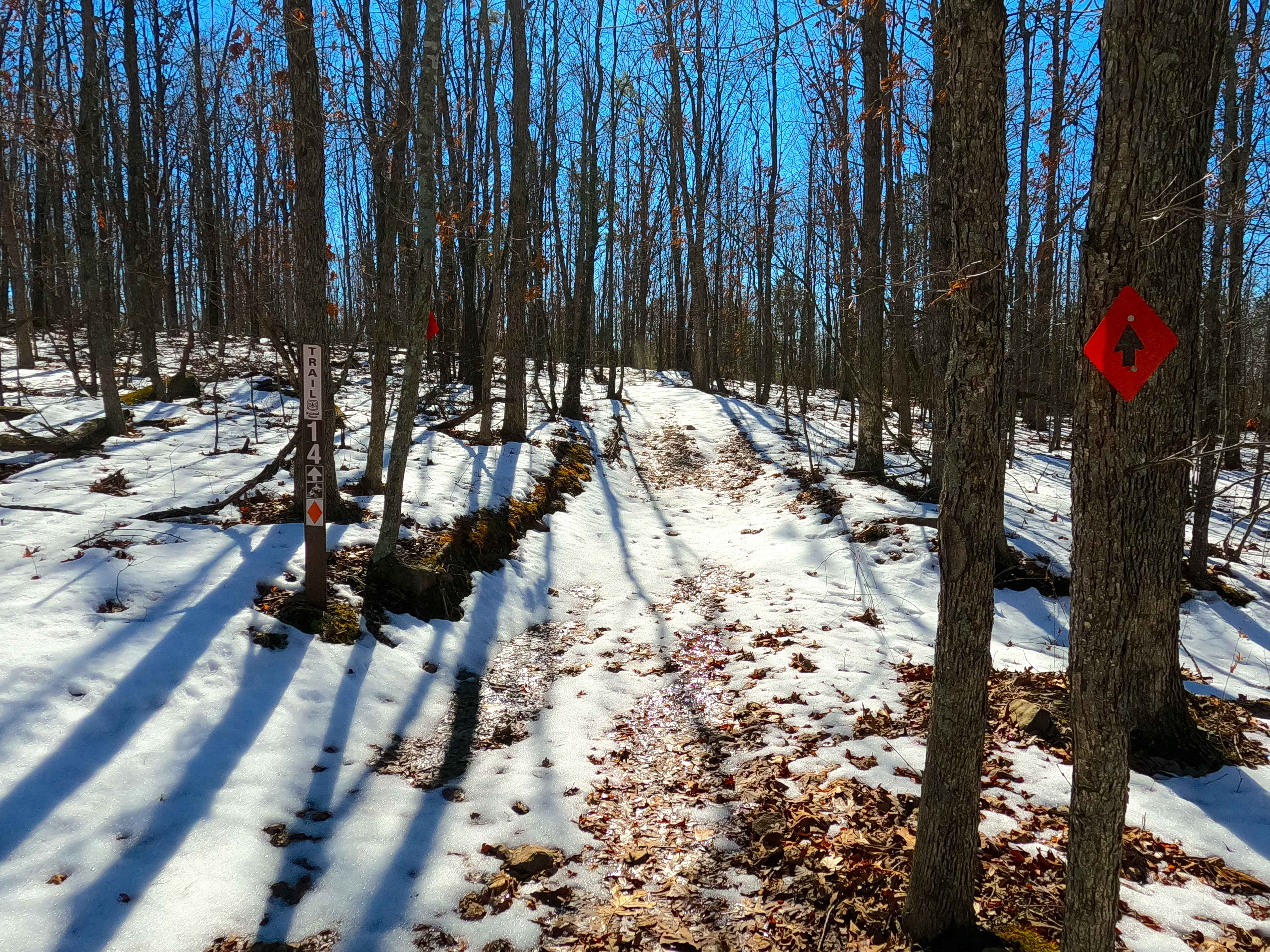
Difficulty
The SB 14 South is given a base rating of 3/10 for having small 3- to 6-inch water crossings and collection spots, with steep grades throughout the hills and switchbacks of the track, occasional small 3- to 12-inch fallen trees, tree roots acting as mini 3- to 8-inch ledges, loose 4- to 10-inch cobbles lying in the trail, 10- to 18-inch mini boulders, and natural slabs present or mostly buried within the ground as part of the path. Difficulty can increase from heavy use, a lack of maintenance, large 12-inch+ fallen trees blocking the trail, wet or rainy conditions, inclement weather, and damage sustained from flash flooding. If actively flooding, consider the trail closed.
Status Reports
Sutton Bluff ATV 14 North - SB 14 can be accessed by the following ride types:
- ATV (50")
- Dirt Bike
Sutton Bluff ATV 14 North - SB 14 Map
Popular Trails
Well Hollow
Eastern Lower
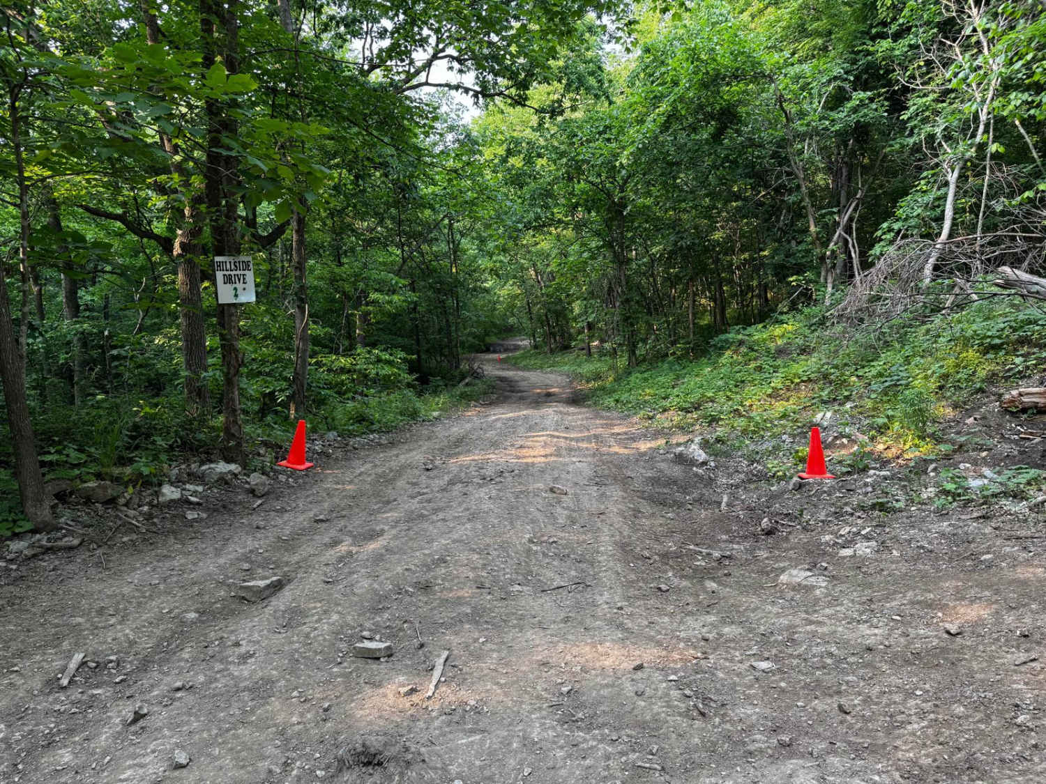
Hillside Drive 142
Reynolds Ford Road
The onX Offroad Difference
onX Offroad combines trail photos, descriptions, difficulty ratings, width restrictions, seasonality, and more in a user-friendly interface. Available on all devices, with offline access and full compatibility with CarPlay and Android Auto. Discover what you’re missing today!