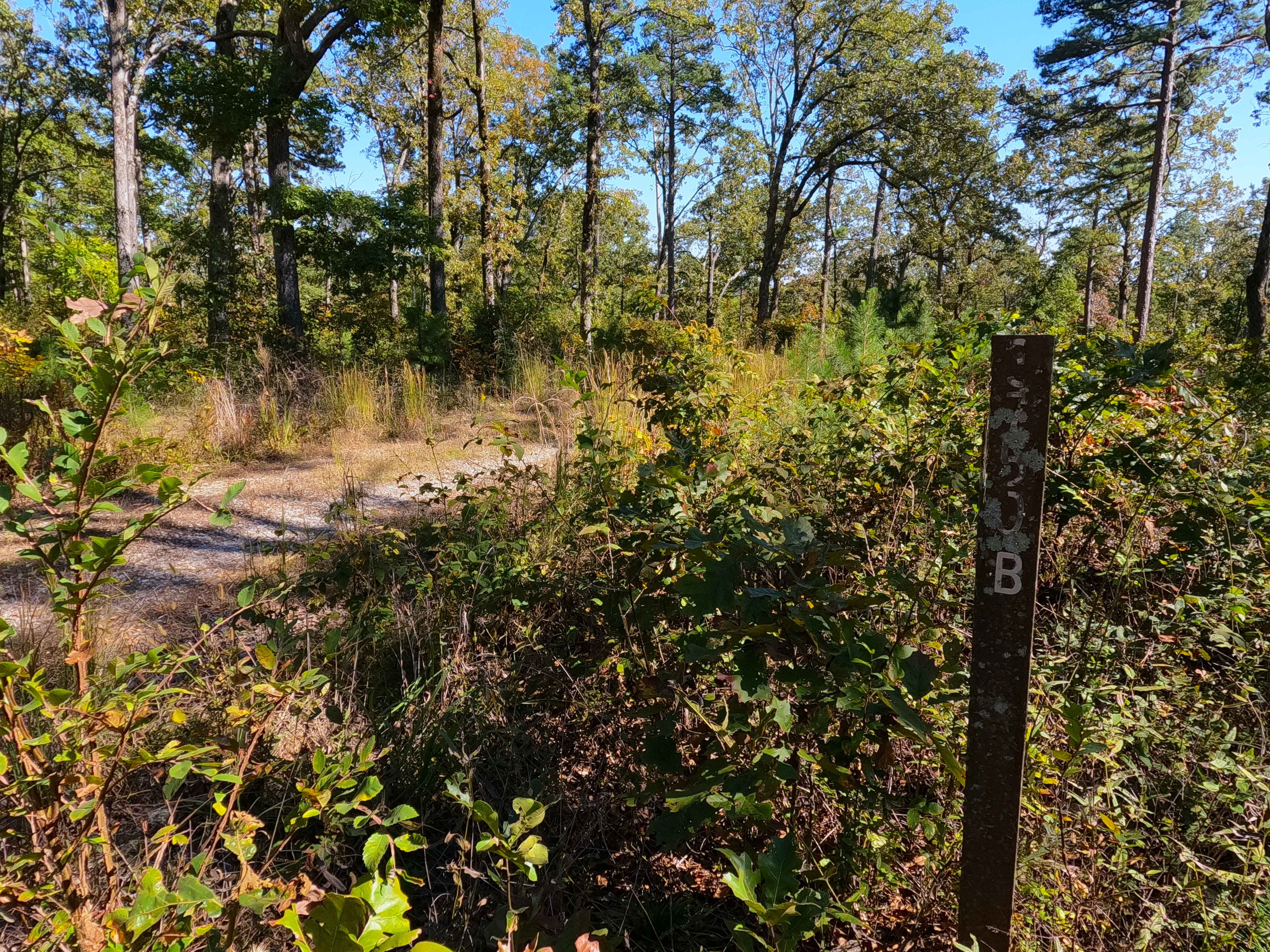
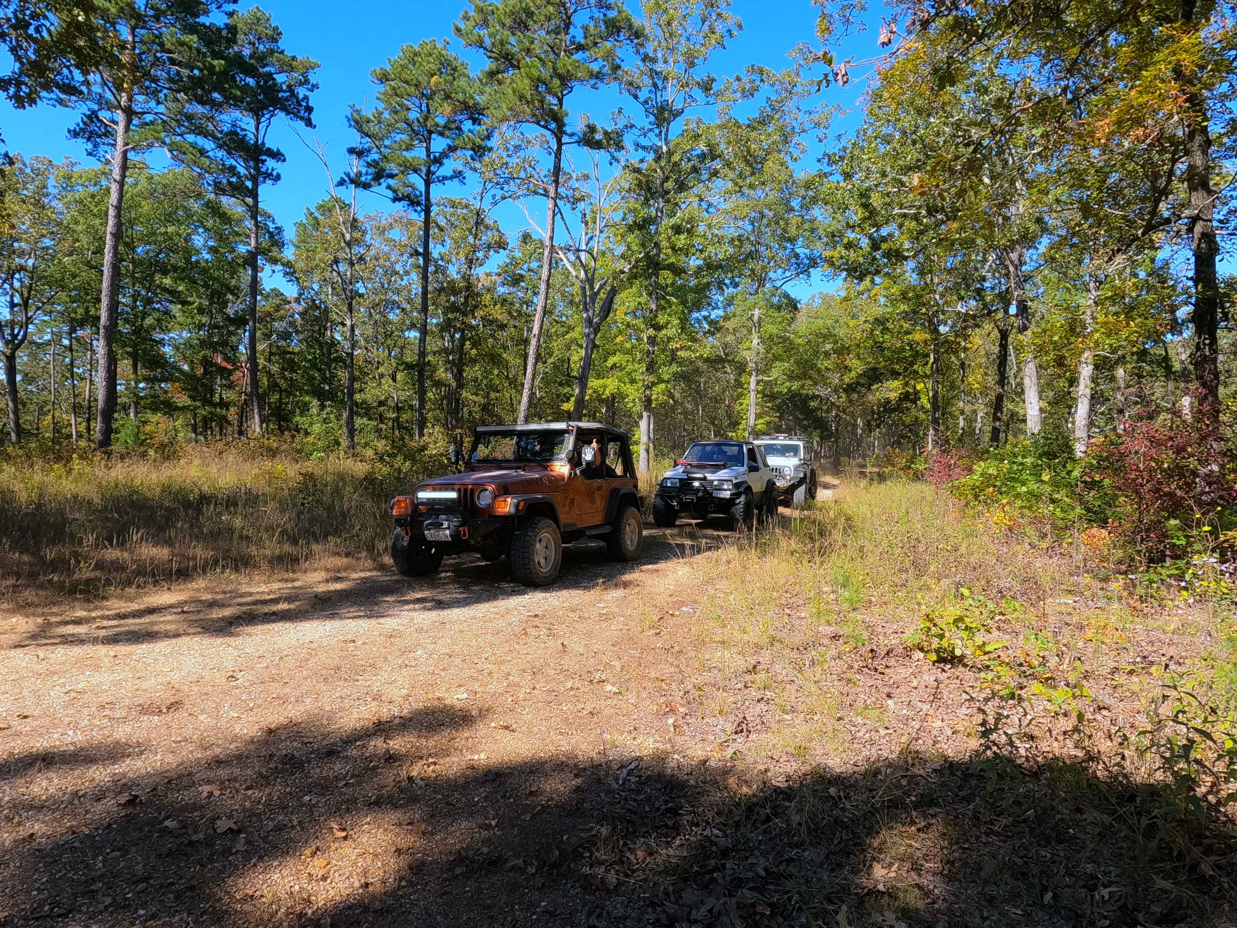
Miller Creek - FS 3750B
Total Miles
0.7
Technical Rating
Best Time
Summer, Winter, Fall
Trail Type
High-Clearance 4x4 Trail
Accessible By
Trail Overview
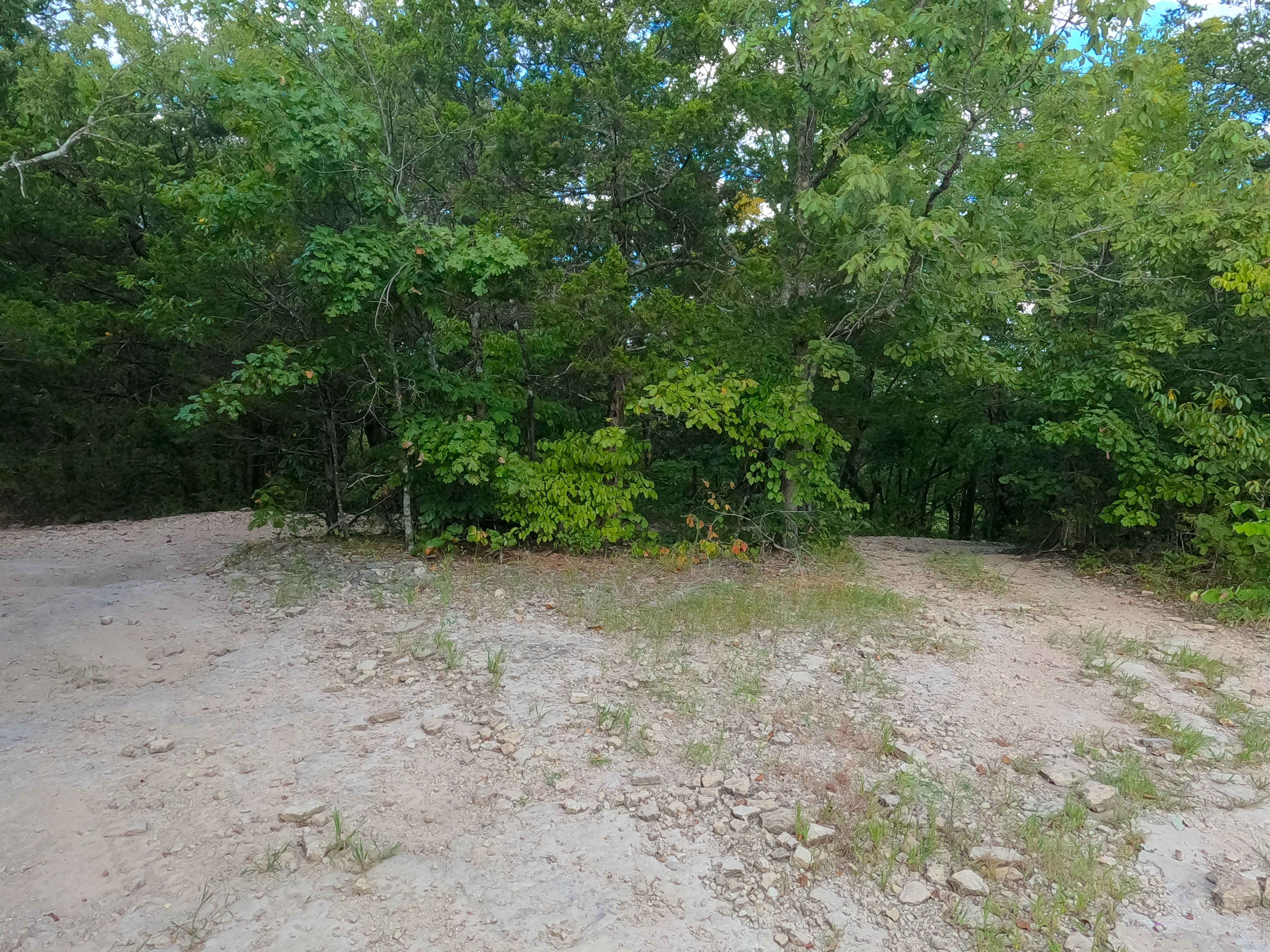
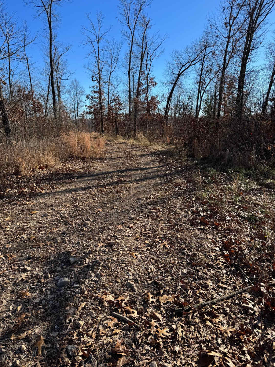
Miller Creek (FS 3750B) is a dirt and gravel forest service road within the Poplar Bluff Unit of Mark Twain National Forest, and is seasonally open from 6/1 to 3/14 yearly. Miller Creek leaves the ridge top along the western end of the High Ridge FS 3750, heading south downhill going over mild erosion rutted hills, with loose cobbles and natural rock poking out at the surface, curving its way down to the valley bottoms, crossing a small water run off, followed by the road leading to a small opening with a dirt berm mounded where the road used to continue going southwestward to the Miller Creek. When walking this area on foot, the former road that the FS MVUM still illustrates was not clearly identifiable, at best, very overgrown. Despite the MVUM not saying this is the legal endpoint, with the dirt berm being the evidence and marker that this is the new and implied end of the FS 3750B, users are advised to turn around and head back the way they entered.
Photos of Miller Creek - FS 3750B
Difficulty
Miller Creek is given a base rating of 2/10, for having a rocky, mild-graded, downhill path to the bottoms, featuring loose 4-6" cobbles, natural rock poking out at the surface, with a small water run off channel where the hill meets the bottoms. Please also expect the usual gravel-road complications, such as potholes, washboards, and gravel mounding. Difficulty can increase in seasons of wet or inclement weather, lack of maintenance, or heavy use.
Status Reports
Miller Creek - FS 3750B can be accessed by the following ride types:
- High-Clearance 4x4
- SxS (60")
- ATV (50")
- Dirt Bike
Miller Creek - FS 3750B Map
Popular Trails
Pet Hollow - FS 507A

Little Gravois Creek South Trail #1

Mall Crawl
The onX Offroad Difference
onX Offroad combines trail photos, descriptions, difficulty ratings, width restrictions, seasonality, and more in a user-friendly interface. Available on all devices, with offline access and full compatibility with CarPlay and Android Auto. Discover what you’re missing today!