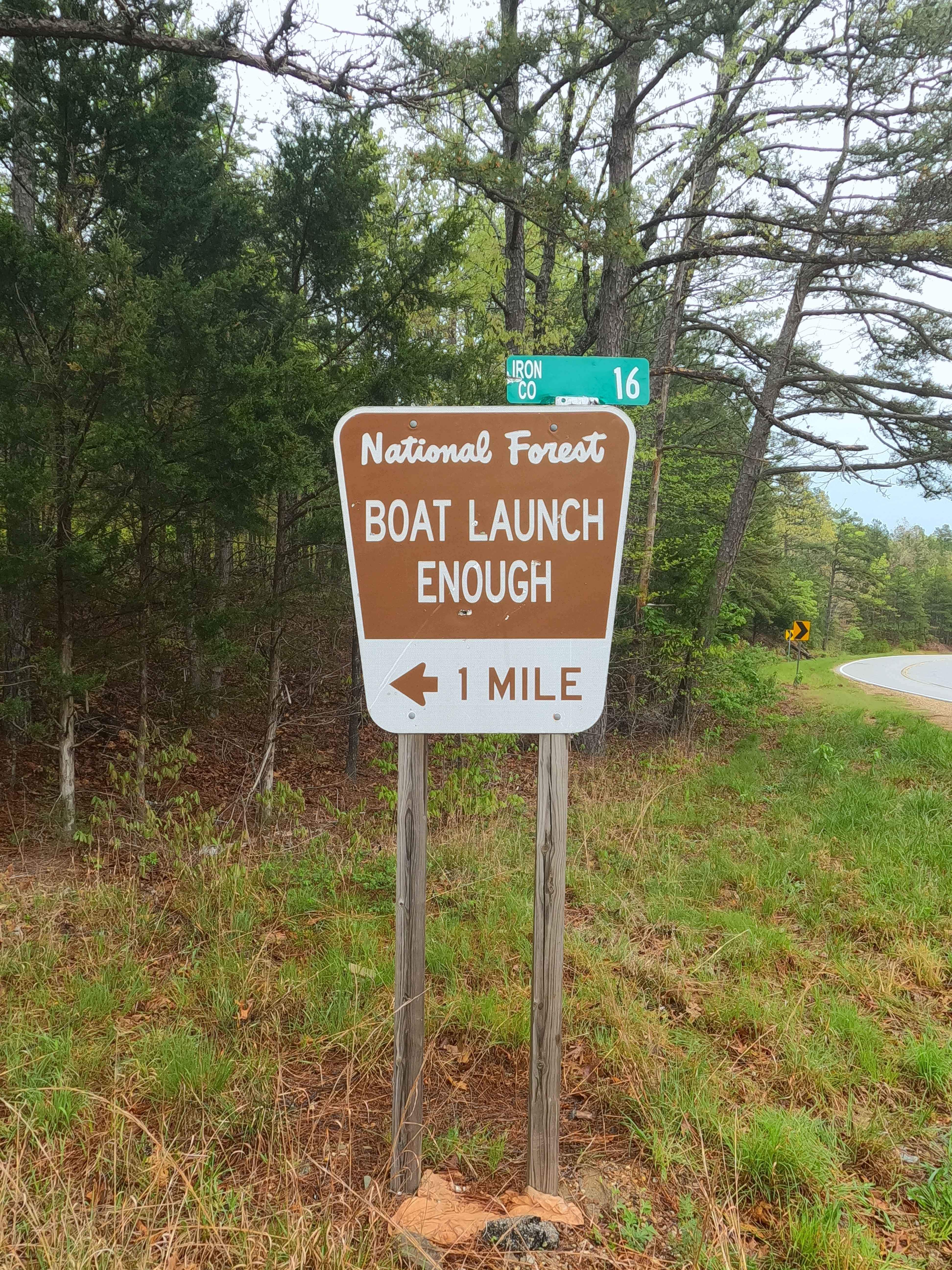
Enough Road - ICR 16 FS 2768
Total Miles
1.5
Technical Rating
Best Time
Spring, Summer, Fall, Winter
Trail Type
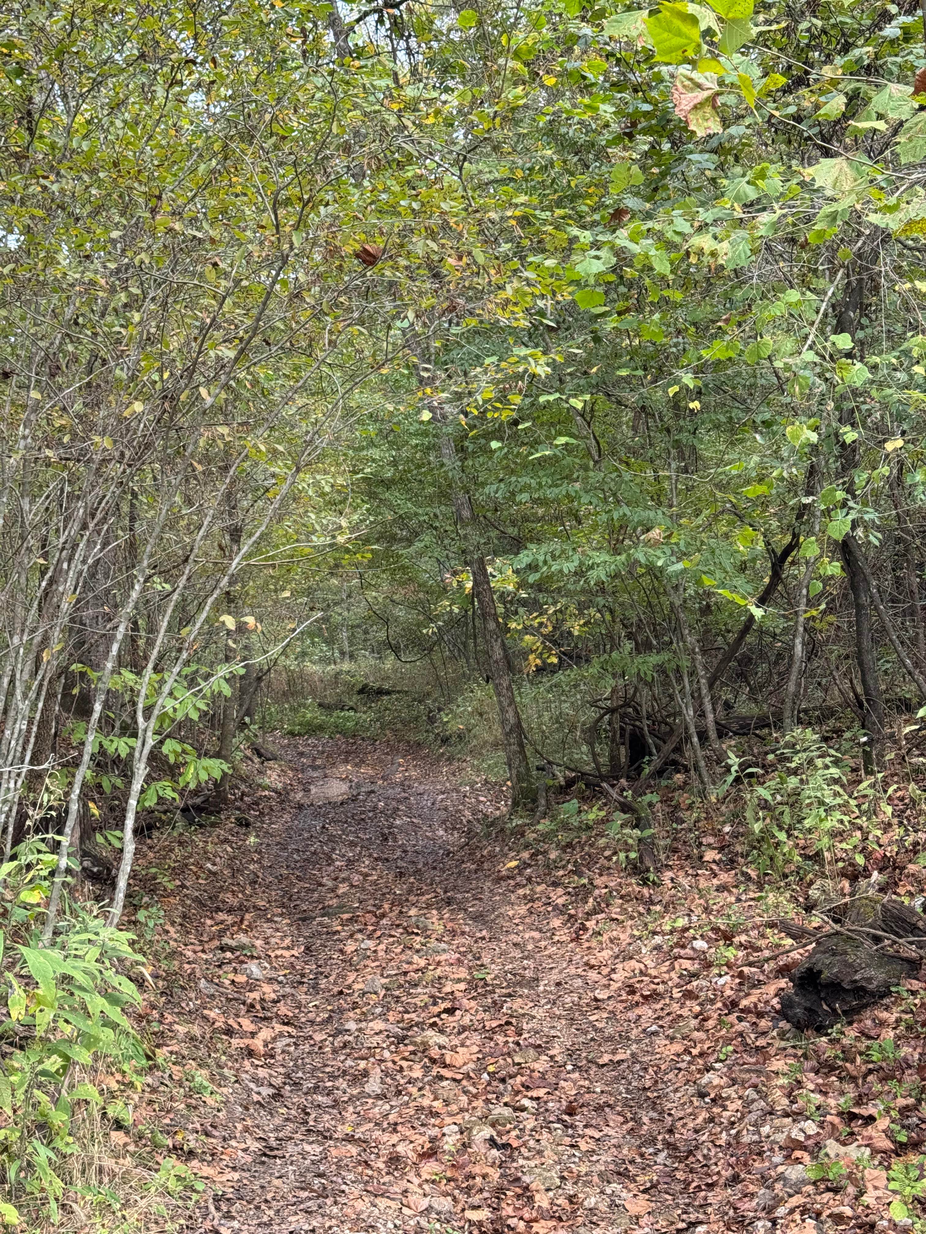
Full-Width Road
Accessible By
Trail Overview
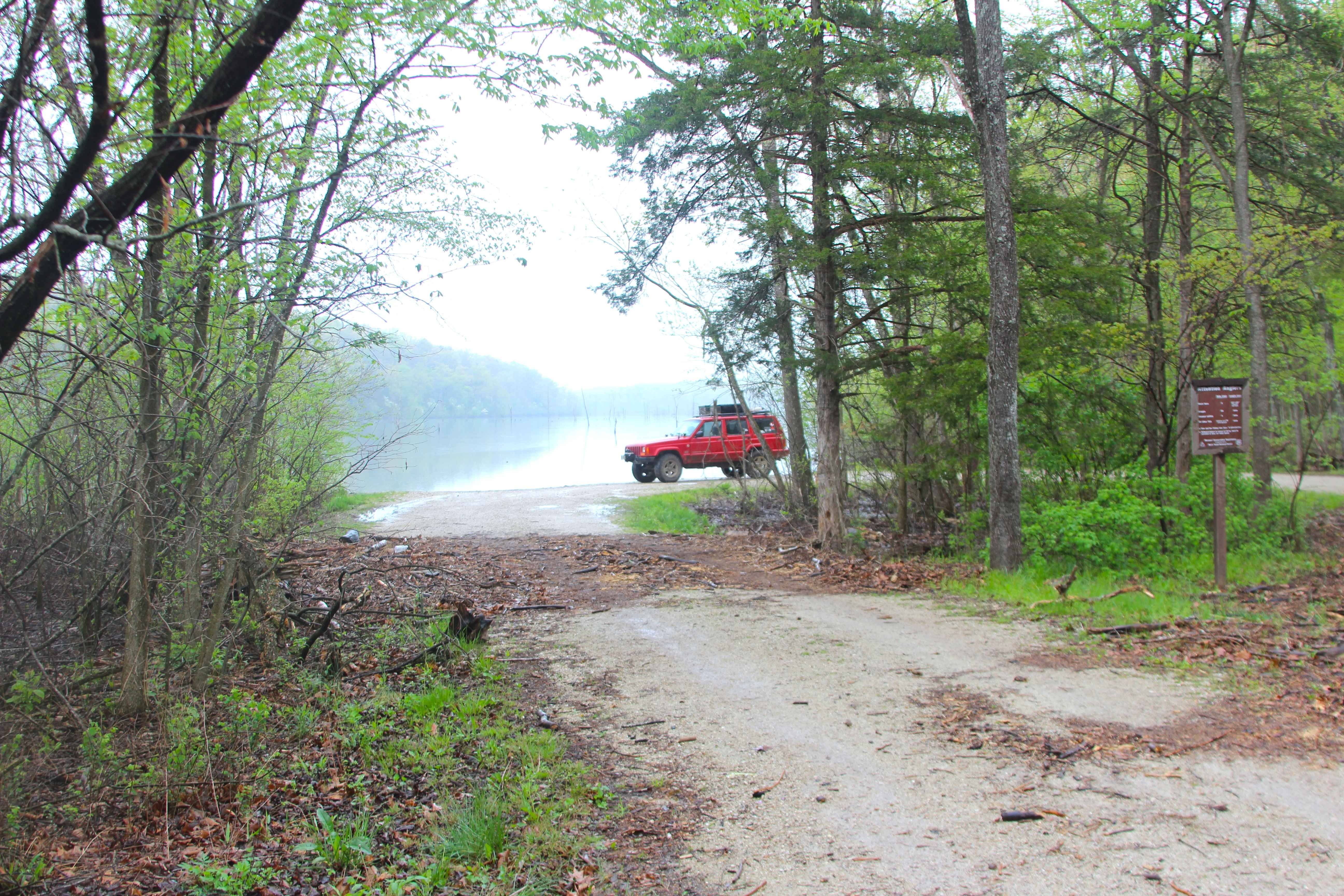
Enough Road Iron County Road 16, and the Enough Boat Ramp FS 2768, is a dirt-gravel-based county and forest road within the Mark Twain National Forest Potosi Unit. The Enough Road is a gentle, semi-maintained, dirty gravel road going downhill from Missouri Route 32 towards Guyser Hollow, with the road following alongside the Sam Branch feeder creek until it meets the edge of Council Bluff Lake's southern shoreline. At the endpoint of the road along the Lake, there is a boat launch, vault toilets, rock fire rings, picnic tables, a hiking trailhead, and parking spaces, but note that there is signage excluding camping and horse riding--an excellent place to use as a meet point, stage vehicles, and take in the beauty and history of the area. This waterside recreation area actually rests on the southeastern edge of the former settlement of Enough, MO, of which inhabitants were forced/bought out and removed before/during the 1979 construction start and 1981 completion of the dam, by 1985 reaching full pool level, by holding back the Big River, and creating Council Bluff Lake. This flooded the bottoms of the valley that held the majority of the farmland that made up the small community/settlement of Enough. Despite this, there are still remnants of homesteads on the southwestern side of Enough still above water, with more that can be seen along the Council Bluff Lake hiking trail, being made up of the former Mail Route Road (going to Missouri DD), School Road, and Old Enough Road that traversed north towards the former Council Bluff Church on the most northern point of the lake. For more history, go to the history section of this trail. If desiring to use the Lake's water, be sure to look into the angling and boating restrictions. There is a sublime feeling along the historic road, especially once it reaches the valley bottom that now hosts the Lake.
Photos of Enough Road - ICR 16 FS 2768
Difficulty
Enough Road is given a base rating of 1/10 for being generally a semi-well-maintained road over mildly graded hills using the base of natural, dirty coarse gravel of Iron County, giving off the vibrant deep orange/lite brown look. There is also a small potential for water collection spots and surface mud found on the road during wet conditions, with potential flash flooding in extreme scenarios. It is safe to expect the normal gravel road complications, such as washboards, potholes, mounding of the gravel, and potential spots where the gravel fades to dirt. Again, difficulty could increase in seasons of extreme inclement weather, lack of maintenance, and heavy use, but would likely drop back to 1/10 difficulty once dry, or as soon as it would be mended.
History
"..To Remember Times Enough.." Linda (Romine) Adkisson was born to her parents in 1959 and immediately brought home to live in the valley community/settlement known as Enough, Missouri. When asked exactly where Enough truly was placed, she said, "Pretty much anything south of the old Council Bluff Church that rested on the Washington and Iron County Line was Enough." I looked at the map and inquired back, "That's pretty much the entire lake, isn't it?" "Yep," she answered, "pretty much everywhere the water is now". Linda went on to point exactly where her parents' farm and grandfather Floyd Romine's farm were side by side, with reference to the Sugarcamp Hollow Sugar Mill to the south and Smith Branch Sugar Mill to the north, and former Enough Road running north and south to the west of the two farms. Now these farms are both about 200 feet into the lake water from the eastern shoreline. She also noted that the two Sugar Mills around their homestead were established by German or Austrian-Hungarian immigrants who tapped the maple trees to refine sugar from the syrup, who also built several structures and houses in Enough and their farms, with their native building styles and techniques, such as the river rock walls with wooden-framed roofs. Then she named families from all corners and coves of the former Enough valley, Barger, Baumgartner, Choate, Crocker, Midget, Shultz, and Long, to name a few. Before she was even 3 months old, her dad was out logging in one of the nearby ravines when a cut log on the trailer caught a standing tree, flipping the trailer and quickly taking the tractor with it, pinning her dad under the fender. Luckily, the family's dog ran home and alerted her mom, who sent a search party after him. He survived but had to go through months of recovery in the Poplar Bluff VA Hospital; at the same time, Linda's mother needed to care for her infant child. Seeing how hard this would be for Linda's mother alone, the Enough community gathered around the Romines and took care of their farm for the time her dad was gone, keeping the cattle, crops, and homestead tended to. Her dad returned home within a year and was able to take care of the farm until the day they had to sell. Linda recalls stories and rumors in the community that the initial plans to convert enough valley into a Lake dated back to the 1930s, but World War II put a damper on how quickly it would see progress. Along came the Feds in the 1960s, ready to see the project through. Linda recalls in the 1970s, one Government agency was trying to come in and eminent domain the land away, with promises of special recreation access or points of interest along the lake named after their families. The people of Enough protested, which put a halt to progress. Then, money offers went out for acreage, some people started biting on that, while others began to seek legal counsel, then the money offers got better, and the end seemed near. Enough residents were often convinced to sell on the proposed opportunity to buy the land back if the Feds decided to abandon the project. As Linda put it, this was just plain bogus, as the first owning Government agency, once it obtained the whole valley bottom, shortly transferred the public land ownership to the USDA Forest Service, erasing any kind of first rights of refusal or promises that had been made to the original land owners of buying their properties back from that first agency. Actions as such quickly put a sour taste in the former landowners' mouths. During the several-year transition period, as the community dwindled one by one, but the dam still wasn't finished, the people who sold out were still allowed to keep farming and ranching cattle on their farms, with some even dismantling their houses and barns to rebuild or reuse elsewhere at their new homes/land, as Linda stressed, "long as the water hadn't taken it yet". With the decreasing population in the valley keeping peace and vigilance, the looters and arsonists moved in and started causing problems. Linda's grandfather's house, set to be rebuilt elsewhere, was criminally burnt to the ground just before planned dismantling and removal. Linda recalls that in 1981, upon completion of the Dam, the lowest point of the Lake slowly began to fill, and the pool, and slowly the water crept southward, and by 1985, everything was underwater. Linda and other locals were sad, bitter, and disgusted by the loss of their old home, with Linda claiming it wasn't until 1987 that she could even stand the thought of going back to witness that it was truly all gone. She now reflects that she doesn't like that her old family farm is underwater, but that it put her "on a different trajectory" one that led her to a successful career in nursing and prosperity, and as for the land, when she makes it back to Enough and Council Bluff Lake, there is still something there that still resonates with it being home, saying something to the effect of, "once we saw how the Government fooled us into selling, I was almost convinced they would then develop it to be this massive cash cow recreational lake, with high end properties all along the shorelines, at least they never did that, rather kept it more true to its orignal form, of being that peaceful sublime valley it always was to me". In the two trips made to Council Bluff Lake and Enough in 2025, the old roads on the southwestern end of Enough still exist, from the current Enough Road at 37.70313, -90.91372 before the boat ramp area the old Enough Road shoots off Northwest wrapping along the ridge to the west, crossing the Big River, then heading north to the intersection at 37.70723, -90.91746, this is where the Walnut Grove Church was, along with the Mail Route Road going west to Missouri Route DD (where along the way you can see the Baumgartner Homestead, many structures are still standing, with several other foundations present) and the Montana School Road, going north to the Schools location (yes the river rock walls are still standing). From the same Walnut Grove intersection the Enough road turned east, and once in the valley (now the lake) it turned back north, passing the Sugarcamp Hollow and Romine Farms to its east, ultimately continuing until it met the Iron and Washington county line at the former Council Bluff Church at 37.73583, -90.91142, were the road continued northeast to Belgrade, MO, often known from that point north as Belgrade Road. Documented By Christopher Menz 11/2025. For even more depth to the history of Enough, MO, search for the Chris Nails Historic Trails series named ..To Remember Times Enough.. on YouTube.
Status Reports
Enough Road - ICR 16 FS 2768 can be accessed by the following ride types:
- High-Clearance 4x4
- SUV
- SxS (60")
Enough Road - ICR 16 FS 2768 Map
Popular Trails

Green 123
Ranger Smith
The onX Offroad Difference
onX Offroad combines trail photos, descriptions, difficulty ratings, width restrictions, seasonality, and more in a user-friendly interface. Available on all devices, with offline access and full compatibility with CarPlay and Android Auto. Discover what you’re missing today!