Crane Tower FSR 2192
Total Miles
0.9
Technical Rating
Best Time
Spring, Summer, Fall, Winter
Trail Type
Full-Width Road
Accessible By
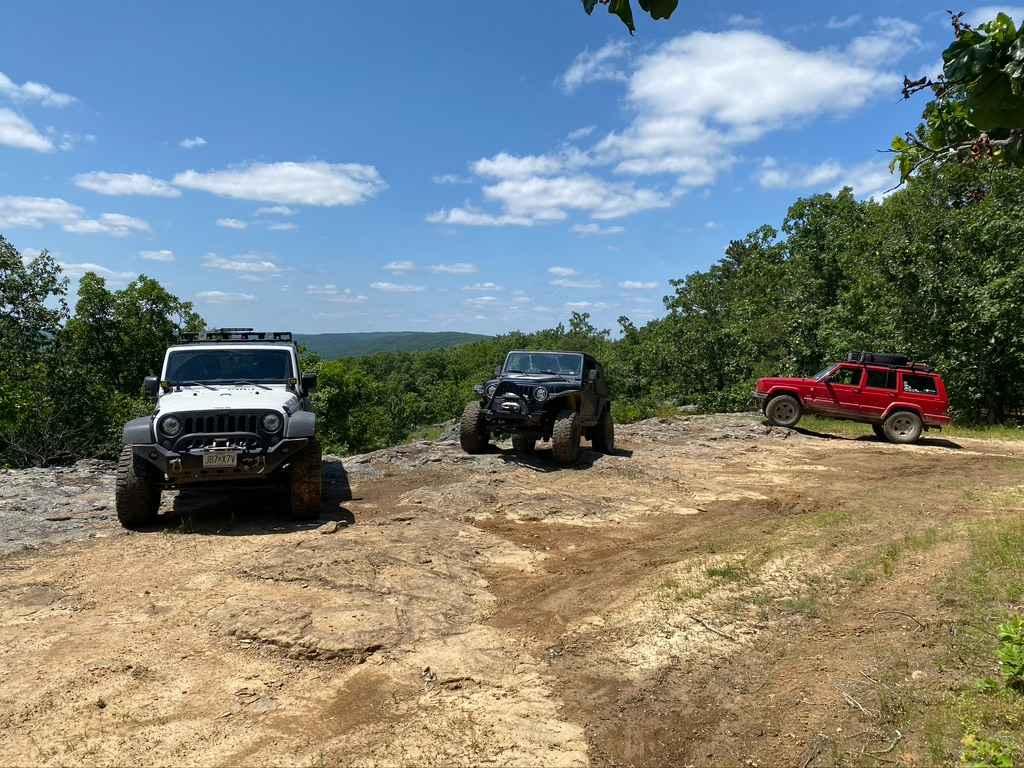
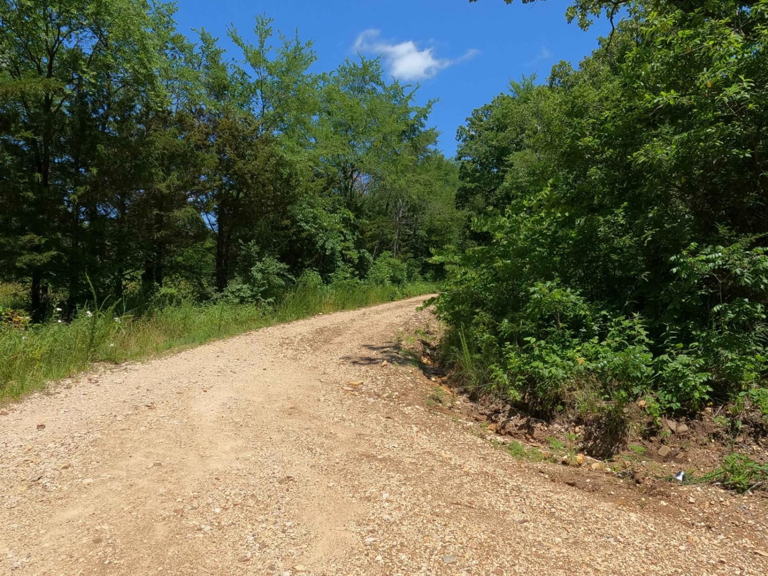
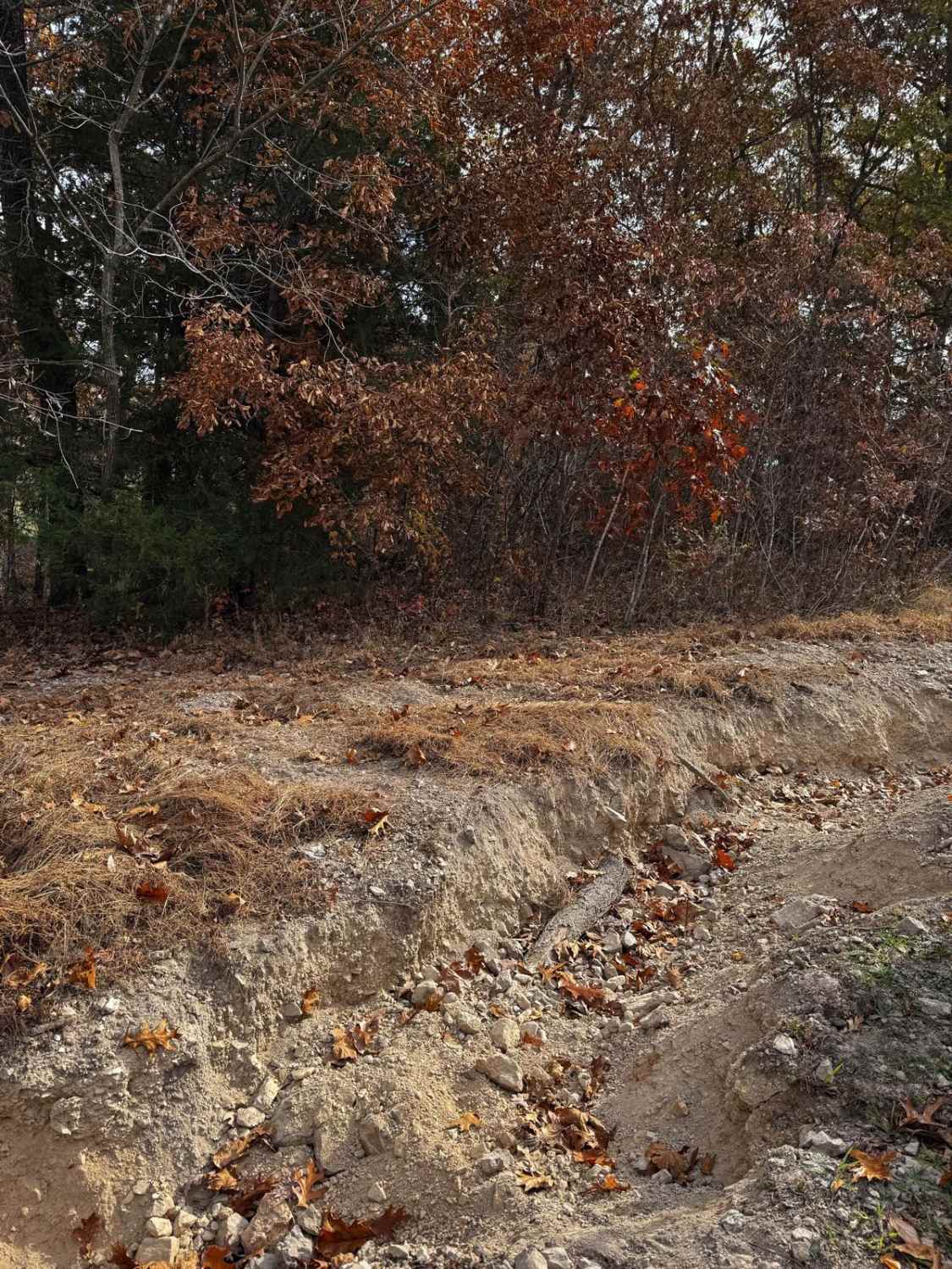
Trail Overview
The Crane Tower FSR 2192 is an old fire tower service road through the Fredericktown sector of Mark Twain National Forest. Through the course of time, the road has become natural; it shows few signs of maintenance and there is very little road gravel left. There are washes going down the hill forming ruts, and this has also eroded away the old road surface to expose the natural coarse rock below. Once to the top, you can see the old fire tower foundation pillars on the left, and to the right, you can drive a loop that leads to a natural bluff overlooking the area towards Ketcherside Mountain and Taum Sauk Mountain. This is one of the best views in the area, especially for an overland camp.
Photos of Crane Tower FSR 2192
Difficulty
The difficulty of the road lies in the washed-away gravel and navigating foot-deep water erosion ruts that have formed due to a serious lack of maintenance. This has also exposed the natural dirt and loose rock below the old road surface, giving the road a natural feel. At the top of the hill, there is an overlook loop that crosses some natural rock. You can go looking for extracurricular obstacles and the loop features a few 12-inch-plus mud holes with natural rock and roots laced throughout. All this forms a fun little road to the top of the hill. The road is given a 4/10 base rating but could elevate in difficulty with heavy rain and progressive erosion. It could also become easier if the road was ever mended.
History
The old fire tower the trail is based upon, was removed in the sweeping trend of tower removal in the 1970-2000 era. No data can be found of when it specifically was removed, but the old foundation piers can be found at 37.47631, -90.62080, just slightly east off of the trail.
Status Reports
Crane Tower FSR 2192 can be accessed by the following ride types:
- High-Clearance 4x4
- SUV
- SxS (60")
Crane Tower FSR 2192 Map
Popular Trails
Bird Loop

Yellow 249

Yellow 360
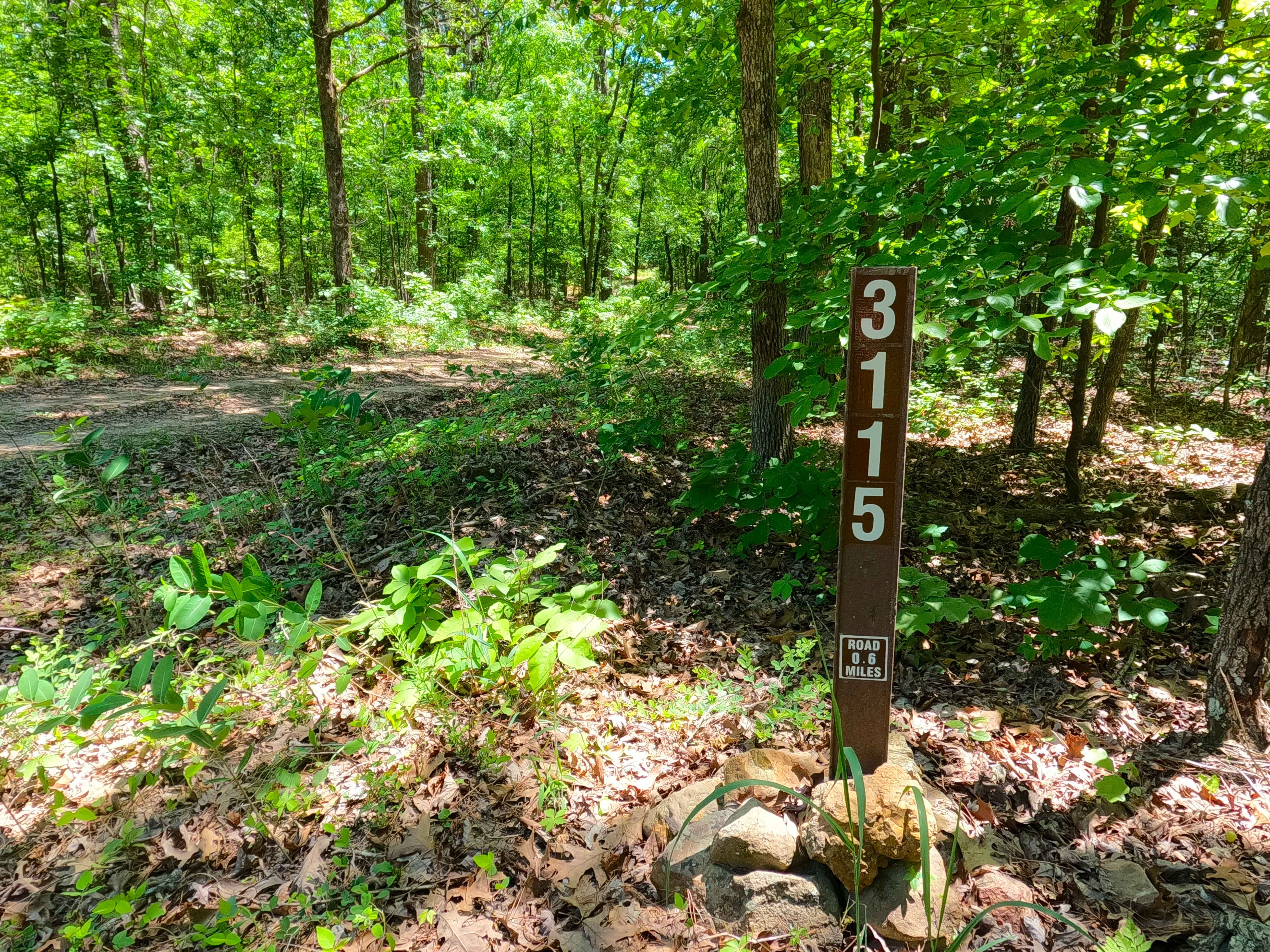
Bunny Hop - FS 3115
The onX Offroad Difference
onX Offroad combines trail photos, descriptions, difficulty ratings, width restrictions, seasonality, and more in a user-friendly interface. Available on all devices, with offline access and full compatibility with CarPlay and Android Auto. Discover what you’re missing today!