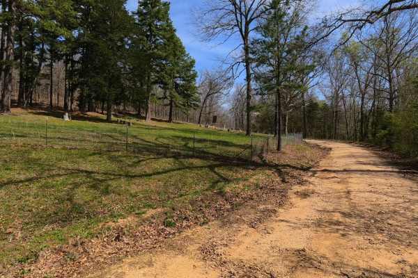
Trail Overview
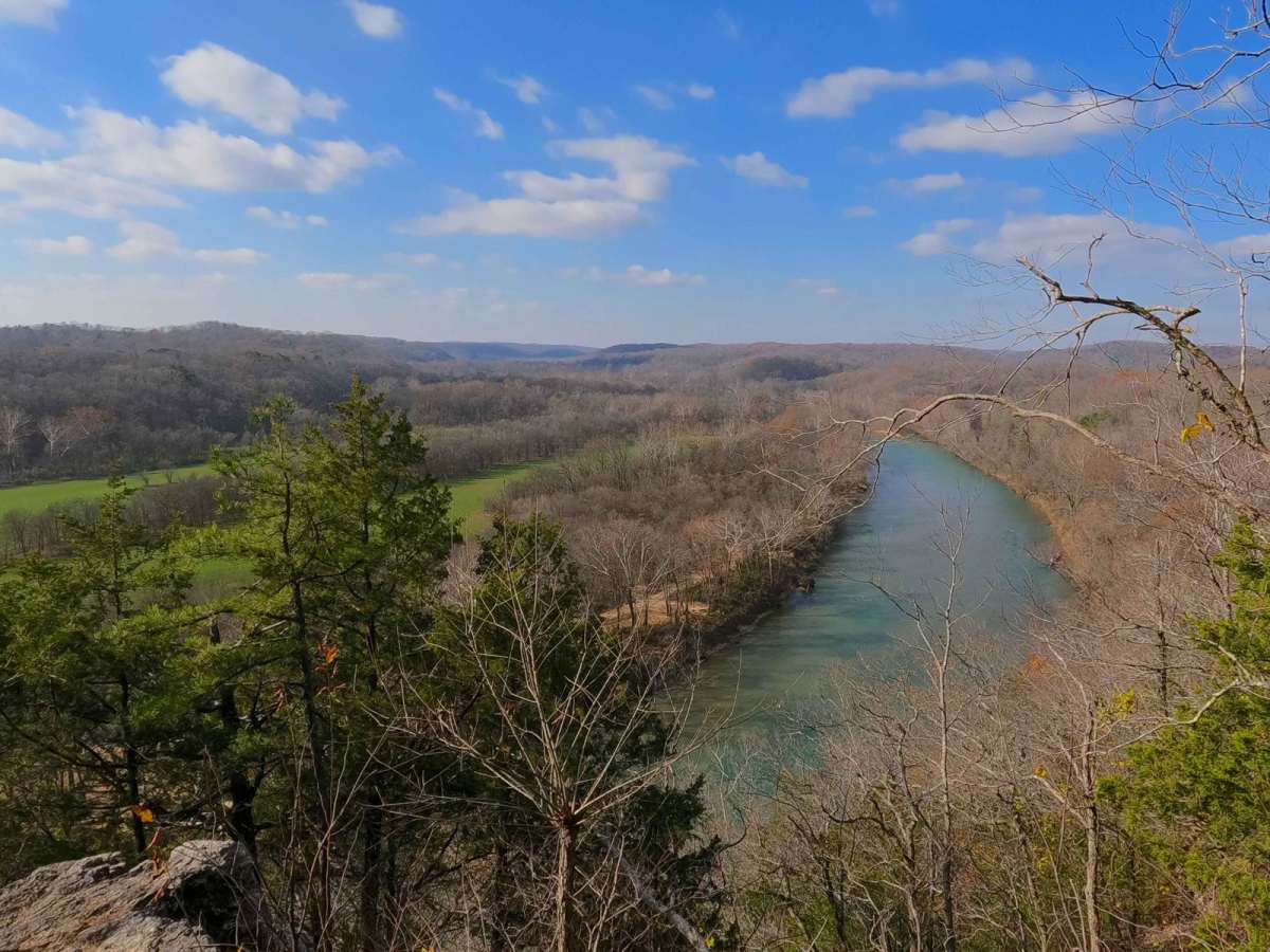
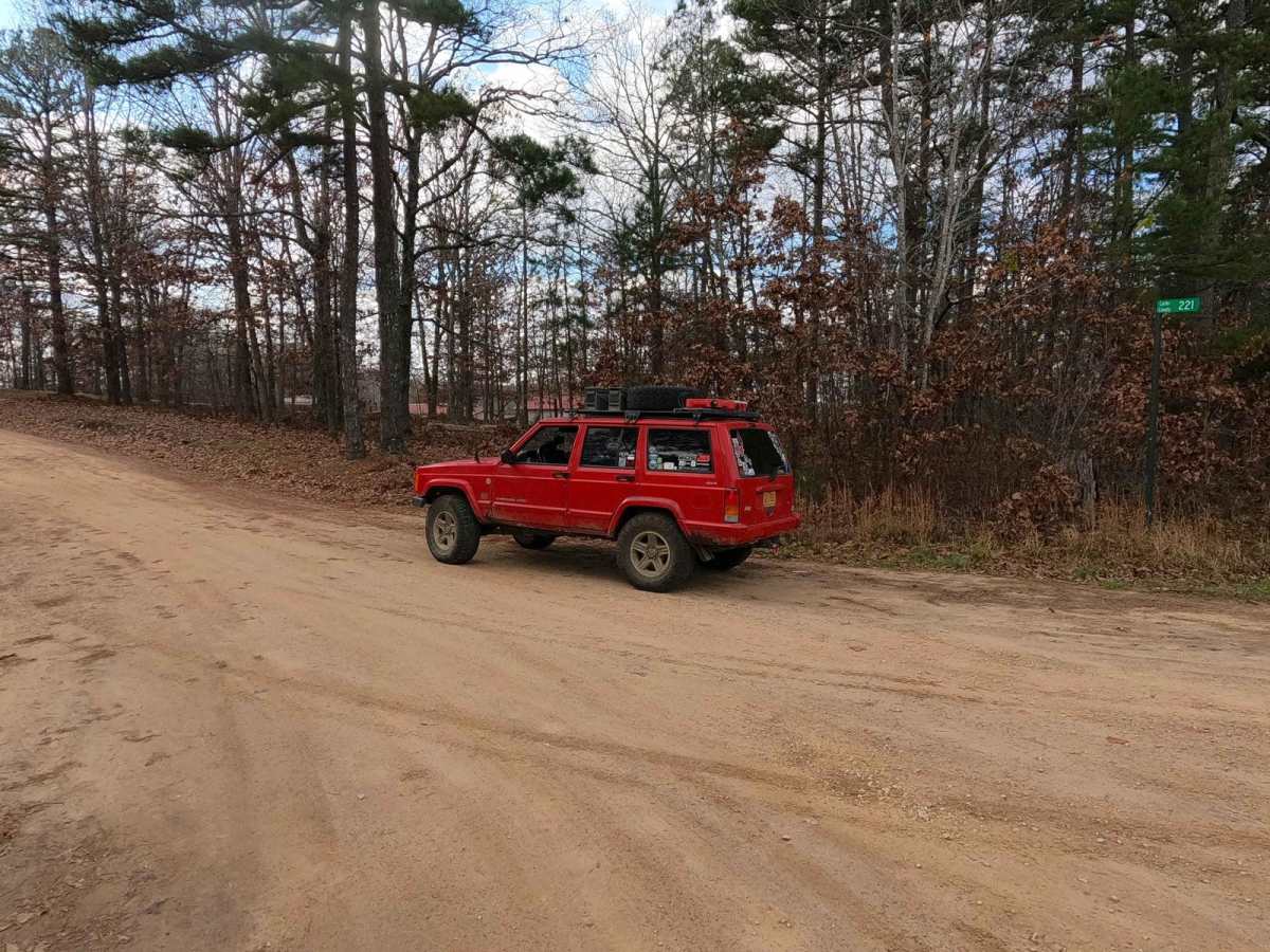
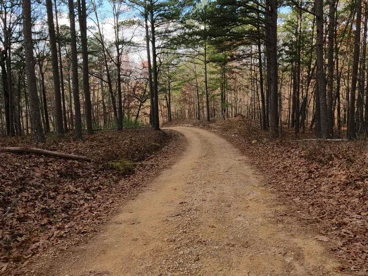
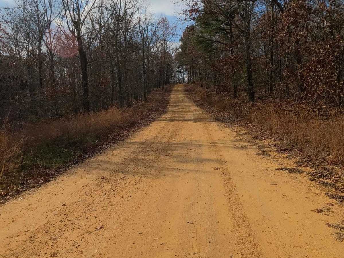
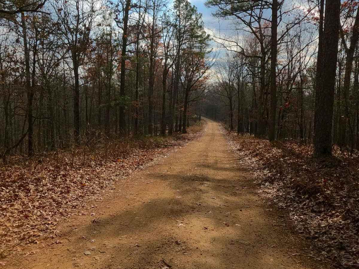
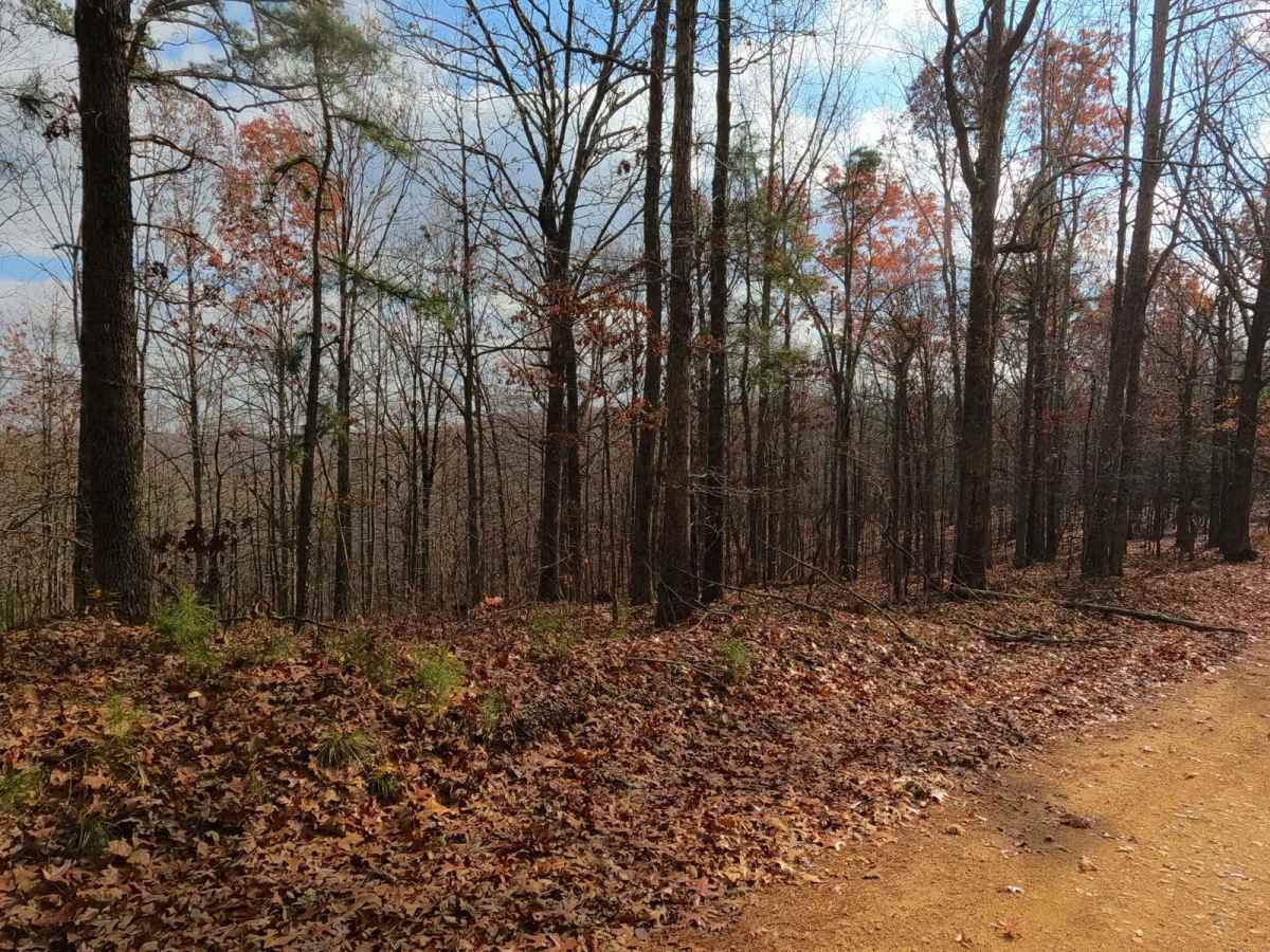
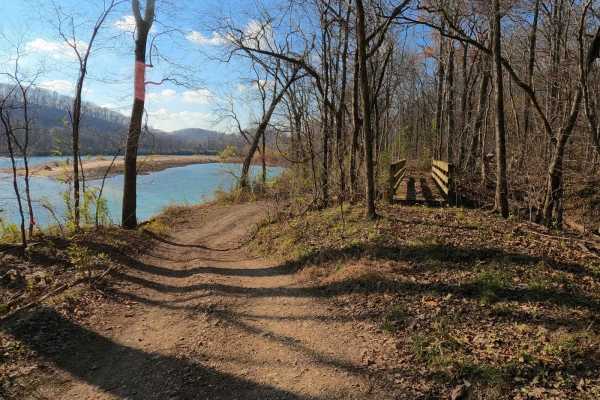
Clubhouse Bluff or Carter County Road 221 is a low-standard coarse gravel and dirt road, passing through several agencies' land, including the Pioneer Forest, Carter County, and ending in the Ozark National Scenic Riverways. The Clubhouse Bluff begins shortly from US60, heading southwestward along the ridge top with views of the neighboring surrounding ridge lines, ultimately tracking to the Clubhouse Bluff overlook, found at 36.926, -90.90073, along the Current River, and shortly after dropping downhill to the river's edge at the Clubhouse Primitive Campground, found at 36.9202, -90.8999. The low standard road is rough featuring sandy dirt and natural coarse gravel as a base with the occasional natural rock poking out at the surface and mild-moderate graded hills. With the Current River's bright blue glow, placement of evergreen trees and natural rock, valleys that are rarely not lush green, and open sky, this road year-round features one of the best natural views in Missouri. Come and see Clubhouse Bluff.
Difficulty
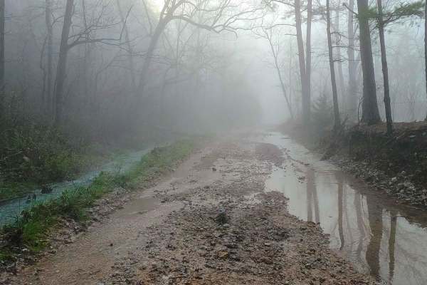
Carter County Road 221 is a simple 1/10 base-rated gravel road, showing only mild forms of erosion in spots, having a mild grade going up/down the ridge/hill it rests on, with the potential of small natural 6" cobbles on the edges of the road and natural rock sticking out at the surface in the road surface, the bottoms on the most southern portion of the trail can feature loose sand and surface mud in spots. Expect the normal gravel road complications of potholes, mounding, and washboards. Difficulty could increase due to heavy rain or extremely wet seasons, with the lower riverside portion potentially being flooded and inaccessible. However, this would be a rare scenario, only affecting the southernmost portion of the track.