Central Bluffs Trail
Total Miles
0.8
Technical Rating
Best Time
Spring, Summer, Fall, Winter
Trail Type
Full-Width Road
Accessible By
Trail Overview
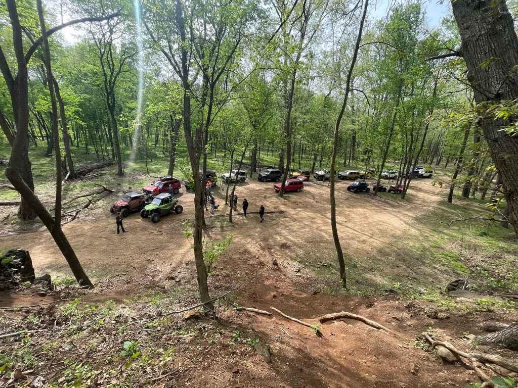
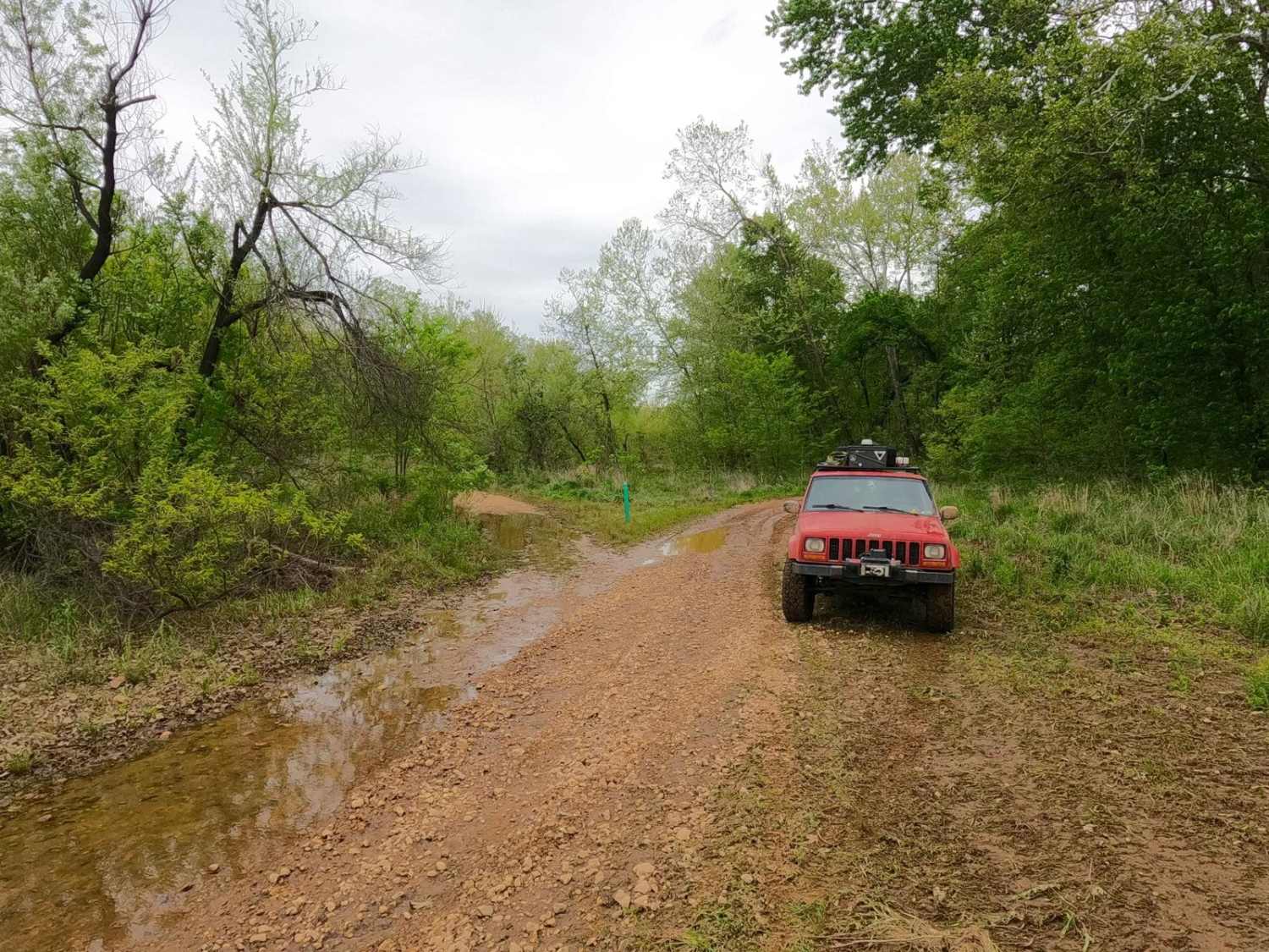
Central Bluffs Trail, or Black River Bottoms Central Hub, consists of parts of the Reynolds County Roads 462 and 464 and is a dirt/sand mix and natural creek-bottom rock trail through the center portion of the Black River Bottoms area within the Clearwater Lake U.S. Army Corps of Engineer Land. The Central Bluff Trail is the main hub trail of the area, tracking at an angle from the northwest, starting at the south endpoint of the Spool Ridge Trail, and ultimately leading to the southeast at Dafron Hollow and Dafron Branch Creek. On the northwest end is a wide-open coarse gravel area perfect for staging large groups together and also facilitating a networking hub to The Spool Trail at 37.27115, -90.77737 and the North Riverside Trail and Whizenhunt Hollow Trail, both at 37.27044, -90.77604. To the east end of the open gravel area is the entry to the Stacked Log Trail at 37.27019, -90.77353. Shortly after, the trail narrows to 2-3 vehicles wide, running just south of a water retaining ditch and section of rock bluffs. Then comes the Dafron Branch creek bottom road section of the trail, making a hard turn going east at the first water crossing at 37.26650, -90.76960. At the same coordinates can be found the Central Riverside Connector trail going south. This a small trail to access the midpoint of the North Riverside Trail. The creek bottom road lasts for 600 feet before turning hard south and entering the Dafron Hollow area, another spot great for staging a medium-sized group and networking to the Dafron Branch Trail headed east at 37.26562, -90.76740 or going on to the Dafron Hollow Trail to the south at 37.26481, -90.76713. Along this trail, several caves can be found in the hills and bluffs. Be careful to enter and bring plenty of lighting sources if you're doing some cave exploration. Two caves can be found at Dafron Hollow Bluff, one smaller animal den (to the right), and one medium-sized (to the left), found at 37.26501, -90.76713. This is a necessary networking trail to understand and explore the area, with thrill and diversity of terrain to make it fun throughout. Just be sure to cross the water at designated spots and follow the green and red markers as labeled. Don't attempt if water levels are at moderate flood stages.
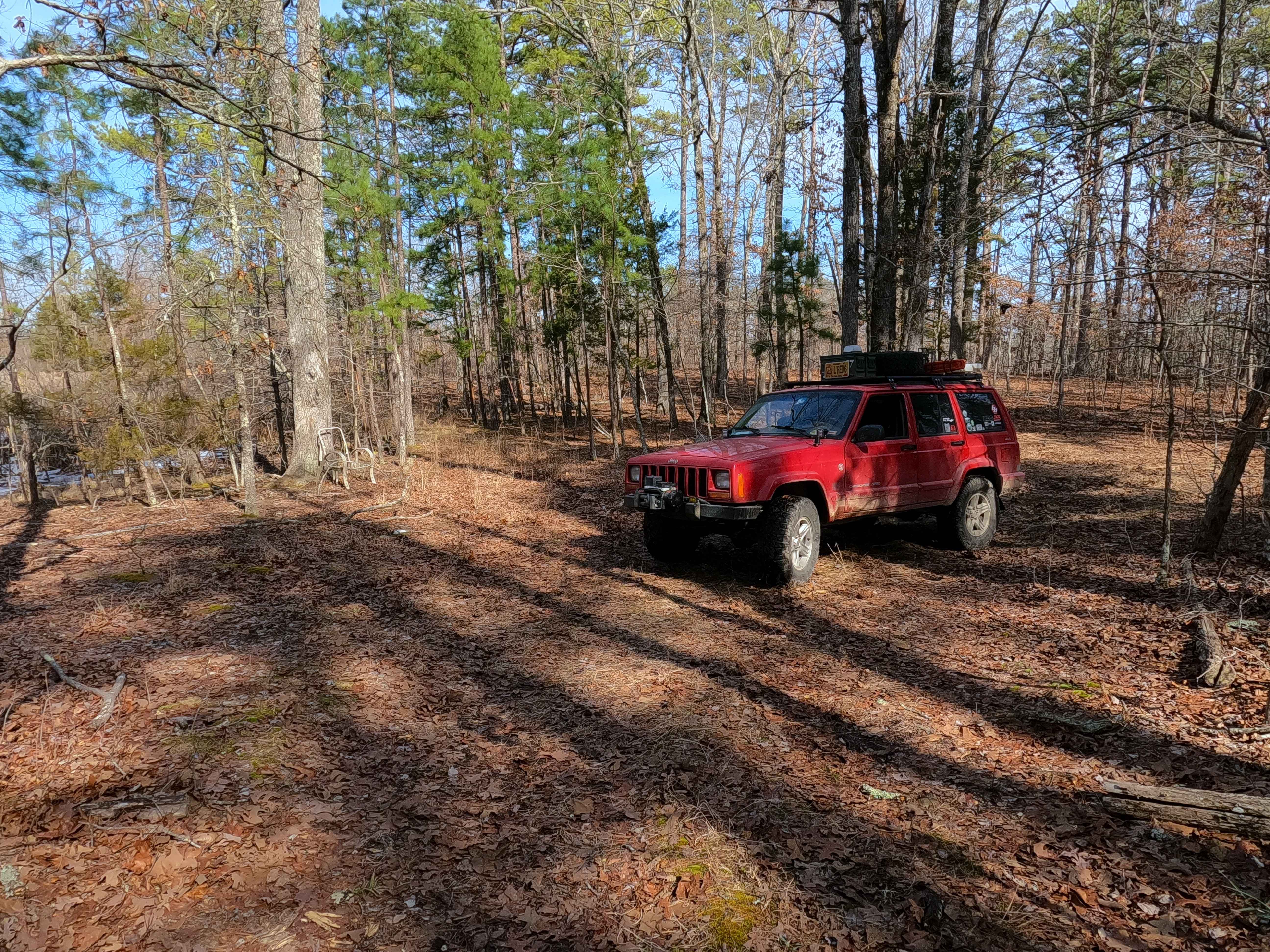
Photos of Central Bluffs Trail
Difficulty
The Central Bluffs Trail is generally easy, especially on the eastern end where the open river rock creek gravel is, where the main driven lanes of the trail are well-packed. Tracking off this path can yield some loose and low-traction gravel. It is hard to get moving, but once you get some momentum, it is easy to get a feel for. The center bluffs part of the trail is more of the same, but does feature finer sandy dirt terrain, with one spot even featuring banked turns and another spot showing signs of holding water. However, it's a hard-bottomed and shallow (less than 6 inches) water hole at best. The creek bottom road section is where the 3/10 given rating comes from; due to heavy use and constant change from flowing water, the creekbed is not consistent and can have anywhere from 6 inches up to 2 feet of water. Generally speaking, it has a 1-foot depth on average. This area features a path straight down the creek or has 3 crossings, with 2 small sections of muddy sand/dirt roads in between. Observe the water levels and determine a safe line through. All this said, in times of dry weather, the creek can potentially dry up, yielding a lesser 2/10 rating, but in times of abundant rain, it could easily add a foot of depth to the Dafron Branch and yield a 4/10 rating. Flash flooding or severe flood stages can close the trail completely due to unpredictable depths of water and reshaped terrain. Be alert and check the water levels at the crossings before entering. Check the Annapolis Black River flood stage gauge (normal levels are 4-6, with the flood stage being 6+). Pictures of the trail were taken at a recorded 5.5- to 6-foot flood stage.
History
The history surrounding the bottoms is one of fighting for public access. This is an example where the presence and public use of Reynolds County Roads 464, 462, 460, 458, 456, 446A, and more have been the driving force keeping these trails open. Locals refuse to let their historic roads be taken away, yielding a place we all can enjoy and use. Please do your part in keeping this place alive; pack it in/pack it out, follow the green and red route markers as marked, and don't drive in the Black River or form new trails.
Central Bluffs Trail can be accessed by the following ride types:
- High-Clearance 4x4
- SUV
- SxS (60")
- ATV (50")
- Dirt Bike
Central Bluffs Trail Map
Popular Trails
Tucker Road - FS 4099
Prospect B - FS 3813B

Loggers Trail / Heavens Stairs Connection

Logging Trail #1
The onX Offroad Difference
onX Offroad combines trail photos, descriptions, difficulty ratings, width restrictions, seasonality, and more in a user-friendly interface. Available on all devices, with offline access and full compatibility with CarPlay and Android Auto. Discover what you’re missing today!