Bee Gum Ridge - CCR 209
Total Miles
3.8
Technical Rating
Best Time
Summer, Spring, Fall, Winter
Trail Type
Full-Width Road
Accessible By
Trail Overview
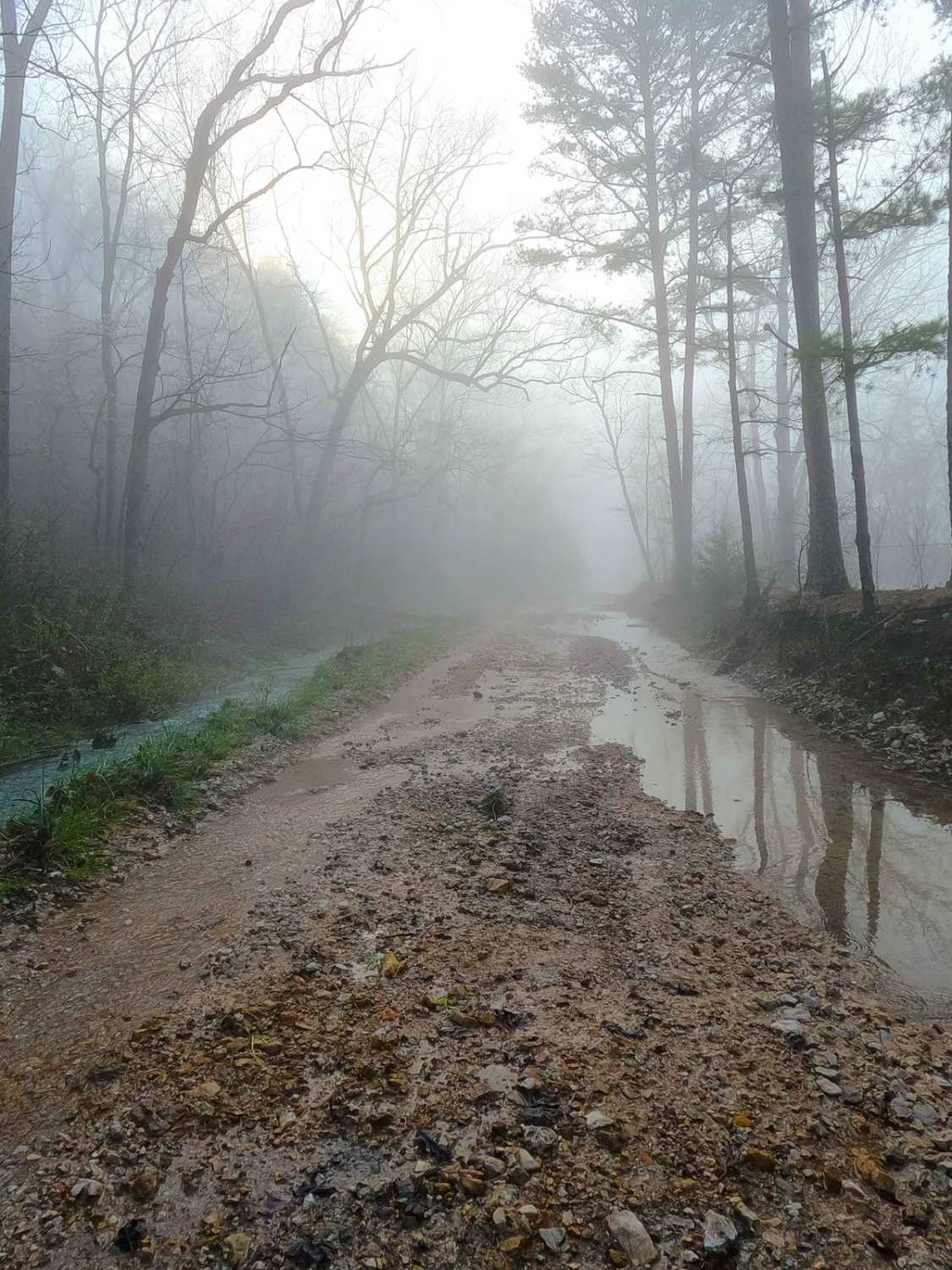
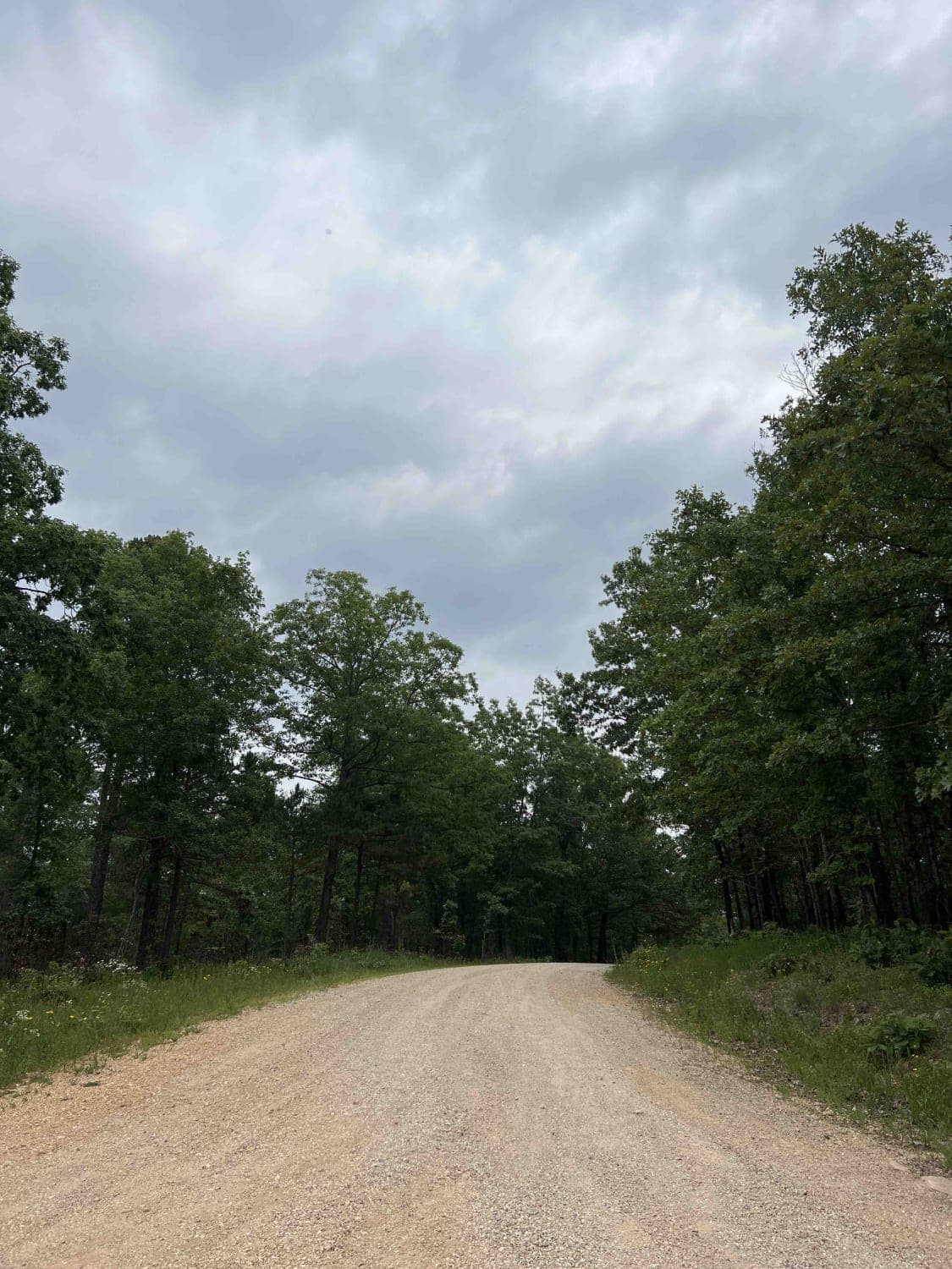
Bee Gum Ridge, Chilton Road, or Carter County Road 209, is a coarse gravel road that crosses Carter County land, Pioneer Forest land, and ultimately leads to Ozark National Scenic Riverways Land. Bee Gum Ridge begins as a ridge-top road right off Missouri Route T, remaining elevated to this height for the first 1.2 miles of the road, before dropping down a moderate-grade hill, into the low-lying valley below known as Aldrich Valley. In the Valley, the road becomes more rugged and the rock base becomes more coarse, with the track passing a local landmark, Todd Spring at 36.94432, -90.92613, just west of Clay Hollow. This is followed shortly by a low water bridge that can range from fully covered to completely dry, this creek ultimately feeds into the Current River. On the road's final stretch, it passes the settlement of Chilton, Missouri, an old train stop on the Current River Line. Be sure to check out the population sign. Shortly after, the road ends at an intersection with the Tram - NPS 123, providing an alternate or midway entry/exit for that road, the proof that this is a logistically relevant road with views and features not seen on the Tram alone.
Photos of Bee Gum Ridge - CCR 209

Difficulty
Bee Gum Ridge is given a 2/10 base rating for the consistent splash level of water on the low water bridge, and in the other low-lying spots along the road, also for the moderately steep grade mid-track between the ridge top and the valley low, there is a high potential for active erosion on the hill and in the valley near the creek. The base of the road has a dynamic range of packed well-maintained gravel to loose coarse natural gravel, with natural rock poking out at the surface throughout, at minimum expect the gravel road complications of mounding, potholes, and washboarding. Difficulty can increase or decrease depending on the season. In spring and fall, with significant rain and wet conditions, the lower valley portion of the road can become inaccessible due to flood waters, and if underwater should be considered closed. In deep summer, the road can also dry completely out for months at a time and drop to an easier rating. Look for water levels of the Current River, documentation of this trail was taken in 4/2025 when the river was at a depth of 10.5 feet on the Van Buren water gauge, with the southern end of the trail only being a few feet away from going underwater. This gauge can be found at https://waterdata.usgs.gov/monitoring-location/07067000/#dataTypeId=continuous-00065-0&period=P30D
History
The State Historic Society of Missouri had this to say in 1945 about Chilton, MO and Chilton Mill: "A small village and post office in Kelley Township on the Current River Railroad on the east side of Current River. Laid out December 31, 1887, by George H. Nettleton and his wife (see Chicopee) on land purchased from James Brown. Named from the Chiltons across the river and for James Chilton, an early settler, near Chilton. During the timber days of 1890, the village had as many as five hundred persons; now only a store, a post office, and a few homes. (F. Kelley; R.L. Coleman; J.J. Chilton; Postal Guide 1889- ) John and Mark Chilton, from Ray County, Tennessee, entered one hundred sixty acres of land on the west side of Current River about one mile north of Chilton (q.v.). In 1828 or 1829, they set up a grist and saw mill near the mouth of the creek that bears their name. The mill, now in ruins, has not been used for thirty years or more. (J.J. Chilton)."
Status Reports
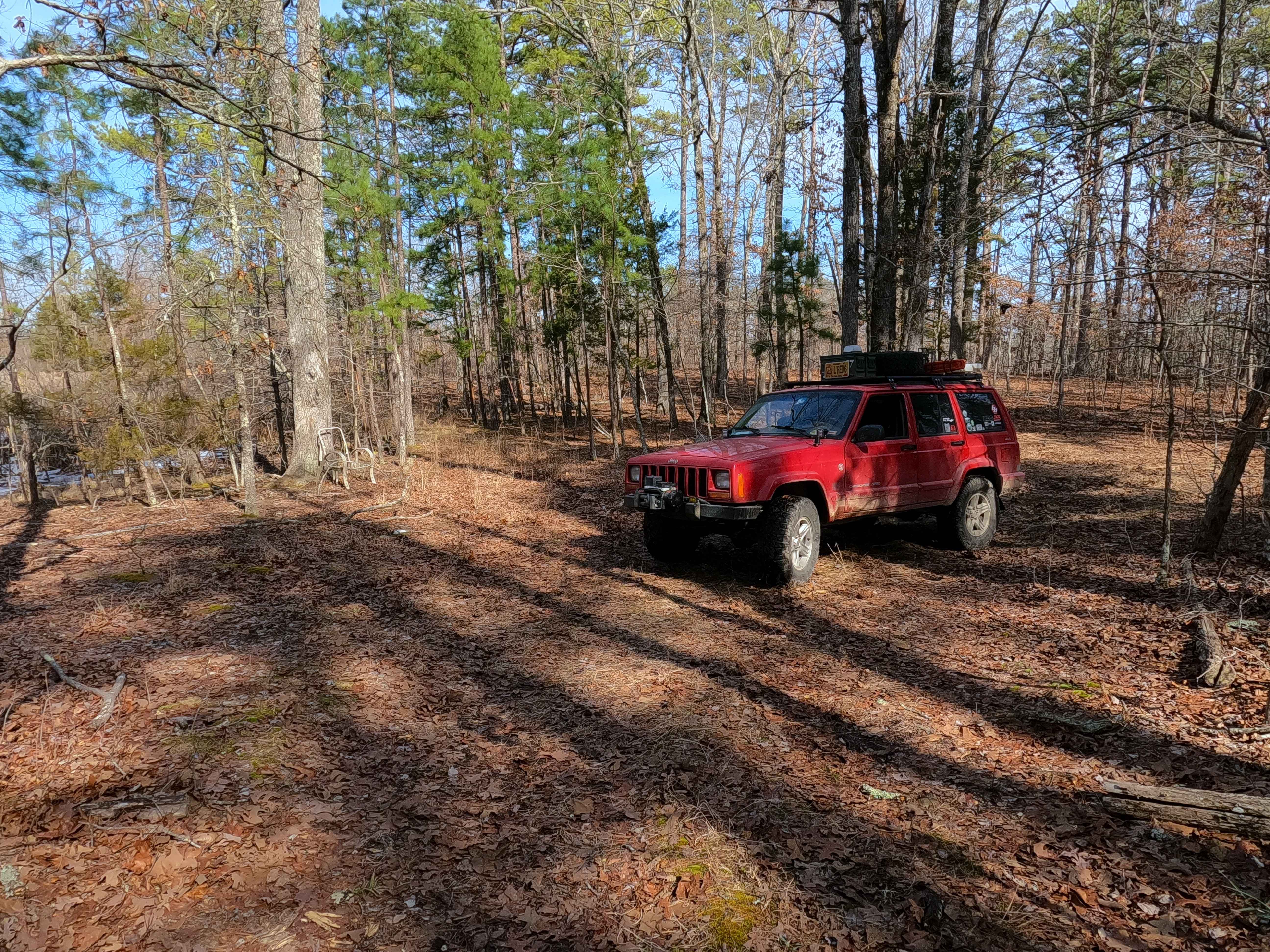
Bee Gum Ridge - CCR 209 can be accessed by the following ride types:
- High-Clearance 4x4
- SUV
Bee Gum Ridge - CCR 209 Map
Popular Trails

Critter Crossing
Turkey Knob 3145
Tucker Road - FS 4099

Outside Loop
The onX Offroad Difference
onX Offroad combines trail photos, descriptions, difficulty ratings, width restrictions, seasonality, and more in a user-friendly interface. Available on all devices, with offline access and full compatibility with CarPlay and Android Auto. Discover what you’re missing today!