Aldrich Cemetery - CCR 205
Total Miles
4.2
Technical Rating
Best Time
Spring, Summer, Fall, Winter
Trail Type
Full-Width Road
Accessible By
Trail Overview
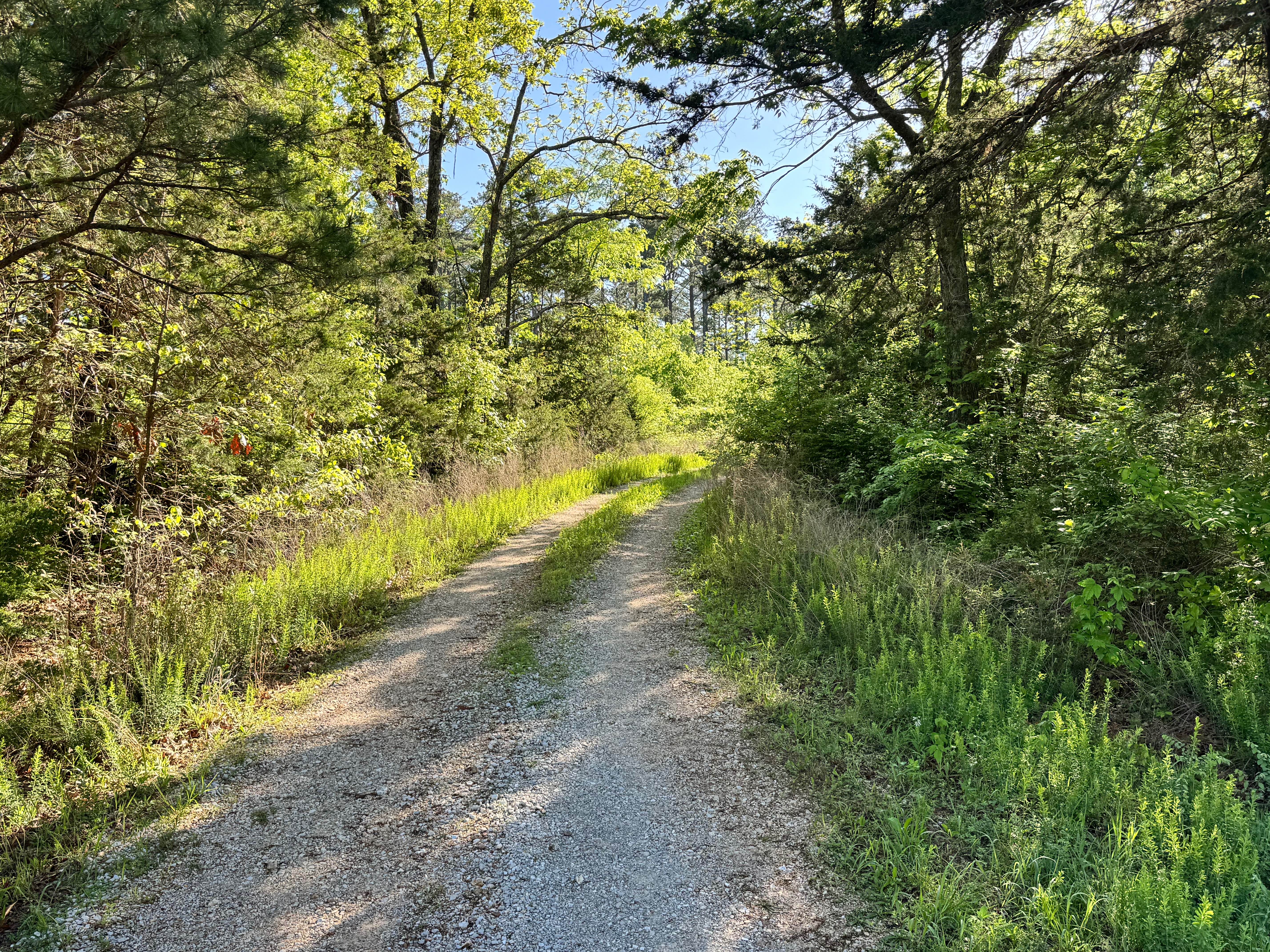
Aldrich Cemetery, Upper Aldrich Valley Road, or Carter County Road 205 is a coarse gravel and occasional creek bottom road traversing Carter County and Pioneer Forest Land. Coming right off US-60, the Aldrich Cemetery road heads southwest before turning even more south towards the low-lying bottoms of the Aldrich Valley. The track features an overall slow grade downhill going south, up and down the small ripples along the hill of valley's western edge, crossing small low water bridges and portions of the road where water follows the road as a channel to the next point it can merge into the larger feeder creek in the area, in these area the gravel becomes more coarse and with random loose cobbles becoming common place. Along the way, the road passes two noteworthy places, one being the former Aldrich School location at roughly 36.98271, -90.93298, and the second being the Aldrich Valley Cemetery at 36.97582, -90.93508. The road ultimately ends at an intersection with Missouri Route T and Carter County 211.
Photos of Aldrich Cemetery - CCR 205


Difficulty
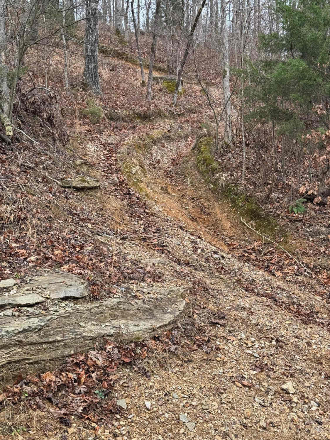
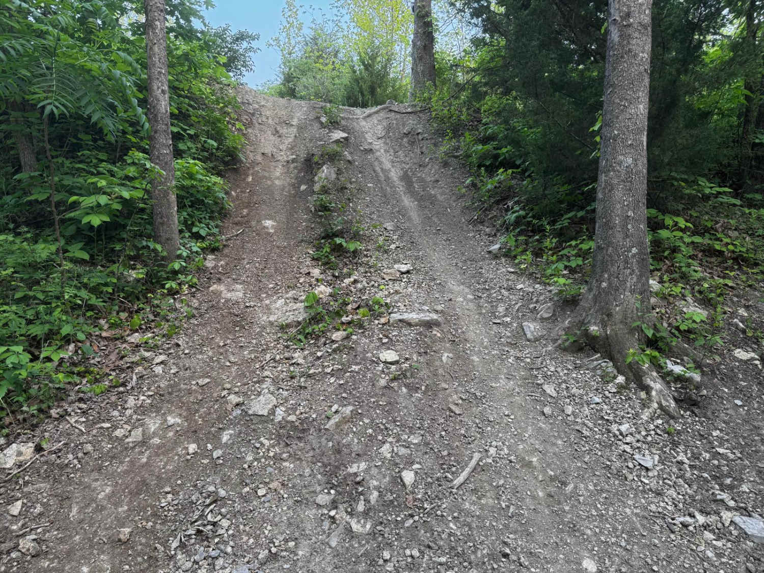
Aldrich Cemetery is given a 2/10 base rating for the consistent splash level of water on the low water bridges, and in the other low-lying spots along the road, there is potential for active erosion on the hills and in the valley near the creek. The base of the road has a dynamic range of packed well-maintained gravel to loose coarse natural gravel, to mild sections of creek bottom road, with cobbles (4-10 inch rocks) randomly lying on the surface, at minimum, expect the gravel road complications of mounding, potholes, and washboarding. Difficulty can increase or decrease depending on the season. In spring and fall, with significant rain and wet conditions, the lower Aldrich Valley portion of the road can become inaccessible due to flood waters, and if underwater, should be considered closed. In deep summer, the road can also dry completely out for months at a time and drop to an easier rating. Look for water levels of the Current River; other local trails are greatly affected by this water level. This gauge can be found at https://waterdata.usgs.gov/monitoring-location/07067000/#dataTypeId=continuous-00065-0&period=P30D
History
In old topo maps dating back to 1943 (Ellington) and 1944 (Grandin), it is clear that the current day Carter 205 and Carter 211 were once a continuous road, under the singular name Aldrich Valley Road. All the 1960s Topos suggest no change to this, but by the time the 1968 Big Spring Topo came out, Missouri Route T had been built, intersecting in the middle of the Aldrich Valley Road, and splitting it into the now known 205 (upper/north) and 211 (lower/south). The State Historical Society of Missouri has records from 1945 stating the following: "Aldrich Valley - In the northeast part of Kelley Township. It leads into the Current River at Chilton. The stream is now generally dry. John Aldrich, from Tennessee, settled here as early as 1840. Also known as Hooper Valley (q.v.) for an early family. (J.J. Chilton; T.J. Brame)" and "Aldrich Valley School - In Kelley Township, eight miles east of Van Buren. Formed from the Chilton District about 1894. Named for the valley. (H.D. Condray)" Research conducted by Christopher Menz
Status Reports
Aldrich Cemetery - CCR 205 can be accessed by the following ride types:
- High-Clearance 4x4
- SUV
Aldrich Cemetery - CCR 205 Map
Popular Trails
Yellow 285

FR 1181 to Scroggins Ridge
Independent - FS 1756
The onX Offroad Difference
onX Offroad combines trail photos, descriptions, difficulty ratings, width restrictions, seasonality, and more in a user-friendly interface. Available on all devices, with offline access and full compatibility with CarPlay and Android Auto. Discover what you’re missing today!