Vermillion Falls - FS 491
Total Miles
8.2
Technical Rating
Best Time
Spring, Summer, Fall, Winter
Trail Type
Full-Width Road
Accessible By
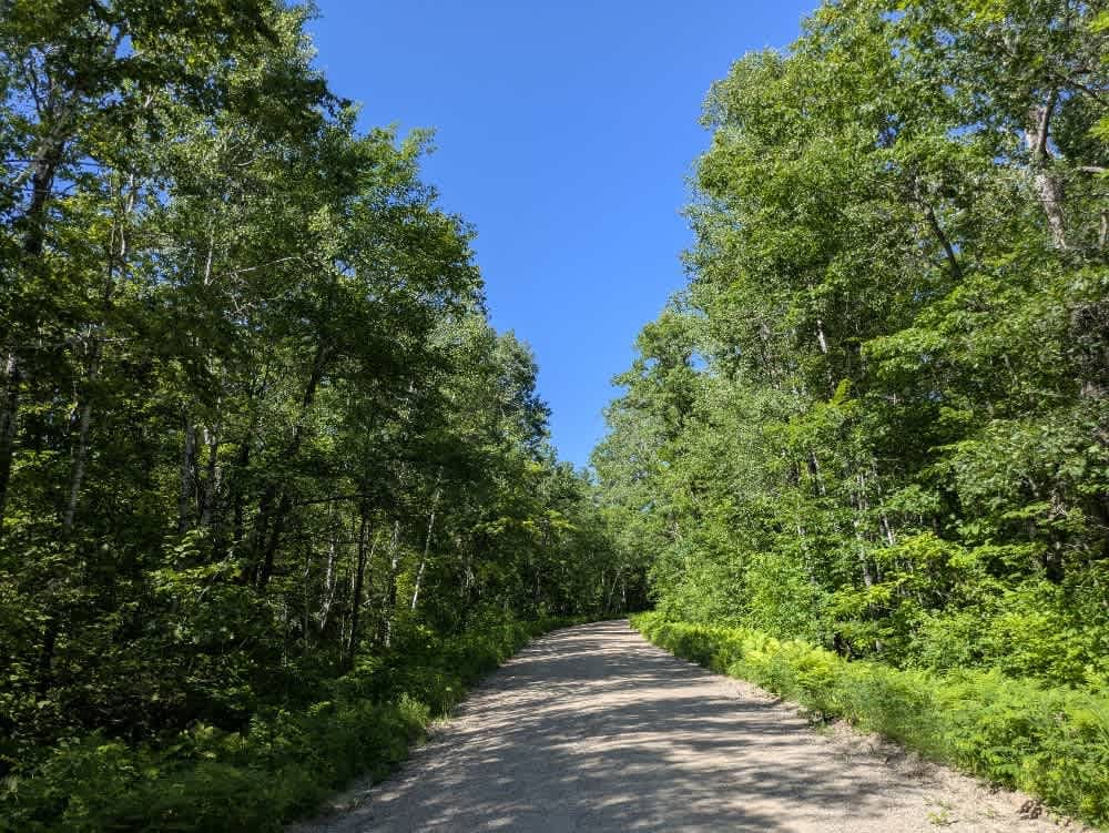
Trail Overview
This trail begins off Crane Lake Road and provides access to Vermillion Falls. It follows a wide and well-maintained gravel surface with a series of mild ascents and descents. The route is shared by local traffic, cyclists, and pedestrians, so caution is advised when driving. Along the way, there is a hiking trail and an ATV trail that branch off from the main route. The trail crosses the Vermillion River via a bridge, and rapids can be seen both upstream and downstream. A designated portage area is located near the bridge, and shortly after, a parking area marks the main access point to the waterfalls. From there, walking trails lead to several viewing platforms, and toilet facilities are available at the lot. Although ATVs are permitted along this trail, it is primarily a mixed-use access route and not intended for high-speed travel. The trail does not offer any dispersed campsites and lacks services such as trash disposal or potable water. Cell service may be intermittent.
Photos of Vermillion Falls - FS 491


Difficulty
This forest trail is well-maintained and used daily by residents and adventurers. The route is wide and clear of debris, with established tread and minimal overgrowth, making it ideal for a smooth and scenic drive.
History
Tucked into the wilderness of northern Minnesota's Superior National Forest, Vermilion Falls is a striking reminder of the raw power of water. Here, the Vermilion River funnels through a narrow granite gorge, plunging ten to fifteen feet with immense force. While not the tallest waterfall in the state, its drama lies in volume--the river crashes through the channel with a roar that's especially thunderous during spring snowmelt. Located just seven miles northeast of Crane Lake, Vermilion Falls is easy to reach. A short quarter-mile trail from the parking area leads to a viewing platform, making it accessible to nearly all visitors. Unlike more urban waterfalls, this one is surrounded by pine forests and exposed rock of the Canadian Shield, offering a true Northwoods atmosphere. The Vermilion River is often called Minnesota's last wild river, flowing largely free of dams, and the falls are part of a chain of rapids that draw canoeists, kayakers, and anglers--though the falls themselves are far too dangerous to navigate. Many visitors pair a stop at the falls with nearby Vermilion Gorge or continue on to explore the Boundary Waters Canoe Area Wilderness and Voyageurs National Park. Vermilion Falls near Crane Lake is more than a scenic stop; it's a glimpse of untamed northern waters carving their way through ancient stone, a place where Minnesota's wilderness still feels untouched.
Status Reports
Vermillion Falls - FS 491 can be accessed by the following ride types:
- High-Clearance 4x4
- SUV
- SxS (60")
- ATV (50")
- Dirt Bike
Vermillion Falls - FS 491 Map
Popular Trails

Bald Eagle Drive Southeast
Hillman to Onamia
The onX Offroad Difference
onX Offroad combines trail photos, descriptions, difficulty ratings, width restrictions, seasonality, and more in a user-friendly interface. Available on all devices, with offline access and full compatibility with CarPlay and Android Auto. Discover what you’re missing today!