South Basch Road
Total Miles
2.5
Technical Rating
Best Time
Spring, Summer, Fall, Winter
Trail Type
Full-Width Road
Accessible By
Trail Overview
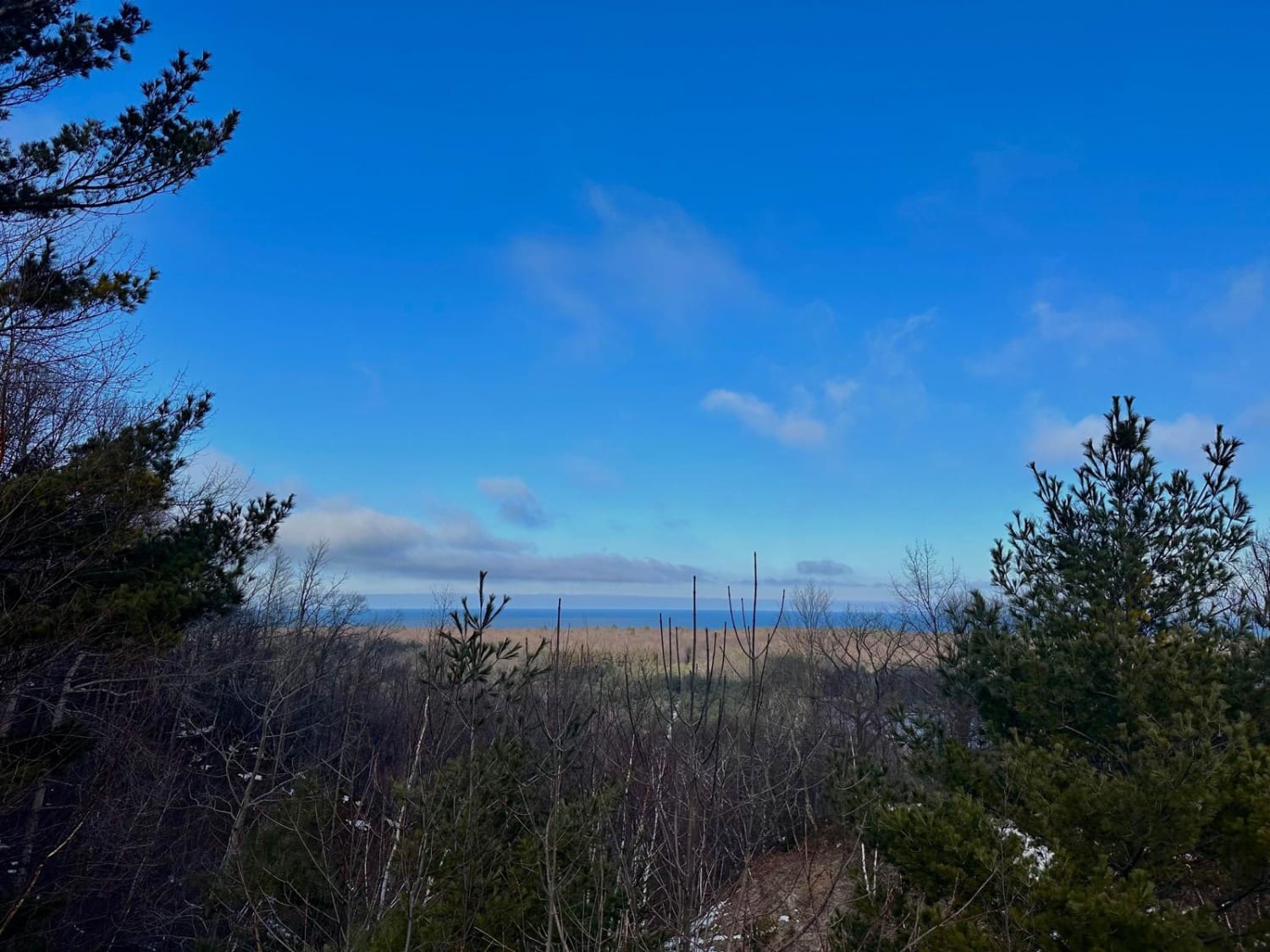
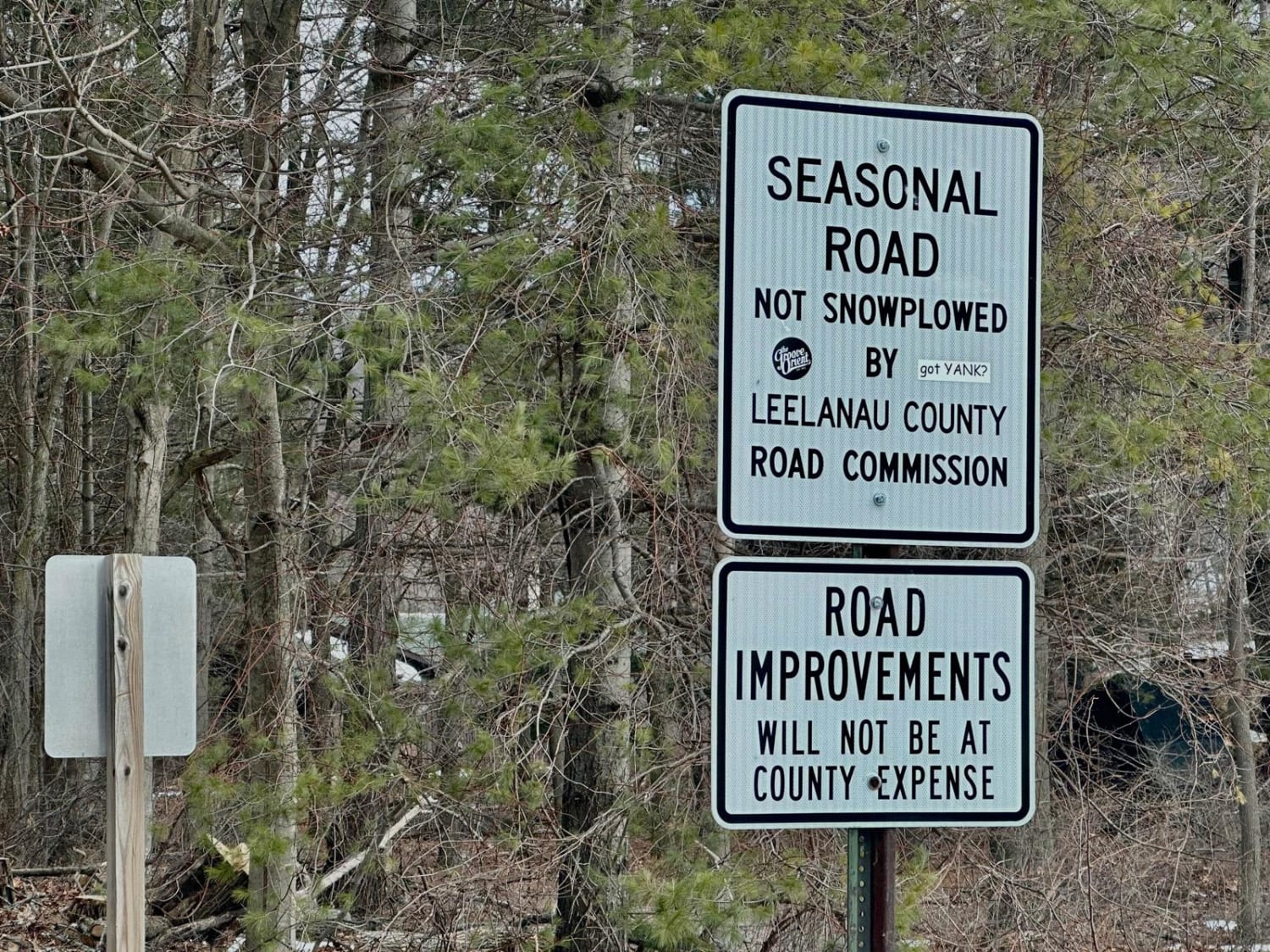
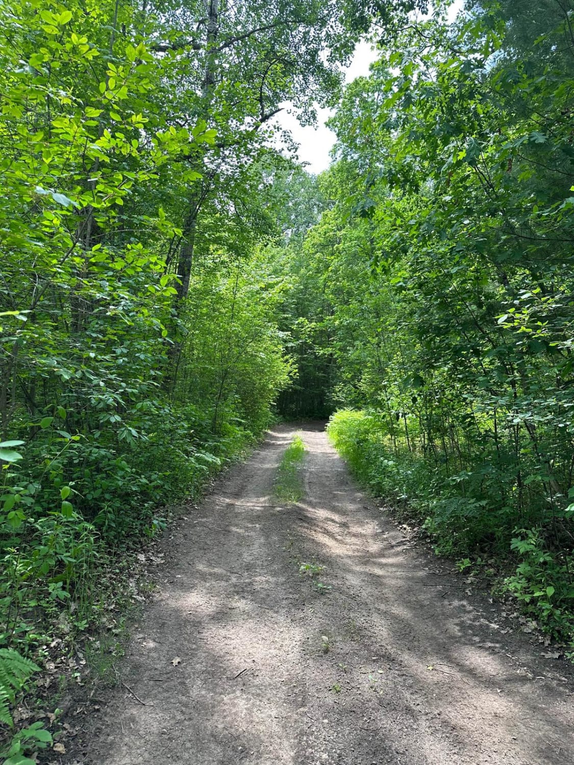
This trail travels through rolling hills and old historic farmland in the Port Oneida section of Sleeping Bear Dunes National Lakeshore. This route can be accessed from South Port Oneida Road on the west side and West Harbor Highway on the east side. Starting on the west end, it is a short stint of maintained dirt road. There will be parking for the Pyramid Point hiking loop on the left-hand side of the road. Just after that turn-off, the road becomes an unmaintained seasonal road. This stint of the trail is one vehicle wide with places to pass. This section is through rolling forested hills. There are steep drop-offs on the sides of the trail. As you continue further on the trail, it will widen up and is a more maintained dirt road. You will get into the historic farmland with very old farmhouses. There is an overlook on the east side of the trail with views of the lake. This overall is a must-do trail in the area of Sleeping Bear Dunes.
Photos of South Basch Road
Difficulty
Most of the route is a two-vehicle-wide dirt road with only a small section of unmaintained trail.
History
"Milton C. Basch was the original owner of this farmstead. Basch was a blacksmith who shod all of the horses in the Port Oneida vicinity. He was also a carpenter whose talents were relied upon to construct other farm buildings in the area. The Basch farm was where the third-generation Milton Basch (owner of HS-35-ll6A) grew up. [Note: From grandfather, to father, to son, all were named Milton Basch." "Solitude and picturesque beauty are the key words to describe Port Oneida, a once thriving center of commerce on Michigan's Leelanau Peninsula. Today the Pyramid Point area is a quiet, rural community within the boundaries of Sleeping Bear Dunes National Lakeshore. Farm buildings dating to as early as the lBSOs can be seen here, although little agricultural activity is now conducted. Few tourists who pass through this pastoral district realize it was one of the earliest settlements in Leelanau County. It was the second mainland community on Sleeping Bear Bay to construct a cordwood dock and wooding station to serve the passing steamers {1862). It received its name from the S.S. Oneida, the first steamer which stopped at the new dock. With the boom in maritime travel on Lake Michigan during the mid-to-late 19th century, fueling stops like Port Oneida were important to these steamships, which required large quantities of wood." http://npshistory.com/publications/slbe/port-oneida-pyramid-pt-shs.pdf
Status Reports
South Basch Road can be accessed by the following ride types:
- High-Clearance 4x4
- SUV
- SxS (60")
- ATV (50")
- Dirt Bike
South Basch Road Map
Popular Trails

Twin Lakes Loop Trail
Rail Trail Part 4

Grassy Grown Trail
The onX Offroad Difference
onX Offroad combines trail photos, descriptions, difficulty ratings, width restrictions, seasonality, and more in a user-friendly interface. Available on all devices, with offline access and full compatibility with CarPlay and Android Auto. Discover what you’re missing today!