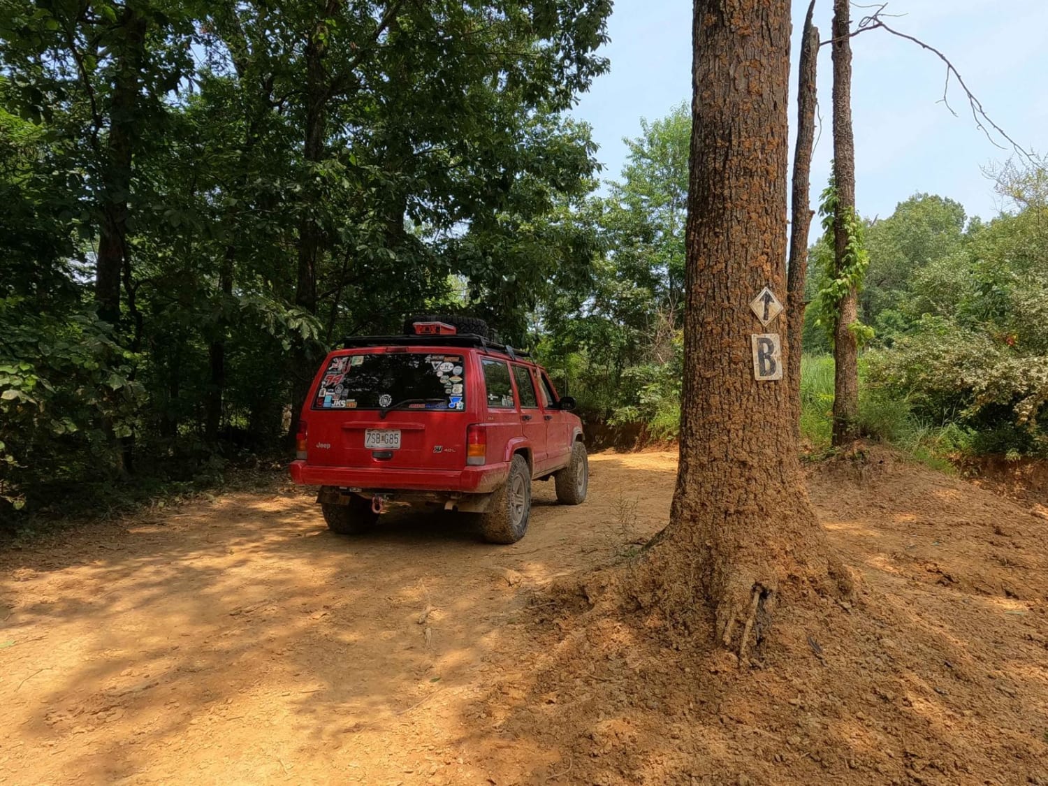
Silo Trail - 5 to B Road
Total Miles
1.9
Technical Rating
Best Time
Spring, Summer, Fall, Winter
Trail Type
Full-Width Road
Accessible By
Trail Overview
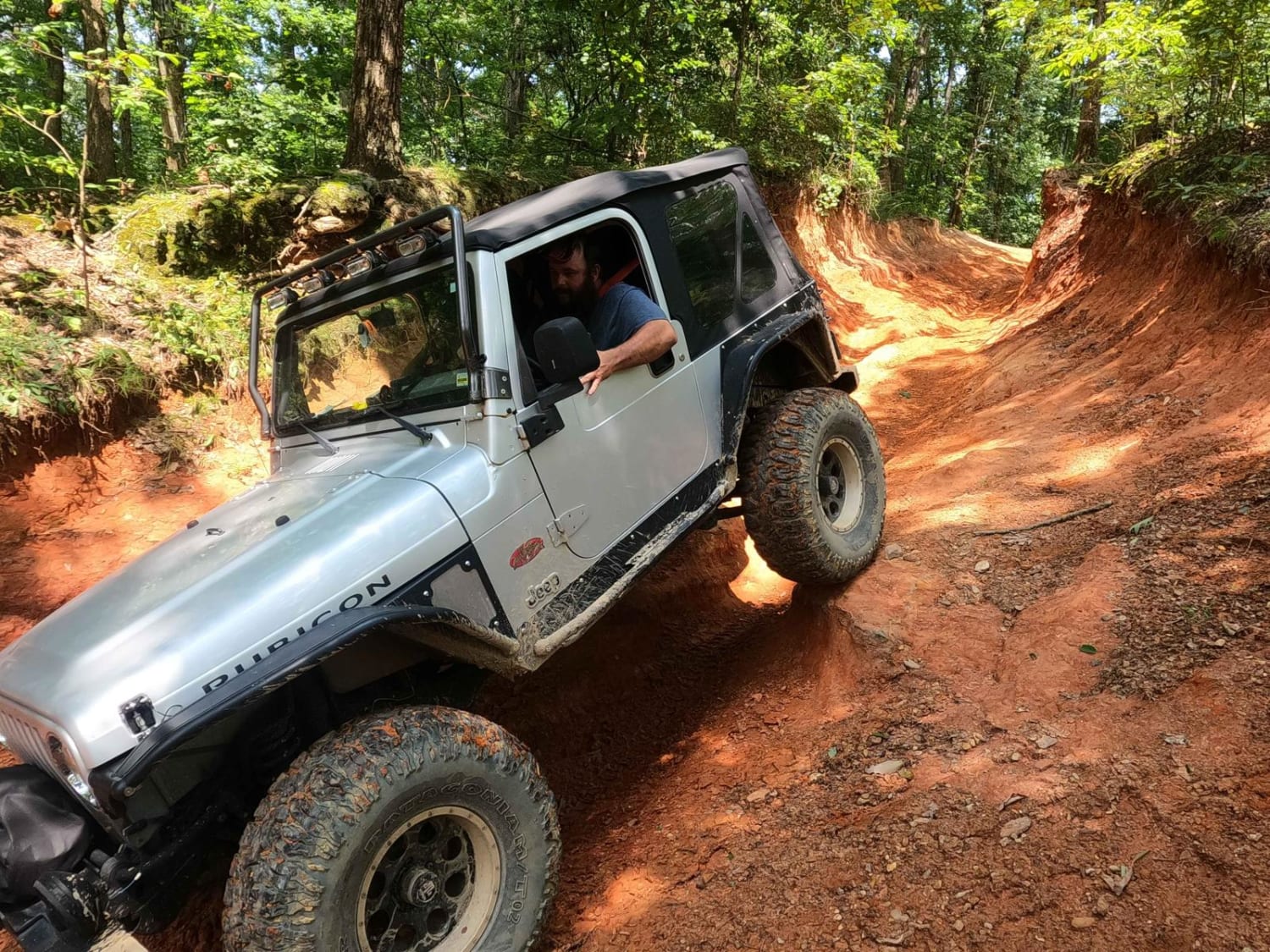
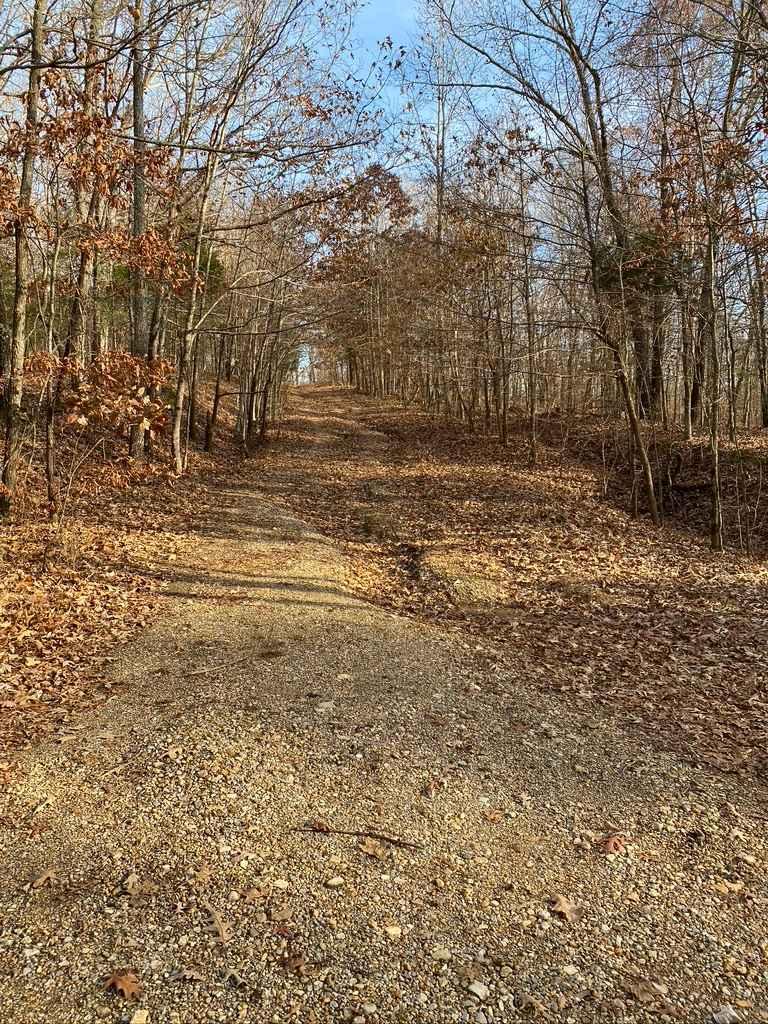
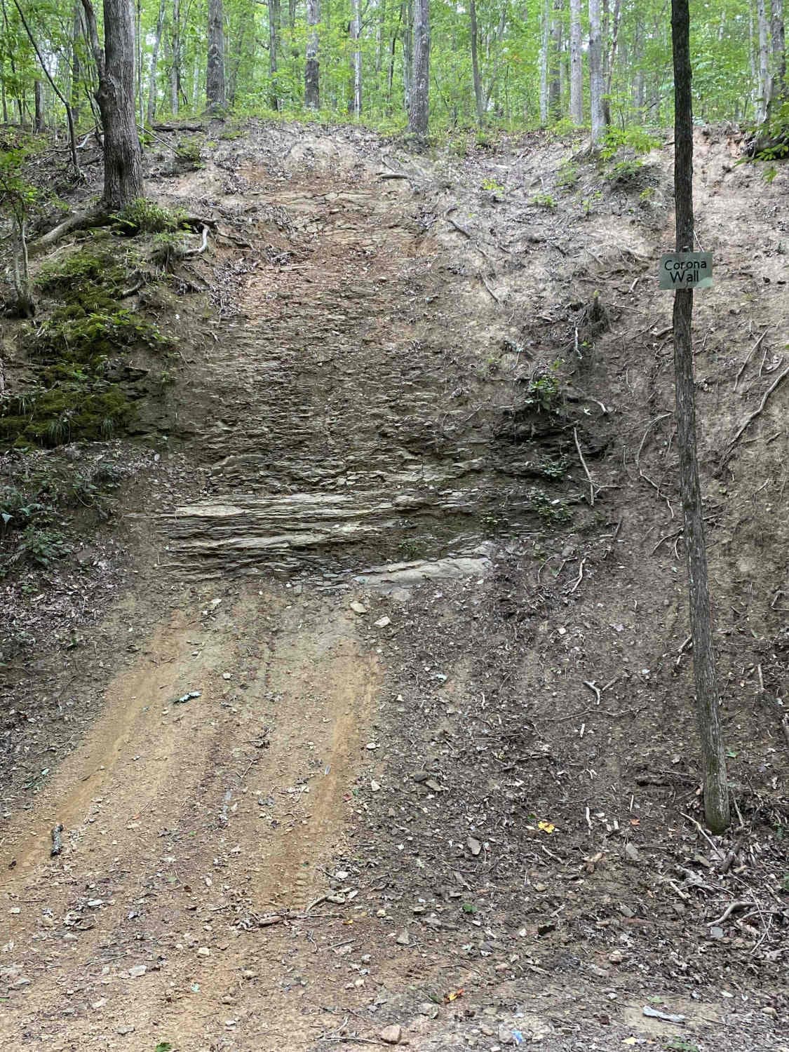
The Silo Trail, or the 5 to B Road, is a natural dirt-based primary road, connecting point to point from the 5 intersection and going over several hills towards the B intersection and historic Silo in Turkey Bay OHV, within the Land Between the Lakes National Recreation Area. Its official ID is Forestry M02. This is the longest, most historical, and nostalgic trail to hit in the park, featuring the ruins of the Silo, from an overlook towards the US-68 bridge crossing Kentucky Lake. Being the furthest corner of the park from the entry and Gatehouse makes the Silo noteworthy, due to how much ground covered (within the park) it takes to get here. The road starts heading northeast at the 5 intersection, shortly after making two 90-degree turns and heading westward through the northern perimeter hills, including Behemoth Hill, at 36.76953, -88.09267, a steep grade with optional ledges and heavy erosion, all the way to the Silo Gatekeeper, at 36.77082, -88.09768. This obstacle is an eroded downhill channel that has been carved 8 feet deep by 12 feet wide over time. It features large off-camber ruts, 2-foot tall ledges, and natural rock all within the obstacle, which would be very challenging when wet. After this, the road returns to being a more mild dirt road, leading over smaller hills and terrain, going past the B intersection, and shortly after ending at the Silo turnaround and parking area in the northwest corner of Turkey Bay. The Silo is located 100 feet north of the parking area. This is one of two primary roads that dead end at the park (the other being the Rock Garden - 6 to C Road). You have to turn around and follow this back out if you desire to use only primary roads.
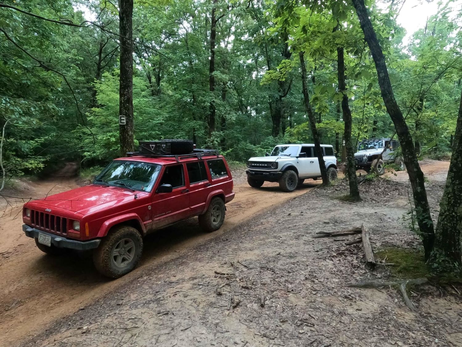
Photos of Silo Trail - 5 to B Road
Difficulty
The Silo Trail - 5 to B Road, is the most challenging primary trail for two specific areas in its wake, one being Behemoth Hill, a steep grade with loose rock, optional deep ruts, and an optional 12-24-inch ledge at the top to climb. This can be bypassed if riding on the perimeter or just picking a wise line. Then there is the Silo Gatekeeper. This is a heavily eroded channel that has formed from years of water carving it out, paired with heavy 4WD use. It features off-camber ruts, 2-foot tall ledges, and natural rock all within the obstacle, and when wet could be void of any easy traction, considering it is heavy clay mixed with fine dirt covering large hard rocks. Mud is not uncommon in this section of the trail, even in dry conditions. The other parts of the trail are very similar to the other primary roads of the OHV park, with simple mild to moderate grades, featuring ruts, mild water collection spots, and mud, with a foundation of mostly dirt roads and gravel in sections. They are scattered with natural rocks ranging in size from golf ball to softball, and rarely soccer ball in size. This is given a base rating of 5/10 due to the large ledges and off-camber ruts of the Behemoth Hill, and Silo Gatekeeper-granted, the Gatekeeper could be mended with maintenance at the park but historically is known by the park staff to wash out again and return to a more offroad worthy state. These two main obstacles would increase in difficulty in wet and rainy conditions. The majority of the road rides like a 3/10, especially when dry.
History
The Silo dates back to earlier Americana, possibly long before the invention of the automobile, from a time when grain was transported by horse and wagon on land and via riverboat on water. The Silo has sadly taken a beating over the course of time and not much remains of the structure as of July 2023.
Status Reports
Silo Trail - 5 to B Road can be accessed by the following ride types:
- High-Clearance 4x4
- SUV
- SxS (60")
- ATV (50")
- Dirt Bike
Silo Trail - 5 to B Road Map
Popular Trails

DBBB - Green Pond Ridge Road
Armadillo Hill FSR 127A
D to E Road
The onX Offroad Difference
onX Offroad combines trail photos, descriptions, difficulty ratings, width restrictions, seasonality, and more in a user-friendly interface. Available on all devices, with offline access and full compatibility with CarPlay and Android Auto. Discover what you’re missing today!